Fernweh: Home
    ExploreTravel GuidesPlan a tripMy tripLast visited
    de|en
    All Places & RegionsAll highlightsAbout FernwehFAQPrivacy PolicyImprint
    ExploreTravel GuidesPlan a tripMy tripLast visited
    • Neighborhoods & highlights
    • Eat & drink
    • Food culture
    • Culture
    • Nightlife
    • Getting around
    • Accommodation
    • Plan trip
    • Nearby
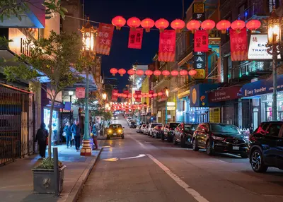
    Union Square, SoMa & the Embarcadero
    Daniel Lu (User:dllu) / Wikimedia Commons / CC BY-SA 4.0

    United States

    Union Square, SoMa & the Embarcadero

    City

    Union Square, SoMa and the Embarcadero make up downtown San Francisco along Market Street, from the shopping district around Union Square to the Ferry Building on the bay.

    by Felix Gillen

    1. Home
    2. Destinations
    3. United States
    4. San Francisco
    5. Union Square, SoMa & the Embarcadero
    Union Square, SoMa and the Embarcadero make up downtown San Francisco along Market Street, from the shopping district around Union Square to the Ferry Building on the bay. This is where many visitors stay, where BART and the cable cars stop, and where you'll find the big art museums and the waterfront farmers market.Union Square is the hotel and shopping district, with department stores and the cable car turnaround at Powell and Market. South of Market Street, SoMa has SFMOMA, Yerba Buena Gardens and Moscone Center by day and bars and clubs in old warehouses by night. The Embarcadero is the bayfront boulevard that replaced the elevated freeway torn down after 1989, now lined with palms, a bike path and the F-line's vintage streetcars. Its centerpiece is the 1898 Ferry Building.Plan your day: Hit the Saturday farmers market at the Ferry Building in the morning, walk along the water, then head up Market Street to SFMOMA.Heads-up: Between Union Square, Civic Center and the Tenderloin, the street scene can change within a few blocks. For current safety information, see the UK FCDO Travel Advice.

    Sights in Union Square, SoMa & the Embarcadero

    Discover the most important sights and attractions

    Ferry Building
    Historic Landmark

    1Ferry Building

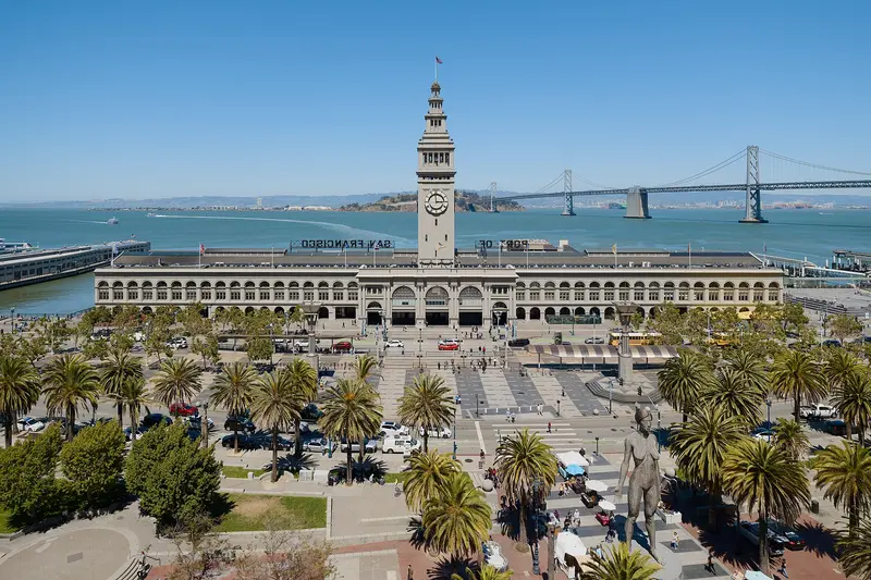
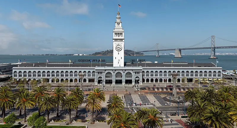
    The 1898 Ferry Terminal, with its 75-meter-high clock tower, stands at the end of Market Street. Since its restoration in 2003, the long ground-floor hall has been a market hall featuring cheese, bread, oysters, coffee, and food stalls. The Ferry Plaza Farmers Market takes place in front of it on Tuesdays and Thursdays from 10 AM to 2 PM, and Saturdays from 8 AM to 2 PM, with Saturdays being its largest and busiest day. From the piers behind the building, ferries depart for Sausalito, Oakland, and Alameda.
    Open in Google Maps
    SFMOMA
    Museum

    2SFMOMA

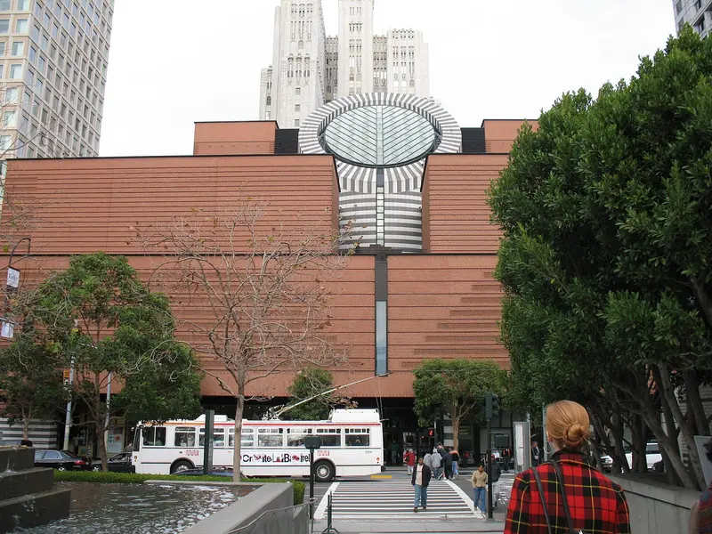
    The San Francisco Museum of Modern Art at 151 Third Street, founded in 1935, is one of the largest modern art museums in the USA. Mario Botta's 1995 building was extended by Snøhetta in 2016. The collection features Frida Kahlo, Diego Rivera, Pollock, Rothko, and Warhol, while a large living wall grows on the third floor. Adults pay $30; under 19s enter free. Closed Wednesdays, open until 8 pm Thursdays. The ground-floor gallery on Howard Street is free.
    Open in Google Maps
    Yerba Buena Gardens
    Park

    3Yerba Buena Gardens

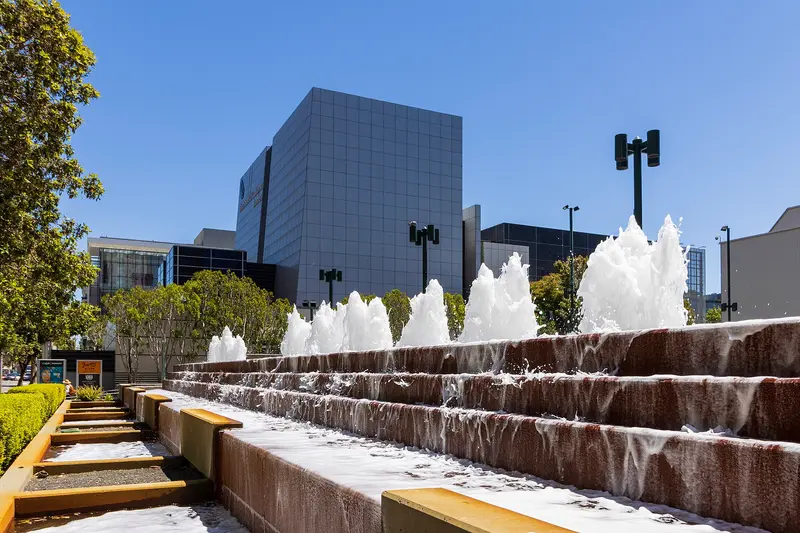
    The park between Third and Fourth Street opened in SoMa in 1993. Behind the Martin Luther King Jr. Memorial's waterfall, you walk along glass panels featuring quotes from his speeches. In the south, a restored 1906 Charles Looff carousel turns. Nearby are the YBCA art center, a children's museum, and an ice rink. Perfect for a break between SFMOMA and Union Square; admission is free.
    Open in Google Maps
    Salesforce Park
    Park

    4Salesforce Park

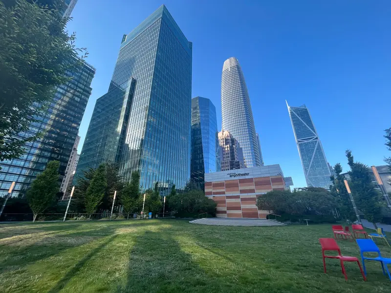
    The 2.2-hectare park is located on the roof of the Salesforce Transit Center and opened in 2018. Paths lead through gardens with trees and flowers, plus there are play areas and a cafe terrace, all overlooked by SoMa's skyscrapers. Access is possible via the small gondola at the corner of Mission and Fremont Street (often out of service), or by stairs, escalators, or elevators. Admission is free.
    Open in Google Maps
    Union Square
    Historic Landmark

    5Union Square

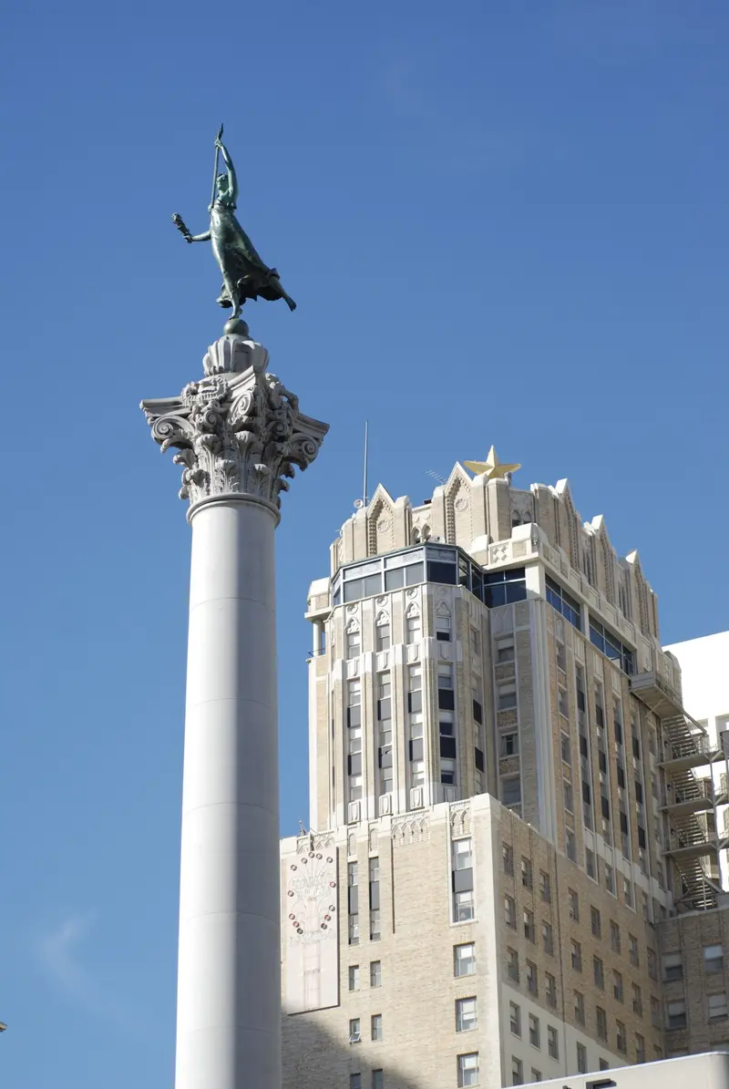
    The square bordered by Geary, Powell, Post, and Stockton Street is the heart of the shopping and hotel district. At its center stands the 1903 Dewey Column, topped by a goddess of victory. Surrounded by department stores like Saks and Neiman Marcus, it hosts an ice rink and a large tree during the pre-Christmas season. Two blocks south, at Powell and Market Street, the Cable Cars turn around, marking the start of the queue.
    Open in Google Maps

    Restaurants in Union Square, SoMa & the Embarcadero

    1

    Hog Island Oyster Co.

    Oyster bar in the Ferry Building, run by an oyster farmer from Tomales Bay north of the city. The menu features raw and grilled oysters and other seafood dishes; through the windows, you see the Bay Bridge. Reservations are limited, and at lunchtime and on weekends, you often wait a while for a spot at the bar.
    Show on Google Maps
    2

    La Mar Cocina Peruana

    Peruvian fish restaurant by chef Gastón Acurio on the Embarcadero, with a large terrace on a pier north of the Ferry Building. Order Ceviche, Causa, and Anticuchos, and a Pisco Sour. The Infatuation particularly praises the terrace; on sunny days, booking an outdoor table is highly recommended.
    Show on Google Maps
    3

    Tadich Grill

    Das Fischrestaurant an der California Street 240 im Financial District geht auf einen Kaffeestand von 1849 zurück und gilt als ältestes durchgehend betriebenes Restaurant Kaliforniens. Kellner in weißen Jacken servieren über Holzkohle gegrillten Fisch, Cioppino, Sand Dabs und Hangtown Fry. Nur ein Teil der Plätze ist reservierbar, der Rest geht an Laufkundschaft, mittags wird es mit Büroleuten voll.
    Show on Google Maps

    Food and drink

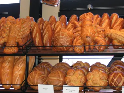
    Sourdough

    Sourdough

    San Francisco sourdough has been famous since the Gold Rush. Bakeries in the Ferry Building marketplace sell fresh loaves, perfect for a picnic by the water.
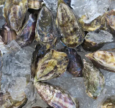
    Bay oysters

    Bay oysters

    Oysters from Tomales Bay and other farms north of the city are served raw or grilled at the oyster bars along the Embarcadero.
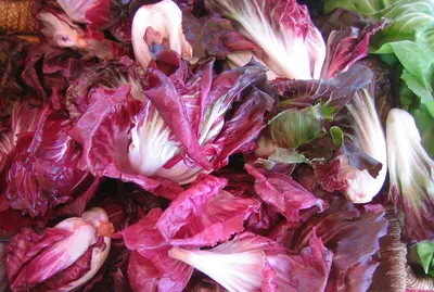
    Farmers market

    Farmers market

    At the Ferry Plaza Farmers Market, Northern California growers sell fruit, vegetables, cheese and street food. Saturday morning is the biggest; weekdays are calmer.

    Culture and history

    During the Gold Rush, ships piled up along the Embarcadero; many were abandoned and buried under landfill, which is how the waterfront crept out into the bay. Until the bridges opened in the 1930s, the 1898 Ferry Building was the gateway to the city.The freeway: From the 1950s, the Embarcadero Freeway cut the city off from the water. After the 1989 Loma Prieta earthquake it came down for good (it was gone by 1992), making way for today's palm-lined boulevard.SoMa: The old industrial and warehouse district became the heart of the tech industry in the 1990s, and companies like Salesforce are headquartered here.Art: SFMOMA and the Yerba Buena Center for the Arts anchor the blocks around Yerba Buena Gardens, along with several smaller museums.

    Nightlife

    1

    Bourbon & Branch

    Prohibition-era speakeasy at 501 Jones Street, a few blocks west of Union Square on the edge of the Tenderloin. Book online to receive a password via email beforehand. Tables are limited to 90 minutes, phones must stay in pockets, and conversation should be kept low. Without a reservation, you can access The Library bar next door. For your evening journey, it's best to take a taxi or ride-share.
    Show on Google Maps
    2

    111 Minna Gallery

    A gallery and event venue in an old warehouse on Minna Street in SoMa, just steps from SFMOMA. During the day, it features rotating exhibitions; in the evenings, there's a bar, DJ nights, parties, and art events. Check the event calendar on the website for what's on, as some evenings are closed for private events.
    Show on Google Maps

    Getting around Union Square, SoMa & the Embarcadero

    Downtown is flat and easy to walk; Union Square to the Ferry Building is about 20 minutes down Market Street.BART and Muni Metro: Civic Center, Powell, Montgomery and Embarcadero stations run under Market Street. BART gets you here from SFO in about 30 minutes, no transfer needed.Muni Metro T: The Central Subway stops at Union Square/Market Street and Yerba Buena/Moscone and continues to Chinatown.F-line: The vintage streetcars run down Market Street and along the Embarcadero to Fisherman's Wharf.Ferries: From the Ferry Building, Golden Gate Ferry runs to Sausalito and Larkspur, and San Francisco Bay Ferry to Oakland, Alameda and Vallejo. You can pay with Clipper.Driving: Hotel parking is steep. Big public garages like Union Square Garage are often cheaper, especially if you reserve online.

    Accommodations in Union Square, SoMa & the Embarcadero

    Find perfect stay in Union Square, SoMa & the Embarcadero
    Booking.com* (Affiliate link)
    Search Hotels
    Agoda* (Affiliate link)
    Search Hotels
    Airbnb
    Vacation Rentals

    * Affiliate link: if you book through it, we earn a small commission. The price stays the same for you.

    Campgrounds in Union Square, SoMa & the Embarcadero
    Find perfect campground in Union Square, SoMa & the Embarcadero
    Search via Google Maps
    Campgrounds nearby (15km)
    Camping.info
    Find Campgrounds
    Park4Night
    RV Parks & Camping

    Plan your trip to Union Square, SoMa & the Embarcadero
    Save places, build a route and plan your city trip, all in one place.

    1. 1
      Sunrise over alpine peaks and a sea of clouds
      1234

      Round trip

      12 days · 4 stops

      Saved

      Pick a route

      Pick a ready-made one or save places and plan your own.

      Open bookmarks
    2. 2

      Trip to Union Square, SoMa & the Embarcadero
      Live
      • 1Ferry Building3 days
      • 2SFMOMA4 days
      • 3Yerba Buena Gardens5 days
      Budget

      Plan your trip

      The planner sorts stops, days and budget. Plan together in real time.

      Start trip planning
    3. 3
      9:41 No signal
      Union Square, SoMa & the Embarcadero
      Available offline

      Use it on the road

      Download the guide to your phone and use it on site, even offline.

    Nearby

    Fisherman's Wharf, North Beach & Chinatown

    Fisherman's Wharf, North Beach & Chinatown

    Fisherman's Wharf, North Beach and Chinatown sit side by side in San Francisco's northeast corner, between the bayfront and the Financial District. On foot, you can work your way from Chinatown's dim sum bakeries through North Beach's espresso bars down to the piers in half a day.Chinatown starts at the Dragon Gate on Grant Avenue, the stretch of souvenir shops and restaurants. For everyday Chinatown, with produce stands and fish markets, walk one block over to Stockton Street. North Beach is the old Italian neighborhood around Columbus Avenue and Washington Square, full of pizzerias, delis and the bars where the Beat writers drank in the 1950s. Above it rises Telegraph Hill and Coit Tower. Fisherman's Wharf is the most touristy part of town: crab stands, T-shirt shops, Pier 39 and the Alcatraz ferry.Plan your day: Chinatown in the morning, lunch in North Beach, then up to Coit Tower in the afternoon and down to the Wharf. From the Dragon Gate to Pier 39 is about 1.5 miles.The Wharf: An hour is plenty for Pier 39 and the sea lions. You'll eat better in North Beach or Chinatown than at the waterfront places that live off foot traffic.
    Nob Hill, Russian Hill and Fillmore

    Nob Hill, Russian Hill and Fillmore

    Nob Hill, Russian Hill and the Fillmore are the hilltop neighborhoods west of Chinatown and North Beach: the railroad barons' grand hotels and cathedral on top, steep residential streets with stairways and gardens to the north, and Japantown and the old Fillmore Street jazz corridor to the west. Come for the cable cars, the views from the hills and Lombard Street, and stay for a drink at the Nob Hill hotel bars.Cable cars are the most practical way around here: the Powell-Hyde line climbs over Nob Hill to Lombard Street, and the California line crosses Nob Hill to Van Ness Avenue. Give Nob Hill and Russian Hill half a day, and save an afternoon for Japantown, Fillmore Street and Alamo Square with the Painted Ladies, a few blocks south.Nob Hill: Grace Cathedral, the Cable Car Museum, Huntington Park and the Fairmont and Mark Hopkins hotels.Russian Hill: Lombard Street, Macondray Lane and stairways with bay views.Japantown and the Fillmore: Japan Center and the Peace Pagoda, ramen and sushi, and on Fillmore Street, boutiques, restaurants and live jazz.The hills are seriously steep. If you're walking, allow extra time going up, and take the cable car or bus back.
    San Francisco

    San Francisco

    San Francisco sits on the hilly northern tip of a peninsula in Northern California, between the Pacific and the Bay, with about 874,000 people. You come for the Golden Gate Bridge, the old prison on Alcatraz, cable cars clanking up steep hills and walkable neighborhoods like Chinatown and the Mission.Give it at least three full days: one for the waterfront from Fisherman's Wharf to the Ferry Building, one for Alcatraz and the Golden Gate Bridge, and one for Chinatown, North Beach, the Mission and Haight-Ashbury.The neighborhoods at a glanceFisherman's Wharf, North Beach & Chinatown: Piers and sea lions, the old Italian quarter and the oldest Chinatown in North America, all linked on foot.Union Square, SoMa & the Embarcadero: Downtown, with hotels, department stores, SFMOMA and the Ferry Building on the water.Nob Hill, Russian Hill & the Fillmore: Cable cars, Grace Cathedral and Lombard Street up on the hills, plus Japantown and the old Fillmore Street jazz corridor.Mission District & the Castro: Murals, taquerias, Dolores Park and the country's best-known gay neighborhood, often sunnier than the rest of town.Haight-Ashbury & Golden Gate Park: Hippie history, Victorian houses and the big park with its museums and Japanese Tea Garden.Presidio, Marina & Lands End: Beach, bayfront path and coastal trail around the Golden Gate Bridge.Book ahead: Alcatraz tickets are sold only through Alcatraz City Cruises, up to 90 days out. For summer, weekends and holiday weekends like Memorial Day or Labor Day, book early; walk-up spots are rare.Weather: Summer fog pours through the Golden Gate, and the waterfront gets cold and windy. Dress in layers and pack a jacket, even in July.Driving: You don't need a car downtown, and parking is expensive. Never leave anything visible in a parked car.
    Mission District & the Castro

    Mission District & the Castro

    The Mission District and the Castro sit next to each other south of downtown San Francisco, with Dolores Park in between. The weather here is often sunnier than on the waterfront, and the days revolve around murals, taquerias and the park, the nights around bars that stay busy late.The Mission is the city's oldest neighborhood, named for Mission Dolores (1776), and for decades the heart of San Francisco's Latino community. Valencia Street has cafés, bookstores and restaurants; Mission Street and 24th Street are louder and cheaper, lined with taquerias and panaderías. The Castro, just west, has been the country's best-known gay neighborhood since the 1970s, marked by the rainbow crosswalks at Castro and 18th and the Castro Theatre's neon sign.Plan your day: Mission Dolores and Dolores Park in the morning, a burrito for lunch, the Balmy Alley murals off 24th Street in the afternoon, then the Castro in the evening.Weather: Sheltered by Twin Peaks, the Mission is often warmer and less foggy than Fisherman's Wharf, which is why Dolores Park gets packed on sunny weekends.
    Presidio, Marina & Lands End

    Presidio, Marina & Lands End

    The Presidio, the Marina and Lands End cover San Francisco's northwest corner, between the Golden Gate Bridge and the Pacific. This is where you spend time outdoors: on the beach at Crissy Field, on wooded trails in the Presidio and along the Lands End coastal trail with views of the Golden Gate.The Marina is an affluent waterfront neighborhood with the Palace of Fine Arts, the Fort Mason cultural center and Chestnut Street for restaurants and bars. Just west is the Presidio, an Army post from 1776 to 1994 and now part of the Golden Gate National Recreation Area, with museums in old barracks, the Tunnel Tops park and Fort Point under the bridge. Farthest west, the Lands End trail winds through cypress groves to the ruins of the Sutro Baths.Plan your day: Walk from the Palace of Fine Arts across Crissy Field to Fort Point (about 3 miles), then take the bus out to the Lands End Lookout.Weather: Fog and wind hit here first. Summer mornings are often gray, so bring a jacket.

    Sources & method

    • Photos: Wikimedia Commons, Google Maps. Each photo carries its credit.
    • Place data such as addresses and ratings comes from Google Maps.
    • The content is based on web research from public, traceable sources. How the content is made · The role of AI