Fernweh: Home
    ExploreTravel GuidesPlan a tripMy tripLast visited
    de|en
    All Places & RegionsAll highlightsAbout FernwehFAQPrivacy PolicyImprint
    ExploreTravel GuidesPlan a tripMy tripLast visited
    • Neighborhoods & highlights
    • Eat & drink
    • Food culture
    • Culture
    • Nightlife
    • Getting around
    • Accommodation
    • Plan trip
    • Nearby
    Mission District & the Castro
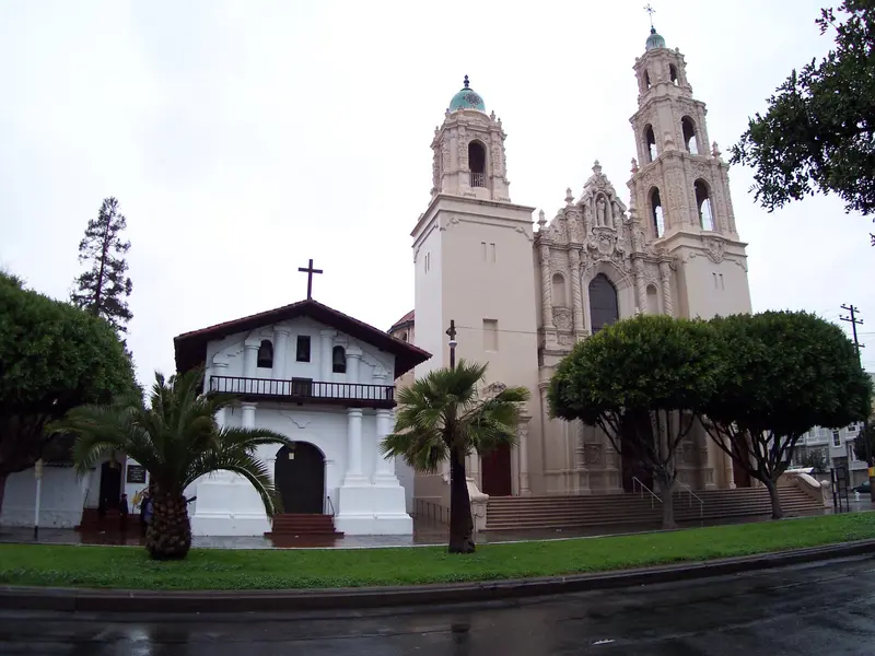
    Tony Webster / Wikimedia Commons / CC BY 2.0

    United States

    Mission District & the Castro

    City

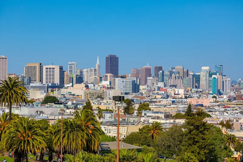
    The Mission District and the Castro sit next to each other south of downtown San Francisco, with Dolores Park in between.

    by Felix Gillen

    1. Home
    2. Destinations
    3. United States
    4. San Francisco
    5. Mission District & the Castro
    The Mission District and the Castro sit next to each other south of downtown San Francisco, with Dolores Park in between. The weather here is often sunnier than on the waterfront, and the days revolve around murals, taquerias and the park, the nights around bars that stay busy late.The Mission is the city's oldest neighborhood, named for Mission Dolores (1776), and for decades the heart of San Francisco's Latino community. Valencia Street has cafés, bookstores and restaurants; Mission Street and 24th Street are louder and cheaper, lined with taquerias and panaderías. The Castro, just west, has been the country's best-known gay neighborhood since the 1970s, marked by the rainbow crosswalks at Castro and 18th and the Castro Theatre's neon sign.Plan your day: Mission Dolores and Dolores Park in the morning, a burrito for lunch, the Balmy Alley murals off 24th Street in the afternoon, then the Castro in the evening.Weather: Sheltered by Twin Peaks, the Mission is often warmer and less foggy than Fisherman's Wharf, which is why Dolores Park gets packed on sunny weekends.

    Sights in Mission District & the Castro

    Discover the most important sights and attractions

    Mission Dolores Park
    Park

    1Mission Dolores Park

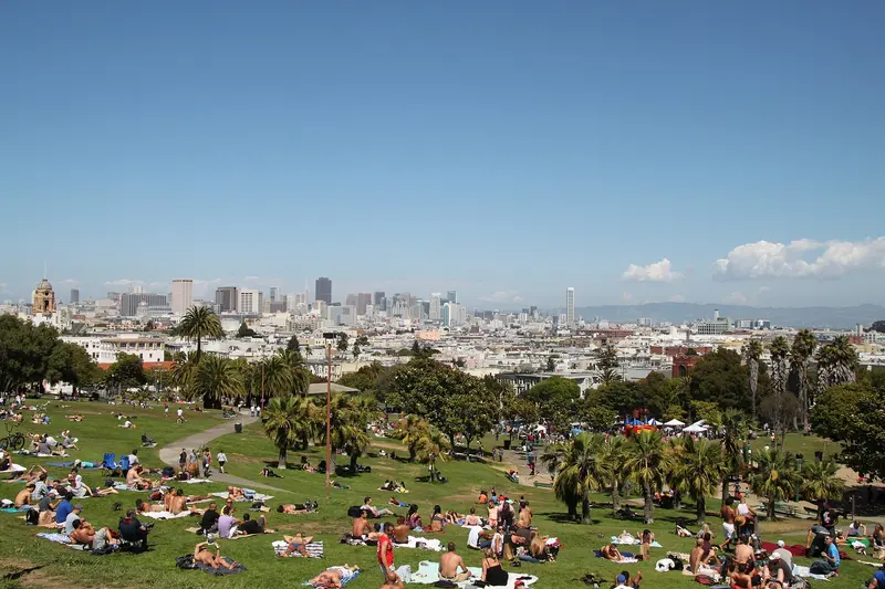
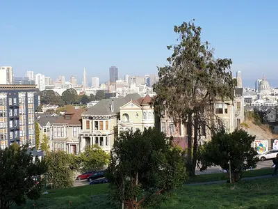
    The roughly 6.5-hectare park slopes southwest, and from its upper corner at 20th and Church Street, you get one of the best skyline views. On sunny weekends, thousands gather on the lawn, with vendors circulating with drinks and snacks. The 2012 Helen Diller Playground is one of the city's best playgrounds. The J Church streetcar stops right on its western edge.
    Open in Google Maps
    Balmy Alley
    Attraction

    2Balmy Alley

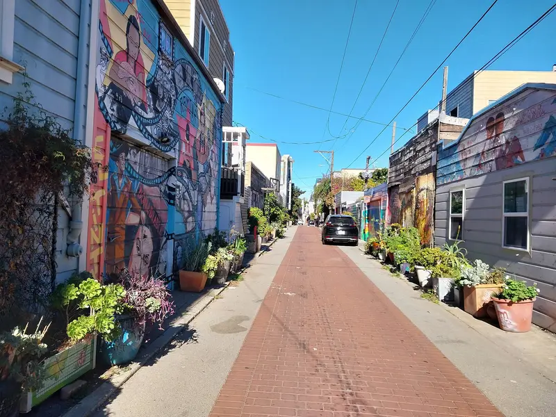
    The short alley between 24th Street and Garfield Square is painted with murals along its entire length. The first were painted in 1972 by Mia Galivez and children from a neighborhood daycare, with more added wall by wall since 1973. The motifs revolve around Latin America, migration, and the neighborhood itself, and are constantly repainted and renewed. Admission is free, plan half an hour, and combine your visit with the bakeries and taquerias on 24th Street.
    Open in Google Maps
    Castro Theatre
    Point of Interest

    3Castro Theatre

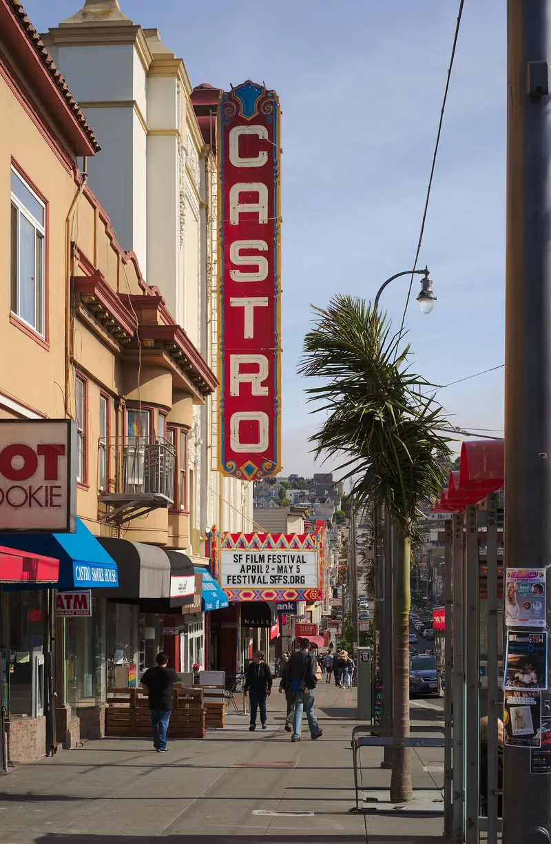
    The 1922 movie palace, designed by Timothy Pflueger, is the Castro's landmark thanks to its neon sign. After two years and about $41 million in renovations, it reopened on February 6, 2026, operated by concert promoter Another Planet. The program now includes films, festivals like Frameline, and concerts. If you're not attending a show, a glance at the facade at 429 Castro Street is enough.
    Open in Google Maps
    GLBT Historical Society Museum
    Museum

    4GLBT Historical Society Museum

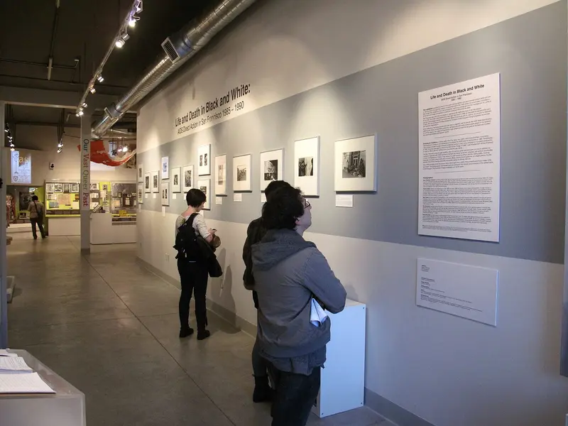
    Small museum at 4127 18th Street, telling the history of San Francisco's queer community, with objects from Harvey Milk's estate, posters, photos, and testimonies from the AIDS crisis. Open Tuesday to Sunday, closed on Mondays. Admission is $10 for adults; on the first Wednesday of the month, entry is free, then without reservation, subject to availability.
    Open in Google Maps
    Mission Dolores
    Church

    5Mission Dolores

    Founded on October 9, 1776, Mission San Francisco de Asís has its 1791 adobe chapel, the city's oldest, beside the 1918 Basilica. The small cemetery holds gravestones from 1830-1898 and the unmarked graves of some 5,000 indigenous Californians. The entrance is at 320 Dolores Street. You pay admission for the chapel, museum, and cemetery.
    Open in Google Maps

    Restaurants in Mission District & the Castro

    1

    La Taqueria

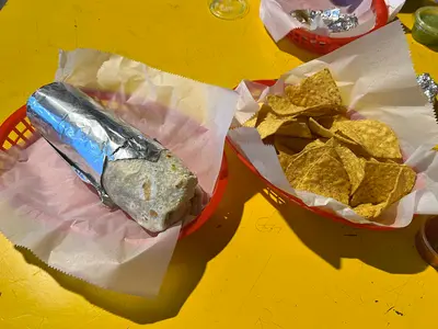
    Miguel Jara opened the Taqueria on Mission Street in 1973; in 2017, it received the James Beard Award as "America's Classic." Here, burritos come without rice, filled with meat like Carnitas, beans, and salsa. Those who like them crispy order them "dorado," pan-fried. There's a line at lunchtime and on weekends; the 24th Street Mission BART station is one block away.
    Show on Google Maps
    2

    Pizzeria Delfina

    The 18th Street pizzeria is part of Trattoria Delfina next door, which Time Out ranks among the Mission's best restaurants. The menu features thin-crust pizzas, salads, and antipasti. Located one block from Dolores Park, it's perfect after an afternoon spent there.
    Show on Google Maps
    3

    Foreign Cinema

    Restaurant on Mission Street, serving California-Mediterranean cuisine since 1999. In the courtyard, a film plays on a screen from dusk, accompanied by oysters and charcoal-grilled dishes. Weekend brunch is as popular as dinner, so reserve in advance for both.
    Show on Google Maps

    Food and drink

    Burrito dorado

    Burrito dorado

    At many Mission taquerias you can have your burrito griddled after it's rolled, so the tortilla gets crisp on the outside. Ask for it "dorado" or crispy.
    Pan dulce

    Pan dulce

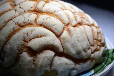
    Mexican sweet breads like sugar-crusted conchas fill the panaderías on 24th Street. They're cheap and freshest early in the morning.
    Morning bun

    Morning bun

    Tartine Bakery on Guerrero Street is known for its sourdough and its morning buns, flaky rolls with orange and cinnamon. Get there at opening to beat the line.

    Culture and history

    Franciscan missionaries founded Mission San Francisco de Asís in 1776, which gave the neighborhood its name. Around 1900 it was home to Irish and German families; from the 1940s on, immigrants from Mexico and Central America moved in.Murals: Since the 1970s, Chicano artists have painted walls and alleys like Balmy Alley and Clarion Alley. The Women's Building on 18th Street carries one of the largest murals in the city.The Castro: In the 1970s the neighborhood became the center of the gay rights movement. Harvey Milk ran a camera shop here and was elected to the Board of Supervisors in 1977, one of the first openly gay elected officials in the country; he was assassinated in 1978.Gentrification: Since the tech boom, rents have soared and many Latino families have been priced out, a theme in many of the newer murals.

    Nightlife

    1

    Twin Peaks Tavern

    Located at the corner of Castro and 17th Street, right by the Castro Muni Station, this bar is considered the USA's first gay bar with large, open street-facing windows: in 1973, owners Mary Ellen Cunha and Peggy Forster removed the coverings. Since 2013, it has been a city landmark. Quieter than nearby clubs, it draws a mixed, often older crowd and offers a good view of the hustle and bustle at the intersection.
    Show on Google Maps
    2

    El Rio

    Bar with a spacious backyard at 3158 Mission Street, in the southern Mission. The calendar is packed: Live bands, movie nights, queer community parties, and in summer, Sunday afternoon salsa in the garden. Simple drinks, a diverse crowd, often with no or low admission.
    Show on Google Maps
    3

    ABV

    Cocktail bar at 3174 16th Street, a short walk from the 16th Street Mission BART station. Fodor's ranks it among the city's best cocktail bars. The menu ranges from classics to house creations with Mezcal and Amaro, plus small dishes. On weekends, it gets crowded from 9 PM.
    Show on Google Maps

    Getting around the Mission & the Castro

    Both neighborhoods are flat enough to walk; cutting through Dolores Park, the Castro to Valencia Street takes about 20 minutes.BART: 16th St Mission and 24th St Mission stations are on Mission Street, about 10 minutes from Powell or Montgomery downtown, with direct trains from SFO.Muni Metro: The K, L and M lines stop at Castro station under Market Street. The J Church streetcar runs right along Dolores Park.F-line: The vintage streetcars end at Castro and 17th, a slow but scenic ride up Market Street.Driving: Street parking around Dolores Park on weekends is close to impossible. Don't leave anything in the car.

    Accommodations in Mission District & the Castro

    Find perfect stay in Mission District & the Castro
    Booking.com* (Affiliate link)
    Search Hotels
    Agoda* (Affiliate link)
    Search Hotels
    Airbnb
    Vacation Rentals

    * Affiliate link: if you book through it, we earn a small commission. The price stays the same for you.

    Campgrounds in Mission District & the Castro
    Find perfect campground in Mission District & the Castro
    Search via Google Maps
    Campgrounds nearby (15km)
    Camping.info
    Find Campgrounds
    Park4Night
    RV Parks & Camping

    Plan your trip to Mission District & the Castro

    Save places, build a route and plan your city trip, all in one place.

    1. 1
      Sunrise over alpine peaks and a sea of clouds
      1234

      Round trip

      12 days · 4 stops

      Saved

      Pick a route

      Pick a ready-made one or save places and plan your own.

      Open bookmarks
    2. 2

      Trip to Mission District & the Castro
      Live
      • 1Mission Dolores Park3 days
      • 2Balmy Alley4 days
      • 3Castro Theatre5 days
      Budget

      Plan your trip

      The planner sorts stops, days and budget. Plan together in real time.

      Start trip planning
    3. 3
      9:41 No signal
      Mission District & the Castro
      Available offline

      Use it on the road

      Download the guide to your phone and use it on site, even offline.

    Nearby

    San Francisco

    San Francisco

    San Francisco sits on the hilly northern tip of a peninsula in Northern California, between the Pacific and the Bay, with about 874,000 people. You come for the Golden Gate Bridge, the old prison on Alcatraz, cable cars clanking up steep hills and walkable neighborhoods like Chinatown and the Mission.Give it at least three full days: one for the waterfront from Fisherman's Wharf to the Ferry Building, one for Alcatraz and the Golden Gate Bridge, and one for Chinatown, North Beach, the Mission and Haight-Ashbury.The neighborhoods at a glanceFisherman's Wharf, North Beach & Chinatown: Piers and sea lions, the old Italian quarter and the oldest Chinatown in North America, all linked on foot.Union Square, SoMa & the Embarcadero: Downtown, with hotels, department stores, SFMOMA and the Ferry Building on the water.Nob Hill, Russian Hill & the Fillmore: Cable cars, Grace Cathedral and Lombard Street up on the hills, plus Japantown and the old Fillmore Street jazz corridor.Mission District & the Castro: Murals, taquerias, Dolores Park and the country's best-known gay neighborhood, often sunnier than the rest of town.Haight-Ashbury & Golden Gate Park: Hippie history, Victorian houses and the big park with its museums and Japanese Tea Garden.Presidio, Marina & Lands End: Beach, bayfront path and coastal trail around the Golden Gate Bridge.Book ahead: Alcatraz tickets are sold only through Alcatraz City Cruises, up to 90 days out. For summer, weekends and holiday weekends like Memorial Day or Labor Day, book early; walk-up spots are rare.Weather: Summer fog pours through the Golden Gate, and the waterfront gets cold and windy. Dress in layers and pack a jacket, even in July.Driving: You don't need a car downtown, and parking is expensive. Never leave anything visible in a parked car.
    Haight-Ashbury & Golden Gate Park

    Haight-Ashbury & Golden Gate Park

    Haight-Ashbury and Golden Gate Park sit on San Francisco's west side, where the old hippie neighborhood around Haight and Ashbury runs right into the park's eastern entrance. Come for Victorian houses, vintage clothing and record stores, then spend a full day in the park with its museums, gardens and lakes.Haight Street was ground zero for the 1967 Summer of Love and still trades on it: thrift stores, smoke shops, murals and street musicians. The side streets are lined with brightly painted Victorians. Golden Gate Park stretches about three miles from here to the Pacific. The de Young Museum, the California Academy of Sciences and the Japanese Tea Garden are clustered together on the east side; farther west it gets quieter, with lakes, meadows and the windmills at Ocean Beach.Time: A morning is enough for the Haight. Give the park a full day if you want to do two museums.Car-free: The eastern stretch of JFK Drive is closed to cars, so it's easy to explore on foot or by bike.
    Nob Hill, Russian Hill and Fillmore

    Nob Hill, Russian Hill and Fillmore

    Nob Hill, Russian Hill and the Fillmore are the hilltop neighborhoods west of Chinatown and North Beach: the railroad barons' grand hotels and cathedral on top, steep residential streets with stairways and gardens to the north, and Japantown and the old Fillmore Street jazz corridor to the west. Come for the cable cars, the views from the hills and Lombard Street, and stay for a drink at the Nob Hill hotel bars.Cable cars are the most practical way around here: the Powell-Hyde line climbs over Nob Hill to Lombard Street, and the California line crosses Nob Hill to Van Ness Avenue. Give Nob Hill and Russian Hill half a day, and save an afternoon for Japantown, Fillmore Street and Alamo Square with the Painted Ladies, a few blocks south.Nob Hill: Grace Cathedral, the Cable Car Museum, Huntington Park and the Fairmont and Mark Hopkins hotels.Russian Hill: Lombard Street, Macondray Lane and stairways with bay views.Japantown and the Fillmore: Japan Center and the Peace Pagoda, ramen and sushi, and on Fillmore Street, boutiques, restaurants and live jazz.The hills are seriously steep. If you're walking, allow extra time going up, and take the cable car or bus back.
    Union Square, SoMa & the Embarcadero

    Union Square, SoMa & the Embarcadero

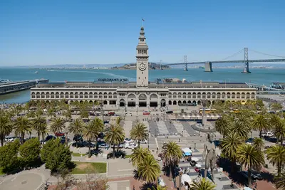
    Union Square, SoMa and the Embarcadero make up downtown San Francisco along Market Street, from the shopping district around Union Square to the Ferry Building on the bay. This is where many visitors stay, where BART and the cable cars stop, and where you'll find the big art museums and the waterfront farmers market.Union Square is the hotel and shopping district, with department stores and the cable car turnaround at Powell and Market. South of Market Street, SoMa has SFMOMA, Yerba Buena Gardens and Moscone Center by day and bars and clubs in old warehouses by night. The Embarcadero is the bayfront boulevard that replaced the elevated freeway torn down after 1989, now lined with palms, a bike path and the F-line's vintage streetcars. Its centerpiece is the 1898 Ferry Building.Plan your day: Hit the Saturday farmers market at the Ferry Building in the morning, walk along the water, then head up Market Street to SFMOMA.Heads-up: Between Union Square, Civic Center and the Tenderloin, the street scene can change within a few blocks. For current safety information, see the UK FCDO Travel Advice.
    Fisherman's Wharf, North Beach & Chinatown

    Fisherman's Wharf, North Beach & Chinatown

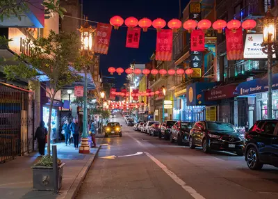
    Fisherman's Wharf, North Beach and Chinatown sit side by side in San Francisco's northeast corner, between the bayfront and the Financial District. On foot, you can work your way from Chinatown's dim sum bakeries through North Beach's espresso bars down to the piers in half a day.Chinatown starts at the Dragon Gate on Grant Avenue, the stretch of souvenir shops and restaurants. For everyday Chinatown, with produce stands and fish markets, walk one block over to Stockton Street. North Beach is the old Italian neighborhood around Columbus Avenue and Washington Square, full of pizzerias, delis and the bars where the Beat writers drank in the 1950s. Above it rises Telegraph Hill and Coit Tower. Fisherman's Wharf is the most touristy part of town: crab stands, T-shirt shops, Pier 39 and the Alcatraz ferry.Plan your day: Chinatown in the morning, lunch in North Beach, then up to Coit Tower in the afternoon and down to the Wharf. From the Dragon Gate to Pier 39 is about 1.5 miles.The Wharf: An hour is plenty for Pier 39 and the sea lions. You'll eat better in North Beach or Chinatown than at the waterfront places that live off foot traffic.

    Sources & method

    • Photos: Wikimedia Commons, Google Maps. Each photo carries its credit.
    • Place data such as addresses and ratings comes from Google Maps.
    • The content is based on web research from public, traceable sources. How the content is made · The role of AI