Fernweh: Home
    ExploreTravel GuidesPlan a tripMy tripLast visited
    de|en
    All Places & RegionsAll highlightsAbout FernwehFAQPrivacy PolicyImprint
    ExploreTravel GuidesPlan a tripMy tripLast visited
    • Neighborhoods & highlights
    • Eat & drink
    • Food culture
    • Culture
    • Nightlife
    • Getting around
    • Accommodation
    • Plan trip
    • Nearby
    Haight-Ashbury & Golden Gate Park
    Misaochan2 / Wikimedia Commons / CC BY-SA 4.0

    United States

    Haight-Ashbury & Golden Gate Park

    City

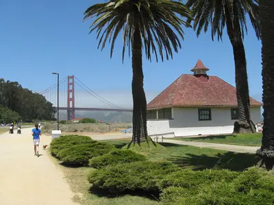
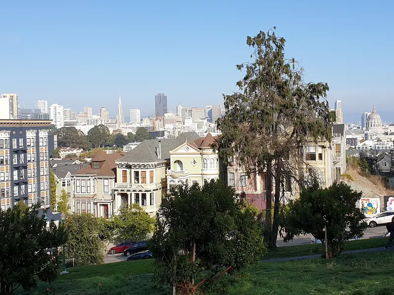
    Haight-Ashbury and Golden Gate Park sit on San Francisco's west side, where the old hippie neighborhood around Haight and Ashbury runs right into the park's eastern entrance.

    by Felix Gillen

    1. Home
    2. Destinations
    3. United States
    4. San Francisco
    5. Haight-Ashbury & Golden Gate Park
    Haight-Ashbury and Golden Gate Park sit on San Francisco's west side, where the old hippie neighborhood around Haight and Ashbury runs right into the park's eastern entrance. Come for Victorian houses, vintage clothing and record stores, then spend a full day in the park with its museums, gardens and lakes.Haight Street was ground zero for the 1967 Summer of Love and still trades on it: thrift stores, smoke shops, murals and street musicians. The side streets are lined with brightly painted Victorians. Golden Gate Park stretches about three miles from here to the Pacific. The de Young Museum, the California Academy of Sciences and the Japanese Tea Garden are clustered together on the east side; farther west it gets quieter, with lakes, meadows and the windmills at Ocean Beach.Time: A morning is enough for the Haight. Give the park a full day if you want to do two museums.Car-free: The eastern stretch of JFK Drive is closed to cars, so it's easy to explore on foot or by bike.

    Sights in Haight-Ashbury & Golden Gate Park

    Discover the most important sights and attractions

    Japanese Tea Garden
    Garden

    1Japanese Tea Garden

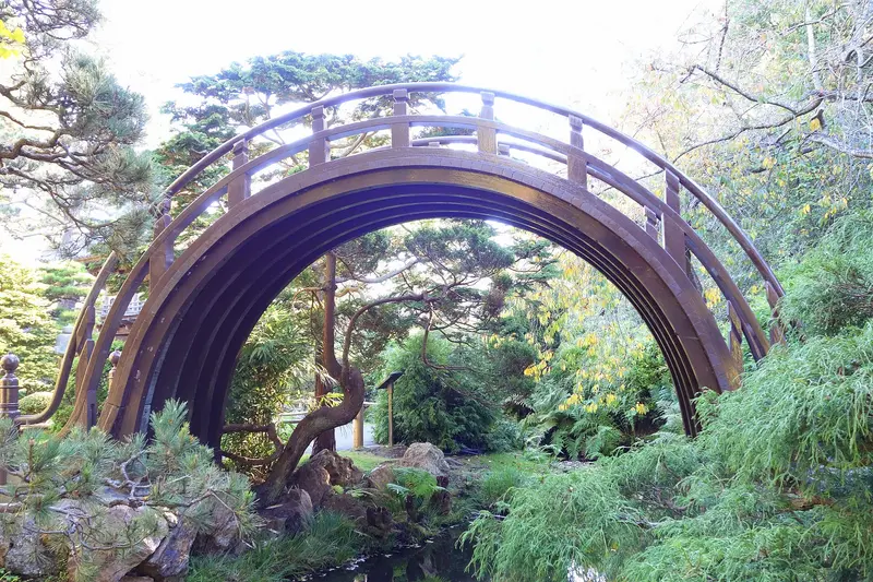
    The garden was created for the 1894 Midwinter Exhibition and is considered the oldest public Japanese garden in the USA. Makoto Hagiwara maintained and expanded it until 1925. You'll cross the steep drum bridge, pass koi ponds and a five-story pagoda from 1915, and enjoy green tea in the teahouse. Outside visitors pay $14 ($16 on weekends); on Mondays, Wednesdays, and Fridays, admission is free from 9 to 10 AM, which is also the quietest time.
    Open in Google Maps
    de Young Museum
    Museum

    2de Young Museum

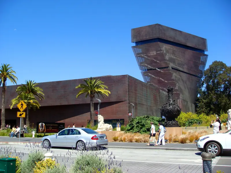
    Since 2005, the art museum in Golden Gate Park has occupied a Herzog & de Meuron building, its copper facade slowly turning green. The collection ranges from 17th-century American painting and textiles to art from Africa, Oceania, and the Americas. From the Hamon Tower, you get panoramic views over the park to the Golden Gate Bridge. Check opening hours, closed days, and admission prices beforehand on famsf.org; time-slot tickets are available for major special exhibitions.
    Open in Google Maps
    California Academy of Sciences
    Museum

    3California Academy of Sciences

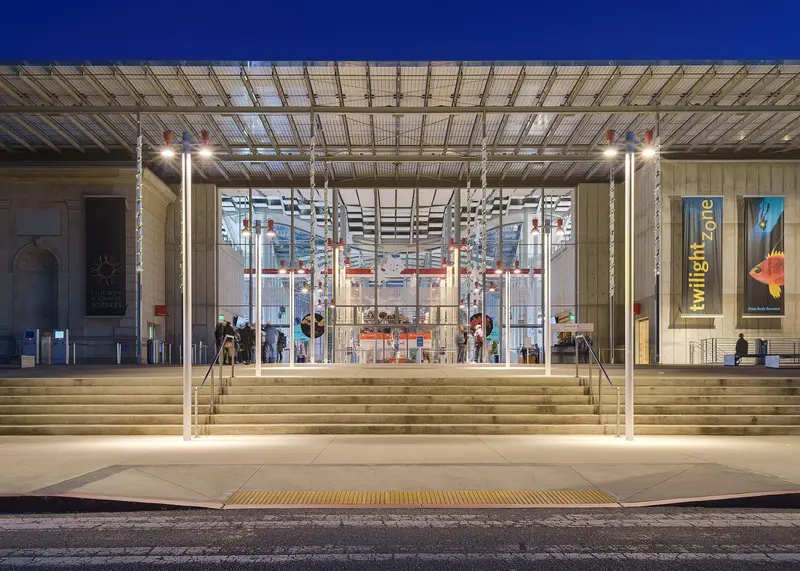
    A natural history museum, aquarium, and planetarium under one roof, opposite the de Young. The new building by Renzo Piano opened in 2008; on the roof, Californian native plants grow across approximately one hectare. Beneath a glass dome lies a four-story rainforest; in the Steinhart Aquarium, you'll find a coral reef. Buy tickets online in advance, especially on weekends. Reserve Planetarium seats on-site via QR code in the lobby. On Thursday evenings, "NightLife" runs for visitors aged 21 and over.
    Open in Google Maps
    Conservatory of Flowers
    Museum

    4Conservatory of Flowers

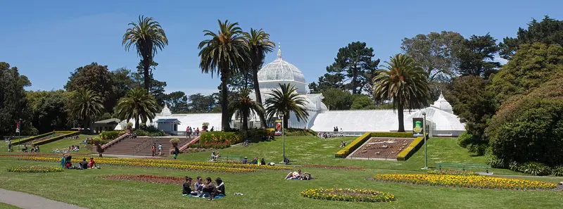
    The white wooden and glass greenhouse opened in April 1879 and is the oldest building in Golden Gate Park. Five rooms host tropical plants from Central and South American lowlands and cloud forests, alongside orchids and carnivorous plants over warm ponds. A tour takes just under an hour, and admission is charged. Even from the outside, the view over the flowerbeds in front is worthwhile.
    Open in Google Maps
    Buena Vista Park
    Park

    5Buena Vista Park

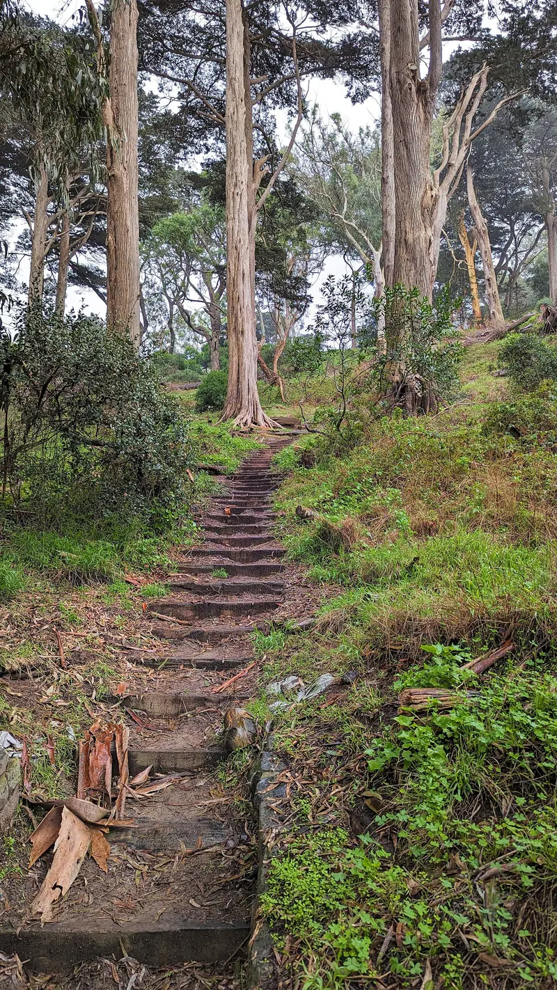
    The steep, wooded hill at the east end of Haight Street has been a park since 1867, making it the city's oldest. On roughly 15 hectares, paths lead up between oaks and cypresses. From the summit, you see across the city to the Golden Gate Bridge, and from a western viewpoint, over Golden Gate Park to the Pacific. The ascent takes about 15 minutes; it's best to go during the day.
    Open in Google Maps

    Restaurants in Haight-Ashbury & Golden Gate Park

    1

    Magnolia Brewing

    Brewpub from 1997 at the corner of Haight and Masonic Street, recently independent again. Alongside its own, often British-inspired beers, there are burgers, fish and chips, and weekend brunch. A good stop in the heart of Upper Haight, usually no wait at lunchtime.
    Show on Google Maps
    2

    Parada 22

    Small Puerto Rican spot at 1805 Haight Street, one of the few in the city and significantly cheaper than most restaurants in the area. Expect Mofongo made from mashed plantains, pork roast with rice and beans, and Tostones. Only a few tables, so it can get crowded at mealtimes.
    Show on Google Maps
    3

    Pork Store Cafe

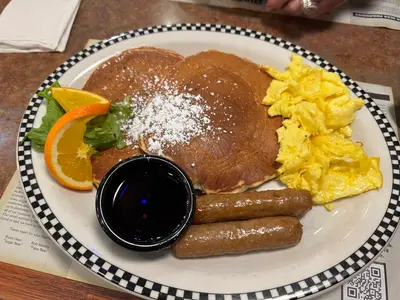
    Breakfast spot at 1451 Haight Street, a neighborhood fixture for ~46 years. Large portions of eggs, hash browns, pancakes, and biscuits with gravy; burgers also available for lunch. Weekend mornings see a line out the door; weekdays, you can usually walk right in.
    Show on Google Maps

    Food and drink

    Diner breakfast

    Diner breakfast

    The Haight has a few old-school breakfast spots serving big plates of eggs, hash browns and pancakes. Expect weekend lines in the morning; weekdays move faster.
    Craft beer

    Craft beer

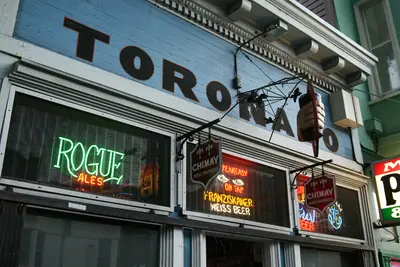
    San Francisco has a long brewing tradition. The Haight has its own brewpubs, and Lower Haight is home to Toronado, a beer bar with dozens of taps.
    Picnic in the park

    Picnic in the park

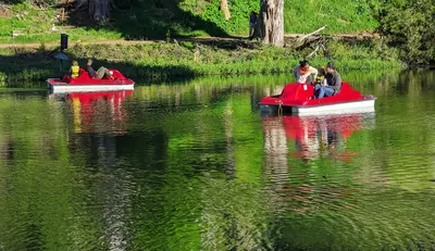
    For a day in Golden Gate Park, pack a picnic. The lawns around Stow Lake and Hellman Hollow near JFK Drive are good spots.

    Culture and history

    Until the 1880s this was all sand dunes and farmland. A cable car line brought day-trippers out to the new Golden Gate Park, and after the 1906 earthquake the Haight filled in with Victorian homes.Summer of Love: Cheap rents drew hippies in the 1960s. In 1967 tens of thousands of young people poured in for the Summer of Love, and bands like the Grateful Dead and Jefferson Airplane lived in the neighborhood.The park: Golden Gate Park was built on sand dunes starting in 1870. The 1894 Midwinter Fair left behind the Japanese Tea Garden and the forerunner of the de Young.Today: The Haight-Ashbury Street Fair has run every June since 1978. Big music festivals take over the park in summer and fall, when paths and buses get packed.

    Nightlife

    1

    Zam Zam

    Martini bar at 1633 Haight Street, operating for over 80 years, making it one of the oldest bars in the Haight. A dimly lit room, classic martinis and simple drinks, a good contrast to the tourist shops outside.
    Show on Google Maps
    2

    The Alembic

    The bar at 1725 Haight Street opened in 2006 and was among the city's first craft cocktail bars. It also features a kitchen that works with whole animals, serving small, hearty dishes. It fills up quickly in the evenings; early evening is your best bet for a spot at the bar.
    Show on Google Maps

    Getting around Haight-Ashbury & Golden Gate Park

    Walk the Haight; for the three-mile-long park, a bike or the bus is the better bet.Muni Metro N Judah: Runs underground from Market Street, then along the south side of the park (Cole and Carl, or 9th Ave and Irving for the museums) all the way to Ocean Beach.Buses: The 7 and 6 run along Haight Street, the 33 links the Haight with the Mission, and the 5 Fulton runs along the park's north side.In the park: Eastern JFK Drive is permanently car-free. Rent bikes or e-bikes at stations around the park edge or from shops on Stanyan Street.Parking: The Music Concourse garage sits underground between the de Young and the Academy of Sciences, handy for a museum day with kids.

    Accommodations in Haight-Ashbury & Golden Gate Park

    Find perfect stay in Haight-Ashbury & Golden Gate Park
    Booking.com* (Affiliate link)
    Search Hotels
    Agoda* (Affiliate link)
    Search Hotels
    Airbnb
    Vacation Rentals

    * Affiliate link: if you book through it, we earn a small commission. The price stays the same for you.

    Campgrounds in Haight-Ashbury & Golden Gate Park
    Find perfect campground in Haight-Ashbury & Golden Gate Park
    Search via Google Maps
    Campgrounds nearby (15km)
    Camping.info
    Find Campgrounds
    Park4Night
    RV Parks & Camping

    Plan your trip to Haight-Ashbury & Golden Gate Park
    Save places, build a route and plan your city trip, all in one place.

    1. 1
      Sunrise over alpine peaks and a sea of clouds
      1234

      Round trip

      12 days · 4 stops

      Saved

      Pick a route

      Pick a ready-made one or save places and plan your own.

      Open bookmarks
    2. 2

      Trip to Haight-Ashbury & Golden Gate Park
      Live
      • 1Japanese Tea Garden3 days
      • 2de Young Museum4 days
      • 3California Academy of Sciences5 days
      Budget

      Plan your trip

      The planner sorts stops, days and budget. Plan together in real time.

      Start trip planning
    3. 3
      9:41 No signal
      Haight-Ashbury & Golden Gate Park
      Available offline

      Use it on the road

      Download the guide to your phone and use it on site, even offline.

    Nearby

    Mission District & the Castro

    Mission District & the Castro

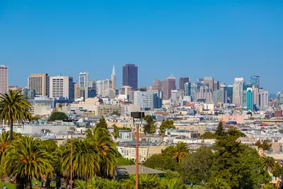
    The Mission District and the Castro sit next to each other south of downtown San Francisco, with Dolores Park in between. The weather here is often sunnier than on the waterfront, and the days revolve around murals, taquerias and the park, the nights around bars that stay busy late.The Mission is the city's oldest neighborhood, named for Mission Dolores (1776), and for decades the heart of San Francisco's Latino community. Valencia Street has cafés, bookstores and restaurants; Mission Street and 24th Street are louder and cheaper, lined with taquerias and panaderías. The Castro, just west, has been the country's best-known gay neighborhood since the 1970s, marked by the rainbow crosswalks at Castro and 18th and the Castro Theatre's neon sign.Plan your day: Mission Dolores and Dolores Park in the morning, a burrito for lunch, the Balmy Alley murals off 24th Street in the afternoon, then the Castro in the evening.Weather: Sheltered by Twin Peaks, the Mission is often warmer and less foggy than Fisherman's Wharf, which is why Dolores Park gets packed on sunny weekends.
    Presidio, Marina & Lands End

    Presidio, Marina & Lands End

    The Presidio, the Marina and Lands End cover San Francisco's northwest corner, between the Golden Gate Bridge and the Pacific. This is where you spend time outdoors: on the beach at Crissy Field, on wooded trails in the Presidio and along the Lands End coastal trail with views of the Golden Gate.The Marina is an affluent waterfront neighborhood with the Palace of Fine Arts, the Fort Mason cultural center and Chestnut Street for restaurants and bars. Just west is the Presidio, an Army post from 1776 to 1994 and now part of the Golden Gate National Recreation Area, with museums in old barracks, the Tunnel Tops park and Fort Point under the bridge. Farthest west, the Lands End trail winds through cypress groves to the ruins of the Sutro Baths.Plan your day: Walk from the Palace of Fine Arts across Crissy Field to Fort Point (about 3 miles), then take the bus out to the Lands End Lookout.Weather: Fog and wind hit here first. Summer mornings are often gray, so bring a jacket.
    San Francisco

    San Francisco

    San Francisco sits on the hilly northern tip of a peninsula in Northern California, between the Pacific and the Bay, with about 874,000 people. You come for the Golden Gate Bridge, the old prison on Alcatraz, cable cars clanking up steep hills and walkable neighborhoods like Chinatown and the Mission.Give it at least three full days: one for the waterfront from Fisherman's Wharf to the Ferry Building, one for Alcatraz and the Golden Gate Bridge, and one for Chinatown, North Beach, the Mission and Haight-Ashbury.The neighborhoods at a glanceFisherman's Wharf, North Beach & Chinatown: Piers and sea lions, the old Italian quarter and the oldest Chinatown in North America, all linked on foot.Union Square, SoMa & the Embarcadero: Downtown, with hotels, department stores, SFMOMA and the Ferry Building on the water.Nob Hill, Russian Hill & the Fillmore: Cable cars, Grace Cathedral and Lombard Street up on the hills, plus Japantown and the old Fillmore Street jazz corridor.Mission District & the Castro: Murals, taquerias, Dolores Park and the country's best-known gay neighborhood, often sunnier than the rest of town.Haight-Ashbury & Golden Gate Park: Hippie history, Victorian houses and the big park with its museums and Japanese Tea Garden.Presidio, Marina & Lands End: Beach, bayfront path and coastal trail around the Golden Gate Bridge.Book ahead: Alcatraz tickets are sold only through Alcatraz City Cruises, up to 90 days out. For summer, weekends and holiday weekends like Memorial Day or Labor Day, book early; walk-up spots are rare.Weather: Summer fog pours through the Golden Gate, and the waterfront gets cold and windy. Dress in layers and pack a jacket, even in July.Driving: You don't need a car downtown, and parking is expensive. Never leave anything visible in a parked car.
    Nob Hill, Russian Hill and Fillmore

    Nob Hill, Russian Hill and Fillmore

    Nob Hill, Russian Hill and the Fillmore are the hilltop neighborhoods west of Chinatown and North Beach: the railroad barons' grand hotels and cathedral on top, steep residential streets with stairways and gardens to the north, and Japantown and the old Fillmore Street jazz corridor to the west. Come for the cable cars, the views from the hills and Lombard Street, and stay for a drink at the Nob Hill hotel bars.Cable cars are the most practical way around here: the Powell-Hyde line climbs over Nob Hill to Lombard Street, and the California line crosses Nob Hill to Van Ness Avenue. Give Nob Hill and Russian Hill half a day, and save an afternoon for Japantown, Fillmore Street and Alamo Square with the Painted Ladies, a few blocks south.Nob Hill: Grace Cathedral, the Cable Car Museum, Huntington Park and the Fairmont and Mark Hopkins hotels.Russian Hill: Lombard Street, Macondray Lane and stairways with bay views.Japantown and the Fillmore: Japan Center and the Peace Pagoda, ramen and sushi, and on Fillmore Street, boutiques, restaurants and live jazz.The hills are seriously steep. If you're walking, allow extra time going up, and take the cable car or bus back.
    Fisherman's Wharf, North Beach & Chinatown

    Fisherman's Wharf, North Beach & Chinatown

    Fisherman's Wharf, North Beach and Chinatown sit side by side in San Francisco's northeast corner, between the bayfront and the Financial District. On foot, you can work your way from Chinatown's dim sum bakeries through North Beach's espresso bars down to the piers in half a day.Chinatown starts at the Dragon Gate on Grant Avenue, the stretch of souvenir shops and restaurants. For everyday Chinatown, with produce stands and fish markets, walk one block over to Stockton Street. North Beach is the old Italian neighborhood around Columbus Avenue and Washington Square, full of pizzerias, delis and the bars where the Beat writers drank in the 1950s. Above it rises Telegraph Hill and Coit Tower. Fisherman's Wharf is the most touristy part of town: crab stands, T-shirt shops, Pier 39 and the Alcatraz ferry.Plan your day: Chinatown in the morning, lunch in North Beach, then up to Coit Tower in the afternoon and down to the Wharf. From the Dragon Gate to Pier 39 is about 1.5 miles.The Wharf: An hour is plenty for Pier 39 and the sea lions. You'll eat better in North Beach or Chinatown than at the waterfront places that live off foot traffic.

    Sources & method

    • Photos: Wikimedia Commons, Google Maps. Each photo carries its credit.
    • Place data such as addresses and ratings comes from Google Maps.
    • The content is based on web research from public, traceable sources. How the content is made · The role of AI