Fernweh: Home
    ExploreTravel GuidesPlan a tripMy tripLast visited
    de|en
    All Places & RegionsAll highlightsAbout FernwehFAQPrivacy PolicyImprint
    ExploreTravel GuidesPlan a tripMy tripLast visited
    Atherton Tablelands

    Australia

    Atherton Tablelands

    Highland Area

    Volcanic high plateau behind Cairns, at 700 to over 1,000 meters. Here it's cooler than on the coast: pastures, coffee plantations, crater lakes, and waterfalls abound.

    by Felix Gillen

    1. Home
    2. Destinations
    3. Australia
    4. Tropical North Queensland
    5. Atherton Tablelands
    Volcanic high plateau behind Cairns, at 700 to over 1,000 meters. Here it's cooler than on the coast: pastures, coffee plantations, crater lakes, and waterfalls abound. A good day trip, even better with two nights in Yungaburra.

    Sehenswürdigkeiten

    Discover the most important sights and attractions

    1Atherton Forest Mountain Bike Park

    Large trail network in the forest directly above Atherton. Trails for beginners to experts, through eucalyptus and rainforest. You can rent bikes in town. After rain, some trails are closed.
    Open in Google Maps

    2Tableland Regional Gallery

    Regional gallery in Atherton with rotating exhibitions by artists from the Tablelands. Small, good for half an hour.
    Open in Google Maps
    Hasties-Swamp-Nationalpark

    3Hasties-Swamp-Nationalpark

    Wetland south of Atherton with a two-storey observation hide. During the dry season, thousands of waterfowl gather here, including Whistling Ducks and Magpie Geese. Bring binoculars, ideally early in the morning.
    Open in Google Maps

    4Hallorans Hill Conservation Park

    Extinct volcanic cone on the edge of Atherton. A short, steep path leads through rainforest remnants to the summit, with views over the town and plateau.
    Open in Google Maps

    5Platypus Park

    Small park by the creek in Atherton. At dusk, with a little patience, platypus appear here. Stay still and watch for ripples in the water.
    Open in Google Maps
    Mount Baldy

    6Mount Baldy

    Forested mountain west of Atherton, part of Mount Baldy Conservation Park. Hiking trails lead through dry eucalyptus forest to viewpoints overlooking the plateau. The ascent is steep, bring sturdy footwear and water.
    Open in Google Maps

    Essen & Trinken

    1

    Northern Star Thai Restaurant

    Thai restaurant in Atherton with curries and noodle dishes. Casual and affordable, reservations recommended on weekend evenings.
    Show on Google Maps
    2

    Baba Curry

    Indian restaurant in Atherton with curries, dal, and naan. Also for takeaway.
    Show on Google Maps
    3

    Atherton Bakehouse

    Bakery in Atherton with bread, cakes and Australian Meat Pies. Good for a quick breakfast or provisions for the Waterfall Circuit.
    Show on Google Maps
    4

    Dolce vita Tablelands

    Italian restaurant in Atherton with pasta and pizza. A relaxed place for dinner; bookings are essential on weekends.
    Show on Google Maps
    5

    Dee-Licious Family Delicatessen

    Small deli-café in Atherton. Sandwiches, salads, cakes, and coffee, plus local products to take away.
    Show on Google Maps
    6

    Greek Street Food Inc

    Greek snack bar on Main Street in Atherton. Gyros, Souvlaki and salads, fast and filling.
    Show on Google Maps

    Kung Food

    Restaurant in 4A Jack St.
    Show on Google Maps

    Subway

    Fast-food chain for customizable sandwiches and salads, also for conscious eaters.
    Show on Google Maps

    Food and Drink

    The Tablelands are the food bowl of Tropical North Queensland – a cool climate on fertile volcanic soil yields what the coast can't.

    Plateau's Coffee

    On the Tablelands, coffee is not just roasted, but grown. Several businesses around Mareeba offer tours of their plantations and roasteries and serve the results directly.

    Dairy Products and Cheese

    Around Malanda lies Queensland's key dairy region. Farms sell cheese, ice cream, chocolate on site, a good break between two waterfalls.

    Country inns and markets

    In Yungaburra and Millaa Millaa, old hotels serve homestyle cooking. At the markets, you'll find tropical fruits, Macadamia, and local preserves.

    Culture & Character

    Cool Highlands Above the TropicsThe Atherton Tablelands lie at 700 to over 1,000 meters behind Cairns. This volcanic plateau has red basalt soil, where dairy farming, coffee, macadamia, and tropical fruits thrive. On the drive up, the temperature drops noticeably, and in the hollows, fog often hangs in the mornings.Villages and Rainforest RemnantsYungaburra has a preserved village center from the era of timber-getters and dairies. Malanda, Atherton, and Millaa Millaa have remained working towns. Between the pastures stand remnants of the original rainforest, including giant strangler figs that germinated on other trees and remained standing alone after their hosts died.

    Orientation & Arrival

    Getting ThereSeveral roads lead up from Cairns: the Gillies Range Road from Gordonvale with tight bends through the rainforest, the Kennedy Highway via Kuranda further north, and the Palmerston Highway from Innisfail in the south. Allow a good hour to reach the highlands.Getting AroundThere is practically no public transport. Waterfalls, lakes, and farms are scattered along country roads and can only be reached by private vehicle or on a guided day tour. Drive carefully at dusk: Tree kangaroos, wallabies, and cassowaries live on the plateau, and the roads are unlit.

    Accommodations in Atherton Tablelands

    Find perfect stay in Atherton Tablelands

    Booking.com* (Affiliate link)
    Search Hotels
    Agoda* (Affiliate link)
    Search Hotels
    Airbnb
    Vacation Rentals

    * Affiliate link: if you book through it, we earn a small commission. The price stays the same for you.
    Nearby

    Cairns

    Cairns

    Cairns, with approximately 160,000 inhabitants, is the largest city in tropical North Queensland and a gateway to the Great Barrier Reef and the Daintree Rainforest. Life revolves around the Esplanade, featuring a large swimming lagoon, BBQ areas, and a promenade.From the Reef Fleet Terminal, boats depart daily for the outer reefs and islands. The best time to visit is the dry season from May to October.
    Tropical North Queensland

    Tropical North Queensland

    Tropical North Queensland is the state's northeast, centered around Cairns. Here, two UNESCO World Heritage Sites converge: the Great Barrier Reef offshore and the Wet Tropics rainforests, including Daintree, on land.Cairns and Port Douglas are the main gateways. In the hinterland lie the cooler Atherton Tablelands, featuring lakes and waterfalls.
    Port Douglas

    Port Douglas

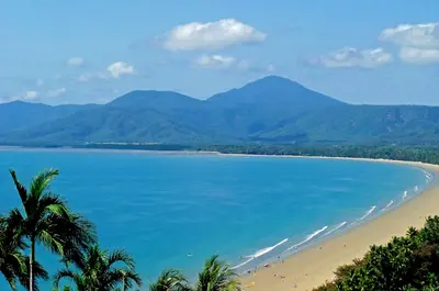
    A small holiday resort an hour's drive north of Cairns. A main street, a long palm-fringed beach, and a harbour where boats depart for the outer reef. The Daintree begins just under an hour further north.
    Mission Beach

    Mission Beach

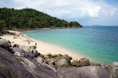
    Four small towns on a roughly 14-kilometer long beach between Cairns and Townsville. The rainforest almost reaches the water, and Dunk Island lies off the coast. It's quieter here than in Cairns or Port Douglas, and with a bit of luck, you'll spot cassowaries by the roadside.
    Daintree National Park

    Daintree National Park

    North of Daintree River, lowland rainforest meets the Coral Sea. The National Park, part of the UNESCO World Heritage Wet Tropics of Queensland, since 2021 co-managed with the Eastern Kuku Yalanji. Boardwalks, remote beaches, and roadside cassowaries shape the days here.

    Sources & method

    • Photos: Wikimedia Commons, Unsplash, Pexels. Each photo carries its credit.
    • Place data such as addresses and ratings comes from Google Maps.
    • The content is based on web research from public, traceable sources. How the content is made · The role of AI