Fernweh: Home
    ExploreTravel GuidesPlan a tripMy tripLast visited
    de|en
    All Places & RegionsAll highlightsAbout FernwehFAQPrivacy PolicyImprint
    ExploreTravel GuidesPlan a tripMy tripLast visited
    • Neighborhoods & highlights
    • Walking tours
    • Eat & drink
    • Food culture
    • Culture
    • Nightlife
    • Getting around
    • Accommodation
    • Plan trip
    • Nearby
    Trento (Trento)

    Italy

    Trento (Trento)

    CityCulture

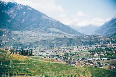
    Trento lies in the Etschtal, directly on the Adige, and is the capital of the Autonomous Province of Trento and the Trentino-South Tyrol region. Council City From 1545 to 1563, the Council of Trent met here intermittently.

    by Felix Gillen

    1. Home
    2. Destinations
    3. Italy
    4. Trento (Trento)
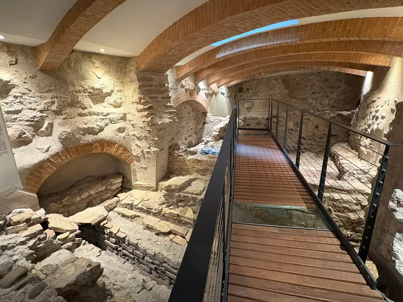
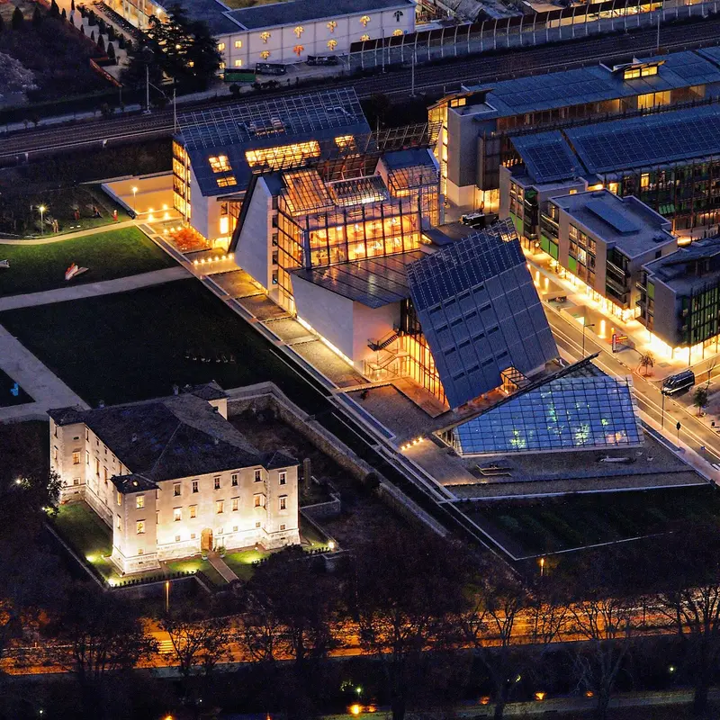
    Trento lies in the Etschtal, directly on the Adige, and is the capital of the Autonomous Province of Trento and the Trentino-South Tyrol region.Council CityFrom 1545 to 1563, the Council of Trent met here intermittently. Several solemn sessions took place in the Cathedral, including the opening in December 1545.AttractionsThe central points are the Piazza Duomo with the Cathedral of San Vigilio and the Castello del Buonconsiglio, the former residence of the prince-bishops. Remains of the Roman Tridentum are accessible, among other places, in the underground S.A.S.S. and beneath Palazzo Lodron. In the Le Albere district, you'll find the MUSE natural history museum by Renzo Piano.SurroundingsA cable car leads across the Adige up to Sardagna; west of the city rises the 2091-meter-high Monte Bondone. The sparkling wine Trentodoc is produced in the surrounding area.

    Sights in Trento (Trento)

    Discover the most important sights and attractions

    MUSE
    Museum

    1MUSE

    Natural History Museum in the Le Albere district, designed by Renzo Piano and opened in July 2013.
    Open in Google Maps
    Piazza Duomo
    Attraction

    2Piazza Duomo

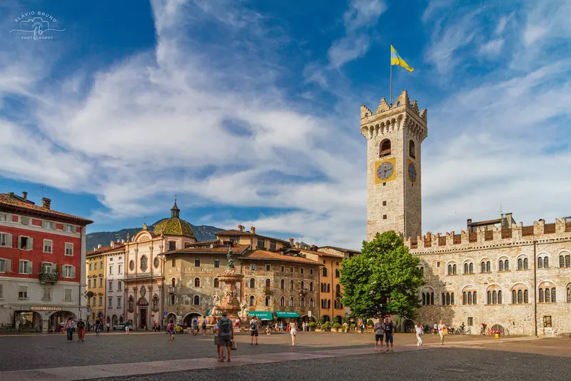
    Main square of the old town, porphyry-paved. In the center is the 18th-century Neptune Fountain, south the Cathedral, east the Palazzo Pretorio with City Tower and Diocesan Museum. On the north side, under arcades, are the frescoed houses Casa Cazuffi and Casa Rella.
    Open in Google Maps
    Dom San Vigilio
    Church

    3Dom San Vigilio

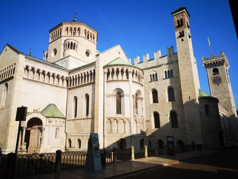
    Cathedral blending Romanesque and Gothic styles, rebuilt from 1212; construction spanned over a century. The rose window in the north transept depicts a Wheel of Fortune. Several sessions of the Council of Trent were held here. Beneath the floor lie remains of a 4th-century basilica, accessible as an archaeological area from the north transept.
    Open in Google Maps
    Doss Trento
    Park

    4Doss Trento

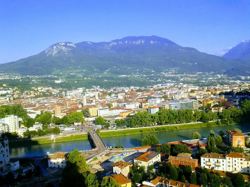
    Hill by the Adige, offering views over the city. At the top are the Mausoleum for Cesare Battisti, built in 1935, and the Alpini Historical Museum.
    Open in Google Maps
    Castello del Buonconsiglio
    Museum

    5Castello del Buonconsiglio

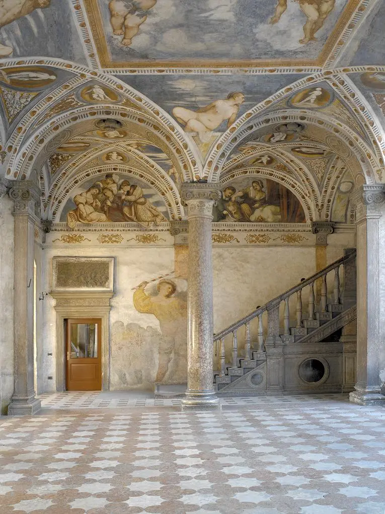
    A castle complex and former residence of the Prince-Bishops of Trent, today a Regional Art Museum. The Eagle Tower preserves the fresco cycle of the Months, commissioned around 1400. In the castle moat, Cesare Battisti was executed in 1916.
    Open in Google Maps
    Tridentum: Archaeological Section Palazzo Lodron
    Museum

    6Tridentum: Archaeological Section Palazzo Lodron

    Excavation area beneath Palazzo Lodron in the Old Town with remains of Roman Tridentum: a section of the city wall from the Augustan era, a paved street, a wine bar, and a house. Admission is free, open only on certain weekdays; check current times in advance.
    Open in Google Maps

    City walks in Trento (Trento)

    Curated walking tours through the city's highlights, handpicked by experienced travel journalists.

    Trento's Splendour: A Journey Through Time Among Palaces and the Council

    Discover the historic old town of Trento on a relaxed walk. Admire magnificent fresco-decorated palaces, learn about the Council of Trent and let the charming flair of this alpine city enchant you.

    ~2 Std.
    Open in Google Maps
    Stops (5)

    Dining & Drinks

    1

    Osteria a le Due Spade

    Small, wood-paneled osteria near the Duomo, with creatively plated meat and fish dishes and an extensive wine list.
    Show on Google Maps
    2

    Restaurant Bernardo Clesio

    Restaurant on Via Alfieri near the station with Italian cuisine.
    Show on Google Maps
    3

    Ristorante Al Vo'

    Family-run restaurant with Trentino dishes in a house with a long guesthouse tradition.
    Show on Google Maps
    4

    Ancient Trattoria Due Mori

    Family-run trattoria near the Castello del Buonconsiglio with Trentino pasta dishes and wines from local wineries.
    Show on Google Maps

    Dining & Drinks

    The Trentino cuisine combines Alpine and Northern Italian traditions.

    Strangolapreti

    Small dumplings from traditional Trentino cuisine, found in establishments bearing the "Osteria Tipica Trentina" sign.

    Carne salada

    Cured beef, which is also a classic in Trentino's osterias.

    Trentodoc

    Trentino sparkling wine, traditional method. Giulio Ferrari introduced bottle fermentation and Chardonnay here in 1902.

    Teroldego and Marzemino

    Red wines from Trentino: Teroldego from Piana Rotaliana, Marzemino from Vallagarina.

    Culture

    Trento dates back to the Roman Tridentum. In 1004, the bishops gained secular power; the Prince-Bishopric endured until its secularization in 1803. The city then belonged to Austria; on November 3, 1918, Italian troops marched in. Cesare Battisti was executed on July 12, 1916, in the moat of Castello del Buonconsiglio; his mausoleum on Doss Trento was created in 1935.The Council of Trent shaped the Catholic Church. The Diocesan Museum in Palazzo Pretorio at Cathedral Square and the Castello del Buonconsiglio, a regional art museum, exhibit artworks of the city's history.

    Nightlife

    1

    Da Robert

    Bar on Via Manci in the Old Town, for an aperitif or a glass in the evening.
    Show on Google Maps
    2

    Bar Picaro

    Bar on Via San Giovanni on the western edge of the Old Town.
    Show on Google Maps
    3

    Forsterbräu Trento

    Forst Brewery's beer pub with regional dishes, cheese platters, and pretzels, a meeting point in the Old Town in the evenings.
    Show on Google Maps
    4

    La Cantinota

    Venue on Via San Marco near the Castello del Buonconsiglio, known as a meeting point with evening music.
    Show on Google Maps

    Traveling

    Trento lies on the Brenner Railway; here also begin the Valsugana Railway and the Trento–Malè–Mezzana narrow-gauge railway.Explore the old town on foot. A cable car connects the city with Sardagna.

    Accommodations in Trento (Trento)

    Find perfect stay in Trento (Trento)

    Booking.com* (Affiliate link)
    Search Hotels
    Agoda* (Affiliate link)
    Search Hotels
    Airbnb
    Vacation Rentals

    * Affiliate link: if you book through it, we earn a small commission. The price stays the same for you.

    Campgrounds in Trento (Trento)

    Find perfect campground in Trento (Trento)

    Search via Google Maps
    Campgrounds nearby (15km)
    Camping.info
    Find Campgrounds
    Park4Night
    RV Parks & Camping

    Plan your trip to Trento (Trento)

    Save places, build a route and plan your city trip, all in one place.

    1. 1
      Sunrise over alpine peaks and a sea of clouds
      1234

      Round trip

      12 days · 4 stops

      Saved

      Pick a route

      Pick a ready-made one or save places and plan your own.

      Open bookmarks
    2. 2

      Trip to Trento (Trento)

      Live
      • 1MUSE3 days
      • 2Piazza Duomo4 days
      • 3Dom San Vigilio5 days
      Budget

      Plan your trip

      The planner sorts stops, days and budget. Plan together in real time.

      Start trip planning
    3. 3
      9:41 No signal
      Trento (Trento)
      Available offline

      Use it on the road

      Download the guide to your phone and use it on site, even offline.

    Nearby

    Bozen

    Bozen

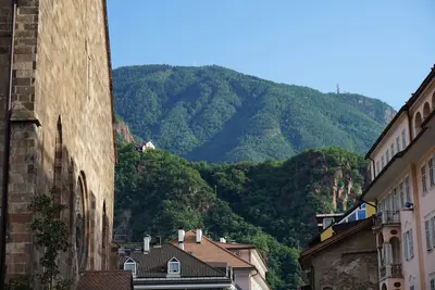
    Nestled in a valley basin at the confluence of the Talfer and Eisack, Bolzano is the capital of South Tyrol. The city is bilingual; unlike the rest of South Tyrol, the Italian language group is in the majority here: In the 2024 language census, about three-quarters of the inhabitants declared themselves part of the Italian language group and about one-quarter part of the German language group.Old TownThe heart of the Old Town features the over 300-meter-long Lauben (arcades) with their merchant houses, the Obstplatz (Fruit Square) with its market, and the Waltherplatz with the Gothic cathedral. Gothic frescoes are preserved in the Dominican Church, while the Franciscan Church boasts a winged altar and a cloister.MuseumsThe South Tyrol Museum of Archaeology exhibits the glacier mummy Ötzi. Additionally, there is the Museion for modern and contemporary art and the Messner Mountain Museum Firmian at Sigmundskron Castle.SurroundingsCable cars lead up to Ritten and Kohlern.
    Südtirol

    Südtirol

    South Tyrol is Italy's northernmost province, bordering the Austrian states of Tyrol and Salzburg, as well as the Swiss canton of Graubünden. Together with Trentino, it forms the autonomous region of Trentino-South Tyrol. The majority of residents speak German, just over a fifth Italian, and about four percent Ladin.LandscapeThe highest mountain is Ortler at 3905 meters. To the east lie the Dolomites, featuring Val Gardena, Alpe di Siusi, and Lake Braies.CitiesBolzano is the regional capital; its Archaeological Museum houses the glacier mummy Ötzi. Merano developed early on as a spa town, while Bressanone was a bishopric for centuries and is now one of the two cathedral cities of the Diocese of Bolzano-Bressanone. Castles such as Tyrol Castle, Runkelstein, and Sigmundskron shape the valleys.WineTypical red wines include Vernatsch and Lagrein, while Gewürztraminer is a characteristic white wine.
    Seiser Alm

    Seiser Alm

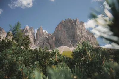
    The Seiser Alm (Alpe di Siusi) is a wide high plateau at roughly 1,680 to 2,350 meters with an area of about 56 square kilometers, and is considered the largest high alpine meadow in Europe. Administratively it is a fraction of the municipality of Kastelruth. Its southern parts belong to the Schlern-Rosengarten Nature Park.SummerA dense network of trails, alpine pastures and huts makes the Alm a destination for families and leisurely hikers. The tours up the Schlern are more demanding.WinterIn winter the Seiser Alm is a ski area with about 60 kilometers of slopes, part of Dolomiti Superski and connected to St. Ulrich in Gröden by a gondola lift.AccessThe road from Seis to Compatsch is closed to private traffic uphill between 9 a.m. and 5 p.m., while you may drive downhill at any time. Since the end of June 2026, an online reservation is mandatory for the parking lots P1 Spitzbühl and P2 Compatsch. The easiest way is to take the cable car from Seis to Compatsch. Guests of accommodations on the Alm receive an access permit from their host. You can find the current rules at Seiser Alm Marketing.
    Veneto

    Veneto

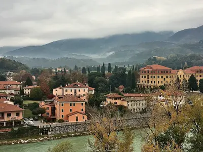
    The Veneto stretches from the Adriatic coast with the Venice Lagoon and the Po Delta, across the Po Plain, to the eastern shore of Lake Garda and into the Dolomites. Around 4.9 million people live here; Venice is the capital, and Verona the largest city. In addition, there are Padua, Vicenza, and Treviso, Palladio's villas, the Prosecco Hills, and winter sports resorts like Cortina d'Ampezzo.
    Meran (Merano)

    Meran (Merano)

    Meran lies in a valley basin in the Etsch Valley, into which the Passeier Valley flows from the north. Its mild climate allows not only wine but also palms, cypresses, holm oaks, and Lebanon cedars to grow.Spa TownMeran has been a spa town since 1855. The Kurhaus on the Passerpromenade consists of a historicist wing (1873/74) and an Art Nouveau wing (1912-1914). The Therme Meran, opened in 2005, continues this tradition.Old Town and SurroundingsThe Laubengasse is the Old Town's main axis; the Parish Church of St. Nicholas stands on Pfarrplatz. The Tappeinerweg runs along the slope of Küchelberg; on the city's eastern edge lie the Gardens of Trauttmansdorff Castle, and north is Dorf Tirol with its namesake castle.

    Sources & method

    • Photos: Unsplash, Google Maps. Each photo carries its credit.
    • Place data such as addresses and ratings comes from Google Maps.
    • The content is based on web research from public, traceable sources. How the content is made · The role of AI