Fernweh: Home
    ExploreTravel GuidesPlan a tripMy tripLast visited
    de|en
    All Places & RegionsAll highlightsAbout FernwehFAQPrivacy PolicyImprint
    ExploreTravel GuidesPlan a tripMy tripLast visited
    Palenque

    Mexico

    Palenque

    Archaeological SiteCulture

    Palenque is a Maya ruined city on the edge of the rainforest in northern Chiapas, which flourished as a powerful regional capital between 500 and 700.

    by Felix Gillen

    1. Home
    2. Destinations
    3. Mexico
    4. Chiapas
    5. Palenque
    Palenque is a Maya ruined city on the edge of the rainforest in northern Chiapas, which flourished as a powerful regional capital between 500 and 700. You come for the Palace with its tower and the Temple of the Inscriptions with the tomb of the ruler Pakal; since 1987 the site, together with its national park, has been a UNESCO World Heritage Site. Add the Temple of the Cross group and waterfalls such as Misol-Ha in the surrounding area.

    Sehenswürdigkeiten

    Discover the most important sights and attractions

    Archaeological Zone of Palenque
    Attraction

    1Archaeological Zone of Palenque

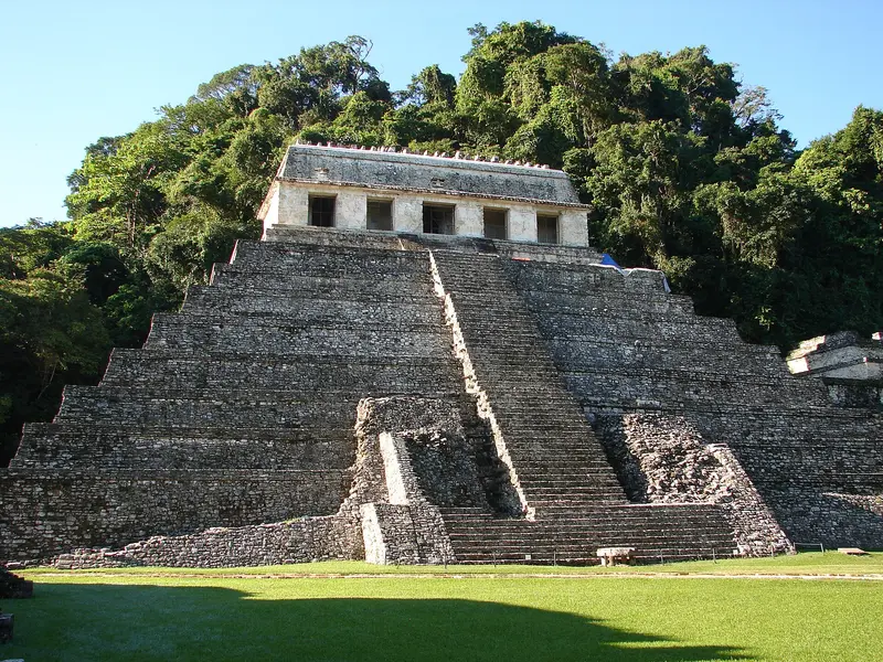
    The ruins of the Maya city, a UNESCO World Heritage site since 1987. Spread across several levels in the rainforest are the Palace, the Temple of the Inscriptions with the tomb of ruler Pakal, and the Temples of the Cross Group.
    Open in Google Maps
    El Palacio
    Historic Landmark

    2El Palacio

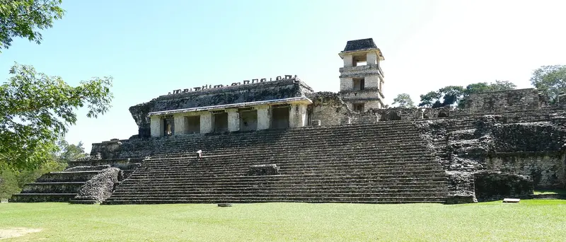
    The Palace is the largest building complex in Palenque: interconnected structures with courtyards, galleries, and stucco reliefs. Its four-story tower is often interpreted as an observatory.
    Open in Google Maps
    Museum

    3Palenque Site Museum "Alberto Ruz Lhuillier"

    The INAH Museum, located on the access road to the ruins (Km 6.5), reopened in September 2024 after renovations. It displays over 230 artifacts from various areas of the site, with a dedicated room featuring a replica of Pakal's burial chamber and sarcophagus. The museum is open Tuesday to Sunday, closed Mondays; check current hours before your visit.
    Open in Google Maps
    Park

    4Aluxes Ecopark

    Eco-park on the road to the ruins (Km 2.6) takes in confiscated and injured wildlife as a rescue station. You'll see crocodiles, manatees, scarlet macaws, and turtles, among others, as a circular path leads through the wooded grounds.
    Open in Google Maps
    Cascada Misol-Ha
    Attraction

    5Cascada Misol-Ha

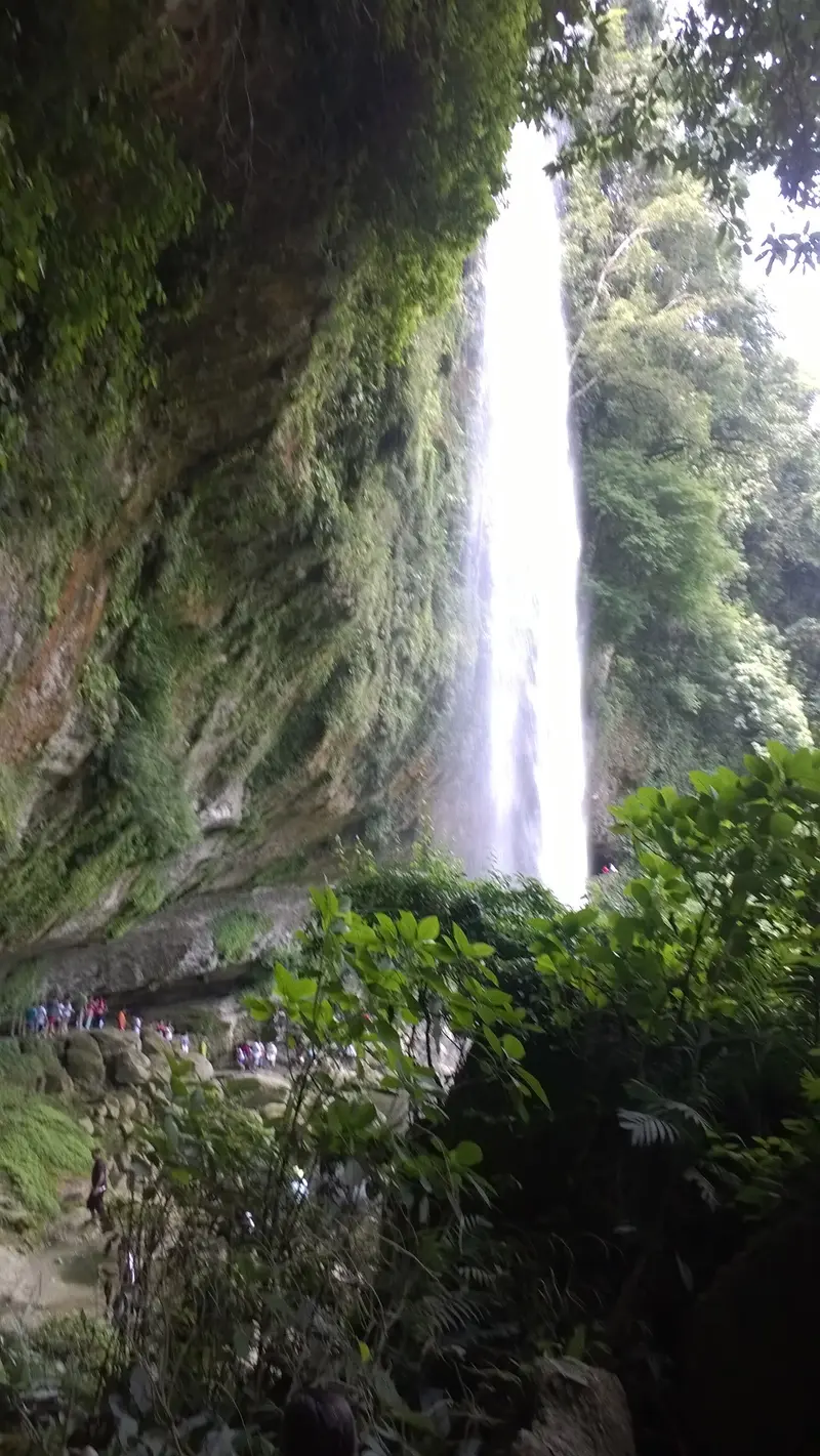
    Around 30-meter high waterfall in the rainforest, about 20 kilometers south of Palenque. A path leads behind the waterfall; the site at the pool at the foot of the falls also offers cabañas.
    Open in Google Maps
    Park

    6Cascadas de Agua Azul

    Cascades of Río Xanil, about 69 kilometers from Palenque, a protected area for flora and fauna since 2000. The water is rich in lime and shimmers turquoise; you can swim in the pools below the tiers.
    Open in Google Maps

    Essen & Trinken

    1

    Bar Mayabell

    Bar and restaurant on the grounds of the Mayabell accommodation, on the road to the ruins, near the entrance to the archaeological zone, with a large pool.
    Show on Google Maps
    2

    Tlatoani Restaurante & Jungle Bar

    Restaurant and bar in Nahual Can Eco Village north of the Ruin Road, surrounded by rainforest.
    Show on Google Maps
    3

    El Panchan

    Restaurant and bar in the El Panchán forest area on the road to the ruins (Km 4), where simple accommodations and eateries gather.
    Show on Google Maps
    4

    Don Mucho's

    Restaurant with a bar in El Panchán, serving Italian-Mexican cuisine such as pizza, calzones, pasta, and meat and fish dishes; local musicians often perform in the evenings.
    Show on Google Maps
    5

    Restaurante El Michol

    Restaurant on the access road to the archaeological zone, convenient for a meal before or after visiting the ruins.
    Show on Google Maps

    History of the Maya City

    The City of PakalThe settlement dates from approx. 226 BC to 799 AD. The city flourished under Kʼinich Janaab Pakal, who reigned from 615 to 683. In 1952, archaeologist Alberto Ruz Lhuillier discovered the entrance to Pakal's burial chamber, with its relief-decorated sarcophagus, beneath the Temple of the Inscriptions. In 1994, the tomb of the so-called Red Queen was found in Temple XIII.What You'll See on SitePalace: Complex of courtyards and galleries with a four-story tower.Group of the Crosses: Temples of the Cross, the Sun, and the Foliated Cross on stepped pyramids.Museo de Sitio Alberto Ruz Lhuillier: Approximately 200 artifacts from the site and a replica of Pakal's sarcophagus. Check current opening hours before your visit.ExcursionsMisol-Ha: Approximately 30-meter-high waterfall about 20 kilometers from Palenque.Agua Azul: Cascades of the Río Xanil with calcareous, turquoise water, about 69 kilometers away.

    Getting To and Around

    The ruins are located a few kilometers west of the city of Palenque. Colectivos run regularly during the day from the town along the Carretera a las Ruinas to the entrance; en route are the accommodations and restaurants in the El Panchán area.Palenque is the terminus of the Tren Maya; the station is located on the site of the former airfield. Long-distance buses connect the town to San Cristóbal de las Casas, Villahermosa, and Mérida. Plan intercity travel during daylight hours and check the latest UK FCDO Travel Advice for Mexico before you go.Come early in the morning, then it's still cooler and the paths are less busy.

    Accommodations in Palenque

    Find perfect stay in Palenque

    Booking.com* (Affiliate link)
    Search Hotels
    Agoda* (Affiliate link)
    Search Hotels
    Airbnb
    Vacation Rentals

    * Affiliate link: if you book through it, we earn a small commission. The price stays the same for you.

    Nearby

    Chiapas

    Chiapas

    Chiapas is Mexico's southernmost state, bordering Guatemala to the east. In the highlands lies the colonial city of San Cristóbal de las Casas at around 2,200 meters, while in the humid northern lowlands is the Mayan site of Palenque, a UNESCO World Heritage site since 1987. The capital is Tuxtla Gutiérrez, from where boat trips through the Cañón del Sumidero are accessible.
    San Cristóbal de las Casas

    San Cristóbal de las Casas

    San Cristóbal de las Casas is a colonial city founded in 1528, situated at around 2,200 meters in the Chiapas Highlands, about an hour's drive from the capital Tuxtla Gutiérrez. You come for its old town with low colonial houses, pedestrian streets, and churches like the Cathedral and Santo Domingo, and for the nearby Tzotzil villages of San Juan Chamula and Zinacantán.
    Comitán de Domínguez

    Comitán de Domínguez

    Comitán de Domínguez, situated at over 1,600 meters in southeastern Chiapas, has been a Pueblo Mágico since 2012. Around the Parque Central, colonial churches, museums, and colorful houses stand, and the city is also a gateway to the Lagunas de Montebello, the waterfalls of El Chiflón, and the Mayan site Tenam Puente.
    Tuxtla Gutiérrez

    Tuxtla Gutiérrez

    Tuxtla Gutiérrez has been the capital of Chiapas since 1892 and, with around 600,000 inhabitants, is the state's largest city. The city is located in the warm valley of the Río Sabinal at just over 500 meters and directly borders the Cañón del Sumidero National Park.
    San Francisco de Campeche

    San Francisco de Campeche

    San Francisco de Campeche, usually just Campeche, is the capital of its eponymous state on the Gulf of Mexico. Its Old Town is surrounded by a city wall with bastions, built in the 17th and 18th centuries to ward off pirate attacks. It has been a UNESCO World Heritage site since 1999. Compared to Cancún and Tulum, it is significantly quieter here.

    Sources & method

    • Photos: Wikimedia Commons, Pexels, Google Maps. Each photo carries its credit.
    • Place data such as addresses and ratings comes from Google Maps.
    • The content is based on web research from public, traceable sources. How the content is made · The role of AI