Fernweh: Home
    ExploreTravel GuidesPlan a tripMy tripLast visited
    de|en
    All Places & RegionsAll highlightsAbout FernwehFAQPrivacy PolicyImprint
    ExploreTravel GuidesPlan a tripMy tripLast visited
    • Neighborhoods & highlights
    • Walking tours
    • Eat & drink
    • Food culture
    • Culture
    • Nightlife
    • Getting around
    • Accommodation
    • Plan trip
    • Nearby
    Tuxtla Gutiérrez

    Mexico

    Tuxtla Gutiérrez

    City

    Tuxtla Gutiérrez has been the capital of Chiapas since 1892 and, with around 600,000 inhabitants, is the state's largest city.

    by Felix Gillen

    1. Home
    2. Destinations
    3. Mexico
    4. Chiapas
    5. Tuxtla Gutiérrez
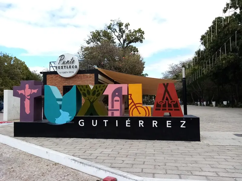
    Tuxtla Gutiérrez has been the capital of Chiapas since 1892 and, with around 600,000 inhabitants, is the state's largest city. The city is located in the warm valley of the Río Sabinal at just over 500 meters and directly borders the Cañón del Sumidero National Park.

    Sights in Tuxtla Gutiérrez

    Discover the most important sights and attractions

    Antiguo Palacio Municipal de Tuxtla

    1Antiguo Palacio Municipal de Tuxtla

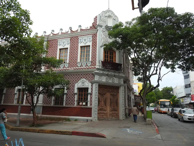
    Historic former town hall building in the center, just a few steps from Parque Central and the Cathedral.
    Open in Google Maps
    Parque de la Marimba

    2Parque de la Marimba

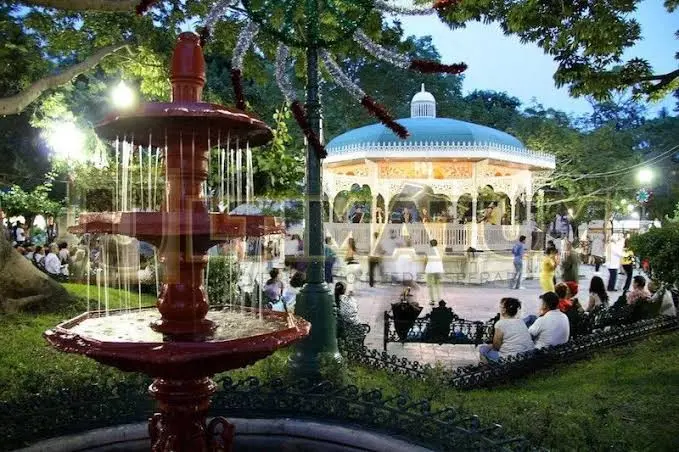
    The park, created in 1993 with a central music pavilion, is the city's evening meeting point. Marimba groups play here regularly, and couples dance on the square.
    Open in Google Maps
    ZooMAT

    3ZooMAT

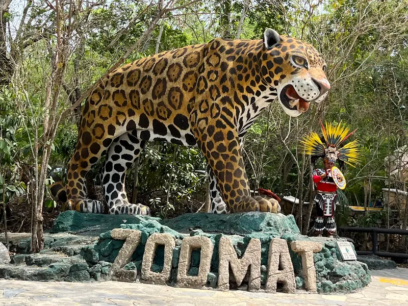
    Miguel Álvarez del Toro Zoo, founded in 1942 by the naturalist of the same name. On forest trails, you'll see around 1,400 animals from about 220 species native to Chiapas, including jaguars and quetzals.
    Open in Google Maps
    Glorioso Cristo de Chiapas

    4Glorioso Cristo de Chiapas

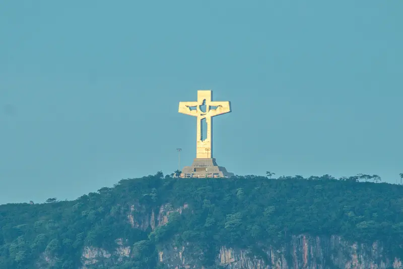
    Approximately 62-meter high cross made of steel and concrete on a hill southwest of the city, inaugurated in 2011 and also called Cristo de Copoya. Inside, the profile of a Christ figure is visible, and below it lies a chapel.
    Open in Google Maps
    Museo del Café de Chiapas

    5Museo del Café de Chiapas

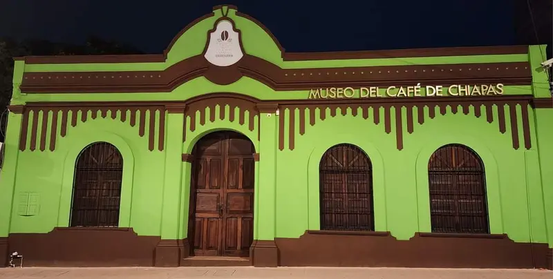
    Museum on the history, cultivation, and processing of Chiapas coffee, located in La Casona, an INAH-designated heritage building. It includes a tasting lab and a small shop.
    Open in Google Maps
    Calzada de las Personas Ilustres

    6Calzada de las Personas Ilustres

    The promenade through Parque Madero in the city's east, once called Paseo de los Hombres Ilustres. Lining it are museums, cultural centers, and the Faustino Miranda Botanical Garden on the Río Sabinal.
    Open in Google Maps

    City walks in Tuxtla Gutiérrez

    Curated walking tours through the city's highlights, handpicked by experienced travel journalists.

    Tuxtla's Heartbeat: A Walk Through Culture and Rhythm

    Discover the vibrant heart of Tuxtla Gutiérrez on this two-hour tour. From the majestic cathedral to the lively Marimba Park, immerse yourself in the history, the vibrant culture and the sounds of this fascinating city in Chiapas.

    ~2 Std.
    Open in Google Maps
    Stops (5)

    Essen & Trinken

    1

    Taco Ciro's

    Taquería on Avenida Séptima Norte Poniente, north of the city center. For the tacos, nearly the entire pig is used; the portions are generous, and onions and salsas are plentiful.
    Show on Google Maps
    2

    Restaurante Zúñiga's - Comida Regional.

    Restaurant serving regional Chiapas cuisine on Avenida 13a Norte Oriente, in the northern city center.
    Show on Google Maps
    3

    Florentina Pizzas

    Pizzeria in the west of the city center, near Parque de la Marimba.
    Show on Google Maps
    4

    La Mies Restaurante

    Restaurant on Avenida 1a. Norte Poniente in the west of the city center.
    Show on Google Maps
    5

    Expendio De Café "San Carlos"

    Coffee shop and café on Avenida Central Poniente, featuring coffee from Chiapas.
    Show on Google Maps
    6

    La Casa del Jardín

    Restaurant with a bar on Avenida 2a. Norte Oriente in the east of downtown.
    Show on Google Maps
    7

    Restaurant Las Pichanchas

    Traditional restaurant for Chiapas cuisine on Avenida Central Oriente, a few blocks east of the center, operating for over 30 years. The menu features Cochito, Pepita con tasajo and Sopa de chipilín; evenings feature Marimba music and a folk dance show.
    Show on Google Maps

    Food and Drink in Tuxtla

    Tuxtla Gutiérrez's cuisine takes you deep into Chiapas' culinary tradition. Here you'll discover authentic regional specialties, from hearty tamales to fresh tacos, served at spots like Restaurante Zúñiga's or Taco Ciro's.

    Tamales de chipilín and Pictes

    Maistamales with Chipilín leaves or as Pictes from sweet young corn.

    Pozol

    Cold drink from corn dough, often with cocoa, available at stands throughout the city.

    Pinole

    Drink of roasted, ground corn, often with cinnamon or cocoa.

    Culture and History

    From Coyatoc to CapitalThe valley's first inhabitants were Zoque, who called the place Coyatoc; the Aztecs later named it Tuchtlan. In 1560, Dominicans built a church for San Marcos; in 1848, the city received its current name in honor of politician Joaquín Miguel Gutiérrez. In 1892, Tuxtla replaced San Cristóbal de las Casas as the capital.Marimba and MuseumsThe marimba is integral to the city's identity; groups play almost every evening in Parque de la Marimba. The Museo Regional de Chiapas exhibits finds from the Olmec, Zoque, and Maya, as well as the history of the state.ExcursionsCañón del Sumidero: Up to 1,000-meter-high cliffs along the Río Grijalva; boat trips depart from Embarcadero Cahuaré near Chiapa de Corzo.San Cristóbal de las Casas: Colonial city in the highlands, reachable via highway in about an hour.

    Nightlife

    1

    Otilia

    Bar with grill and Mexican cuisine on Avenida 1a Norte Poniente in the west of downtown.
    Show on Google Maps
    2

    Café Bar 500 Noches Tuxtla

    Cafe-bar on Boulevard Belisario Domínguez in the west of the city.
    Show on Google Maps
    3

    Malhaya

    Bar with Mexican cuisine on Avenida 3a. Norte Poniente, near Parque de la Marimba.
    Show on Google Maps
    4

    Terraza La Violeta

    Lounge bar on a rooftop terrace on Calle 4a Oriente Sur, a few blocks from the Cathedral.
    Show on Google Maps

    Exploring locally

    Tuxtla has no subway or tram. In the city, buses and colectivos run on fixed routes, and taxis are available on every corner. In the evening, it's best to take a taxi from a designated stand (Sitio) or a vehicle ordered via an app.Ángel Albino Corzo Airport (TGZ) lies about 35 kilometers south of the city; a taxi to the center takes around 40 minutes. Long-distance buses from OCC connect Tuxtla with San Cristóbal, Palenque and Oaxaca. Before intercity journeys, check the current UK FCDO Travel Advice for Mexico.

    Accommodations in Tuxtla Gutiérrez

    Find perfect stay in Tuxtla Gutiérrez

    Booking.com* (Affiliate link)
    Search Hotels
    Agoda* (Affiliate link)
    Search Hotels
    Airbnb
    Vacation Rentals

    * Affiliate link: if you book through it, we earn a small commission. The price stays the same for you.

    Plan your trip to Tuxtla Gutiérrez

    Save places, build a route and plan your city trip, all in one place.

    1. 1
      Sunrise over alpine peaks and a sea of clouds
      1234

      Round trip

      12 days · 4 stops

      Saved

      Pick a route

      Pick a ready-made one or save places and plan your own.

      Open bookmarks
    2. 2

      Trip to Tuxtla Gutiérrez

      Live
      • 1Antiguo Palacio Municipal de Tuxtla3 days
      • 2Parque de la Marimba4 days
      • 3ZooMAT5 days
      Budget

      Plan your trip

      The planner sorts stops, days and budget. Plan together in real time.

      Start trip planning
    3. 3
      9:41 No signal
      Tuxtla Gutiérrez
      Available offline

      Use it on the road

      Download the guide to your phone and use it on site, even offline.

    Nearby

    Chiapas

    Chiapas

    Chiapas is Mexico's southernmost state, bordering Guatemala to the east. In the highlands lies the colonial city of San Cristóbal de las Casas at around 2,200 meters, while in the humid northern lowlands is the Mayan site of Palenque, a UNESCO World Heritage site since 1987. The capital is Tuxtla Gutiérrez, from where boat trips through the Cañón del Sumidero are accessible.
    San Cristóbal de las Casas

    San Cristóbal de las Casas

    San Cristóbal de las Casas is a colonial city founded in 1528, situated at around 2,200 meters in the Chiapas Highlands, about an hour's drive from the capital Tuxtla Gutiérrez. You come for its old town with low colonial houses, pedestrian streets, and churches like the Cathedral and Santo Domingo, and for the nearby Tzotzil villages of San Juan Chamula and Zinacantán.
    Comitán de Domínguez

    Comitán de Domínguez

    Comitán de Domínguez, situated at over 1,600 meters in southeastern Chiapas, has been a Pueblo Mágico since 2012. Around the Parque Central, colonial churches, museums, and colorful houses stand, and the city is also a gateway to the Lagunas de Montebello, the waterfalls of El Chiflón, and the Mayan site Tenam Puente.
    Palenque

    Palenque

    Palenque is a Maya ruined city on the edge of the rainforest in northern Chiapas, which flourished as a powerful regional capital between 500 and 700. You come for the Palace with its tower and the Temple of the Inscriptions with the tomb of the ruler Pakal; since 1987 the site, together with its national park, has been a UNESCO World Heritage Site. Add the Temple of the Cross group and waterfalls such as Misol-Ha in the surrounding area.
    Hierve el Agua

    Hierve el Agua

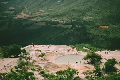
    Hierve el Agua is located about 70 kilometers east of Oaxaca de Juárez in the mountains above the Mitla Valley. Over millennia, calcareous spring water has flowed down the cliffs here, creating deposits that look like petrified waterfalls. Above are pools of spring water and expansive views over the Sierra.

    Sources & method

    • Photos: Wikimedia Commons, Pexels, Google Maps. Each photo carries its credit.
    • Place data such as addresses and ratings comes from Google Maps.
    • The content is based on web research from public, traceable sources. How the content is made · The role of AI