Fernweh: Home
    ExploreTravel GuidesPlan a tripMy tripLast visited
    de|en
    All Places & RegionsAll highlightsAbout FernwehFAQPrivacy PolicyImprint
    ExploreTravel GuidesPlan a tripMy tripLast visited
    Hierve el Agua

    Mexico

    Hierve el Agua

    Natural SiteNature

    Hierve el Agua is located about 70 kilometers east of Oaxaca de Juárez in the mountains above the Mitla Valley. Over millennia, calcareous spring water has flowed down the cliffs here, creating deposits that look like petrified waterfalls.

    by Felix Gillen

    1. Home
    2. Destinations
    3. Mexico
    4. Oaxaca
    5. Hierve el Agua
    Hierve el Agua is located about 70 kilometers east of Oaxaca de Juárez in the mountains above the Mitla Valley. Over millennia, calcareous spring water has flowed down the cliffs here, creating deposits that look like petrified waterfalls. Above are pools of spring water and expansive views over the Sierra.

    Sights

    Discover the most important sights and attractions

    Cascada Grande

    1Cascada Grande

    The larger of the two petrified waterfalls descends as a white limestone streak approximately 30 meters down a rock face; the cliff wall below it is significantly higher. You get the best view from the opposite side; a steep path leads from the parking lot down into the valley and up the other side (round trip about one hour).

    Open in Google Maps
    The pool at Cascada Chica

    2The pool at Cascada Chica

    Above the smaller, approx. 12-meter-high petrified waterfall, springs collect in natural and artificially enclosed pools directly at the cliff edge. The mineral-rich water is about 22 to 27 degrees; bathing is allowed. From the pool's edge, gaze far over the mountains. Due to disputes between neighboring communities, the site was closed multiple times; check the current situation before your visit.
    Open in Google Maps

    Restaurants & Cafés

    The History

    HistoryAlready some 2,500 years ago, the Zapotecs utilized the spring water, building irrigation terraces and canals on the slopes, the remains of which are still visible today. Hierve el Agua is now one of the state's most visited destinations. Due to disputes between the neighboring communities of San Isidro Roaguía and San Lorenzo Albarradas over administration and revenue, access has been repeatedly blocked, most recently from March to October 2021.

    Arrival

    Getting ThereMost visitors arrive via day tours from Oaxaca de Juárez, which often include Mitla, the Árbol del Tule, and a Mezcal distillery. To go independently, take a bus to Mitla and from there a shared pickup (colectivo) or taxi via the mountain road. If driving your own car, head from Oaxaca on Federal Highway 190 via Mitla and San Lorenzo Albarradas, a journey of about 70 kilometers and just over an hour.

    Accommodations in Hierve el Agua

    Find perfect stay in Hierve el Agua

    Booking.com* (Affiliate link)
    Search Hotels
    Agoda* (Affiliate link)
    Search Hotels
    Airbnb
    Vacation Rentals

    * Affiliate link: if you book through it, we earn a small commission. The price stays the same for you.

    Nearby

    Teotitlán del Valle

    Teotitlán del Valle

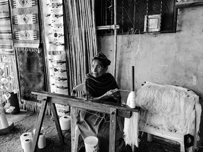
    Teotitlán del Valle is a Zapotec village situated about 30 kilometers east of Oaxaca de Juárez at the foot of the Sierra Juárez. It is known for its wool carpets, many of which are produced by families on treadle looms, often using natural dyes. In daily life, Zapotec is still spoken alongside Spanish.
    Jalatlaco

    Jalatlaco

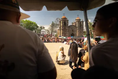
    Jalatlaco is located east of the Old Town and is one of Oaxaca's oldest barrios; according to tradition, it was founded in 1486, and later primarily tanners lived here. The cobblestone streets with low, brightly painted houses and murals are quieter than the center. Its focal point is the Church of San Matías Jalatlaco. In 2023, the district was named Oaxaca's first Barrio Mágico. In recent years, many cafés, small restaurants, and guesthouses have emerged; Santo Domingo can be reached in about ten minutes on foot.
    Oaxaca

    Oaxaca

    The state of Oaxaca in southern Mexico stretches from the highlands of the Sierra Madre del Sur to the Pacific coast. With 16 officially recognized indigenous peoples, including Zapotec and Mixtec, it is culturally one of the most diverse regions of the country.At its heart lies the capital, Oaxaca de Juárez, with Monte Albán and the artisan villages of the Oaxaca Valley. Over the mountains, for instance through San José del Pacífico, roads lead to the coast, home to Puerto Escondido, Mazunte, and Zipolite.
    Oaxaca de Juárez

    Oaxaca de Juárez

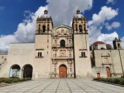
    Oaxaca de Juárez is the capital of the eponymous state in southern Mexico, located at an altitude of around 1,550 meters in the Oaxaca Valley at the foot of the Sierra Madre del Sur. Visitors are drawn by its colonial center built from green Cantera stone, which, along with the Zapotec site Monte Albán, has been a UNESCO World Heritage site since 1987, and by one of the country's most distinctive cuisines.The city also offers large markets, numerous museums and galleries, and handicrafts from the surrounding villages. It also serves as a starting point for tours to Mezcal distilleries, markets, and archaeological sites in the Valley of Oaxaca.
    Xochimilco

    Xochimilco

    The Barrio Xochimilco is located north of the old town and is considered one of Oaxaca's oldest neighborhoods: According to tradition, it was founded around 1486 by warriors from Xochimilco in the Valley of Mexico. Characteristic features are the arches of the 18th-century San Felipe Aqueduct, cobblestone streets, and the parish church of Santo Tomás. From Santo Domingo, you can reach the neighborhood on foot in about ten minutes.

    Sources & method

    • Photos: Pexels. Each photo carries its credit.
    • The content is based on web research from public, traceable sources. How the content is made · The role of AI