Fernweh: Home
    ExploreTravel GuidesPlan a tripMy tripLast visited
    de|en
    All Places & RegionsAll highlightsAbout FernwehFAQPrivacy PolicyImprint
    ExploreTravel GuidesPlan a tripMy tripLast visited
    • Neighborhoods & highlights
    • Eat & drink
    • Culture
    • Getting around
    • Accommodation
    • Plan trip
    • Nearby
    Plettenberg Bay

    South Africa

    Plettenberg Bay

    City

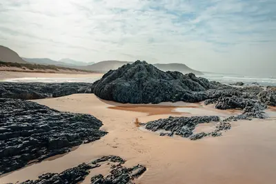
    Plettenberg Bay, or Plett for short, is the Garden Route's most popular seaside resort. Long sandy beaches, the hiking trails in Robberg Nature Reserve, and whales in the bay define the town.

    by Felix Gillen

    1. Home
    2. Destinations
    3. South Africa
    4. Garden Route
    5. Plettenberg Bay
    Plettenberg Bay, or Plett for short, is the Garden Route's most popular seaside resort. Long sandy beaches, the hiking trails in Robberg Nature Reserve, and whales in the bay define the town.

    Sights in Plettenberg Bay

    Discover the most important sights and attractions

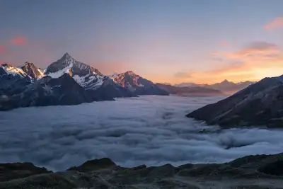
    1Robberg Nature Reserve

    Plett's top hiking destination: the rocky peninsula south of town. Three varied circular routes cross cliffs and beaches; a seal colony awaits. The long route is tough; start early and pack water. Sections may close during high tide and rough seas.
    Open in Google Maps
    Attraction

    2Central Beach

    The city's main beach is located right next to the prominent hotel on Beacon Island. Boats for whale and dolphin tours depart from here. Only swim in the supervised areas.
    Open in Google Maps
    Park

    3Keurbooms River

    East of town, the Keurbooms flows through forested cliffs to the sea. At the N2 bridge, you can rent canoes or take a ferry upstream. Ideal for a peaceful morning on the water.
    Open in Google Maps

    Essen & Trinken

    1

    Cafe Civara

    Restaurant in Main St.
    Show on Google Maps
    2

    Amelia's at The Plettenberg

    Restaurant in 40 Church St.
    Show on Google Maps
    3

    Nguni Restaurant

    Restaurant in 6 Crescent St.
    Show on Google Maps
    4

    Fat Fish

    Restaurant with fish, seafood, and sushi.
    Show on Google Maps

    Culture & History

    Portuguese navigators called the bay Bahia Formosa, beautiful bay. It received its current name at the end of the 18th century, after the governor of the Cape Colony, Joachim van Plettenberg. Until 1916, Beacon Island hosted a whaling station; today, a hotel stands there. Finds in the Nelson Bay Cave on Robberg show that people lived here as early as the Stone Age.

    Traveling

    The nearest major airport is George, about 1.5 hours' drive. Center and Central Beach are walkable; Robberg, Keurbooms & the animal parks require a car. Uber also runs in Plett.

    Accommodations in Plettenberg Bay

    Find perfect stay in Plettenberg Bay

    Booking.com* (Affiliate link)
    Search Hotels
    Agoda* (Affiliate link)
    Search Hotels
    Airbnb
    Vacation Rentals

    * Affiliate link: if you book through it, we earn a small commission. The price stays the same for you.

    Plan your trip to Plettenberg Bay

    Save places, build a route and plan your city trip, all in one place.

    1. 1
      Sunrise over alpine peaks and a sea of clouds
      1234

      Round trip

      12 days · 4 stops

      Saved

      Pick a route

      Pick a ready-made one or save places and plan your own.

      Open bookmarks
    2. 2

      Trip to Plettenberg Bay

      Live
      • 1Robberg Nature Reserve3 days
      • 2Central Beach4 days
      • 3Keurbooms River5 days
      Budget

      Plan your trip

      The planner sorts stops, days and budget. Plan together in real time.

      Start trip planning
    3. 3
      9:41 No signal
      Plettenberg Bay
      Available offline

      Use it on the road

      Download the guide to your phone and use it on site, even offline.

    Nearby

    Nature's Valley

    Nature's Valley

    Nature's Valley is a small holiday village on the Garden Route, nestled between a lagoon, sandy beach, and the forest of the Tsitsikamma section of the Garden Route National Park. There are hardly any shops, but instead peace and beautiful hiking trails. This is where the multi-day Otter Trail ends.
    Garden Route

    Garden Route

    The Garden Route is the coastal stretch between Mossel Bay and the Storms River, a good 200 kilometers along the N2 and about four to five hours' drive east of Cape Town. Lagoons, ancient forests, long sandy beaches, and small seaside resorts like Wilderness, Knysna, and Plettenberg Bay make it the country's most popular self-drive route.
    Knysna

    Knysna

    Knysna is located on a large lagoon, its outlet to the sea formed by two sandstone cliffs, the Knysna Heads. Surrounding it are South Africa's largest continuous forests.
    Tsitsikamma National Park

    Tsitsikamma National Park

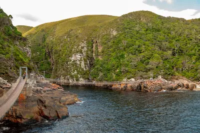
    The Tsitsikamma section of the Garden Route National Park stretches along a steep rocky coastline between Nature's Valley and the mouth of the Storms River. Dense primeval forest with Yellowwood trees extends here right to the ocean, and off the coast lies one of Africa's oldest marine protected areas. The park is known for the suspension bridge at Storms River Mouth and the multi-day Otter Trail.
    Storms River Village

    Storms River Village

    Storms River Village is a small village in the forest, near the mouth of the Storms River. It's the base for the Tsitsikamma section of the Garden Route National Park and for adventures like Canopy Tours and Tubing.

    Sources & method

    • Photos: Unsplash. Each photo carries its credit.
    • Place data such as addresses and ratings comes from Google Maps.
    • The content is based on web research from public, traceable sources. How the content is made · The role of AI