Fernweh: Home
    ExploreTravel GuidesPlan a tripMy tripLast visited
    de|en
    All Places & RegionsAll highlightsAbout FernwehFAQPrivacy PolicyImprint
    ExploreTravel GuidesPlan a tripMy tripLast visited
    • Neighborhoods & highlights
    • Eat & drink
    • Food culture
    • Culture
    • Getting around
    • Accommodation
    • Plan trip
    • Nearby
    Koh Phangan

    Thailand

    Koh Phangan

    City

    Koh Phangan lies in the Gulf of Thailand between Koh Samui and Koh Tao.

    by Felix Gillen

    1. Home
    2. Destinations
    3. Thailand
    4. Gulf of Thailand Coast
    5. Koh Phangan
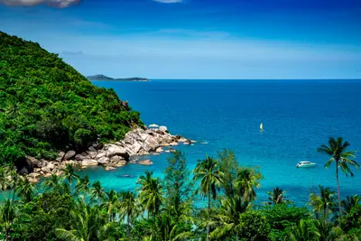
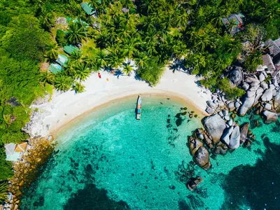
    Koh Phangan lies in the Gulf of Thailand between Koh Samui and Koh Tao. The island became known through the Full Moon Party on Haad Rin beach in the south, but most of it is quiet: wooded hill country fills the interior, and individual bays lie along the edges.The main arrival point is the harbour of Thong Sala with the island's largest market. On the west coast around Srithanu, a yoga and wellness scene has settled, and in the north-east lie Thong Nai Pan and Bottle Beach, which can only be reached by boat or on foot.In the east, the Than Sadet Waterfall drops through the forest; King Chulalongkorn visited it several times, and his initials are carved into a rock. Hiking trails lead up Khao Ra, at 635 metres the highest point on the island.Ferries run from Surat Thani, Koh Samui and Koh Tao. The roads in the island's interior are in places very steep, and for some stretches pick-up taxis are the safer choice compared with a scooter. Around the full moon, accommodation in Haad Rin is booked out early.

    Sights in Koh Phangan

    Discover the most important sights and attractions

    1Wat Rat Charoen

    A community temple on Koh Phangan, away from the beaches and party coves. The complex follows the typical Thai layout with sweeping roofs and a main hall featuring several Buddha figures. The temple is supported by the island's residents, not by tourism – offering a glimpse into daily life on Koh Phangan beyond the Full Moon Parties. Covered shoulders and knees are required. Mornings are the busiest.

    Open in Google Maps

    2Haad Rin

    This beach section at the island's southeast tip hosts the monthly Full Moon Party. Haad Rin Nok on the east side is the party beach, while Haad Rin Nai in the west remains quieter. Outside of party nights, the area is notably emptier; many establishments align their opening hours with the lunar calendar.
    Open in Google Maps

    3Bottle Beach (Haad Khuat)

    A bay on the north coast, without permanent road access. Access is by longtail boat from Chaloklum or via a steep hiking trail from Haad Khom. Only a few bungalow resorts and sparse day visits; consequently, a limited selection of provisions.
    Open in Google Maps

    4Than Sadet Waterfall

    Waterfall on the east coast in Than Sadet-Ko Pha-ngan National Park. King Chulalongkorn (Rama V.) visited up to fourteen times from 1888, his initials carved into a memorial rock near the mouth of Than Sadet Bay. Later kings, including Rama IX., also visited the site, its name meaning royal river.
    Open in Google Maps

    5Khao Ra

    At 635 meters, it's the island's highest point, located within Than Sadet-Ko Pha-ngan National Park. The climb leads through forested terrain. When wet, root sections are slippery; many opt for a local guide.
    Open in Google Maps

    6Thong Nai Pan

    Open in Google Maps

    Essen & Trinken

    1

    MZFamily Shawarma

    A small eatery on Koh Phangan serving Shawarma and other Middle Eastern dishes. Eat standing or at a few tables; takeaway is also available. On an island where menus usually alternate between Thai and Western, this is a rare departure.
    Show on Google Maps
    2

    Som Tam Yam Kathoey (Koh Phangan)

    A local eatery on Koh Phangan specializing in Som Tam and Yam, the salads of Northeastern Thai cuisine. The papaya salad is pounded in a mortar, and its spiciness can be adjusted – just tell them how many chilies you want, otherwise you'll get the local level. Sticky rice is served with it. The decor is simple, and the clientele is predominantly Thai.
    Show on Google Maps
    3

    M Thai Food Restaurant

    An unfussy Thai restaurant on Koh Phangan with a broad standard menu. The decor is simple, the vibe relaxed, guests are a mix of islanders and travelers. A reliable address without aspiring to be more.
    Show on Google Maps
    4

    Fried Garlic Chicken

    A street eatery on Koh Phangan, named after its signature dish: Gai Tod Kratiem, fried chicken with garlic, served with rice and a spicy dipping sauce. The menu is short, service is quick, and the decor is limited to the bare essentials. One of the more affordable options to get a satisfying meal on the island.
    Show on Google Maps
    5

    Thong Nai Pan Yai, Restaurant RAM & PHA

    A Thai restaurant in Thong Nai Pan Yai bay on the northeast of Koh Phangan, with fish and seafood on the menu. The bay is off the main towns and accessible only via a steep mountain road, so the atmosphere is accordingly quiet. The decor is simple, and guests come from the bay's accommodations.
    Show on Google Maps

    Dining and Drinks

    The island's cuisine is Southern Thai-influenced: richly spiced, with coconut milk, turmeric, and plenty of fish. The evening market in Thong Sala offers the best overview; in the tourist bays, milder versions and international menus dominate. If you want to reduce the spiciness, say mai phet.

    Gaeng Som

    Hot and sour fish curry with turmeric, typical of Southern Thailand and markedly spicier than curries from central Thailand.

    Khanom Chin Nam Ya

    Fermented rice noodles with fish curry, accompanied by raw vegetables for self-mixing. Primarily found at markets in the morning.

    Grilled Fish and a Selection of Seafood

    Prepared on the beaches in the evenings over charcoal and usually charged by weight. Confirm the price per kilogram before ordering.

    Roti

    Pan-fried filled flatbread, sweet with banana & condensed milk or savory with egg. A standard at night markets.

    Night Market Thong Sala

    The island's central market with food stalls, grill stands, and fruit vendors. It opens in the early evening and is also the go-to spot for locals.

    Culture & Everyday

    Island Life Beyond the PartyBefore tourism, the island thrived on coconut plantations, rubber, and fishing. The plantations remain in the island's interior to this day, and in North Coast villages like Chaloklum, fishing is still part of the income. Today, the Full Moon Party in Haad Rin dictates the island's rhythm: room rates, ferry schedules, and staffing needs are aligned with the lunar calendar. King Chulalongkorn visited the island fourteen times during his reign.Thong Sala is home to the administration, schools, and markets; the temples serve as places for the village communities. When visiting, shoulders and knees must be covered, and shoes removed before entering the hall. In the west, around Srithanu, a yoga and retreat scene has become established. Nudity is not customary in Thailand and is considered disrespectful.

    Exploring locally

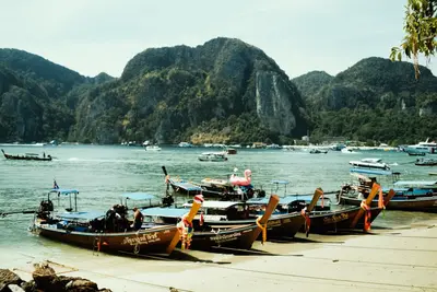
    From Thong Sala ferry port, Songthaews, open shared taxis with fixed routes, run to the major bays. The price is per person and is stated before departure; the fare increases with fewer passengers. They operate regularly to Haad Rin and the west, less often to the secluded northern bays, and usually only during the day.Scooters are the most common mode of transport and simultaneously the biggest risk of your stay. Scooter accidents are a documented problem on Koh Phangan. The ramps into the island's interior and to Thong Nai Pan are very steep, surfaces become slippery after rain, and many riders are on a two-wheeler for the first time. Alcohol is also a factor around party nights. Without a valid motorcycle driver's license, insurance coverage generally does not apply in case of damage. Wear a helmet, avoid steep routes when wet, and refrain from driving after partying.For individual trips, taxis and private vans are the calmer choice; the price is negotiated before departure. Bays without road access, such as Bottle Beach, are reached by longtail boat from Chaloklum. During the peak rainy season in October and November, these boat connections are cancelled in windy conditions, and individual road sections are temporarily flooded after heavy rain.

    Accommodations in Koh Phangan

    Find perfect stay in Koh Phangan

    Booking.com* (Affiliate link)
    Search Hotels
    Agoda* (Affiliate link)
    Search Hotels
    Airbnb
    Vacation Rentals

    * Affiliate link: if you book through it, we earn a small commission. The price stays the same for you.

    Plan your trip to Koh Phangan

    Save places, build a route and plan your city trip, all in one place.

    1. 1
      Sunrise over alpine peaks and a sea of clouds
      1234

      Round trip

      12 days · 4 stops

      Saved

      Pick a route

      Pick a ready-made one or save places and plan your own.

      Open bookmarks
    2. 2

      Trip to Koh Phangan

      Live
      • 1Wat Rat Charoen3 days
      • 2Haad Rin4 days
      • 3Bottle Beach (Haad Khuat)5 days
      Budget

      Plan your trip

      The planner sorts stops, days and budget. Plan together in real time.

      Start trip planning
    3. 3
      9:41 No signal
      Koh Phangan
      Available offline

      Use it on the road

      Download the guide to your phone and use it on site, even offline.

    Nearby

    Koh Samui

    Koh Samui

    Koh Samui, Thailand's second-largest after Phuket, is the Gulf's most developed, with its airport, ring road, and lodging from basic bungalows to large resorts. The east coast (Chaweng, Lamai) drives tourism; the south and mountainous, palm-filled interior is calmer. Beyond beaches, the Big Buddha, Wat Plai Laem temple, and island waterfalls merit a visit. Planning note: Samui's rain patterns differ from the Andaman Coast, with most rain from mid-October to early December.
    Ang Thong Marine National Park

    Ang Thong Marine National Park

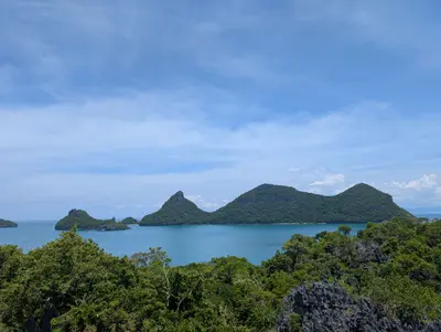
    The Ang Thong Marine National Park comprises 42 islands in the Gulf of Thailand, located approximately 30 kilometers northwest of Koh Samui. Established in 1980, it spans over 100 square kilometers, with about half of that being land.The landscape features steep, forested limestone islands and saltwater lakes in the interior, such as the emerald-green Lake Thale Nai on Koh Mae Ko. Koh Wua Talap hosts the park headquarters, bungalows, and a steep path to a viewpoint. The park gained wider recognition through Alex Garland's novel The Beach.Access is restricted to authorized tour operators, with most visitors arriving via day trips from Koh Samui or Koh Phangan. Annually, the park closes for recuperation from approximately November 1st to December 15th.
    Koh Tao

    Koh Tao

    Koh Tao is the smallest of the three well-known islands in the Gulf of Thailand and thrives mainly on diving. Short boat rides to dive sites and numerous dive schools make the island one of the world's most important locations for dive training.The main arrival point is the pier of Mae Haad; the largest area is along the long Sairee Beach on the west coast. To the south, Chalok Baan Kao is quieter, while in the east, rocky bays can be reached via steep tracks.Notable dive sites include Chumphon Pinnacle, where lucky divers may spot whale sharks, most likely in April and May, and the rock Sail Rock between Koh Tao and Koh Phangan. In Shark Bay to the southeast, blacktip reef sharks can be observed while snorkeling.Northwest lies Koh Nang Yuan, three rocky islets connected by sandbars. Ferries operate from Chumphon, Koh Phangan, and Koh Samui; however, crossings are occasionally cancelled due to strong winds.
    Gulf of Thailand Coast

    Gulf of Thailand Coast

    The Gulf of Thailand coast here stretches from Hua Hin south of Bangkok, via Chumphon and Surat Thani, down to Songkhla. It includes beach resorts like Hua Hin, tranquil fishing villages, and the island group of Koh Samui, Koh Phangan, and Koh Tao.The beaches are mostly shallow, and the sea is calmer than on the Andaman Coast. Important for planning: The southern Gulf receives most rain from October to December, which is when the season starts on the Andaman Coast. In May and June, it's the opposite, making the Gulf the better choice.Trains, buses, and highways run parallel along the coast. You can reach the islands by ferry from Chumphon, Surat Thani, and Don Sak.
    Nam Talu Cave

    Nam Talu Cave

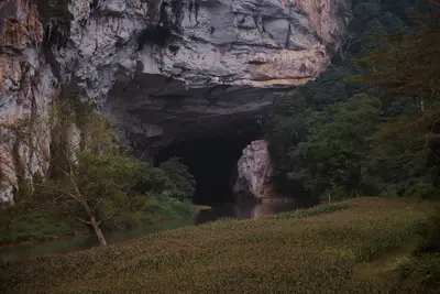
    The **Nam Talu Cave** is a river cave in Khao Sok National Park on Cheow Lan Lake. A stream flows through the limestone mountain, with the path often leading through water: knee-deep, sometimes deeper, and some sections requiring swimming. Inside, you'll find stalactites and bats.Access is by boat and hike, usually as a day trip from one of the raft houses. A **licensed guide is mandatory**.The reason is serious: Eight tourists died in a flash flood in the cave in October 2007, and a guide in August 2024. The cave is therefore closed from June 1 to November 30; even outside this period, it can close at short notice after rain.You should bring shoes that can get wet and provide grip, a headlamp, and waterproof packed items. If you cannot swim or tolerate confined spaces poorly, you should skip the tour.

    Sources & method

    • Photos: Unsplash. Each photo carries its credit.
    • The content is based on web research from public, traceable sources. How the content is made · The role of AI