ExploreTravel GuidesPlan a trip
    de|en
    All Places & RegionsAbout FernwehFAQPrivacy PolicyImprint
    ExploreTravel GuidesPlan a trip
    Ang Thong Marine National Park
    National Park

    Thailand

    Ang Thong Marine National Park

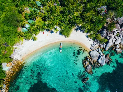
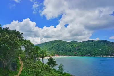
    The Ang Thong Marine National Park encompasses 42 islands in the Gulf of Thailand, approximately 30 kilometers from Koh Samui.

    1. Home
    2. Destinations
    3. Thailand
    4. Gulf of Thailand Coast
    5. Ang Thong Marine National Park
    The Ang Thong Marine National Park encompasses 42 islands in the Gulf of Thailand, approximately 30 kilometers from Koh Samui. The landscape features steep limestone islands and saltwater lakes in the island's interior, such as the lagoon on Koh Mae Ko. Koh Wua Talap is home to the park's headquarters and bungalows. Access is restricted to authorized tour operators, with most visitors arriving via day trips from Koh Samui or Koh Phangan.

    Restaurants in Ang Thong Marine National Park

    Accommodations in Ang Thong Marine National Park

    Find perfect stay in Ang Thong Marine National Park

    Booking.com* (Affiliate link)
    Search Hotels
    Agoda* (Affiliate link)
    Search Hotels
    Airbnb
    Vacation Rentals

    * Affiliate link: if you book through it, we earn a small commission. The price stays the same for you.
    Nearby

    Koh Samui

    Koh Samui

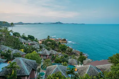
    Koh Samui, Thailand's second-largest after Phuket, is the Gulf's most developed, with its airport, ring road, and lodging from basic bungalows to large resorts. The east coast (Chaweng, Lamai) drives tourism; the south and mountainous, palm-filled interior is calmer. Beyond beaches, the Big Buddha, Wat Plai Laem temple, and island waterfalls merit a visit. Planning note: Samui's rain patterns differ from the Andaman Coast, with most rain from mid-October to early December.
    Koh Phangan

    Koh Phangan

    Koh Phangan liegt im Golf von Thailand zwischen Koh Samui und Koh Tao. Bekannt wurde die Insel durch die Full Moon Party am Strand Haad Rin im Süden, doch der größte Teil ist ruhig: Bewaldetes Bergland füllt das Innere, an den Rändern liegen einzelne Buchten.Anlaufpunkt ist der Hafen von Thong Sala mit dem größten Markt der Insel. An der Westküste rund um Srithanu hat sich eine Yoga- und Wellness-Szene angesiedelt, im Nordosten liegen Thong Nai Pan und die nur per Boot oder zu Fuß erreichbare Bottle Beach.Im Osten fällt der Than-Sadet-Wasserfall durch den Wald; König Chulalongkorn besuchte ihn mehrfach, seine Initialen sind in einen Felsen gemeißelt. Wanderwege führen auf den Khao Ra, mit 635 Metern der höchste Punkt der Insel.Fähren verkehren von Surat Thani, Koh Samui und Koh Tao. Die Straßen im Inselinneren sind teils sehr steil, für manche Strecken sind Pick-up-Taxis die sicherere Wahl als der Roller. Rund um den Vollmond sind Unterkünfte in Haad Rin früh ausgebucht.
    Koh Tao

    Koh Tao

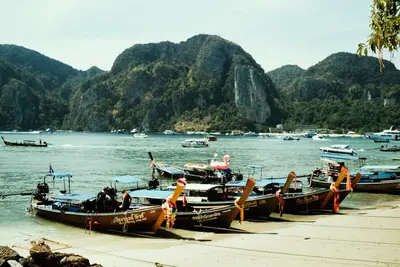
    Koh Tao is the smallest of the three well-known islands in the Gulf of Thailand and thrives mainly on diving. Short boat rides to dive sites and numerous dive schools make the island one of the world's most important locations for dive training.The main arrival point is the pier of Mae Haad; the largest area is along the long Sairee Beach on the west coast. To the south, Chalok Baan Kao is quieter, while in the east, rocky bays can be reached via steep tracks.Notable dive sites include Chumphon Pinnacle, where lucky divers may spot whale sharks, most likely in April and May, and the rock Sail Rock between Koh Tao and Koh Phangan. In Shark Bay to the southeast, blacktip reef sharks can be observed while snorkeling.Northwest lies Koh Nang Yuan, three rocky islets connected by sandbars. Ferries operate from Chumphon, Koh Phangan, and Koh Samui; however, crossings are occasionally cancelled due to strong winds.
    Gulf of Thailand Coast

    Gulf of Thailand Coast

    The Gulf of Thailand coast stretches from the east, near the Cambodian border, through the curve at Bangkok, south to the peninsula. Its sections vary accordingly: high-rise beach resorts, quiet fishing villages, and the famous southern island groups.You'll primarily find gently sloping sandy beaches and a calmer sea here than on the Andaman Coast. Key for planning: The rainy season differs from the country's west – on the southern Gulf, most rain falls towards year-end, while the Andaman side then has its high season. Those traveling in October or November are usually better off on the west coast; the opposite applies to May and June.The islands are accessible by ferry from mainland ports; several coastal towns lie on railway lines or main roads and can be reached from Bangkok in a few hours.
    Nam Talu Cave

    Nam Talu Cave

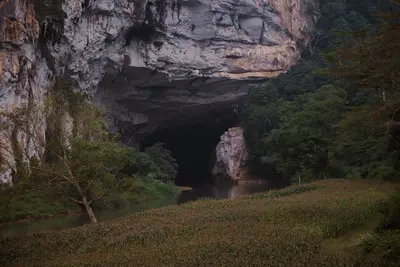
    This impressive cave, often visited during sea tours, offers an exciting adventure with water passages and spectacular stalactite formations.