Fernweh: Home
    ExploreTravel GuidesPlan a tripMy tripLast visited
    de|en
    All Places & RegionsAll highlightsAbout FernwehFAQPrivacy PolicyImprint
    ExploreTravel GuidesPlan a tripMy tripLast visited
    • Neighborhoods & highlights
    • Recommendations
    • Videos
    • Eat & drink
    • Food culture
    • Culture
    • Getting around
    • Accommodation
    • Plan trip
    • Nearby
    Providencia

    Colombia

    Providencia

    City

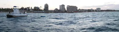
    Providencia is a small island in the San Andrés archipelago, about 20 flight minutes north of San Andrés. You come for Colombia's longest coral reef, the mangroves in McBean Lagoon National Park, and the tranquil beaches in the south.

    by Felix Gillen

    1. Home
    2. Destinations
    3. Colombia
    4. San Andrés & Providencia
    5. Providencia
    Providencia is a small island in the San Andrés archipelago, about 20 flight minutes north of San Andrés. You come for Colombia's longest coral reef, the mangroves in McBean Lagoon National Park, and the tranquil beaches in the south. The island measures approximately 7 by 4 km, has around 5,000 inhabitants, and is connected to Santa Catalina via a pedestrian bridge.

    Sights in Providencia

    Discover the most important sights and attractions

    Bahia Suroeste

    1Bahia Suroeste

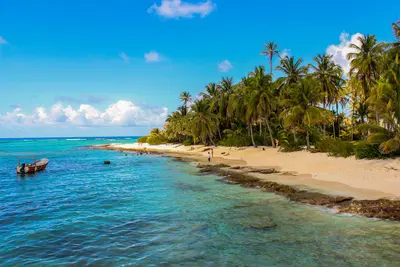
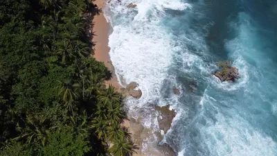
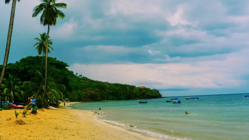
    One of the island's two largest beaches, hundreds of meters long and palm-lined. Bars and restaurants are available, with direct beach snorkeling.
    Open in Google Maps
    Bridge of the Lovers
    Point of Interest

    2Bridge of the Lovers

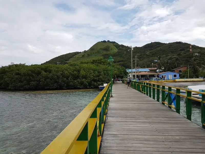
    Pedestrian bridge over the narrow canal between Providencia and Santa Catalina. It is the only land access to the small neighbouring island.
    Open in Google Maps
    Alto El Pico
    Natural Feature

    3Alto El Pico

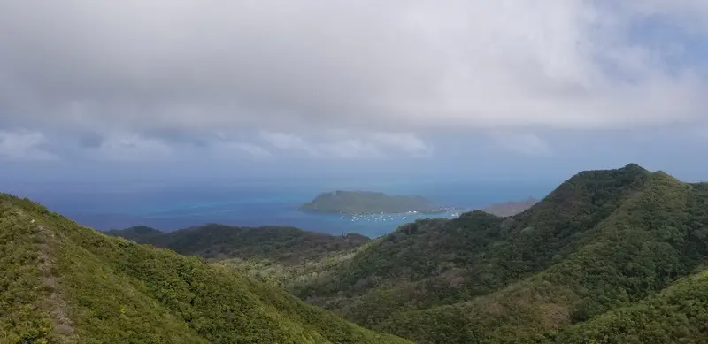
    At 360 meters, the island's highest point. Most of Providencia's freshwater springs originate here.
    Open in Google Maps
    Crab Cay
    Natural Feature

    4Crab Cay

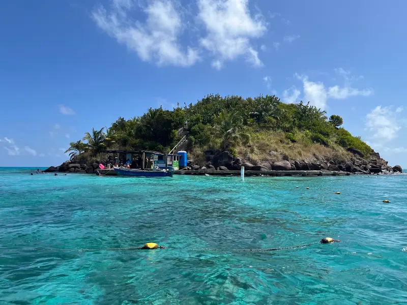
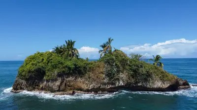
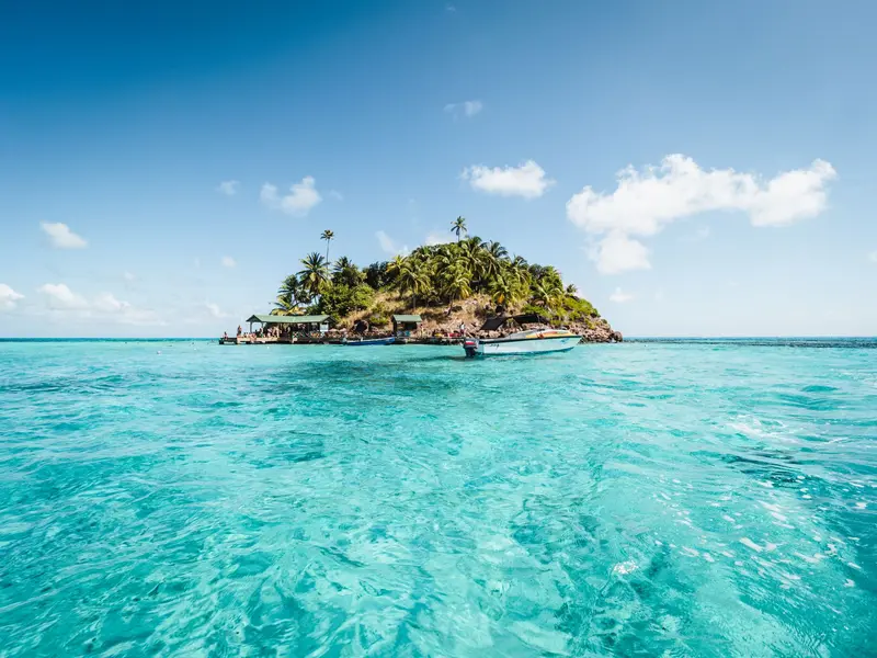
    Small island in McBean Lagoon National Park with visitor station. Clear waters, great for marine life.
    Open in Google Maps

    Videos & Travel Reports

    13 of the best places to visit in Colombia

    13 of the best places to visit in Colombia

    Lonely Planet article by Steph Dyson, last updated in March 2026, covering Cartagena, the Amazon, the coffee region, Tayrona, the Sierra Nevada, La Guajira, San Gil, Providencia, Caño Cristales and…
    Restaurants in Providencia

    1

    El Divino Niño

    Beach restaurant on Southwest Bay with Caribbean seafood cuisine and sunset views. Serving lobster, conch, shrimp, and red snapper, often as a large platter.
    Show on Google Maps
    2

    Roland Roots Reggae Bar & Restaurant

    Beach bar with restaurant on Bahía Manzanillo in the south of the island, with bamboo cabins in the sand. They offer lobsters, seafood, and Coco Loco in a coconut, often live music in the evenings.
    Show on Google Maps
    3

    Restaurante Miss Elma

    Restaurant at Freshwater Bay with fish and seafood. On the menu are Arroz a la marinera and whole Red Snapper with land crab sauce.
    Show on Google Maps

    Food & Drink in Providencia

    Raizal cuisine on Providencia revolves around Black land crab, fish, and coconut. It's spiced with fiery Basket pepper.

    Dark-hued crab

    Die Schwarze Landkrabbe von Providencia ist von Slow Food als Presidio der Raizal-Kultur anerkannt und im Vereinigten Königreich seit 2025 als geschützte geografische Angabe registriert. Während der Wanderung vom 1. April bis 31. Juli ist ihr Fang verboten.

    Crab crusher claws

    Krebsscheren gelten als typisches Gericht von Providencia. Sie werden aus den Scheren der Landkrabbe zubereitet.
    Rondón

    Rondón

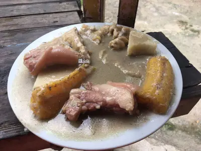
    Coconut milk stew with fish, snail, crab, yuca, yam, plantain and breadfruit. It's the official dish of the Archipelago.

    Basket pepper

    A hot chili variety from the islands, indispensable in Rondón, Crab Empanadas, and Fish balls.

    After Hurricane Iota

    On November 16 and 17, 2020, Hurricane Iota moved across the archipelago. On Providencia, approximately 98 percent of the infrastructure was damaged or destroyed.The island has been rebuilt and is open to visitors again. In 2025, the removal of approximately 40,000 tons of rubble began; by the end of 2025, the government presented a further plan, which, among other things, aims to renovate poorly reconstructed houses.History: Settled in 1629 by the English Providence Island Company, later a base for privateers.

    Getting there and around

    Flight: Satena flies from San Andrés to El Embrujo Airport, about 15 to 20 minutes. Book early; planes are small.Catamaran: From San Andrés on certain weekdays, 2.5 to 3.5 hours, unsteady in rough seas.Tourist Card: It is valid for the entire archipelago and is purchased before flying to San Andrés.

    Accommodations in Providencia

    Find perfect stay in Providencia

    Booking.com* (Affiliate link)
    Search Hotels
    Agoda* (Affiliate link)
    Search Hotels
    Airbnb
    Vacation Rentals

    * Affiliate link: if you book through it, we earn a small commission. The price stays the same for you.

    Plan your trip to Providencia

    Save places, build a route and plan your city trip, all in one place.

    1. 1
      Sunrise over alpine peaks and a sea of clouds
      1234

      Round trip

      12 days · 4 stops

      Saved

      Pick a route

      Pick a ready-made one or save places and plan your own.

      Open bookmarks
    2. 2

      Trip to Providencia

      Live
      • 1Bahia Suroeste3 days
      • 2Bridge of the Lovers4 days
      • 3Alto El Pico5 days
      Budget

      Plan your trip

      The planner sorts stops, days and budget. Plan together in real time.

      Start trip planning
    3. 3
      9:41 No signal
      Providencia
      Available offline

      Use it on the road

      Download the guide to your phone and use it on site, even offline.

    Nearby

    San Andrés is the main island of the Colombian archipelago in the western Caribbean, reachable by direct flight from the mainland. You come for the coral reefs, snorkeling spots, and offshore cays like Johnny Cay. The main town is lively and touristy; it's quieter on the east coast near San Luis.
    San Andrés & Providencia

    San Andrés & Providencia

    The archipelago of San Andrés, Providencia and Santa Catalina is located in the western Caribbean, closer to Nicaragua than to the Colombian mainland. You travel here for coral reefs, snorkeling, and the Creole culture of the Raizales. San Andrés is the bustling main island, Providencia the quieter neighboring island.
    Tortuguero

    Tortuguero

    Tortuguero is a national park and a small village on Costa Rica's northern Caribbean coast, accessible only by boat or small plane. You come here for boat tours through a network of rainforest canals and lagoons, and for the sea turtles that lay their eggs on the beaches.The national park was founded in 1975 and covers approximately 312 square kilometers. On its beaches, Green Sea Turtles, Leatherback Sea Turtles, Hawksbill Sea Turtles, and Loggerhead Sea Turtles nest. The Green Sea Turtle is the most common and arrives from July to October, peaking in September and October; Leatherback Turtles nest less frequently and from March to May.The village, with around 1,200 inhabitants, is located on a narrow strip of land between the Caribbean and the canal. A car-free path connects the boat dock with the ranger station at the south end of the village. At the north end, the Sea Turtle Conservancy, which began its research in Tortuguero in 1959, operates a small visitor center with a museum.The park is best experienced via its waterways. Guided canoe or boat tours show you monkeys, sloths, birds, and caimans, which you often miss on your own; you can also rent kayaks yourself. On land, there are only a few, often muddy paths. Admission for foreign visitors costs 15 US dollars and is purchased online from SINAC; the ticket is valid for land and water trails.Turtle observation on the beach is only permitted at night with a certified guide. Cameras and white light are prohibited, and dark clothing is expected. Not far from the village rises the 119-meter-high Cerro Tortuguero, an old volcanic cone with panoramic views over canals and coastline.
    The Caribbean

    The Caribbean

    The Caribbean coast encompasses the Limón province in eastern Costa Rica, from the Tortuguero canals in the north to the border with Panama in the south. This is where you go for rainforest that stretches right to the beach, for nesting sea turtles, and for an Afro-Caribbean culture that distinctly differs from the rest of the country.The city of Limón is located approximately 170 kilometers from San José; the road leads through the Zurquí Tunnel and Braulio Carrillo National Park. The north, around Tortuguero, is only accessible by boat or plane; you reach the Southern Caribbean, with Cahuita and Puerto Viejo, via the coastal road south of Limón.Many residents are descendants of Jamaican workers who arrived in the late 19th century for railway and banana plantations. Additionally, there are Chinese immigrants, and in the south, the indigenous Bribri and Cabécar people. Calypso, Reggae, and a cuisine featuring coconut milk define the region.
    Cahuita

    Cahuita

    Cahuita is a small village on the southern Caribbean coast, approximately 40 minutes south of Limón and 20 minutes north of Puerto Viejo de Talamanca. You come here for Cahuita National Park, which starts right at the edge of the village, featuring rainforest, beaches, and an offshore coral reef.The village is quieter than nearby Puerto Viejo: a small grid of streets where many locals get around by bicycle. The Afro-Caribbean influence is clearly noticeable in the cuisine and music. Cahuita was home to calypso singer Walter Ferguson, whose 100th birthday in 2019 was declared a national Calypso Day.Around the village are three beaches. Playa Blanca, with its light sand, borders the park entrance and is best for swimming. Playa Negra, with dark sand, is just north of the village and less visited; further north still is the more secluded Playa Grande.The National Park has two entrances: Kelly Creek at the eastern end of the village, where entry is by donation, and Puerto Vargas further south on the main road, where foreigners pay a fee. A coastal path connects both entrances. It is open daily from 8 AM to 4 PM. You may only visit the reef as part of a guided snorkeling tour.

    Sources & method

    • Photos: Pexels, Google Maps. Each photo carries its credit.
    • Place data such as addresses and ratings comes from Google Maps.
    • Video reportages: 13 of the best places to visit in Colombia
    • The content is based on web research from public, traceable sources. How the content is made · The role of AI