Fernweh: Home
    ExploreTravel GuidesPlan a tripMy tripLast visited
    de|en
    All Places & RegionsAll highlightsAbout FernwehFAQPrivacy PolicyImprint
    ExploreTravel GuidesPlan a tripMy tripLast visited
    • Overview
    • Places in the region
    • Recommendations
    • Food culture
    • Best travel time
    • Culture
    • Getting around
    • Round trips
    • Nearby
    San Andrés & Providencia
    belemita@gmail.com / Wikimedia Commons / CC BY 3.0

    Colombia

    San Andrés & Providencia

    Region

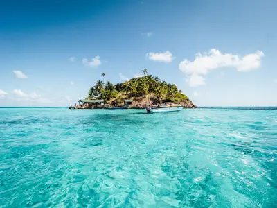
    The archipelago of San Andrés, Providencia and Santa Catalina is located in the western Caribbean, closer to Nicaragua than to the Colombian mainland. You travel here for coral reefs, snorkeling, and the Creole culture of the Raizales.

    by Felix Gillen

    1. Home
    2. Destinations
    3. Colombia
    4. San Andrés & Providencia
    The archipelago of San Andrés, Providencia and Santa Catalina is located in the western Caribbean, closer to Nicaragua than to the Colombian mainland. You travel here for coral reefs, snorkeling, and the Creole culture of the Raizales. San Andrés is the bustling main island, Providencia the quieter neighboring island.
    The archipelago is protected as the Seaflower Biosphere Reserve, which includes vast areas of the surrounding sea in addition to the islands. Off Providencia, at approximately 32 km, lies Colombia's longest coral reef.Two Islands, Two PacesSan Andrés has an international airport, hotels, and boat excursions to offshore cays like Johnny Cay. Providencia is smaller and only accessible via San Andrés. In November 2020, Hurricane Iota destroyed about 98 percent of the infrastructure there; the island is now open again for visitors.For entry to the archipelago, all non-residents, including mainland Colombians, must pay a tourist card fee.
    Place 1 of 2

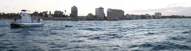
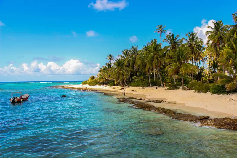
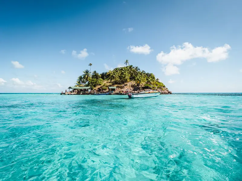
    San Andrés is the main island of the Colombian archipelago in the western Caribbean, reachable by direct flight from the mainland. You come for the coral reefs, snorkeling spots, and offshore cays like Johnny Cay.

    Discover
    Providencia

    Place 2 of 2

    Providencia

    Providencia is a small island in the San Andrés archipelago, about 20 flight minutes north of San Andrés. You come for Colombia's longest coral reef, the mangroves in McBean Lagoon National Park, and the tranquil beaches in the south.

    Discover

    Food & Drink on San Andrés and Providencia

    Die Raizal-Küche der Inseln ist karibisch geprägt: Kokosmilch, Fisch, Schnecken, Krebse und Brotfrucht. Die Rezepte unterscheiden sich deutlich vom kolumbianischen Festland.
    Rondón

    Rondón

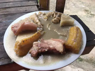
    The islands' official dish, also known as Rundown, is a thick coconut milk-based stew. Depending on what's available, it includes fish, conch, crab, salted meat, yuca, yams, plantain, and breadfruit.

    Crab backs

    Crab shells, filled with a spicy crab meat ragout and gratinéed. They are considered one of the best dishes on the islands.

    Arroz con coco

    Arroz con coco

    Coconut milk rice, Raizal cuisine's most important side dish. Other dishes include beans, yams, yuca, and breadfruit.

    Black crab

    The Black Land Crab from Providencia is a key product of Raizal cuisine, recognized by Slow Food as a Presidium. From April 1st to July 31st, fishing and trading are prohibited during its migration.

    Best Time to Visit

    When is the best time for your trip?

    February
    March
    April
    27–27°C·24–38 mm(little rain)
    On San Andrés, February to April are the driest months with the most hours of sunshine; March sees an average of only about 24 mm of rain. Rainfall increases from June, and October and November are the wettest, with around 270 to 320 mm.
    The sea temperature is 27 to 29 degrees year-round. Providencia lies approximately 20 flight minutes north and has a similar climate. Ferry and flights to Providencia are in high demand in January, February, and July.

    Seasons

    Jan
    Feb
    Mar
    Apr
    May
    Jun
    Jul
    Aug
    Sep
    Oct
    Nov
    Dec
    High season
    Dry season
    Übergangszeit
    Wet season
    Best Time to Visit
    ▶Show detailed monthly data
    MonthTemp (°C)Rain (mm)Sun (h)
    January26.7778.2
    February26.6388.2
    March26.9249.1
    April27.4339.2
    May27.91317.8
    June28.02066.1
    July27.91996.2
    August27.92017.0
    September27.82386.4
    October27.63246.1
    November27.42706.3
    December27.11416.9

    Raizal Culture

    The Raizales are the Afro-Caribbean population of the islands. Their language is an English-based Creole; many also speak Spanish and English.Cuisine: Rondón is a stew made from coconut milk, fish, conch, cassava, yams, and dumplings.Music: Reggae, Calypso, and Soca are present on the islands.Accommodation: Posadas nativas are guesthouses owned by Raizales.

    Getting there and around

    Tourist Card: In 2026, it costs 153,000 COP per person, according to a decree from the Governor's Office. Purchase it in advance online via the Governor's Office, with the airline, or at the departure airport before check-in.To Providencia: Flight from San Andrés with Satena in approx. 20 minutes, or catamaran in about 3 hours, depending on sea conditions.On San Andrés: Many visitors rent a vehicle; boats travel to the Cays.
    Round trips through this region

    Caribbean islands San Andrés and Providencia

    Caribbean islands San Andrés and Providencia

    Two islands in Colombia's San Andrés archipelago in the Caribbean: the vibrant San Andrés and tranquil Providencia, home to Colombia's longest coral reef and McBean Lagoon National Park. The route thrives on snorkeling and beaches.

    8 Days
    2 stops

    Nearby

    San Andrés is the main island of the Colombian archipelago in the western Caribbean, reachable by direct flight from the mainland. You come for the coral reefs, snorkeling spots, and offshore cays like Johnny Cay. The main town is lively and touristy; it's quieter on the east coast near San Luis.
    Providencia

    Providencia

    Providencia is a small island in the San Andrés archipelago, about 20 flight minutes north of San Andrés. You come for Colombia's longest coral reef, the mangroves in McBean Lagoon National Park, and the tranquil beaches in the south. The island measures approximately 7 by 4 km, has around 5,000 inhabitants, and is connected to Santa Catalina via a pedestrian bridge.
    Tortuguero

    Tortuguero

    Tortuguero is a national park and a small village on Costa Rica's northern Caribbean coast, accessible only by boat or small plane. You come here for boat tours through a network of rainforest canals and lagoons, and for the sea turtles that lay their eggs on the beaches.The national park was founded in 1975 and covers approximately 312 square kilometers. On its beaches, Green Sea Turtles, Leatherback Sea Turtles, Hawksbill Sea Turtles, and Loggerhead Sea Turtles nest. The Green Sea Turtle is the most common and arrives from July to October, peaking in September and October; Leatherback Turtles nest less frequently and from March to May.The village, with around 1,200 inhabitants, is located on a narrow strip of land between the Caribbean and the canal. A car-free path connects the boat dock with the ranger station at the south end of the village. At the north end, the Sea Turtle Conservancy, which began its research in Tortuguero in 1959, operates a small visitor center with a museum.The park is best experienced via its waterways. Guided canoe or boat tours show you monkeys, sloths, birds, and caimans, which you often miss on your own; you can also rent kayaks yourself. On land, there are only a few, often muddy paths. Admission for foreign visitors costs 15 US dollars and is purchased online from SINAC; the ticket is valid for land and water trails.Turtle observation on the beach is only permitted at night with a certified guide. Cameras and white light are prohibited, and dark clothing is expected. Not far from the village rises the 119-meter-high Cerro Tortuguero, an old volcanic cone with panoramic views over canals and coastline.
    The Caribbean

    The Caribbean

    The Caribbean coast encompasses the Limón province in eastern Costa Rica, from the Tortuguero canals in the north to the border with Panama in the south. This is where you go for rainforest that stretches right to the beach, for nesting sea turtles, and for an Afro-Caribbean culture that distinctly differs from the rest of the country.The city of Limón is located approximately 170 kilometers from San José; the road leads through the Zurquí Tunnel and Braulio Carrillo National Park. The north, around Tortuguero, is only accessible by boat or plane; you reach the Southern Caribbean, with Cahuita and Puerto Viejo, via the coastal road south of Limón.Many residents are descendants of Jamaican workers who arrived in the late 19th century for railway and banana plantations. Additionally, there are Chinese immigrants, and in the south, the indigenous Bribri and Cabécar people. Calypso, Reggae, and a cuisine featuring coconut milk define the region.
    Cahuita

    Cahuita

    Cahuita is a small village on the southern Caribbean coast, approximately 40 minutes south of Limón and 20 minutes north of Puerto Viejo de Talamanca. You come here for Cahuita National Park, which starts right at the edge of the village, featuring rainforest, beaches, and an offshore coral reef.The village is quieter than nearby Puerto Viejo: a small grid of streets where many locals get around by bicycle. The Afro-Caribbean influence is clearly noticeable in the cuisine and music. Cahuita was home to calypso singer Walter Ferguson, whose 100th birthday in 2019 was declared a national Calypso Day.Around the village are three beaches. Playa Blanca, with its light sand, borders the park entrance and is best for swimming. Playa Negra, with dark sand, is just north of the village and less visited; further north still is the more secluded Playa Grande.The National Park has two entrances: Kelly Creek at the eastern end of the village, where entry is by donation, and Puerto Vargas further south on the main road, where foreigners pay a fee. A coastal path connects both entrances. It is open daily from 8 AM to 4 PM. You may only visit the reef as part of a guided snorkeling tour.

    Sources & method

    • Photos: Wikimedia Commons. Each photo carries its credit.
    • The content is based on web research from public, traceable sources. How the content is made · The role of AI