Fernweh: Home
ExploreGuideDestinationsMy tripsMy trip
de|en
All Places & RegionsRound tripsNight trains in EuropeAll highlightsAbout FernwehFAQPrivacy PolicyImprint
Download on the App StoreGet it on Google Play
ExploreGuideDestinationsMy tripsMy trip
    • Neighborhoods & highlights
    • Eat & drink
    • Culture
    • Getting around
    • Accommodation
    • Plan trip
    • Nearby
    Popoyo and Playa Gigante

    Ridiculopathy / Wikimedia Commons / CC0

    Nicaragua

    Popoyo and Playa Gigante

    CityBeach

    Popoyo and Playa Gigante lie on the Pacific coast of Tola municipality in Rivas department, north of San Juan del Sur.

    by Felix Gillen

    1. Home
    2. Destinations
    3. Nicaragua
    4. Ometepe and the South
    5. Popoyo and Playa Gigante
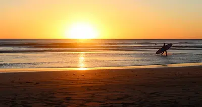
    Popoyo and Playa Gigante lie on the Pacific coast of Tola municipality in Rivas department, north of San Juan del Sur. Both were fishing villages and are now surf destinations, with waves ranging from beginner beaches such as Playa Amarillo to the Popoyo Outer Reef, which is for experienced surfers only. Between the surf spots lie long sandy beaches such as Playa Guasacate and small villages such as Las Salinas.For information on the dangers of swimming and water sports in the sea, see the UK FCDO travel advice.
    Nicaragua travel guideRound trips in NicaraguaPlan a trip with Popoyo and Playa Gigante

    Contents

    • Neighborhoods & highlights
    • Eat & drink
    • Culture
    • Getting around
    • Accommodation
    • Nearby

    Sights in Popoyo and Playa Gigante

    Discover the most important sights and attractions

    Point of Interest

    1Playa Amarillo and Playa Gigante

    Playa Amarillo, north of Playa Gigante, is suitable for beginner surfers. To its south is the crescent-shaped bay of Playa Gigante with surf camps, where you can also swim; it gets busy on holidays. Both beaches are connected by foot.

    Open in Google Maps

    2Playa Guasacate and Popoyo

    The long sandy beach stretches to the former fishing village of Popoyo at its northern end, a river separating the two. At Popoyo Reef, waves break for various skill levels; the Outer Reef further out is only for experts. At low tide, rock pools form at the beach's end; pay attention to the tides, especially when crossing the river.
    Open in Google Maps
    Attraction

    3Playa Santana

    The beach located south of Popoyo, approximately 20 minutes away, features a consistent beach break that is particularly well-suited for advanced surfers.
    Open in Google Maps

    4The Nagualapa Saltworks

    The fishing village inland from Popoyo gets its name from the natural salt flats at the mouth of the Río Nagualapa. This is also where you'll find the area's nearest ATM.
    Open in Google Maps

    Restaurants in Popoyo and Playa Gigante

    1

    Magnific Rock Café

    The terrace restaurant above Playa Popoyo offers views of the sea and the surf breaks. The menu prominently features local fish and seafood; on Saturdays, enjoy DJ nights.
    Show on Google Maps

    Surfing and Fishing

    Living with the WavesDaily life along this stretch of coast revolves around the waves, surf schools, and small accommodations. In addition to tourism, fishing also shapes the villages.Las SalinasThe fishing village of Las Salinas de Nagualapa gets its name from the salt flats at the mouth of the Río Nagualapa.

    Getting there and around

    Getting thereRivas is the hub. From there you can take a taxi, or a cheaper and slower bus, to Popoyo and Guasacate.For Playa Gigante, take the Las Salinas bus from Rivas to El Tambor and walk about 3 km from there.By car it is about 100 km from Managua.Getting aroundThe nearest cash machine is in Las Salinas, and many businesses do not take cards.Watch the tides, both when surfing and when crossing the river between Guasacate and Popoyo. For information on the dangers of swimming in the sea, see the UK FCDO travel advice.

    Accommodations in Popoyo and Playa Gigante

    Find perfect stay in Popoyo and Playa Gigante

    Booking.com* (Affiliate link)
    Search Hotels
    Agoda* (Affiliate link)
    Search Hotels
    Airbnb
    Vacation Rentals

    * Affiliate link: if you book through it, we earn a small commission. The price stays the same for you.

    Plan your trip to Popoyo and Playa Gigante

    Save places, build a route and plan your city trip, all in one place.

    1. 1
      Sunrise over alpine peaks and a sea of clouds
      1234

      Round trip

      12 days · 4 stops

      Saved

      Pick a route

      Pick a ready-made one or save places and plan your own.

      Open bookmarks
    2. 2

      Trip to Popoyo and Playa Gigante

      Live
      • 1Playa Amarillo and Playa Gigante3 days
      • 2Playa Guasacate and Popoyo4 days
      • 3Playa Santana5 days
      Budget

      Plan your trip

      The planner sorts stops, days and budget. Plan together in real time.

      Start trip planning
    3. 3
      9:41 No signal
      Popoyo and Playa Gigante
      Available offline

      Ridiculopathy / Wikimedia Commons / CC0

      Use it on the road

      Download the guide to your phone and use it on site, even offline.

    Nearby

    San Juan del Sur

    San Juan del Sur

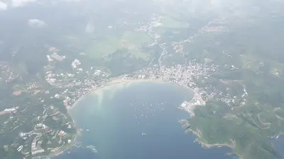
    San Juan del Sur, on a crescent bay of Nicaragua's southern Pacific coast, is a popular resort and hub for local surf beaches. Weekdays are quiet; weekends bring many backpackers to party. Overlooking the bay is the Cristo de la Misericordia Christ statue; to its south, the La Flor turtle reserve.

    JorgeRodriguez·CC BY-SA 4.0

    Ometepe and the South

    Ometepe and the South

    In the south of the country, in the Department of Rivas, two of Nicaragua's most popular destinations are located close to each other: the twin-volcano island of Ometepe in Lake Nicaragua and the surf town San Juan del Sur on the Pacific coast. Rivas is the hub: From there, a bus takes about an hour to San Juan del Sur, and in nearby San Jorge, ferries depart for Ometepe, with the crossing also taking about an hour.

    Paul Biondi·CC0

    Laguna de Apoyo

    Laguna de Apoyo

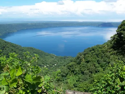
    Laguna de Apoyo, located between Granada and Masaya, is a clear crater lake formed approximately 23,000 years ago when a volcano collapsed. Travelers come here to swim, kayak, and relax on its forested shores, just about 20 minutes from Granada. The lake reaches depths of up to 175 meters, measures approximately 6.6 km in diameter, and is protected as a nature reserve.

    Zuluniga·CC0

    Granada and Masaya

    Granada and Masaya

    Between Managua and Lake Nicaragua, the country's most visited destinations are close by: the colonial city of Granada on the lake shore, the artisan city of Masaya with its active volcano, and the crater lagoon Laguna de Apoyo for swimming. From Granada, Laguna de Apoyo is about 20 minutes by car; Masaya lies about 14 km west.

    Alvison Lucas Hunter Arnuero·Unsplash

    Granada

    Granada

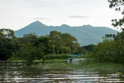
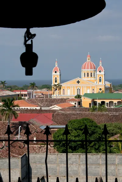
    Located on the western shore of Lake Nicaragua, Granada entices with colorful colonial houses, churches, and squares against the backdrop of Mombacho Volcano, serving as the classic base for exploring western Nicaragua. Founded by Francisco Hernández de Córdoba in 1524, it ranks among the oldest Spanish cities on the American mainland. In 1856, the troops of adventurer William Walker burned Granada to the ground during their retreat, and many buildings were subsequently rebuilt.

    Sebastian Scheper·CC BY-SA 4.0

    Your next steps

    Popoyo and Playa Gigante is in Nicaragua. Ways to carry on from here.

    • More in Nicaragua

      Highlights, areas, routes and the best time to travel for all of Nicaragua.

      Nicaragua travel guide
    • Round trips in Nicaragua

      Ready-made routes through Nicaragua, with stops, nights and a map.

      See the routes

    Sources & method

    • Photos: Wikimedia Commons. Each photo carries its credit.
    • Place data such as addresses and ratings comes from Google Maps.
    • The content is based on web research from public, traceable sources. How the content is made · The role of AI