Fernweh: Home
    ExploreTravel GuidesPlan a tripMy tripLast visited
    de|en
    All Places & RegionsAll highlightsAbout FernwehFAQPrivacy PolicyImprint
    ExploreTravel GuidesPlan a tripMy tripLast visited
    • Neighborhoods & highlights
    • Eat & drink
    • Culture
    • Getting around
    • Accommodation
    • Plan trip
    • Nearby
    Weligama

    Sri Lanka

    Weligama

    CityBeach

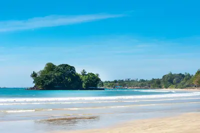
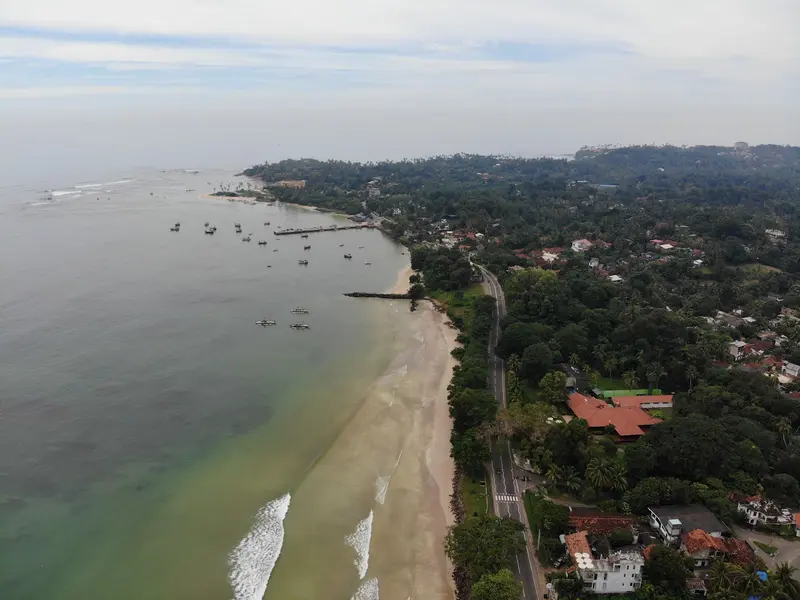
    Weligama is situated on a wide sandy bay about 144 kilometers south of Colombo, between Galle and Mirissa. The sheltered bay is considered one of the best beginner spots for surfing in Sri Lanka, with surf schools lining the central beach.

    by Felix Gillen

    1. Home
    2. Destinations
    3. Sri Lanka
    4. South Coast
    5. Weligama
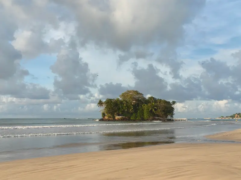
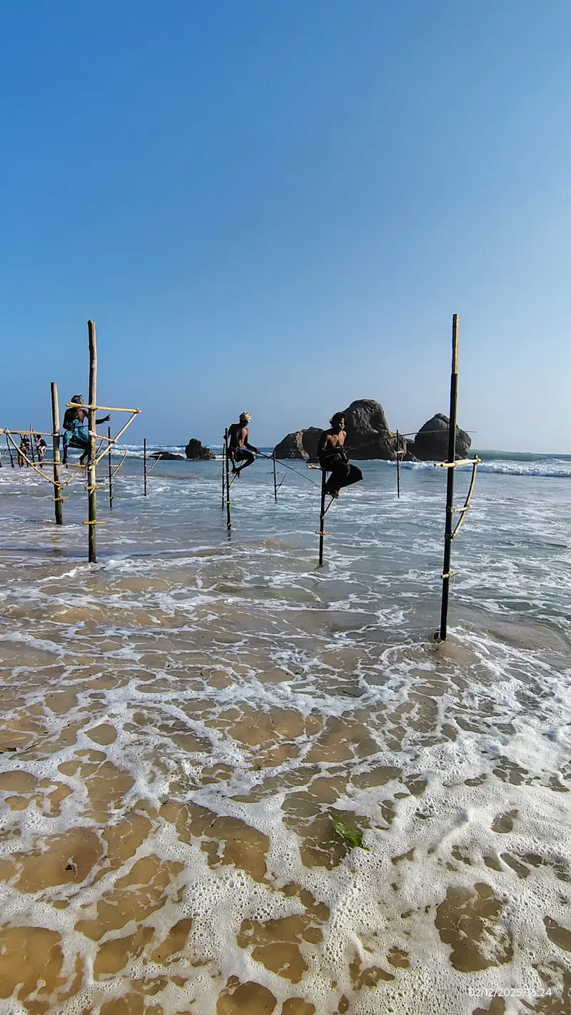
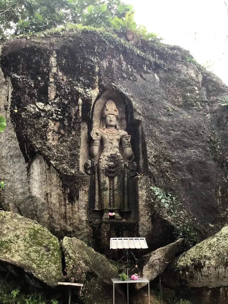
    Weligama is situated on a wide sandy bay about 144 kilometers south of Colombo, between Galle and Mirissa. The sheltered bay is considered one of the best beginner spots for surfing in Sri Lanka, with surf schools lining the central beach.The name means "sandy village". Off the western part of the bay lies the tiny island of Taprobane with a single villa, and on the outskirts of the village is the Kusta Raja Gala relief carved into the rock. West of Weligama, along the coast near Ahangama, Kathaluwa, and Koggala, the famous stilt fishermen sit on their poles.Besides simple surf camps, a variety of cafés and restaurants have established themselves in and around Weligama, ranging from brunch spots to the gourmet offerings of the Cape Weligama resort on the headland to the west.

    Sights in Weligama

    Discover the most important sights and attractions

    Taprobane Island
    Point of Interest

    1Taprobane Island

    Small island in the western part of the bay with a single villa, commissioned by the French Count de Mauny-Talvande in the 1920s. The island is privately owned and can be rented.
    Open in Google Maps
    The Bay of Weligama
    Attraction

    2The Bay of Weligama

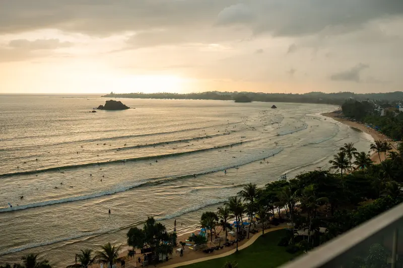
    The sheltered bay blocks large swells, making it one of the country's best beginner spots. Surf season runs roughly November to April.
    Open in Google Maps
    Stilt Fishermen of Koggala
    Attraction

    3Stilt Fishermen of Koggala

    On the coast between Koggala, Kathaluwa, and Ahangama, fishermen sit on stilts in the shallow water. Today, this mostly happens for visitors, especially in the late afternoon, and a fee is expected for photos.
    Open in Google Maps
    Kusta Raja Gala

    4Kusta Raja Gala

    Approx. three-meter rock relief (6th-9th c.), usually interpreted as Bodhisattva Avalokiteshvara. The name means "Rock of the Leper King".
    Open in Google Maps

    Restaurants in Weligama

    1

    The Atlas

    Restaurant at Resort Cape Weligama, named by Condé Nast Traveller Middle East among Sri Lanka's 30 best restaurants. Reserve a table outside for sunset.
    Show on Google Maps
    2

    Nomad Cafe

    Long-popular cafe with a predominantly vegan, healthy menu, like avocado toast, fish tacos, and hummus; rather pricey for the area.
    Show on Google Maps
    3

    KAIYŌ Sushi Bar

    Sushi bar, opened 2022, known for seasonal cocktails made with Japanese spirits and Sri Lankan ingredients. Reservation recommended.
    Show on Google Maps

    Stilt Fishermen and Culture

    Stilt FishingFishermen sit on a crossbar attached to a single pole in chest-deep water, casting their bamboo rods beyond the surf. The technique likely originated during or after World War II. Since the 2004 tsunami, it has been primarily demonstrated for visitors along the Koggala, Kathaluwa, and Ahangama stretch; a fee per camera is usually expected for photos.Kusta Raja GalaThis rock relief, approximately three meters high, dates from the 6th to 9th centuries and is considered by historians to depict the Bodhisattva Avalokiteshvara. Local legend identifies it as a king who was cured of a skin disease.

    Arrival and Getting Around

    Getting ThereWeligama has a station on the Colombo-Matara coastal railway and is on the A2 main road.Getting AroundThe central beach with the surf schools is within walking distance. To the stilt fishermen at Ahangama and Koggala, Mirissa, and Kusta Raja Gala, the easiest way is by tuk-tuk or bus along the A2.

    Accommodations in Weligama

    Find perfect stay in Weligama

    Booking.com* (Affiliate link)
    Search Hotels
    Agoda* (Affiliate link)
    Search Hotels
    Airbnb
    Vacation Rentals

    * Affiliate link: if you book through it, we earn a small commission. The price stays the same for you.

    Plan your trip to Weligama

    Save places, build a route and plan your city trip, all in one place.

    1. 1
      Sunrise over alpine peaks and a sea of clouds
      1234

      Round trip

      12 days · 4 stops

      Saved

      Pick a route

      Pick a ready-made one or save places and plan your own.

      Open bookmarks
    2. 2

      Trip to Weligama

      Live
      • 1Taprobane Island3 days
      • 2The Bay of Weligama4 days
      • 3Stilt Fishermen of Koggala5 days
      Budget

      Plan your trip

      The planner sorts stops, days and budget. Plan together in real time.

      Start trip planning
    3. 3
      9:41 No signal
      Weligama
      Available offline

      Use it on the road

      Download the guide to your phone and use it on site, even offline.

    Nearby

    South Coast

    South Coast

    Sri Lanka's south coast stretches from Hikkaduwa, about 100 kilometers south of Colombo, through Galle and the bays of Weligama and Mirissa, all the way to Tangalle. It connects a UNESCO-protected colonial city with surf beaches, fishing ports, and, further inland, some of the island's most renowned national parks.Most coastal towns are located along the coastal railway from Colombo to Matara and the A2 highway, making travel between them easy. Further inland lie the Sinharaja rainforest and the dry forests of Udawalawe and Yala, all of which can be visited from the coast as day or overnight excursions.

    Mirissa is a beach town in the Matara District, approximately 150 kilometers south of Colombo. It is primarily known as a starting point for whale watching tours, where blue whales are sighted during the season, and for its bright sandy beach with bars.The Mirissa boat harbor is considered the largest fishing port on the south coast, where tuna, mullet, and snapper, among other fish, are landed. On the beach lies the small rocky island Parrot Rock, and at its eastern end is the palm-covered Coconut Tree Hill.The main beach, with most restaurants and bars, lies between the A2 and the sea. Slightly off the beaten path, Secret Beach is reachable via a short walk.
    Unawatuna

    Unawatuna

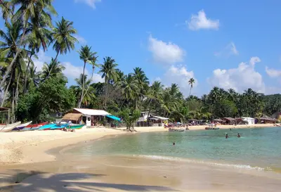
    Unawatuna is a seaside resort on a curving bay about five kilometers southeast of Galle and around 108 kilometers south of Colombo. Due to its proximity to the Fort and the coral reefs off the coast, it is one of the most visited beaches on the south coast.In front of the beach lie reefs and shipwrecks, home to fish and turtles. West of the bay rises the forested hill Rumassala, with the hidden Jungle Beach and the Japanese Peace Pagoda. The 2004 tsunami destroyed many beach restaurants; the development along the beach has since been rebuilt.Life unfolds along the beachfront promenade and in the alleys behind it; quieter accommodations are located towards Dalawella in the east.
    Galle

    Galle

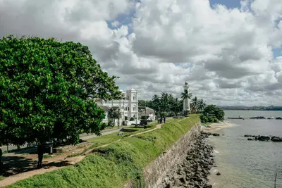
    Galle is the main city on the south coast, approximately 1.5 to 2 hours away from Colombo via the expressway. Its heart is the Fort, an old town enclosed by ramparts, which was declared a UNESCO World Heritage site in 1988 as the "Old Town of Galle and its Fortifications".The Portuguese established a first fortification here in the 16th century, which the Dutch expanded from 1649 onwards; the sea wall was completed in 1729. The Fort covers around 52 hectares with 14 bastions, churches, a mosque, and colonial houses, which today host cafés, boutiques, and restaurants. The walls largely withstood the 2004 tsunami, which damaged parts of the modern city.Outside the ramparts lies the new town with its train station and central bus terminal, both within walking distance of the Fort. Most visitors stay and dine within the walls, for example, around Church Street and Pedlar Street.
    Tangalle

    Tangalle

    Tangalle is a port town in the Hambantota District, approximately 195 kilometers south of Colombo and 35 kilometers east of Matara. Located on one of Sri Lanka's largest bays, with its tranquil beaches, the Mulkirigala rock temple, and the Rekawa turtle nesting sites, it's a destination for travelers who prefer a less bustling atmosphere.The name means "projecting rock" in Sinhalese. In the town center stands an old Dutch fort, which today serves as a prison. The Dutch and British utilized the bay as an anchorage.The beaches are divided into several sections: Medaketiya is the liveliest with cafés and guesthouses, Goyambokka is situated in a sheltered bay west of town, and Silent Beach is a small, palm-fringed cove away from the hustle and bustle.

    Sources & method

    • Photos: Pexels, Google Maps. Each photo carries its credit.
    • Place data such as addresses and ratings comes from Google Maps.
    • The content is based on web research from public, traceable sources. How the content is made · The role of AI