ExploreTravel GuidesPlan a trip
    de|en
    All Places & RegionsAbout FernwehFAQPrivacy PolicyImprint
    ExploreTravel GuidesPlan a trip
    • Places in the region
    • Getting around
    • Nearby
    Nevada

    United States

    Nevada

    Region

    Nevada is located east of California, between Oregon, Idaho, Utah, and Arizona. The state is primarily known as the home of Las Vegas, but you'll also find desert mountains, red sandstone canyons, and one side of Lake Tahoe here.

    1. Home
    2. Destinations
    3. United States
    4. Nevada
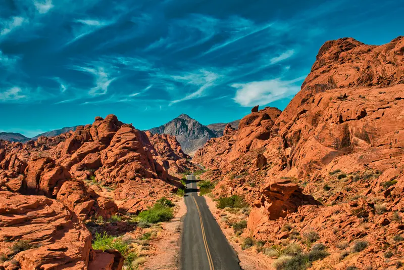
    Nevada is located east of California, between Oregon, Idaho, Utah, and Arizona. The state is primarily known as the home of Las Vegas, but you'll also find desert mountains, red sandstone canyons, and one side of Lake Tahoe here.With an average of around 180 millimeters of precipitation per year, Nevada is the driest state in the USA. Most of it belongs to the Great Basin, the south to the Mojave Desert, and over 80 percent of its area is federally administered. Its highest peak is Boundary Peak at 4,007 meters. Carson City is the capital, Reno is the center of the north, and about one-third of Lake Tahoe's water area lies in Nevada.To the east, the Great Basin National Park protects bristlecone pines, which are up to 5,000 years old, as well as the Lehman Caves. Around Las Vegas are the Hoover Dam from 1936, the Valley of Fire, Nevada's oldest State Park, and the Red Rock Canyon National Conservation Area. A part of Death Valley also belongs to Nevada.
    Las Vegas

    Place 1 of 2

    Las Vegas

    Las Vegas is located in a basin of the Mojave Desert in Nevada and is connected to Los Angeles via Interstate 15. Founded in 1905, the city is known for its casino resorts and as a starting point for Grand Canyon scenic flights.

    Las Vegas is located in Southern Nevada's Mojave Desert. The city proper has about 680,000 residents; the Las Vegas Valley is home to some 2.4 million people.

    Discover
    Red Rock Canyon National Conservation Area
    The Cosmonaut / Wikimedia Commons / CC BY-SA 2.5 ca

    Place 2 of 2

    Red Rock Canyon National Conservation Area

    Just about 27 kilometers west of the Strip, the city abruptly ends.

    Discover

    Sights in Nevada

    Discover the most important sights and attractions

    Valley of Fire State Park
    Park

    Valley of Fire State Park

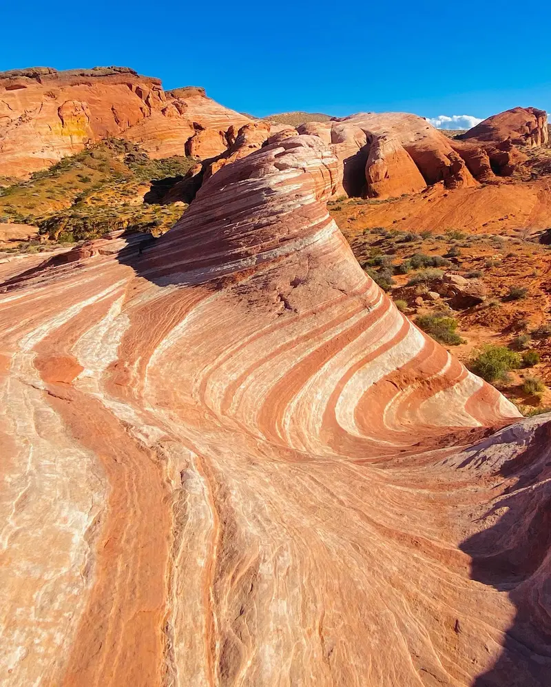
    Nevada's oldest State Park, about an hour northeast of Las Vegas: vibrant red sandstone, rock carvings, and petrified wood. Most beautiful early morning or at sunset.
    Open in Google Maps
    Hoover Dam
    Attraction

    Hoover Dam

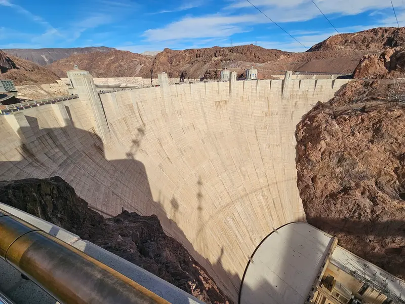
    The dam, built between 1931 and 1936 on the Arizona border, dams the Colorado River into Lake Mead. Around 50 km southeast of Las Vegas, it features a visitor center and guided tours inside.
    Open in Google Maps
    Great Basin National Park
    National Park

    Great Basin National Park

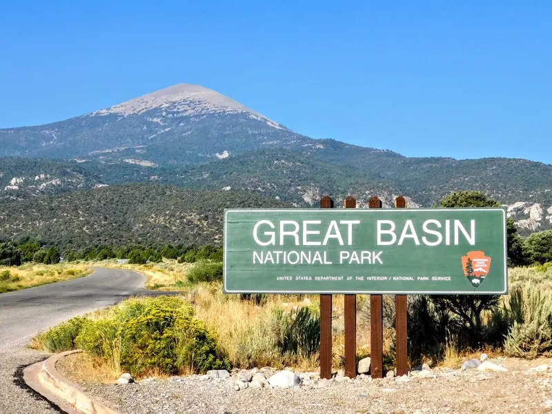
    Remote National Park in eastern Nevada featuring Wheeler Peak, ancient bristlecone pines, and the Lehman Caves stalactite cavern, only visitable by guided tour. Very dark night sky.
    Open in Google Maps

    Getting There & Around

    Almost all trips begin in Las Vegas. Vast, sparsely populated distances lie between destinations, so you'll need a rental car.Airports: Harry Reid International in Las Vegas (LAS) and Reno-Tahoe (RNO) in the north.From Las Vegas: The Hoover Dam is about 48 kilometers southeast, the Valley of Fire about 80 kilometers northeast, and Death Valley is less than 160 kilometers away.Travel time: Spring and autumn. In summer, the south is extremely hot; the record is 52 °C in Laughlin. In winter, it can get very cold in the highlands.
    Nearby

    Yosemite National Park

    Yosemite National Park

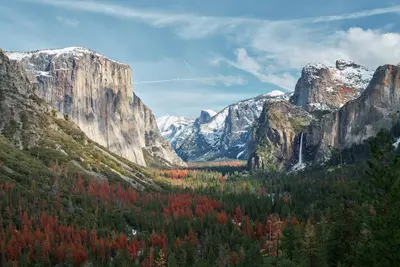
    The Yosemite National Park is located in the Sierra Nevada in California, about 300 km east of San Francisco. You go there for the Yosemite Valley with its steep rock faces, high waterfalls, and the giant sequoias in the south of the park.Above the valley, El Capitan rises about 914 m, and the Yosemite Falls plunge 739 m in total over three tiers. Near the south entrance, the Mariposa Grove hosts over 500 mature giant sequoias; a shuttle connects the parking lot and the grove. The park has existed since 1890 and has been a UNESCO World Heritage site since 1984.Admission costs 35 US dollars per car for 7 days. Visitors not residing in the USA pay an additional 100 US dollars per person from age 16, unless they have the America the Beautiful annual pass (250 US dollars). An entry reservation is not required in 2026. Tioga Road and Glacier Point Road are usually closed from November until the end of May or early June.
    Red Rock Canyon National Conservation Area

    Red Rock Canyon National Conservation Area

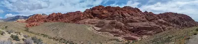
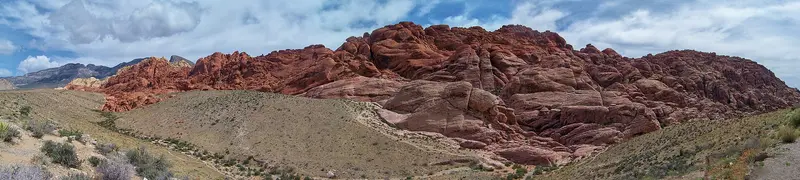
    Just about 27 kilometers west of the Strip, the city abruptly ends. In Red Rock Canyon, red-and-white striped sandstone walls rise from the Mojave Desert; the area has been protected as a National Conservation Area since 1990 and is managed by the Bureau of Land Management. Its rocks are an international climbing destination; for everyone else, there are hiking trails ranging from short family loops to summit treks.Geologically fascinating is the Keystone Thrust, a fault that formed about 66 million years ago and is visible for about 21 kilometers along the rock face. The red Aztec sandstone originated from dunes that were here about 180 million years ago, glowing particularly intensely in the Calico Hills. In some places, you'll find rock art from earlier indigenous cultures.Most visitors drive the 13-mile (21 km) long Scenic Drive, featuring viewpoints and hiking trail parking areas. Important: From October 1st to May 31st, you'll need a Timed-Entry Reservation via Recreation.gov for entry between 8 AM and 5 PM; this also applies to the Visitor Center. With the ticket, you may enter up to 30 minutes earlier and stay all day, but re-entry requires a new reservation.The best time to visit is autumn, winter, and spring. Those wishing to visit without a reservation can enter before 8 AM or after 5 PM. On weekends, parking lots are often full between 9 AM and 3 PM.
    Downtown and Fremont Street

    Downtown and Fremont Street

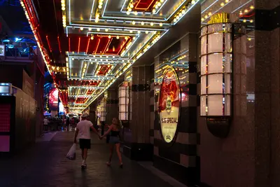
    Downtown is the old Las Vegas: The first casinos were located here, long before resorts grew on the Strip. The Golden Nugget opened in 1946, and even today, casinos line Fremont Street, appearing smaller, louder, and more affordable than their rivals to the south.Since 1995, a roughly 420-meter-long and 27-meter-high barrel vault canopy has spanned four city blocks. The Fremont Street Experience was updated in 2019 with over 49 million LEDs; in the evenings, light and music shows run on it, with bands playing on three stages. Beneath the canopy, people zip past on the SlotZilla zipline. The latest addition is Circa, which opened in 2020, an adults-only hotel with a massive sportsbook and a rooftop pool amphitheater. East of Las Vegas Boulevard, Fremont East begins, featuring bars, the Downtown Container Park, and the neon bar Atomic Liquors.During the day, two museums are worth visiting: The Mob Museum, housed in the former 1933 federal courthouse, tells the story of organized crime, while the Neon Museum displays over 200 decommissioned city signs.Come in the late afternoon, visit one of the museums, and stay for dinner and the first light show. Downtown is more compact than the Strip; almost everything is within walking distance.
    Las Vegas

    Las Vegas

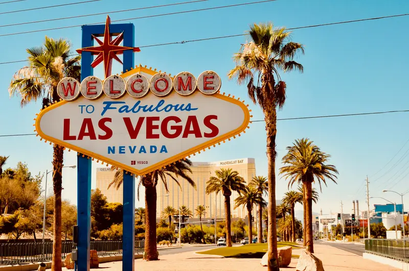
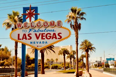
    Las Vegas is located in a basin of the Mojave Desert in Nevada and is connected to Los Angeles via Interstate 15. Founded in 1905, the city is known for its casino resorts and as a starting point for Grand Canyon scenic flights.The approximately 6.8-kilometer long Strip lies outside the city limits in Paradise and Winchester. There, resorts like Bellagio with its freely accessible water fountains, Caesars Palace, and The Venetian are located; the Sphere opened in 2023. The "Welcome to Fabulous Las Vegas" sign from 1959 is a popular photo motif. In Downtown, the Fremont Street Experience has covered five blocks with casinos since 1995, while the Neon Museum displays neon signs outdoors in the Neon Boneyard.Harry Reid International Airport is located just over 3 kilometers from the Strip. Along the resorts, the Monorail with seven stations and the Deuce bus operate; taxis can be taken from hotel stands. In July, average daily highs reach 40 degrees Celsius, and winters are short and mild.
    Arts District

    Arts District

    Between Downtown and the Strip lies the district where Las Vegas looks least like itself: flat commercial buildings, murals, galleries, vintage shops, and breweries instead of casinos. Officially, it's called 18b The Las Vegas Arts District, named for its original 18 blocks. East Charleston Boulevard bisects it, and you'll find most shops and bars on Main Street and Commerce Street.It all began in 1997 with the Arts Factory, when artists moved into vacant spaces. In 2002, antique dealer Cindy Funkhouser launched the First Friday, a monthly art festival that still draws thousands. Since then, theaters, restaurants, and in 2014, Hop Nuts Brewing, the first of many breweries, have joined.By day, browse the shops of Antique Alley on Main Street for Tiki decor, comics, and old Las Vegas souvenirs; pop into the Arts Factory studios and Recycled Propaganda. By evening, it transforms into a nightlife hub: breweries, small cocktail bars, an indie theater, and live music at Swan Dive.The first Friday of the month is the busiest. Following a fatal incident at First Friday in October 2026, the festival's future is under discussion, so check 18b.org beforehand to confirm if and how it's taking place. The district is quieter and more relaxed on weekday afternoons.