Fernweh: Home
    ExploreTravel GuidesPlan a tripMy tripLast visited
    de|en
    All Places & RegionsAll highlightsAbout FernwehFAQPrivacy PolicyImprint
    ExploreTravel GuidesPlan a tripMy tripLast visited
    Arenal Volcano National Park

    Costa Rica

    Arenal Volcano National Park

    Point of Interest

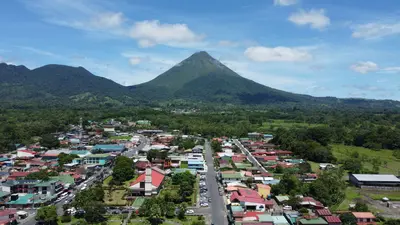
    Arenal Volcano National Park protects the roughly 1,630-meter-high cone of Arenal and its forested flanks in the Arenal and Monteverde region, about 30 minutes drive west of La Fortuna.

    by Felix Gillen

    1. Home
    2. Destinations
    3. Costa Rica
    4. Arenal and Monteverde
    5. Arenal Volcano National Park
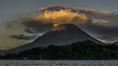
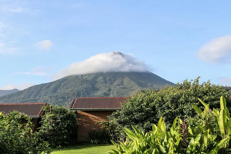
    Arenal Volcano National Park protects the roughly 1,630-meter-high cone of Arenal and its forested flanks in the Arenal and Monteverde region, about 30 minutes drive west of La Fortuna. You come here to hike across solidified lava fields and see the volcano up close.Arenal erupted unexpectedly on July 29, 1968, burying the villages of Tabacón, Pueblo Nuevo, and San Luís and claiming dozens of lives. It remained continuously active until 2010, and has been dormant since. The park was established in 1991 and covers approximately 121 square kilometers.Visitors can access two sectors. In the Volcán sector, near the visitor center, short, mostly flat trails like Las Coladas (approx. 2 km) lead over lava flows from the 1992 eruption, while El Ceibo (approx. 3 km) goes through secondary forest. The Península sector is a few minutes' drive away on Lake Arenal and offers views of the lake and volcano via the Los Miradores trail and an observation tower.The summit itself is closed to visitors; the national protected area authority SINAC explicitly warns against illegal summit hikes. Admission is charged at the sectors, with current prices and opening hours published by SINAC. Come as early as possible, as the summit often becomes cloud-covered as the day progresses.

    Sights in Arenal Volcano National Park

    Discover the most important sights and attractions

    El Ceibo Trail
    Attraction

    1El Ceibo Trail

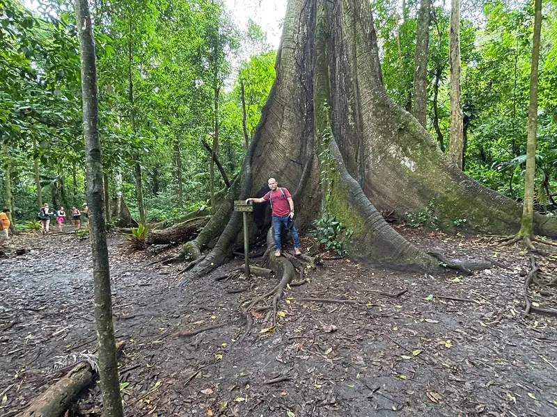
    The approximately three-kilometer El Ceibo loop trail in the Volcán sector runs through forest that regenerated after the 1968 eruption. It was named after a mighty kapok tree that fell during a storm in 2023; its trunk can still be seen along the path. The trail is easy to moderate and can be easily combined with the Las Coladas lava path.
    Open in Google Maps
    Attraction

    2Trail Las Coladas

    The roughly two-kilometer path in the Volcán Sector crosses cooled lava flows from the 1992 eruption. Raised boardwalks lead to viewpoints, offering an unobstructed view of the volcano cone on clear days. The trail can be easily combined with the El Ceibo loop trail.
    Open in Google Maps
    Attraction

    3Peninsula Sector

    The national park's second visitor sector is about a 35-minute drive from La Fortuna on the shore of Lake Arenal. The flat Los Miradores trail (approx. 1.2 km) leads to an observation tower with lake and volcano views, from which the shorter El Tororoi trail branches off. The access road is not entirely paved but is passable without a 4x4.
    Open in Google Maps

    Restaurants in Arenal Volcano National Park

    History of the Volcano

    The 1968 EruptionOn the morning of July 29, 1968, an explosive eruption began on the western flank of the mountain, which until then had been considered dormant. Three small villages were buried. The lava flows of the subsequent decades shaped the landscape through which the hiking trails in the Volcán sector now lead.From Active Volcano to Hiking AreaUntil 2010, Arenal was one of the most active volcanoes in the country; since then, it has been considered dormant. The area is also an important watershed for Lake Arenal, whose reservoir supplies electricity to the national grid.

    Getting There & Around

    ArrivalThe Visitor Center in the Volcán sector is about a 30-minute drive from La Fortuna; an SUV is not needed for access. The Península sector is approximately 35 minutes from La Fortuna, with access roads partly unpaved. Public buses stop only at the main road, not at the entrances; without a car, take a taxi or a guided tour.In the ParkTickets are purchased at the entrance; currently, only card payments are accepted. The Las Coladas and El Ceibo trails can be combined into an approximately five-kilometer loop; the trail in the Península sector is paved and easily accessible. Toilets are available at the main entrance. Bring rain protection; showers are frequent year-round.
    Accommodations in Arenal Volcano National Park

    Find perfect stay in Arenal Volcano National Park

    Booking.com* (Affiliate link)
    Search Hotels
    Agoda* (Affiliate link)
    Search Hotels
    Airbnb
    Vacation Rentals

    * Affiliate link: if you book through it, we earn a small commission. The price stays the same for you.

    Nearby

    La Fortuna

    La Fortuna

    La Fortuna is the main town at the foot of Arenal Volcano in the Arenal and Monteverde region, about three to three-and-a-half hours' drive northwest of San José. You come here because the Arenal Volcano National Park, the Río Fortuna waterfall, and the surrounding hot springs are all easily accessible from the town.The town was founded in the mid-1930s by settlers from Ciudad Quesada, Grecia, and Alajuela, and was originally called El Burío. It owes its current name to the fertile soil, not, as is often recounted, to the 1968 eruption which hit the villages west of the volcano and spared La Fortuna.The town center spans just a few streets. Most accommodations, restaurants, and tour operators are located along the main road and around Parque Central with its church, behind which the cone of Arenal rises on clear days.The range of activities is wide: horseback riding, rafting, canyoning, ziplines, and hanging bridges are all available, as are the warm springs, which emerge at around 30 to 50 degrees Celsius, including along the Río Tabacón. Plan at least two full days, as the peak region is often shrouded in clouds.
    Arenal and Monteverde

    Arenal and Monteverde

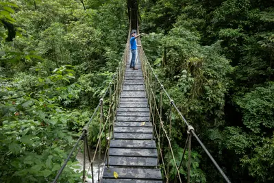
    Arenal and Monteverde form the green highlands in northwestern Costa Rica, about three to four hours' drive northwest of San José. You travel here for the cone-shaped Arenal Volcano with its hot springs and for the cloud forests of Monteverde, two of the country's most visited natural destinations.Arenal was continuously active from 1968 to 2010; today it is dormant, and around the town of La Fortuna, hiking trails over old lava fields, suspension bridges, a waterfall, and numerous hot springs have developed. Southwest of it, beyond Lake Arenal, lies the Monteverde highlands with its privately and communally managed cloud forest reserves.By road around the lake, the drive between both destinations is longer than the map suggests. Many travelers therefore combine it with a transfer by boat across Lake Arenal.
    Monteverde

    Monteverde

    Monteverde is the cloud forest highlands in the Arenal and Monteverde region, about a four-hour drive from the Valle Central around San José. You come here to hike through the Monteverde and Santa Elena cloud forest reserves, where mosses, epiphytes, and with a bit of luck, the quetzal can be seen.The settlement lies at around 1,300 to 1,400 meters. The main town and supply center is Santa Elena, with most accommodations, restaurants, and tour offices; along the road towards the reserve are Cerro Plano and the Quaker-founded Monteverde settlement.The climate is cool and often foggy. Besides the reserves, private parks like Selvatura offer hanging bridges and ziplines; several operators lead night walks in the evenings.Plan at least two nights. Early mornings are best for birdwatching, and a local guide increases your chances of spotting animals.
    Río Celeste

    Río Celeste

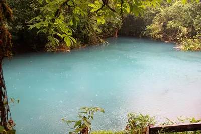
    The Río Celeste is a glowing light blue river in the Tenorio Volcano National Park in Guanacaste, near the town of Bijagua de Upala in the north of the country. You come here for its turquoise waterfall and the spot where two clear rivers mix and the water suddenly turns blue.The color appears when the volcanically influenced Río Buenavista meets the acidic Quebrada Agria: Tiny aluminum silicate particles clump together and scatter sunlight. After heavy rains, the water is murkier and less blue.The Misterios del Tenorio hiking trail starts at El Pilón Station and leads to a viewpoint, Laguna Azul, the Borbollones where gas bubbles from the riverbed, and the Teñideros where the rivers meet. The stairs to the waterfall were only partially open from mid-2025 after damage; check before visiting which sections are open.Swimming is prohibited in the National Park. Tickets are booked online through the protected area authority SINAC, and entry is granted in time slots; in case of bad weather, the park may close at short notice.
    Poás Volcano National Park

    Poás Volcano National Park

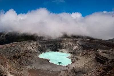
    Poás Volcano National Park is located in the Cordillera Central on the northern edge of the Valle Central, north of Alajuela and San José. You come here to gaze from a viewpoint into an active crater featuring one of the world's most acidic crater lakes.The volcano stands at 2,697 meters. In the northern crater, at approximately 2,300 meters, lies Laguna Caliente, a hot lake whose pH value is at times close to zero and where liquid sulfur accumulates on its bed. A second, cold and clear lake, Laguna Botos, fills an extinct crater within the park's cloud forest.Poás is one of the country's most active volcanoes. Following a major eruption in April 2017, the park remained closed for approximately 17 months. 2025 saw further closures due to heightened activity. Since February 2026, the volcano has again recorded eruptive phases; after an eruption on August 27, 2026, SINAC tightened visiting rules.According to the rules effective since August 28, 2026, a maximum of 1,064 people per day are allowed into the park, with 56 people simultaneously permitted at the crater viewpoint for a maximum of 20 minutes. Helmets are compulsory on the main path to the crater and on the Sendero Sombrilla de Pobre. Tickets are only available in advance through SINAC's online reservation system. The park normally opens from 8 AM to 4 PM, with the last entry at 2 PM.Since access rules and opening hours can change at short notice depending on activity, it's best to check the current status directly with SINAC prior to your visit. Arrive as early as possible: The crater is often shrouded in clouds, and visibility is usually better in the morning.

    Sources & method

    • Photos: Wikimedia Commons, Google Maps. Each photo carries its credit.
    • Place data such as addresses and ratings comes from Google Maps.
    • The content is based on web research from public, traceable sources. How the content is made · The role of AI