Fernweh: Home
    ExploreTravel GuidesPlan a tripMy tripLast visited
    de|en
    All Places & RegionsAll highlightsAbout FernwehFAQPrivacy PolicyImprint
    ExploreTravel GuidesPlan a tripMy tripLast visited
    Poás Volcano National Park

    Costa Rica

    Poás Volcano National Park

    Point of Interest

    Poás Volcano National Park is located in the Cordillera Central on the northern edge of the Valle Central, north of Alajuela and San José.

    by Felix Gillen

    1. Home
    2. Destinations
    3. Costa Rica
    4. Central Valley
    5. Poás Volcano National Park
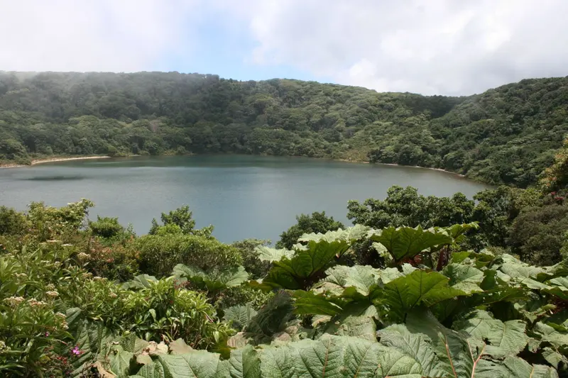
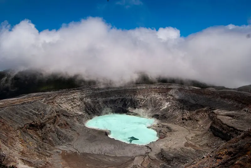
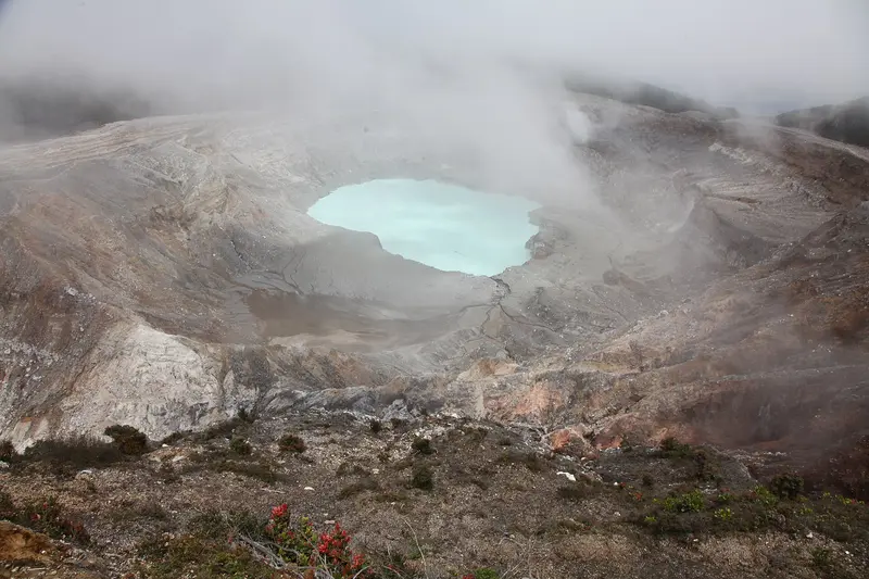
    Poás Volcano National Park is located in the Cordillera Central on the northern edge of the Valle Central, north of Alajuela and San José. You come here to gaze from a viewpoint into an active crater featuring one of the world's most acidic crater lakes.The volcano stands at 2,697 meters. In the northern crater, at approximately 2,300 meters, lies Laguna Caliente, a hot lake whose pH value is at times close to zero and where liquid sulfur accumulates on its bed. A second, cold and clear lake, Laguna Botos, fills an extinct crater within the park's cloud forest.Poás is one of the country's most active volcanoes. Following a major eruption in April 2017, the park remained closed for approximately 17 months. 2025 saw further closures due to heightened activity. Since February 2026, the volcano has again recorded eruptive phases; after an eruption on August 27, 2026, SINAC tightened visiting rules.According to the rules effective since August 28, 2026, a maximum of 1,064 people per day are allowed into the park, with 56 people simultaneously permitted at the crater viewpoint for a maximum of 20 minutes. Helmets are compulsory on the main path to the crater and on the Sendero Sombrilla de Pobre. Tickets are only available in advance through SINAC's online reservation system. The park normally opens from 8 AM to 4 PM, with the last entry at 2 PM.Since access rules and opening hours can change at short notice depending on activity, it's best to check the current status directly with SINAC prior to your visit. Arrive as early as possible: The crater is often shrouded in clouds, and visibility is usually better in the morning.

    Sights in Poás Volcano National Park

    Discover the most important sights and attractions

    Crater and Laguna Caliente

    1Crater and Laguna Caliente

    From the viewpoint on the rim of the active North Crater, you look down onto Laguna Caliente. The hot crater lake, with a pH value sometimes near zero, is one of the world's most acidic lakes. Since August 2026, a maximum of 56 people are permitted simultaneously at the viewpoint for up to 20 minutes; helmets are mandatory on the path.
    Open in Google Maps
    Laguna Botos
    Natural Feature

    2Laguna Botos

    The cold, clear lake fills an extinct crater south of the active crater and is surrounded by cloud forest. Whether the path to it is open is determined by SINAC depending on the volcano's activity.
    Open in Google Maps

    Restaurants in Poás Volcano National Park

    Living with the Volcano

    Ash over the Valle CentralDuring major eruptions, the ash plume of Poás is visible as far as Alajuela and San José. In the April 2017 eruption, it rose over three kilometers, and residents were evacuated. Ashfall from recent eruptions primarily occurred southwest of the volcano, towards Sarchí and Grecia.A Park Under RestrictionsSince its reopening in September 2018, visits are only possible with an online reservation and limited access to the crater. Mandatory helmets, short viewing times at the lookout, and daily visitor quotas are the authorities' response to the recurring eruptions.

    Arrival and Your Visit

    Getting ThereThe park is located in the Cordillera Central north of Alajuela. You can reach it by car or as part of a booked tour from the Valle Central. Plan your journey to arrive at the entrance at your reserved time slot; the last entry is at 2 PM.In the ParkFrom the visitor area, a path leads to the crater viewpoint; helmets are mandatory on this path and on the Sendero Sombrilla de Pobre. SINAC determines which paths are open depending on the current danger level.
    Accommodations in Poás Volcano National Park

    Find perfect stay in Poás Volcano National Park

    Booking.com* (Affiliate link)
    Search Hotels
    Agoda* (Affiliate link)
    Search Hotels
    Airbnb
    Vacation Rentals

    * Affiliate link: if you book through it, we earn a small commission. The price stays the same for you.

    Nearby

    San José

    San José

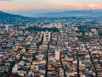
    San José is the capital of Costa Rica and the heart of the Central Valley. Almost all travelers arrive here. One to two days are sufficient to visit the museums of pre-Columbian gold and jade, the National Theater, and the market halls before continuing on to volcanoes and coasts. The city lies at an altitude of approximately 1,030 meters and has been the capital since 1823; Juan Santamaría International Airport is located a good 20 kilometers away in Alajuela.The center around the Plaza de la Cultura is compact and easily explored on foot. Here you'll find the Teatro Nacional, which opened in 1897, and below it the Museo del Oro Precolombino. A few blocks to the east are the Museo del Jade and the Museo Nacional, located in the former Bellavista army barracks. West of the Cathedral, the Mercado Central has occupied an entire block on Avenida Central since 1880, featuring over 200 stalls and simple sodas in narrow passageways.Barrio Amón, north of the center, emerged in the late 19th century as a residential quarter for the coffee oligarchy. Among low wooden houses with verandas and wrought-iron railings stand buildings like the 1930 Mudéjar-style Castillo del Moro or the prefabricated metal building from 1890, which has housed the Alianza Francesa since 1965. Many of the restored villas now accommodate small hotels, cafés, and galleries. Some streets are considered sparsely populated in the evenings, so you're better off taking a taxi at night there.Barrio Escalante in the east is the city's restaurant district. Around Calle 33, eateries have set up shop in old residential buildings: vegan cafés, specialty coffee, craft beer pubs, and cuisines ranging from Mediterranean to Mexican. This area is liveliest in the evenings, and accordingly, most of the city's bars are located in this neighborhood.
    Central Valley

    Central Valley

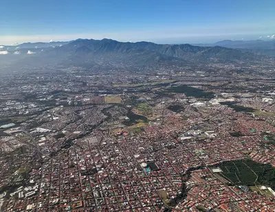
    The Valle Central is the highlands in the heart of Costa Rica, home to the capital San José and the cities of Alajuela, Heredia, and Cartago. Almost every trip begins here, as the international airport is located in Alajuela, and from here you can quickly reach active volcanoes, museums, and colonial churches.The valley lies at an altitude of about 800 to 1,500 meters. To the north, it is bounded by the Cordillera Central with the volcanoes Poás, Barva, Irazú, and Turrialba, and to the south by the Cordillera de Talamanca. Temperatures are mostly between 18 and 30 degrees, significantly milder than on the coasts.Almost three-quarters of the population lives in the Valle Central; consequently, roads, traffic, and services are dense. For travelers, this means: short distances to the Poás and Irazú Volcano Parks, a good day for the museums in San José, and a side trip to Cartago for the Basilica.
    Irazú Volcano National Park

    Irazú Volcano National Park

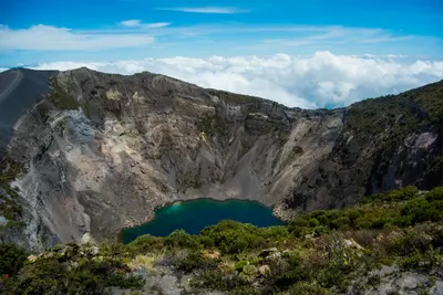
    Irazú Volcano National Park is located in the Cordillera Central above Cartago, in the east of the Central Valley. You come here to walk right up to the rim of several craters, which are among Costa Rica's most easily accessible volcanic landscapes.Irazú stands at 3,432 meters. The National Park was founded on August 9, 1955. An eruption, which began in March 1963 and lasted about two years, covered San José and large parts of the highlands with ash.At the summit are several craters, including the Main Crater, the Diego de la Haya Crater, and the small, ash-covered Playa Hermosa Crater. During the rainy season, water collects in the Main Crater and Diego de la Haya, forming colorful lagoons. On very clear days, both the Caribbean and the Pacific can be seen from the summit; such days are rare, as clouds usually hang over the peak from late morning.The park also includes the Prusia sector, a former forest reserve where reforestation has taken place and hiking trails lead through the mountain forest. Tickets are available exclusively online via the SINAC reservation system, with a fixed entry time slot. Before your visit, check there for current opening hours and whether all sectors are accessible.At over 3,000 meters, it is cold and windy, even in the tropics. Bring warm clothing and rain gear, and come early to see the craters before the clouds roll in.
    Cartago

    Cartago

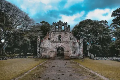
    Cartago is the first capital of Costa Rica, located in the east of the Central Valley, southeast of San José at the foot of Irazú Volcano. You visit here for the Basílica de los Ángeles, the country's most important sanctuary, and as a starting point for Irazú National Park.Juan Vásquez de Coronado founded the city in 1563, and it is considered the country's first permanent Spanish settlement. Cartago served as the capital until 1823, when the seat of government moved to San José. Earthquakes in 1822, 1841, and 1910 severely damaged the city, which is why little of its colonial cityscape remains.The city center can be explored on foot in half a day. To the east stands the Basilica with the Marian figure La Negrita; about seven blocks west, on the Plaza Mayor, are the Ruinas de Santiago Apóstol, a never-completed church whose walls now enclose a garden. In between, you'll find the Centro Cultural, housed in the neo-Gothic building of the former Banco Crédito Agrícola from 1924, and the municipal market with simple eateries.The city is situated at an elevation of approximately 1,435 meters, making it noticeably cooler than the coasts. From here, the road leads up to Irazú; southeast of the city lies the Lankester Botanical Garden.
    La Fortuna

    La Fortuna

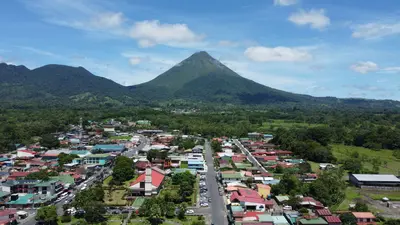
    La Fortuna is the main town at the foot of Arenal Volcano in the Arenal and Monteverde region, about three to three-and-a-half hours' drive northwest of San José. You come here because the Arenal Volcano National Park, the Río Fortuna waterfall, and the surrounding hot springs are all easily accessible from the town.The town was founded in the mid-1930s by settlers from Ciudad Quesada, Grecia, and Alajuela, and was originally called El Burío. It owes its current name to the fertile soil, not, as is often recounted, to the 1968 eruption which hit the villages west of the volcano and spared La Fortuna.The town center spans just a few streets. Most accommodations, restaurants, and tour operators are located along the main road and around Parque Central with its church, behind which the cone of Arenal rises on clear days.The range of activities is wide: horseback riding, rafting, canyoning, ziplines, and hanging bridges are all available, as are the warm springs, which emerge at around 30 to 50 degrees Celsius, including along the Río Tabacón. Plan at least two full days, as the peak region is often shrouded in clouds.

    Sources & method

    • Photos: Wikimedia Commons, Pexels. Each photo carries its credit.
    • Place data such as addresses and ratings comes from Google Maps.
    • The content is based on web research from public, traceable sources. How the content is made · The role of AI