Fernweh: Home
    ExploreTravel GuidesPlan a tripMy tripLast visited
    de|en
    All Places & RegionsAll highlightsAbout FernwehFAQPrivacy PolicyImprint
    ExploreTravel GuidesPlan a tripMy tripLast visited
    Río Celeste
    Cephas / Wikimedia Commons / CC BY-SA 4.0

    Costa Rica

    Río Celeste

    Point of Interest

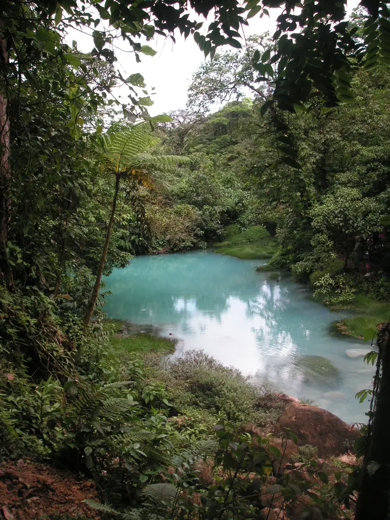
    The Río Celeste is a glowing light blue river in the Tenorio Volcano National Park in Guanacaste, near the town of Bijagua de Upala in the north of the country.

    by Felix Gillen

    1. Home
    2. Destinations
    3. Costa Rica
    4. Guanacaste
    5. Río Celeste
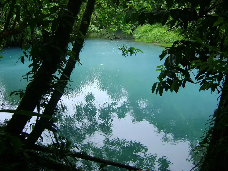
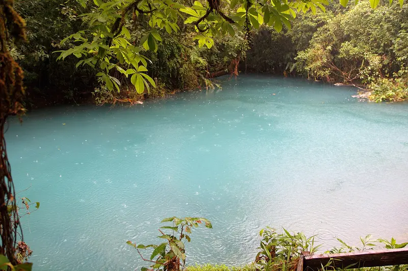
    The Río Celeste is a glowing light blue river in the Tenorio Volcano National Park in Guanacaste, near the town of Bijagua de Upala in the north of the country. You come here for its turquoise waterfall and the spot where two clear rivers mix and the water suddenly turns blue.The color appears when the volcanically influenced Río Buenavista meets the acidic Quebrada Agria: Tiny aluminum silicate particles clump together and scatter sunlight. After heavy rains, the water is murkier and less blue.The Misterios del Tenorio hiking trail starts at El Pilón Station and leads to a viewpoint, Laguna Azul, the Borbollones where gas bubbles from the riverbed, and the Teñideros where the rivers meet. The stairs to the waterfall were only partially open from mid-2025 after damage; check before visiting which sections are open.Swimming is prohibited in the National Park. Tickets are booked online through the protected area authority SINAC, and entry is granted in time slots; in case of bad weather, the park may close at short notice.

    Sights in Río Celeste

    Discover the most important sights and attractions

    Río Celeste Falls
    Natural Feature

    1Río Celeste Falls

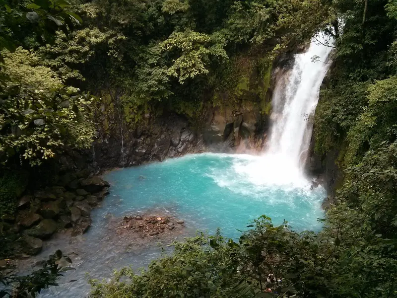
    The waterfall plunges into a turquoise-blue basin and is the National Park's most iconic sight. A long staircase leads to its base; after damage from heavy rain, it was only partially reopened in June 2025, and in heavy rain, the section must be evacuated immediately. Check before your visit how far down the descent is currently possible.
    Open in Google Maps
    Los Teñideros
    Natural Feature

    2Los Teñideros

    At the end of the hiking trail, two clear rivers meet, and from here the water is light blue. Two bridges lead to the spot: The first crosses the still colourless river, the second the already blue one. A sign explains the origin of the colour.
    Open in Google Maps
    Laguna Azul
    Natural Feature

    3Laguna Azul

    The Blue Lagoon is about 200 meters past the viewpoint on the hiking trail, reachable via steep steps and large rocks. Fifty meters beyond are the Borbollones, where hot, sulfur-smelling water bubbles from the riverbed. The area is cordoned off; do not touch the water.
    Open in Google Maps

    Restaurants in Río Celeste

    Nature and Legend

    Why the River is BlueBefore the confluence, both tributaries are clear. At the Teñideros, where the Río Buenavista meets the acidic Quebrada Agria, tiny aluminosilicate particles combine into larger ones. These scatter sunlight, making the water appear blue. A plaque at the site explains the phenomenon.A Local LegendA local legend claims God washed his brush in Río Celeste after painting the sky. The Tenorio Volcano National Park, home to the river, was established in 1976 and spans about 129 square kilometers.

    Arrival and On the Go

    ArrivalThe park entrance at El Pilón station is near Bijagua de Upala. For GPS, enter "Parque Nacional Volcán Tenorio", as "Río Celeste" isn't reliably found. Most visitors arrive by rental car or tour.In the ParkThe Teñideros trail is a round trip; viewpoint after ~0.5 km, Teñideros at the end. Parts are steep and muddy after rain; sturdy shoes are advised. Show ticket and ID at entrance, arrive on time for booked slot. Outside the park, private and public bathing spots are available along the river.
    Accommodations in Río Celeste

    Find perfect stay in Río Celeste

    Booking.com* (Affiliate link)
    Search Hotels
    Agoda* (Affiliate link)
    Search Hotels
    Airbnb
    Vacation Rentals

    * Affiliate link: if you book through it, we earn a small commission. The price stays the same for you.

    Nearby

    Rincón de la Vieja National Park

    Rincón de la Vieja National Park

    Rincón de la Vieja National Park protects its namesake volcanic massif in Guanacaste, about 25 kilometers northeast of Liberia. You come here to hike through tropical forest among fumaroles, bubbling mud pots, and waterfalls.Established in 1973, the 141 sq km park is a UNESCO World Heritage site (Area de Conservación Guanacaste). The volcano is active: repeated minor eruptions occurred in Aug/Sept 2026; early Sept. saw the national emergency agency CNE issue a green alert for surrounding districts. The hiking trail to the crater has been closed for years.Most visitors enter via the Las Pailas sector. A roughly three-kilometer loop trail here passes fumaroles, a steaming lagoon, and mud pots; longer trails lead to La Cangreja and Escondida waterfalls. The quieter Santa María sector further north is only accessible by 4x4 vehicles.The park closes Mondays. Entrance fees and current access rules are published by protected area authority SINAC. Volcanic activity may restrict access short-term; check the current status before visiting and heed foreign office advisories.
    Arenal Volcano National Park

    Arenal Volcano National Park

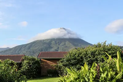
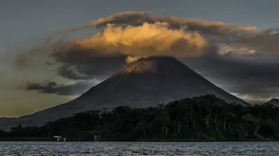
    Arenal Volcano National Park protects the roughly 1,630-meter-high cone of Arenal and its forested flanks in the Arenal and Monteverde region, about 30 minutes drive west of La Fortuna. You come here to hike across solidified lava fields and see the volcano up close.Arenal erupted unexpectedly on July 29, 1968, burying the villages of Tabacón, Pueblo Nuevo, and San Luís and claiming dozens of lives. It remained continuously active until 2010, and has been dormant since. The park was established in 1991 and covers approximately 121 square kilometers.Visitors can access two sectors. In the Volcán sector, near the visitor center, short, mostly flat trails like Las Coladas (approx. 2 km) lead over lava flows from the 1992 eruption, while El Ceibo (approx. 3 km) goes through secondary forest. The Península sector is a few minutes' drive away on Lake Arenal and offers views of the lake and volcano via the Los Miradores trail and an observation tower.The summit itself is closed to visitors; the national protected area authority SINAC explicitly warns against illegal summit hikes. Admission is charged at the sectors, with current prices and opening hours published by SINAC. Come as early as possible, as the summit often becomes cloud-covered as the day progresses.
    Arenal and Monteverde

    Arenal and Monteverde

    Arenal and Monteverde form the green highlands in northwestern Costa Rica, about three to four hours' drive northwest of San José. You travel here for the cone-shaped Arenal Volcano with its hot springs and for the cloud forests of Monteverde, two of the country's most visited natural destinations.Arenal was continuously active from 1968 to 2010; today it is dormant, and around the town of La Fortuna, hiking trails over old lava fields, suspension bridges, a waterfall, and numerous hot springs have developed. Southwest of it, beyond Lake Arenal, lies the Monteverde highlands with its privately and communally managed cloud forest reserves.By road around the lake, the drive between both destinations is longer than the map suggests. Many travelers therefore combine it with a transfer by boat across Lake Arenal.
    La Fortuna

    La Fortuna

    La Fortuna is the main town at the foot of Arenal Volcano in the Arenal and Monteverde region, about three to three-and-a-half hours' drive northwest of San José. You come here because the Arenal Volcano National Park, the Río Fortuna waterfall, and the surrounding hot springs are all easily accessible from the town.The town was founded in the mid-1930s by settlers from Ciudad Quesada, Grecia, and Alajuela, and was originally called El Burío. It owes its current name to the fertile soil, not, as is often recounted, to the 1968 eruption which hit the villages west of the volcano and spared La Fortuna.The town center spans just a few streets. Most accommodations, restaurants, and tour operators are located along the main road and around Parque Central with its church, behind which the cone of Arenal rises on clear days.The range of activities is wide: horseback riding, rafting, canyoning, ziplines, and hanging bridges are all available, as are the warm springs, which emerge at around 30 to 50 degrees Celsius, including along the Río Tabacón. Plan at least two full days, as the peak region is often shrouded in clouds.
    Guanacaste

    Guanacaste

    Guanacaste is Costa Rica's dry northwestern province on the Pacific coast, approximately 215 kilometers northwest of San José. You come here for the beaches of the Pacific coast, for volcanic landscapes like the Rincón de la Vieja, and for the light blue Río Celeste.From November to April, there's hardly any rain here, which makes Guanacaste the country's most reliable beach destination during this time; from May to October, it usually rains daily. The landscape is characterized by pastureland, dry forest, and volcanic ranges; the Area de Conservación Guanacaste in the north is a UNESCO World Heritage site.The capital is Liberia, home to the country's second international airport, the Aeropuerto Daniel Oduber Quirós. From there, you can reach the beaches around Tamarindo as quickly as the national parks inland.

    Sources & method

    • Photos: Wikimedia Commons. Each photo carries its credit.
    • The content is based on web research from public, traceable sources. How the content is made · The role of AI