Fernweh: Home
    ExploreTravel GuidesPlan a tripMy tripLast visited
    de|en
    All Places & RegionsAll highlightsAbout FernwehFAQPrivacy PolicyImprint
    ExploreTravel GuidesPlan a tripMy tripLast visited
    • Overview
    • Places in the region
    • Round trips
    • Nearby
    Guanacaste
    Alicearias11 / Wikimedia Commons / CC BY 4.0

    Costa Rica

    Guanacaste

    Region

    Guanacaste is Costa Rica's dry northwestern province on the Pacific coast, approximately 215 kilometers northwest of San José.

    by Felix Gillen

    1. Home
    2. Destinations
    3. Costa Rica
    4. Guanacaste
    Guanacaste is Costa Rica's dry northwestern province on the Pacific coast, approximately 215 kilometers northwest of San José. You come here for the beaches of the Pacific coast, for volcanic landscapes like the Rincón de la Vieja, and for the light blue Río Celeste.From November to April, there's hardly any rain here, which makes Guanacaste the country's most reliable beach destination during this time; from May to October, it usually rains daily. The landscape is characterized by pastureland, dry forest, and volcanic ranges; the Area de Conservación Guanacaste in the north is a UNESCO World Heritage site.The capital is Liberia, home to the country's second international airport, the Aeropuerto Daniel Oduber Quirós. From there, you can reach the beaches around Tamarindo as quickly as the national parks inland.
    Guanacaste, covering around 10,000 square kilometers, is Costa Rica's second-largest and most sparsely populated province. The territory joined Costa Rica from Nicaragua in 1824 after a plebiscite; the anniversary of this annexation on July 25th remains a public holiday today. Cattle ranching, the culture of the Sabaneros, and the Marimba, the national instrument, shape the province's identity.On the coast lies Tamarindo, the region's most famous beach resort, home to Las Baulas Marine National Park, where Leatherback sea turtles lay their eggs. Inland, the Guanacaste Volcanic Range, featuring Rincón de la Vieja National Park, and further east, the Río Celeste in Tenorio National Park, attract most visitors.Liberia serves as the practical starting point: car rental companies are located at the airport, and the Interamericana connects the city with the north and San José.
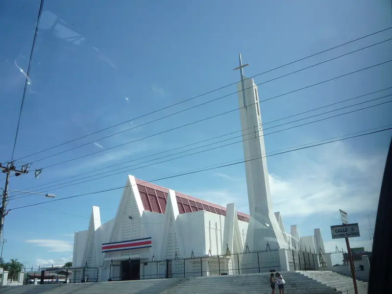
    Liberia
    Emw / Wikimedia Commons / CC BY-SA 3.0

    Place 1 of 4

    Liberia

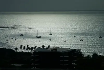
    Liberia, the capital of Guanacaste province, lies about 215 kilometers northwest of San José on the Interamericana.

    Discover
    Río Celeste
    Cephas / Wikimedia Commons / CC BY-SA 4.0

    Place 2 of 4

    Río Celeste

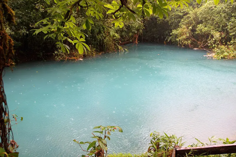
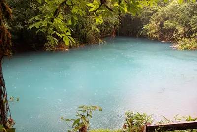
    The Río Celeste is a glowing light blue river in the Tenorio Volcano National Park in Guanacaste, near the town of Bijagua de Upala in the north of the country.

    Discover
    Tamarindo

    Place 3 of 4

    Tamarindo

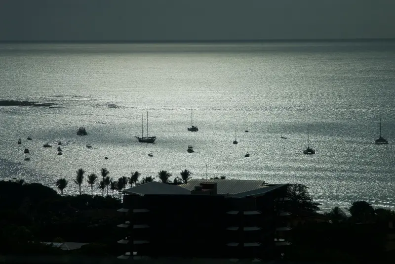
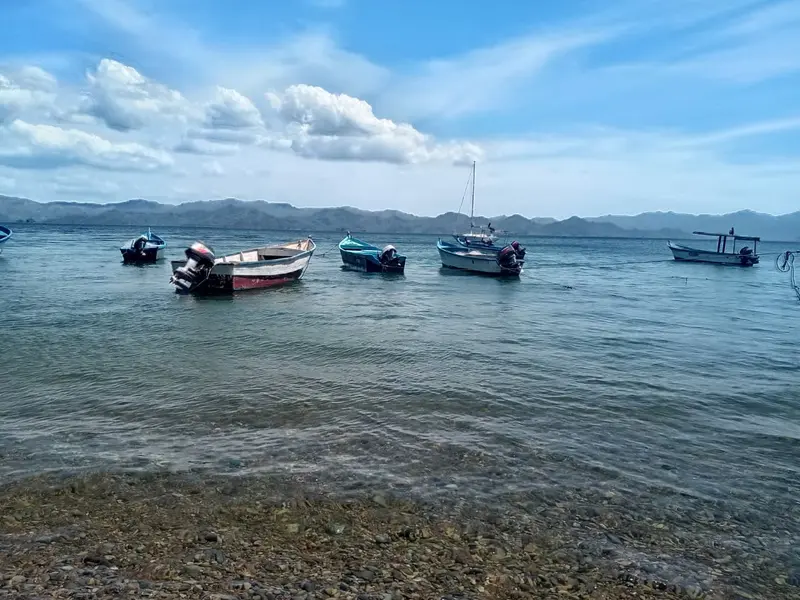
    Tamarindo is Guanacaste's most famous beach resort on the Pacific Coast of the Nicoya Peninsula, about an hour's drive from Liberia International Airport.

    Discover
    Rincón de la Vieja National Park
    Kobold66 / Wikimedia Commons / CC BY-SA 3.0

    Place 4 of 4

    Rincón de la Vieja National Park

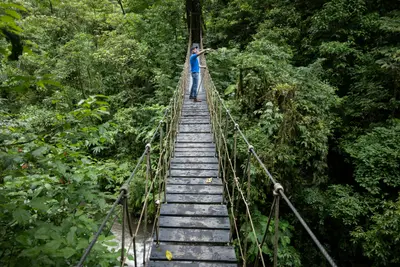
    Rincón de la Vieja National Park protects its namesake volcanic massif in Guanacaste, about 25 kilometers northeast of Liberia. You come here to hike through tropical forest among fumaroles, bubbling mud pots, and waterfalls.

    Discover

    Round trips through this region

    Pacific Coast from Guanacaste to Osa

    Pacific Coast from Guanacaste to Osa

    The route follows the Pacific coast from the dry beaches of Guanacaste, via the surf towns of the Nicoya Peninsula and Manuel Antonio National Park, to the rainforest of the Osa Peninsula. It is suitable for a 4x4 rental car and ends with a domestic flight back to San José.

    17 Days
    7 stops
    Open jaw

    Nearby

    Liberia

    Liberia

    Liberia, the capital of Guanacaste province, lies about 215 kilometers northwest of San José on the Interamericana. Most visitors arrive via Daniel Oduber Quirós International Airport, using the city as a base for exploring Pacific coast beaches and Rincón de la Vieja National Park.Liberia earned its nickname "White City" from the light gravel that once paved its streets and the whitewashed colonial houses. Some of these, along with the 19th-century Ermita de la Agonía, are preserved in the city center.With over 50,000 inhabitants, the city serves as a commercial and administrative hub, not a resort. Around Parque Central, you'll find banks, supermarkets, and simple restaurants, making Liberia a practical stopover before or after onward travel.If you don't head straight to the coast after landing, half a day is enough for a stroll through the center. For Rincón de la Vieja, the city is a good base; access to the Las Pailas sector takes about an hour.
    Rincón de la Vieja National Park

    Rincón de la Vieja National Park

    Rincón de la Vieja National Park protects its namesake volcanic massif in Guanacaste, about 25 kilometers northeast of Liberia. You come here to hike through tropical forest among fumaroles, bubbling mud pots, and waterfalls.Established in 1973, the 141 sq km park is a UNESCO World Heritage site (Area de Conservación Guanacaste). The volcano is active: repeated minor eruptions occurred in Aug/Sept 2026; early Sept. saw the national emergency agency CNE issue a green alert for surrounding districts. The hiking trail to the crater has been closed for years.Most visitors enter via the Las Pailas sector. A roughly three-kilometer loop trail here passes fumaroles, a steaming lagoon, and mud pots; longer trails lead to La Cangreja and Escondida waterfalls. The quieter Santa María sector further north is only accessible by 4x4 vehicles.The park closes Mondays. Entrance fees and current access rules are published by protected area authority SINAC. Volcanic activity may restrict access short-term; check the current status before visiting and heed foreign office advisories.
    Río Celeste

    Río Celeste

    The Río Celeste is a glowing light blue river in the Tenorio Volcano National Park in Guanacaste, near the town of Bijagua de Upala in the north of the country. You come here for its turquoise waterfall and the spot where two clear rivers mix and the water suddenly turns blue.The color appears when the volcanically influenced Río Buenavista meets the acidic Quebrada Agria: Tiny aluminum silicate particles clump together and scatter sunlight. After heavy rains, the water is murkier and less blue.The Misterios del Tenorio hiking trail starts at El Pilón Station and leads to a viewpoint, Laguna Azul, the Borbollones where gas bubbles from the riverbed, and the Teñideros where the rivers meet. The stairs to the waterfall were only partially open from mid-2025 after damage; check before visiting which sections are open.Swimming is prohibited in the National Park. Tickets are booked online through the protected area authority SINAC, and entry is granted in time slots; in case of bad weather, the park may close at short notice.
    Tamarindo

    Tamarindo

    Tamarindo is Guanacaste's most famous beach resort on the Pacific Coast of the Nicoya Peninsula, about an hour's drive from Liberia International Airport. You come here for the wide surf beach, the mangroves of the Tamarindo Estuary, and the Las Baulas Marine National Park, where leatherback sea turtles lay their eggs.From a small fishing village, it transformed into a resort starting in the mid-1980s; the 1994 surf film The Endless Summer II made its waves internationally famous. Today, surf schools, hotels, restaurants, and bars line the main road parallel to the beach.The main beach, Playa Tamarindo, with its consistent waves, is well-suited for beginner surfers. To the south lies the quieter Playa Langosta, while to the north, beyond the river mouth, is Playa Grande, which belongs to the national park.Tamarindo is heavily tourist-oriented and more expensive than smaller coastal towns. However, you'll find a wide selection of accommodations, restaurants, and evening entertainment here. The best time for swimming is during the dry season, from November to April.
    Monteverde

    Monteverde

    Monteverde is the cloud forest highlands in the Arenal and Monteverde region, about a four-hour drive from the Valle Central around San José. You come here to hike through the Monteverde and Santa Elena cloud forest reserves, where mosses, epiphytes, and with a bit of luck, the quetzal can be seen.The settlement lies at around 1,300 to 1,400 meters. The main town and supply center is Santa Elena, with most accommodations, restaurants, and tour offices; along the road towards the reserve are Cerro Plano and the Quaker-founded Monteverde settlement.The climate is cool and often foggy. Besides the reserves, private parks like Selvatura offer hanging bridges and ziplines; several operators lead night walks in the evenings.Plan at least two nights. Early mornings are best for birdwatching, and a local guide increases your chances of spotting animals.

    Sources & method

    • Photos: Wikimedia Commons. Each photo carries its credit.
    • The content is based on web research from public, traceable sources. How the content is made · The role of AI