Fernweh: Home
    ExploreTravel GuidesPlan a tripMy tripLast visited
    de|en
    All Places & RegionsAll highlightsAbout FernwehFAQPrivacy PolicyImprint
    ExploreTravel GuidesPlan a tripMy tripLast visited
    • Neighborhoods & highlights
    • Recommendations
    • Eat & drink
    • Food culture
    • Culture
    • Nightlife
    • Getting around
    • Accommodation
    • Plan trip
    • Nearby
    Tamarindo

    Costa Rica

    Tamarindo

    City

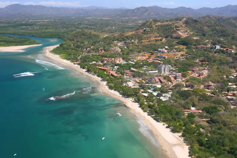
    Tamarindo is Guanacaste's most famous beach resort on the Pacific Coast of the Nicoya Peninsula, about an hour's drive from Liberia International Airport.

    by Felix Gillen

    1. Home
    2. Destinations
    3. Costa Rica
    4. Guanacaste
    5. Tamarindo
    Tamarindo is Guanacaste's most famous beach resort on the Pacific Coast of the Nicoya Peninsula, about an hour's drive from Liberia International Airport. You come here for the wide surf beach, the mangroves of the Tamarindo Estuary, and the Las Baulas Marine National Park, where leatherback sea turtles lay their eggs.From a small fishing village, it transformed into a resort starting in the mid-1980s; the 1994 surf film The Endless Summer II made its waves internationally famous. Today, surf schools, hotels, restaurants, and bars line the main road parallel to the beach.The main beach, Playa Tamarindo, with its consistent waves, is well-suited for beginner surfers. To the south lies the quieter Playa Langosta, while to the north, beyond the river mouth, is Playa Grande, which belongs to the national park.Tamarindo is heavily tourist-oriented and more expensive than smaller coastal towns. However, you'll find a wide selection of accommodations, restaurants, and evening entertainment here. The best time for swimming is during the dry season, from November to April.

    Sights in Tamarindo

    Discover the most important sights and attractions

    Playa Tamarindo
    Beach

    1Playa Tamarindo

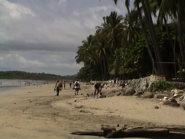
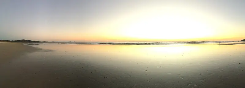
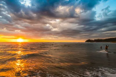
    The town's main beach stretches in a wide arc along the town center. Its consistent waves make it one of the most popular learning spots for surfers on the Pacific Coast, with numerous surf schools renting boards. At the north end, the beach opens to the mouth of the Tamarindo Estuary, where many visitors gather for sunset in the evening.
    Open in Google Maps
    Playa Grande
    Beach

    2Playa Grande

    The long, sparsely developed beach north of the river mouth belongs to Las Baulas Marine National Park. From October to May, leatherback turtles lay their eggs here; nocturnal observations are only possible under strict conditions. During the day, Playa Grande is a quieter surf spot than Tamarindo; you can reach it by water taxi across the estuary or by road via Villarreal.
    Open in Google Maps
    Playa Langosta
    National Park

    3Playa Langosta

    South of the center lies the quieter Playa Langosta, which also belongs to the Las Baulas Marine National Park. The beach is less busy than Playa Tamarindo and is perfect for walks; further mangroves are found at the mouth of the Río San Francisco to the south. You can reach it on foot along the beach or via a road east of the town center.
    Open in Google Maps
    Estero Tamarindo
    Attraction

    4Estero Tamarindo

    The mangrove estuary at the north end of the town belongs to the Las Baulas Marine National Park and has been protected as a Ramsar wetland since 1993. Boat tours and kayak trips lead through the mangrove channels, home to waterfowl. Water taxis cross the mouth to Playa Grande.
    Open in Google Maps

    Restaurants in Tamarindo

    1

    Pangas Beach Club

    The upscale beach restaurant at the north end of Playa Tamarindo is located right at the mouth of the estuary. The menu features mainly fish and seafood, and the tables in the sand offer views of mangroves and the sunset.
    Show on Google Maps
    2

    Green Papaya Taco Bar

    The central open palapa serves tacos, bowls, and breakfast. This casual spot is a no-fuss place for a quick bite between two surf sessions.
    Show on Google Maps
    3

    El Mercadito de Tamarindo

    The central food hall features several food stalls around a shared courtyard, plus a cocktail bar. As everyone can order something different here, it's popular with groups and families.
    Show on Google Maps

    Food and Drink

    Neben internationaler Küche findest du in Tamarindo einfache Sodas mit costa-ricanischer Hausmannskost.

    Casado

    The classic lunch dish of the Sodas: rice, beans, salad, fried plantain, and choice of meat, chicken, or fish.

    Fresh Fish

    Beach restaurants prepare freshly caught fish, including that caught by anglers themselves on the same day.

    Culture and History

    From Fishing Village to Surf TownUntil the 1980s, Tamarindo was a small fishing village in the Santa Cruz canton. With the first holiday bungalows from 1985, the film The Endless Summer II, and the expansion of flight connections to Liberia in the early 2000s, the town grew rapidly. Many newcomers now shape its character, and you hear English everywhere.Protection of Leatherback TurtlesFounded in 1991, the Las Baulas Marine National Park includes Playa Grande, Ventanas, and Langosta beaches, as well as the Tamarindo Estuary, which is protected as a Ramsar wetland. From October to May, leatherback turtles come ashore here to lay their eggs.

    Nightlife

    1

    El Be Tamarindo Beach Club

    The Beach Club is right on the main beach and is most popular at sunset. The terrace offers cocktails and light bites, after which guests usually head to the town's central bars.
    Show on Google Maps
    2

    El Garito

    The club on Avenida Central is one of the go-to spots for late nights in Tamarindo. DJs play, with rotating theme nights on various weekdays; it typically only gets busy late.
    Show on Google Maps

    Getting There & Around

    Getting ThereFrom Daniel Oduber Quirós Airport in Liberia, the drive is about an hour. From San José, the journey takes three and a half hours or more, depending on traffic; a daily bus also runs between San José and Tamarindo. Regular buses connect the town with Liberia. Additionally, Tamarindo has a small airstrip for domestic flights.In TownYou can explore the town center with its beach, restaurants, and bars on foot. Playa Langosta can be reached via a road east of the center. To reach Playa Grande, you can cross the estuary by water taxi or drive about 17 kilometers via Villarreal. For excursions to other beaches, a rental car is recommended.

    Accommodations in Tamarindo

    Find perfect stay in Tamarindo

    Booking.com* (Affiliate link)
    Search Hotels
    Agoda* (Affiliate link)
    Search Hotels
    Airbnb
    Vacation Rentals

    * Affiliate link: if you book through it, we earn a small commission. The price stays the same for you.

    Plan your trip to Tamarindo

    Save places, build a route and plan your city trip, all in one place.

    1. 1
      Sunrise over alpine peaks and a sea of clouds
      1234

      Round trip

      12 days · 4 stops

      Saved

      Pick a route

      Pick a ready-made one or save places and plan your own.

      Open bookmarks
    2. 2

      Trip to Tamarindo

      Live
      • 1Playa Tamarindo3 days
      • 2Playa Grande4 days
      • 3Playa Langosta5 days
      Budget

      Plan your trip

      The planner sorts stops, days and budget. Plan together in real time.

      Start trip planning
    3. 3
      9:41 No signal
      Tamarindo
      Available offline

      Use it on the road

      Download the guide to your phone and use it on site, even offline.

    Nearby

    Nosara

    Nosara

    Nosara is a district on the west coast of the Nicoya Peninsula in Guanacaste Province, about two and a half hours' drive from Liberia Airport and approximately five hours from San José. You come here to surf at Playa Guiones, for yoga classes, and due to its proximity to Ostional's turtle beach.Nosara consists of several parts: the Costa Rican village about six kilometers inland by the Río Nosara, the quieter Playa Pelada, and the area around Playa Guiones, where most accommodations, cafés, and surf schools are located. A tangle of unpaved roads and paths connects the neighborhoods.In the 1960s, a US entrepreneur bought the coastal land to subdivide it for a residential development. The project failed, but the landowners founded the Nosara Civic Association, which to this day ensures that a forested strip is preserved along the beaches. That's why you barely see any buildings from the water.Playa Guiones is an approximately six-kilometer-long sandy beach with very consistent waves, where beginners and advanced surfers can surf. Since the founding of the Nosara Yoga Institute in 1994, the place has also been a center for yoga and retreats.
    Liberia

    Liberia

    Liberia, the capital of Guanacaste province, lies about 215 kilometers northwest of San José on the Interamericana. Most visitors arrive via Daniel Oduber Quirós International Airport, using the city as a base for exploring Pacific coast beaches and Rincón de la Vieja National Park.Liberia earned its nickname "White City" from the light gravel that once paved its streets and the whitewashed colonial houses. Some of these, along with the 19th-century Ermita de la Agonía, are preserved in the city center.With over 50,000 inhabitants, the city serves as a commercial and administrative hub, not a resort. Around Parque Central, you'll find banks, supermarkets, and simple restaurants, making Liberia a practical stopover before or after onward travel.If you don't head straight to the coast after landing, half a day is enough for a stroll through the center. For Rincón de la Vieja, the city is a good base; access to the Las Pailas sector takes about an hour.
    Guanacaste

    Guanacaste

    Guanacaste is Costa Rica's dry northwestern province on the Pacific coast, approximately 215 kilometers northwest of San José. You come here for the beaches of the Pacific coast, for volcanic landscapes like the Rincón de la Vieja, and for the light blue Río Celeste.From November to April, there's hardly any rain here, which makes Guanacaste the country's most reliable beach destination during this time; from May to October, it usually rains daily. The landscape is characterized by pastureland, dry forest, and volcanic ranges; the Area de Conservación Guanacaste in the north is a UNESCO World Heritage site.The capital is Liberia, home to the country's second international airport, the Aeropuerto Daniel Oduber Quirós. From there, you can reach the beaches around Tamarindo as quickly as the national parks inland.
    Nicoya Peninsula

    Nicoya Peninsula

    The Nicoya Peninsula, in northwestern Costa Rica, juts about 120 kilometers into the Pacific, separating the Gulf of Nicoya from the open ocean. You come for its long, sparsely developed beaches, the surf spots on the west coast, and the small towns where roads often still consist of gravel.Politically, the peninsula is divided: the north belongs to Guanacaste Province, while the south, with Santa Teresa, Mal País, and Montezuma, belongs to Puntarenas Province. Nosara is located on the west coast in the Nicoya Canton, near the turtle beach of Ostional.The peninsula is counted among the so-called Blue Zones, regions where many people live to be very old. In daily life, you notice little of this, but certainly the tranquil pace in the villages away from the surf towns.
    Rincón de la Vieja National Park

    Rincón de la Vieja National Park

    Rincón de la Vieja National Park protects its namesake volcanic massif in Guanacaste, about 25 kilometers northeast of Liberia. You come here to hike through tropical forest among fumaroles, bubbling mud pots, and waterfalls.Established in 1973, the 141 sq km park is a UNESCO World Heritage site (Area de Conservación Guanacaste). The volcano is active: repeated minor eruptions occurred in Aug/Sept 2026; early Sept. saw the national emergency agency CNE issue a green alert for surrounding districts. The hiking trail to the crater has been closed for years.Most visitors enter via the Las Pailas sector. A roughly three-kilometer loop trail here passes fumaroles, a steaming lagoon, and mud pots; longer trails lead to La Cangreja and Escondida waterfalls. The quieter Santa María sector further north is only accessible by 4x4 vehicles.The park closes Mondays. Entrance fees and current access rules are published by protected area authority SINAC. Volcanic activity may restrict access short-term; check the current status before visiting and heed foreign office advisories.

    Sources & method

    • Photos: Wikimedia Commons, Pexels, Google Maps. Each photo carries its credit.
    • Place data such as addresses and ratings comes from Google Maps.
    • The content is based on web research from public, traceable sources. How the content is made · The role of AI