Fernweh: Home
    ExploreTravel GuidesPlan a tripMy tripLast visited
    de|en
    All Places & RegionsAll highlightsAbout FernwehFAQPrivacy PolicyImprint
    ExploreTravel GuidesPlan a tripMy tripLast visited
    Everglades National Park
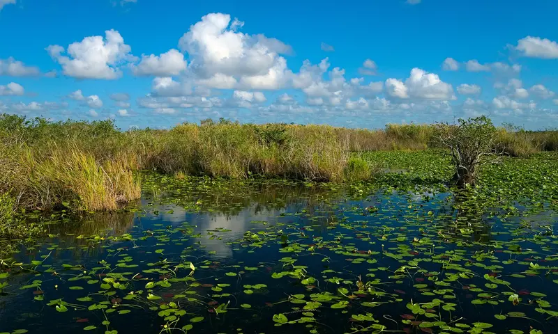
    Daniel Kraft / Wikimedia Commons / CC BY-SA 3.0

    United States

    Everglades National Park

    Point of Interest

    Everglades National Park covers the southern tip of the Florida peninsula between Miami and the Gulf, the largest subtropical wilderness in the country.

    by Felix Gillen

    1. Home
    2. Destinations
    3. United States
    4. Florida
    5. Everglades National Park
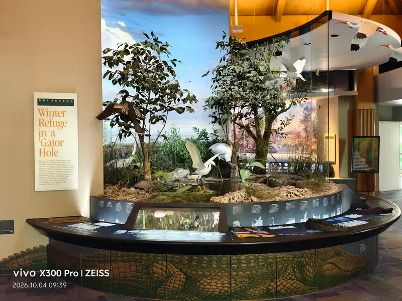
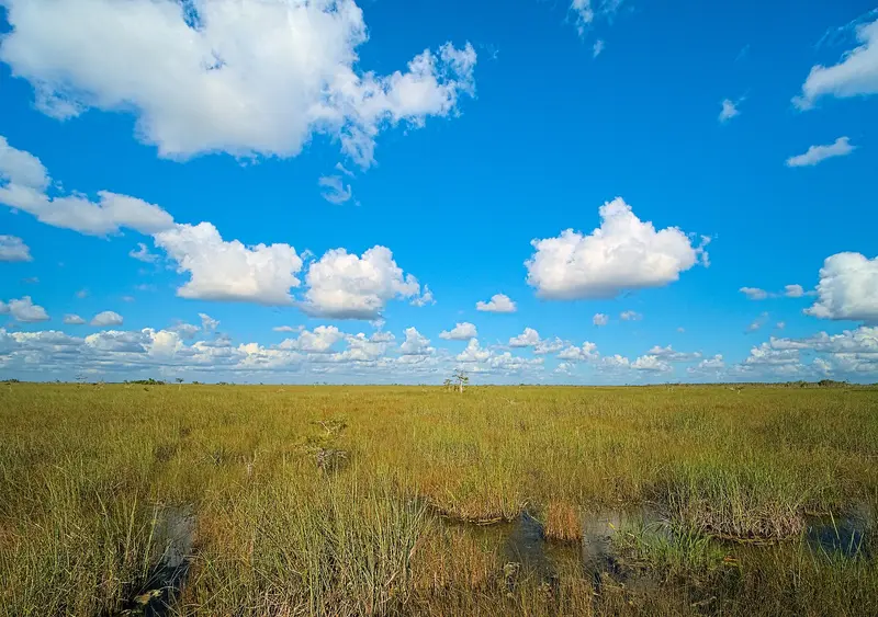
    Everglades National Park covers the southern tip of the Florida peninsula between Miami and the Gulf, the largest subtropical wilderness in the country. You come to see alligators, herons, anhingas and turtles from a few feet away on short boardwalks and bike paths, about an hour's drive from Miami.The Everglades aren't a swamp in the usual sense but a shallow, slow-moving sheet of water and sawgrass flowing south, dotted with islands of hardwood hammock, pine and mangrove. The park has three entrances with no road connecting them inside the park: Shark Valley on the Tamiami Trail (US 41) in the north, the main entrance at the Ernest F. Coe Visitor Center near Homestead in the east, where the 38-mile road to Flamingo begins, and the Gulf Coast entrance at Everglades City in the west.Before you goFees: $35 per private vehicle, good for seven days at all entrances. Visitors 16 and older who aren't US residents pay an additional $100 per person; US citizens and residents don't, and neither does anyone entering on an annual pass (the nonresident America the Beautiful pass is $250). The park doesn't take cash, only cards or a digital pass.When to go: the dry season, roughly November through April. Wildlife gathers at the remaining water, it's cooler, and there are the most ranger programs. It's busiest over the winter holidays and spring break.Mosquito season: the wet season, May through October, is hot and humid, and mosquitoes can be brutal, especially at Flamingo and around the mangroves. Bring long sleeves and repellent; even winter isn't completely bug-free. The wet season also overlaps with hurricane season.Supplies: there's no gas in the park. Fill up in Homestead or Florida City. The marina store at Flamingo has snacks and basic groceries.FlamingoAt the end of the 38-mile park road, Flamingo sits on Florida Bay with a visitor center, a marina with boat tours and kayak rentals, a campground and eco-tents. Manatees and American crocodiles often show up in the marina basin; the Everglades are one of the few places where alligators and crocodiles live side by side. With stops along the way, such as Pa-hay-okee Overlook, plan on a full day for the round trip.

    Sights in Everglades National Park

    Discover the most important sights and attractions

    Shark Valley
    Attraction

    1Shark Valley

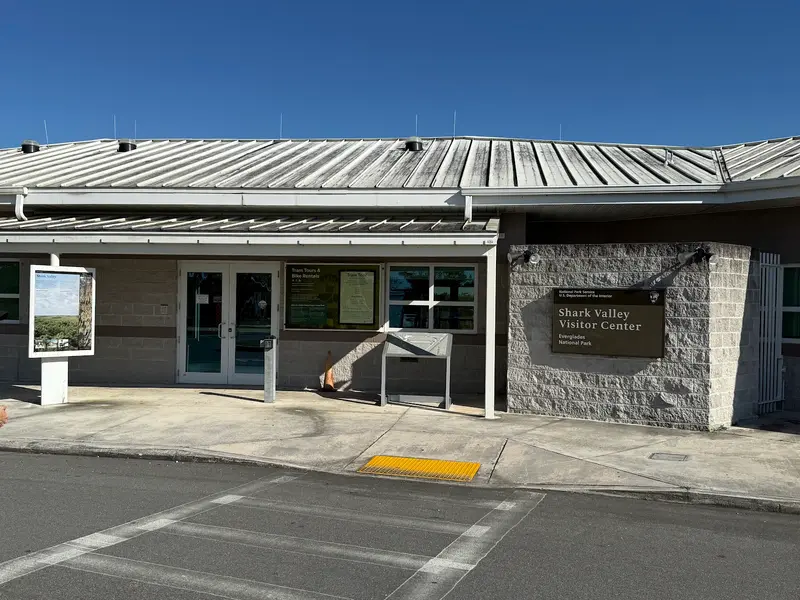
    About an hour west of Miami on the Tamiami Trail (US 41): A 15-mile paved loop trail leads through the Everglades grasslands to a 45-foot observation tower halfway along. You can cycle it (rentals at the entrance) or take the approximately two-hour narrated tram tour, usually spotting alligators and waterfowl along the way. The dry season from December to April is best. The parking lot is often full between 10 AM and 3 PM, operating on a "one car out, one car in" system, and return trips via ride-sharing apps are unreliable. The regular park entrance fee applies ($35 per car, seven days).
    Open in Google Maps
    Royal Palm: Anhinga Trail and Gumbo Limbo Trail

    2Royal Palm: Anhinga Trail and Gumbo Limbo Trail

    A few miles beyond the main entrance at Homestead is the Royal Palm Visitor Center, starting point for the park's two most famous short trails. The Anhinga Trail (approx. 0.8 miles round trip, wheelchair accessible) leads over a boardwalk through sawgrass and a freshwater slough. In winter, you'll see alligators, turtles, herons, and the namesake anhingas drying their feathers with outstretched wings, all up close. The Gumbo Limbo Trail next door is a shady loop through hardwood hammock. Restrooms, drinking water, and a bottle filling station are available at the Visitor Center. During peak season, the parking lot fills up by late morning, so arrive early or for sunset.
    Open in Google Maps
    Ernest F. Coe Visitor Center
    Attraction

    3Ernest F. Coe Visitor Center

    The Main Entrance Visitor Center, just under half an hour's drive west of Homestead and Florida City on State Road 9336. Here you pay the entrance fee (card only, no cash), get your park pass and current Ranger programs, and a small exhibit explains how water flows through the Everglades. From December to April, the free Homestead Trolley runs from downtown Homestead here and on to Royal Palm. From here begins the 38-mile park road to Flamingo. Worth a stop along the way is the Pa-hay-okee Overlook, a short boardwalk with a viewing platform over the open "River of Grass".
    Open in Google Maps

    Restaurants in Everglades National Park

    1

    Everglades Gator Grill

    Eatery at 36650 SW 192nd Avenue in Homestead, about six miles before the park entrance. Here, you can try alligator: as a grilled sandwich, in tacos, as a skewer, or stir-fry. Also available are Shrimp Po' Boys and other Southern dishes. Order at the counter and eat at the outdoor picnic tables. Convenient for lunch before or after your visit to the park.
    Show on Google Maps
    2

    Rosita's Mexican Restaurant

    Small Mexican eatery at 199 W Palm Drive in Florida City, near the motels at the intersection of US 1 and Krome Avenue. Fodor's notes all-day breakfast, lunch, and dinner: enchiladas, taco salad, braised beef. Open kitchen, takeaway counter, inexpensive. Good for an early breakfast before heading to the park.
    Show on Google Maps

    Nature and history

    The Everglades are a shallow river that flows slowly south from Lake Okeechobee to Florida Bay. Writer Marjory Stoneman Douglas called it the "River of Grass" in her 1947 book, the same year President Truman dedicated the national park. It's a UNESCO World Heritage Site, an International Biosphere Reserve and a Wetland of International Importance.Canals, levees and farming south of the lake drastically altered the flow of water over the 20th century; in 2000 Congress approved the Comprehensive Everglades Restoration Plan, one of the largest ecosystem restoration projects in the country. Another threat is invasive Burmese pythons, which have hit small mammal populations hard.The Miccosukee and Seminole people, whose ancestors retreated into the Everglades in the 19th century, still live along the Tamiami Trail. Airboat rides are only available outside the park, for example along the Tamiami Trail; airboats are prohibited inside the national park.

    Getting there and around

    The three entrances are far apart and not connected inside the park. Plan on one area per day.Shark Valley: on the Tamiami Trail (US 41), about an hour west of downtown Miami. An easy half-day trip from the city.Main entrance (Ernest F. Coe): take Florida's Turnpike or US 1 to Homestead/Florida City and follow the signs west, about 1 to 1.5 hours from Miami depending on traffic. From here the 38-mile park road runs past Royal Palm and Pa-hay-okee Overlook to Flamingo.Gulf Coast: in Everglades City on the west coast, a little over two hours from Miami, the starting point for boat tours into the Ten Thousand Islands.Without a carFrom December through April, the free Homestead Trolley runs from downtown Homestead to the Ernest F. Coe Visitor Center and Royal Palm. At Shark Valley, getting a rideshare back is hit or miss because drivers are rarely nearby.Supplies on the wayThere's no gas in the park, and apart from the marina store at Flamingo nowhere to buy food. Fill up in Homestead or Florida City. A popular stop before or after is the Robert Is Here fruit stand in Homestead, known for its tropical fruit shakes.Traveling by RVThe paved road to Flamingo handles big rigs fine, but the lots at Royal Palm and Shark Valley fill quickly in season, and Shark Valley has only a handful of spaces for long vehicles, so get there early. You can fill fresh water at Long Pine Key and Flamingo, and there's a dump station at Flamingo.

    Accommodations in Everglades National Park

    Find perfect stay in Everglades National Park

    Booking.com* (Affiliate link)
    Search Hotels
    Agoda* (Affiliate link)
    Search Hotels
    Airbnb
    Vacation Rentals

    * Affiliate link: if you book through it, we earn a small commission. The price stays the same for you.

    Campgrounds in Everglades National Park

    Find perfect campground in Everglades National Park

    Search via Google Maps
    Campgrounds nearby (15km)
    Camping.info
    Find Campgrounds
    Park4Night
    RV Parks & Camping

    Nearby

    Coral Gables

    Coral Gables

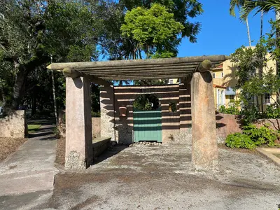
    Coral Gables is its own city southwest of downtown Miami and one of the first fully planned communities in the country. Developer George Merrick laid it out during the 1920s Florida land boom along City Beautiful lines, and it incorporated in April 1925. The original plan required Mediterranean Revival architecture, which is why you still see tile roofs, arcades, fountains and tree-lined streets everywhere.The heart of town is Miracle Mile, the main shopping street Merrick planned as the spine of his business district. The Coral Gables Museum, in the old police and fire station, tells the city's story.Two Merrick-era landmarks are worth the trip: the Venetian Pool, a swimming pool built in a former quarry, and the Biltmore Hotel, which opened in 1926. Farther south are the University of Miami campus and Fairchild Tropical Botanic Garden.When to go: Hit the Venetian Pool in the morning before it fills up, have lunch on Miracle Mile and spend the afternoon at Fairchild.
    Coconut Grove

    Coconut Grove

    Coconut Grove is one of the oldest settlements in the Miami area and much greener than the rest of the city. The name comes from a post office Horace P. Porter opened in 1873. Black Bahamian workers built many of the early buildings, and the West Grove is still home to many families of Bahamian descent, whose history is celebrated at the Goombay Festival. Miami annexed Coconut Grove in 1925.The neighborhood follows the shore of Biscayne Bay. The village center around Main Highway and Grand Avenue has cafés, restaurants and the CocoWalk shopping center with a movie theater. The Barnacle shows how the pioneers lived in the 19th century, and The Kampong, plant explorer David Fairchild's former home, is a tropical garden. Vizcaya, on the north edge, is covered on the Miami page.When to go: Visit the gardens in the morning before the heat sets in, wander the village center in the afternoon and head to the bay for sunset.
    Little Havana

    Little Havana

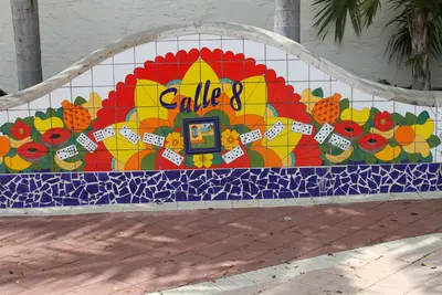
    Little Havana, just west of downtown, has been the heart of Cuban Miami since the 1960s. After the 1959 revolution, tens of thousands of exiles settled in what were then the Riverside and Shenandoah neighborhoods, and by 1970 more than 85 percent of residents were Cuban. Since the late 1990s, many newcomers have arrived from Nicaragua, Honduras and elsewhere in Central America.The main drag is Calle Ocho, SW 8th Street. Between 12th and 17th Avenues you'll find Domino Park, the Tower Theater, the Walk of Fame with stars for Celia Cruz and Gloria Estefan, and cafés selling cafecito from their ventanitas, the walk-up windows. On SW 13th Avenue, the Cuban Memorial Boulevard honors the veterans of the 1961 Bay of Pigs invasion.You come here to eat, drink coffee and listen. At night, live bands play at Ball & Chain and Café La Trova, and on salsa nights the dance floor fills up.When to go: Late morning, when the domino games are on. On the last Friday of every month, Viernes Culturales brings free music, art and vendors to Calle Ocho.
    Downtown and Brickell

    Downtown and Brickell

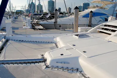
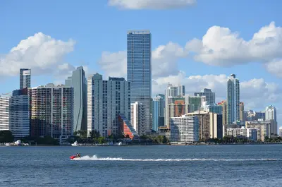
    Downtown Miami and Brickell, just south of it, make up the city's core: high-rises, banks, hotels and bayfront parks. Brickell is named for pioneers William and Mary Brickell. From the 1970s on, office towers replaced the mansions on Brickell Avenue; today many people live in condo towers here, and the streets stay busy at night.Much of what you'll want to see is on the water. Museum Park holds the Pérez Art Museum and the Frost Museum of Science with its huge aquarium. Farther south is Bayfront Park, designed by sculptor Isamu Noguchi. Across Biscayne Boulevard, the Freedom Tower recalls the 1960s, when Cuban refugees were processed here; it reopened in September 2025 after a restoration.The driverless Metromover is free and runs daily from 5am to midnight, so you can ride above the streets and hop off wherever you like.When to go: Museums in the morning, then a loop on the Metromover. Late afternoon is good for Bayfront Park, evenings for Brickell's rooftop bars. Weekday rush hour on Brickell Avenue and I-95 is heavy, so skip driving if you can.
    Key Biscayne

    Key Biscayne

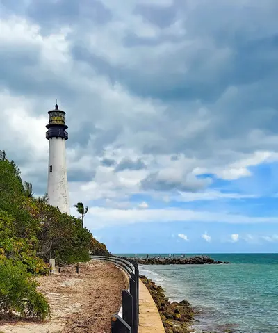
    Key Biscayne is an island southeast of downtown Miami, reached by the roughly 4-mile Rickenbacker Causeway (1947) by way of Virginia Key. Crandon Park takes up the north end, the Village of Key Biscayne (incorporated 1991) the middle, and Bill Baggs Cape Florida State Park the south.The Matheson family, who ran a coconut plantation here, gave the Crandon Park land to the county in 1940 in exchange for a causeway. Today the park has about 2 miles of Atlantic beach, where a sandbar keeps the water shallow and calm, which makes it a good bet for small kids. Swimming is allowed only when lifeguards are on duty. At the north end, the Marjory Stoneman Douglas Biscayne Nature Center explores the seagrass beds just offshore.At the southern tip stands the Cape Florida Lighthouse: the 1825 tower was set on fire in an 1836 Seminole attack and rebuilt in 1847. Next to it is little No Name Harbor. Richard Nixon bought the first of his homes here in 1969, and the compound became known as the Florida White House.When to go: Come on a weekday or early on weekend mornings; otherwise traffic backs up on the causeway and the shaded picnic tables are taken. Stay for sunset at No Name Harbor.

    Sources & method

    • Photos: Wikimedia Commons, Google Maps. Each photo carries its credit.
    • Place data such as addresses and ratings comes from Google Maps.
    • The content is based on web research from public, traceable sources. How the content is made · The role of AI