Fernweh: Home
    ExploreTravel GuidesPlan a tripMy tripLast visited
    de|en
    All Places & RegionsAll highlightsAbout FernwehFAQPrivacy PolicyImprint
    ExploreTravel GuidesPlan a tripMy tripLast visited
    • Overview
    • Places in the region
    • Eat & drink
    • Food culture
    • Best travel time
    • Culture
    • Getting around
    • Round trips
    • Nearby
    Shark Bay

    Australia

    Shark Bay

    Region

    Shark Bay on the West Coast has been a UNESCO World Heritage site since 1991: a vast, shallow bay with seagrass meadows, dugongs, the dolphins of Monkey Mia, stromatolites, and a shell beach. A good eight hours' drive north of Perth.

    by Felix Gillen

    1. Home
    2. Destinations
    3. Australia
    4. Shark Bay
    Shark Bay on the West Coast has been a UNESCO World Heritage site since 1991: a vast, shallow bay with seagrass meadows, dugongs, the dolphins of Monkey Mia, stromatolites, and a shell beach. A good eight hours' drive north of Perth.
    The bay is divided by two peninsulas. On the Peron Peninsula are the only town Denham, the dolphin sanctuary Monkey Mia, and to the north the François Péron National Park. On the way from the highway, you'll pass Hamelin Pool with its stromatolites and Shell Beach. To the west are Dirk Hartog Island and Steep Point, both accessible only by 4WD or boat. The bay's seagrass meadows are among the largest in the world and sustain a large dugong population. Plan at least two full days; distances are vast.

    Sights in Shark Bay

    Discover the most important sights and attractions

    Shell Beach

    Shell Beach

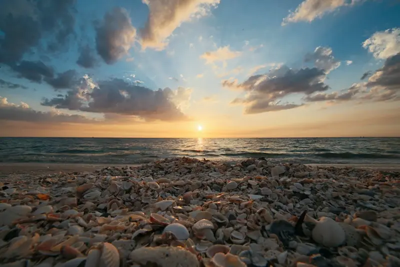
    At Shell Beach, the shore stretches for kilometers, made of tiny white cockle shells instead of sand. The shells are meters thick; in the past, building blocks were cut from the solidified layer. The water in the bay here is very salty, so you float almost effortlessly when bathing.
    Open in Google Maps
    Hamelin Pool Stromatolites

    Hamelin Pool Stromatolites

    In the shallow, extremely salty water of Hamelin Pool, stromatolites grow, calcareous structures formed by microorganisms. Their relatives are among Earth's oldest life forms. They grow only fractions of a millimeter per year; stepping on them is forbidden. Observe them from the shore or the viewing platform.
    Open in Google Maps
    Eagle Bluff

    Eagle Bluff

    From the timber jetty on the Eagle Bluff cliff south of Denham, gaze out over clear, shallow water. With a bit of luck, you might spot sharks, rays, turtles, or dugongs, best seen on calm seas with the sun high.
    Open in Google Maps
    Steep Point

    Steep Point

    Steep Point is the westernmost point of the Australian mainland. Its cliffs drop sheer into the Indian Ocean, popular with anglers. Access is via soft sand tracks and is only manageable with 4WD and experience. Overnight stays by permit only.
    Open in Google Maps
    François Péron National Park

    François Péron National Park

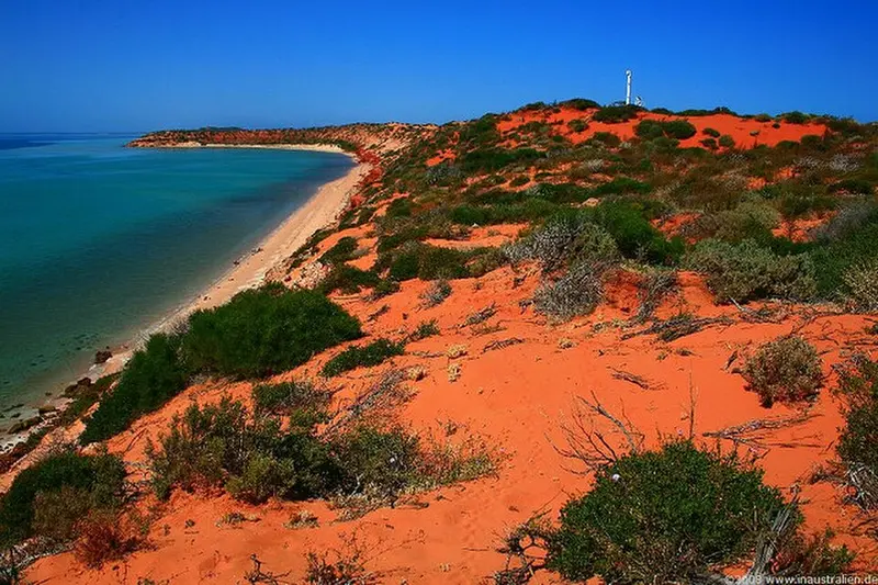
    The François Péron National Park, at the tip of the Peron Peninsula, glows in red, white, and turquoise: red sand dunes meet white beaches. Only accessible by 4WD. At Cape Peron and Skipjack Point, you often spot sharks, rays, and dugongs; at the old Peron Homestead, there is a warm water pool.
    Open in Google Maps
    Monkey Mia

    Monkey Mia

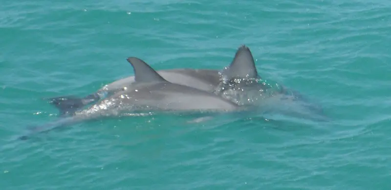
    In Monkey Mia, wild bottlenose dolphins have come to the shallow beach waters for decades. In the morning, under ranger supervision, a few visitors may feed some female dolphins. Come early, the reserve charges admission.
    Open in Google Maps

    Restaurants & Cafés

    1

    The Old Pearler Restaurant

    Restaurant in a building of shell limestone blocks from Shell Beach, located on Denham's coastal road. The menu primarily features fish and seafood caught fresh from the bay. Evening reservations recommended.
    Show on Google Maps

    Food and Drink

    The selection is small: a few restaurants, a pub, and takeaways in Denham, plus the resort in Monkey Mia. Buy larger supplies already in Geraldton or Carnarvon.

    Fish from the Bay

    Pink Snapper and Whiting from Shark Bay are often on the menu in Denham, freshly grilled or as Fish and Chips.

    Best Time to Visit

    When is the best time for your trip?

    April
    May
    June
    July
    August
    September
    October
    17–23°C·5–50 mm(little rain)
    From April to October, it's pleasantly warm and dry. In summer it gets hot, and the wind's often strong.
    Shark Bay is dry and sunny. Little rain falls, mostly in winter. In summer, a strong southerly wind blows almost daily.

    Seasons

    Jan
    Feb
    Mar
    Apr
    May
    Jun
    Jul
    Aug
    Sep
    Oct
    Nov
    Dec
    Winter and Spring
    Transfer
    Blazing Summer
    Best Time to Visit
    ▶Show detailed monthly data
    MonthTemp (°C)Rain (mm)Sun (h)
    January26.5811.0
    February27.01510.5
    March25.51510.0
    April23.0159.0
    May20.0408.0
    June17.5507.5
    July16.5408.0
    August17.0209.0
    September19.0810.0
    October21.0511.0
    November23.0311.5
    December25.0312.0

    History

    The bay is called Gathaagudu, "two waters", in the Malgana language. The Malgana have lived here for millennia and today offer cultural tours in Monkey Mia.In 1616, the Dutchman Dirk Hartog landed on the island later named after him and left behind a pewter plate, the oldest known European artifact from Australia. The Englishman William Dampier named the bay Shark Bay in 1699. Later, pearl fishing and sheep farming shaped the area; in Denham, the Old Pearler Restaurant, made of shell limestone, recalls this time.

    Traveling in Shark Bay

    From Perth, you drive approximately 830 kilometers via the North West Coastal Highway to Denham. From the Overlander Roadhouse, it's another 130 kilometers on the spur road. Small planes fly from Perth to Monkey Mia.The main road to Denham and Monkey Mia is asphalted. For François Péron National Park and Steep Point, you'll need a 4WD vehicle and must lower your tire pressure. Refuel whenever possible.

    Round trips through this region

    West Coast Australia Road Trip

    West Coast Australia Road Trip

    From Perth, head up the coast to the gorges of Kalbarri National Park, to Shark Bay with the dolphins of Monkey Mia, and to the Ningaloo Reef near Coral Bay and Exmouth. Finally, the route leads inland to Karijini National Park. The distances are long and petrol stations are rare.

    20 Days
    6 stops

    Nearby

    Kalbarri NP

    Kalbarri National Park, about six hours north of Perth, combines two landscapes: red sandstone gorges along the Murchison River inland and high cliffs on the Indian Ocean. The town of Kalbarri at the river mouth is the starting point.

    Coral Bay

    Coral Bay is a tiny place on the southern Ningaloo Reef, around 1,100 km north of Perth. The reef starts directly at the beach, and from here, boats go to manta rays and whale sharks.

    Exmouth

    Exmouth, at the tip of the North West Cape, is the gateway to the Ningaloo Reef and the Cape Range National Park. Here, you can snorkel from the beach over corals and swim with whale sharks in autumn.

    Karijini NP

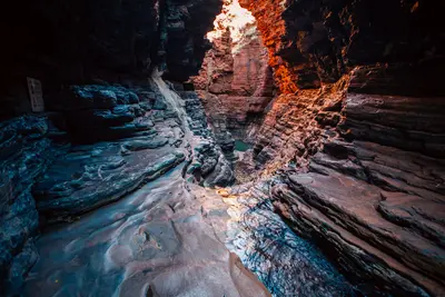
    Karijini National Park in the Pilbara is one of Australia's most impressive parks: narrow red gorges, cutting up to 100 metres deep into the Hamersley Plateau, with waterfalls and swimming holes at their base.
    Perth

    Perth

    Perth, one of the world's most remote major cities: sunny, relaxed, long Indian Ocean beaches, vast Kings Park, and port city Fremantle nearby.

    Sources & method

    • Photos: Wikimedia Commons, Unsplash, Pexels. Each photo carries its credit.
    • The content is based on web research from public, traceable sources. How the content is made · The role of AI