Fernweh: Home
    ExploreTravel GuidesPlan a tripMy tripLast visited
    de|en
    All Places & RegionsAll highlightsAbout FernwehFAQPrivacy PolicyImprint
    ExploreTravel GuidesPlan a tripMy tripLast visited
    Great Smoky Mountains National Park
    xiquinhosilva / Wikimedia Commons / CC BY 4.0

    United States

    Great Smoky Mountains National Park

    Point of Interest

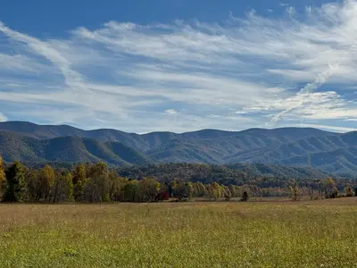
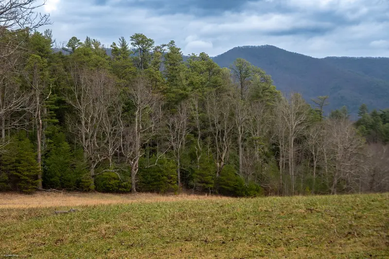
    Great Smoky Mountains National Park straddles the Tennessee–North Carolina line in the Appalachians, split roughly half and half between the two states, about an hour southeast of Knoxville.

    by Felix Gillen

    1. Home
    2. Destinations
    3. United States
    4. Tennessee
    5. Great Smoky Mountains National Park
    Great Smoky Mountains National Park straddles the Tennessee–North Carolina line in the Appalachians, split roughly half and half between the two states, about an hour southeast of Knoxville. Come for forested ridges topping 6,600 feet, black bears and the log cabins of Cades Cove, all with no entrance fee.With more than 12 million visits in 2024, it's the most visited national park in the country and has been a UNESCO World Heritage Site since 1983. About 1,900 black bears live here.Before you goNo entrance fee, but you need a parking tag: Since 2023, any vehicle parked for more than 15 minutes needs a tag: $5 a day, $15 a week or $40 a year (as of October 2026). Tags must be printed and displayed on your dashboard; digital copies don't count. Buy daily and weekly tags on recreation.gov and print them, or get one at a visitor center or kiosk, but most trailheads don't have machines. America the Beautiful passes aren't accepted.Where to stay: On the Tennessee side, most people base themselves in Gatlinburg, about 2 miles from Sugarlands Visitor Center, or in quieter Townsend near Cades Cove. Cherokee is the gateway on the North Carolina side.Hurricane Helene (September 2024): The eastern, North Carolina side took the worst of it, especially Cataloochee and Big Creek. As of October 23, 2026, the NPS still lists several trails there as closed, including Caldwell Fork, Gunter Fork and Swallow Fork, and Big Creek Trail is open only for its first two miles. The main sights on the Tennessee side weren't affected. Check the park's Current Road, Facility, Trail Closures page before any hike.Other closures: Popular Laurel Falls Trail near Gatlinburg is closed for rehabilitation and expected to reopen in 2027.

    Sights in Great Smoky Mountains National Park

    Discover the most important sights and attractions

    Cades Cove

    1Cades Cove

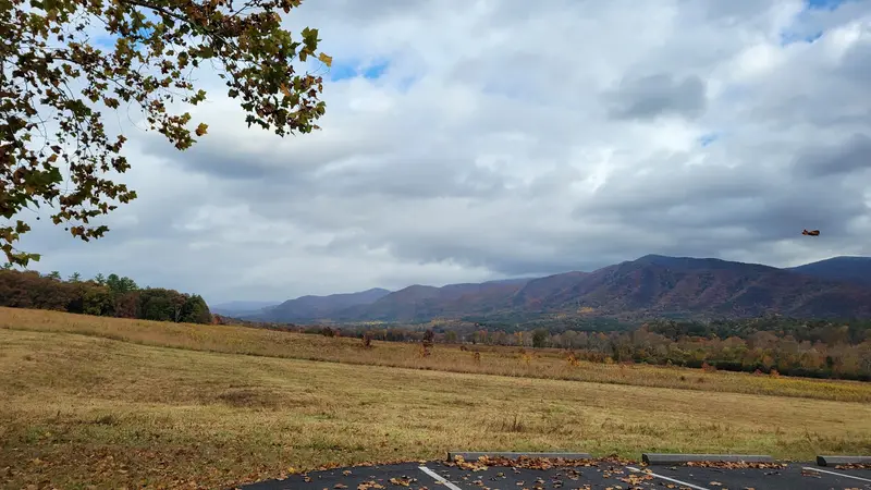
    This broad valley on the park's west side, quickest to reach from Townsend, is the busiest corner of the Smokies. An 11-mile one-way loop circles the meadows, passing the John Oliver Cabin (around 1822), three churches from the 19th and early 20th centuries and the 1868 Cable Mill. Black bears and deer are spotted here more than almost anywhere else in the park. The loop is open sunrise to sunset; the NPS says to allow two to four hours, and traffic is heavy in summer, in fall and on weekends. From early May through September, the loop is closed to cars on Wednesdays so cyclists and walkers have it to themselves. Abrams Falls is a hike of just under 5 miles round trip.
    Open in Google Maps
    Newfound Gap
    Attraction

    2Newfound Gap

    At 5,048 feet, this is the high point of Newfound Gap Road, right on the Tennessee–North Carolina line. President Franklin D. Roosevelt formally dedicated the park at the Rockefeller Memorial here on September 2, 1940. The Appalachian Trail crosses the road, and a few minutes on it gets you a view across the ridges. Big lot with restrooms, but it fills early on fall weekends. Kuwohi Road branches off just to the west.
    Open in Google Maps
    Kuwohi (formerly Clingmans Dome)

    3Kuwohi (formerly Clingmans Dome)

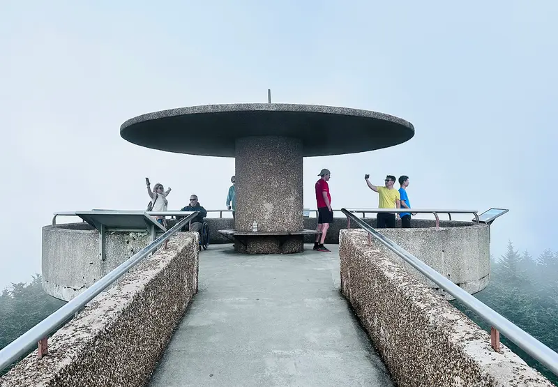
    At 6,643 feet, this is the highest point in Tennessee and in the park, and the highest point on the entire Appalachian Trail. It was officially renamed Kuwohi, its Cherokee name, in September 2024. From the Forney Ridge parking area at the end of 7-mile Kuwohi Road, which branches off near Newfound Gap, a steep paved path (about half a mile, 330 feet of climb) leads to a 45-foot concrete observation tower from 1959 with a 360-degree view. In 2026 the road is open April 1 to November 29. It's noticeably cooler up top than in the valleys and often foggy, so bring a jacket.
    Open in Google Maps
    Roaring Fork Motor Nature Trail
    Historic Landmark

    4Roaring Fork Motor Nature Trail

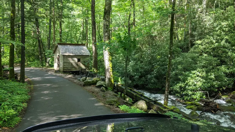
    This narrow 5.5-mile one-way road starts a few minutes from downtown Gatlinburg and winds through dense forest past streams, old cabins and a mill. Trailheads for Grotto Falls and Rainbow Falls are along the way. Open May 1 to November 29 in 2026; no RVs, buses or trailers. A good alternative when Cades Cove is jammed.
    Open in Google Maps
    Sugarlands Visitor Center
    Point of Interest

    5Sugarlands Visitor Center

    The park's busiest visitor center sits about 2 miles south of Gatlinburg on US 441, where Newfound Gap Road begins. Stop here for maps, current closure and weather updates, backcountry permits and parking tags. If you're coming from Gatlinburg, make it your first stop.
    Open in Google Maps
    Oconaluftee Visitor Center and Mountain Farm Museum
    Museum

    6Oconaluftee Visitor Center and Mountain Farm Museum

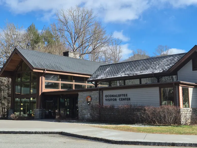
    The North Carolina-side visitor center sits at the south end of Newfound Gap Road, just before Cherokee. Next door, the Mountain Farm Museum has historic farm buildings from the region. Elk often graze in the field by the visitor center, usually about an hour before sunset, and during the fall rut you'll hear them too. Keep your distance; they're big and can be aggressive.
    Open in Google Maps

    Restaurants in Great Smoky Mountains National Park

    Food and Drink

    There are no restaurants inside the park. Pack a lunch and use one of the picnic areas, and eat out in Gatlinburg, Townsend or Cherokee.
    Picnicking in the Park

    Picnicking in the Park

    Cades Cove, Greenbrier and Deep Creek picnic areas are open year-round, and Chimneys on Newfound Gap Road is open April 3 to November 30 in 2026. Clean up thoroughly afterward, grill included: food scraps draw bears, and feeding wildlife is illegal. You still need a parking tag at a reserved picnic pavilion.

    Moonshine in Gatlinburg

    Moonshine is part of Appalachian history, and these days it's legal. Ole Smoky opened in downtown Gatlinburg in 2010 as the first federally licensed distillery in East Tennessee, and tastings run about $5. Don't drive into the mountains afterward.

    Nature and History

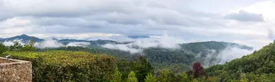
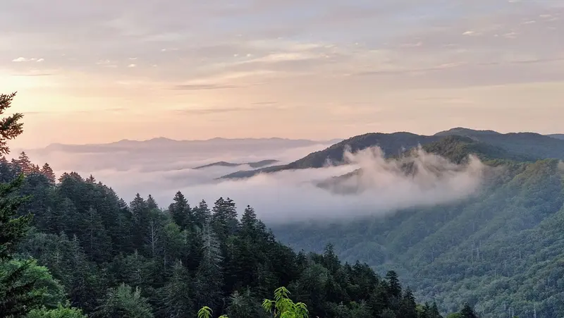
    The park was established in 1934 and covers about 522,000 acres. Unlike the big Western parks, it was carved out of settled land: families in valleys like Cades Cove and Cataloochee had to move out, and their churches, mills and cabins are still standing. The Cherokee lived in these mountains long before the settlers, and the Qualla Boundary borders the park at Cherokee, North Carolina.The name comes from the bluish haze that hangs over the valleys in the morning. Besides the bears, elk have lived in Cataloochee and around Oconaluftee since they were reintroduced in 2001.Synchronous firefliesIn late May and early June, the fireflies at Elkmont (Photinus carolinus) flash in unison. Evening access is by lottery only on recreation.gov, usually in late April: it's $1 to apply and $29 if you win, for one vehicle with up to seven people. In 2026 there were 120 spots a night. The NPS announces the dates each spring.WildlifeKeep your distance from bears and elk. The NPS suggests the thumb test: if your outstretched thumb doesn't cover the animal, you're too close. Feeding wildlife is illegal.

    Getting There and Around

    You need a car; there's no public transit in the park. The closest major airport is Knoxville (TYS), about 40 miles from Gatlinburg, and Nashville is a little over four hours away.Newfound Gap Road (US 441): The only road across the park, about 33 miles from Gatlinburg to Cherokee, roughly an hour without stops. Open year-round, though it closes at times for snow and ice in winter.Seasonal roads in 2026: Kuwohi Road April 1 to November 29, Roaring Fork Motor Nature Trail May 1 to November 29, Rich Mountain Road April 10 to November 9. RVs, buses and trailers aren't allowed on these roads.Crowds: October (fall color) and summer bring backups in Gatlinburg and Cades Cove, and holiday weekends like Labor Day are especially busy. Start before 9 a.m. to find parking at Newfound Gap and Kuwohi.Time zone: The park is on Eastern Time, an hour ahead of Nashville.

    Accommodations in Great Smoky Mountains National Park

    Find perfect stay in Great Smoky Mountains National Park

    Booking.com* (Affiliate link)
    Search Hotels
    Agoda* (Affiliate link)
    Search Hotels
    Airbnb
    Vacation Rentals

    * Affiliate link: if you book through it, we earn a small commission. The price stays the same for you.

    Campgrounds in Great Smoky Mountains National Park

    Find perfect campground in Great Smoky Mountains National Park

    Search via Google Maps
    Campgrounds nearby (15km)
    Camping.info
    Find Campgrounds
    Park4Night
    RV Parks & Camping

    Nearby

    Tennessee

    Tennessee

    Tennessee is the long, narrow state stretching from the Appalachians to the Mississippi River, about 440 miles end to end. People come for the music, from country in Nashville to blues and soul in Memphis, and for Great Smoky Mountains, the most visited national park in the country.The state splits into three Grand Divisions, the same three represented by the stars on the state flag: East Tennessee, with Knoxville, Chattanooga and the Smokies; Middle Tennessee, with Nashville and rolling whiskey country; and flat West Tennessee, with Memphis on the Mississippi. I-40 ties all three together.
    Nashville

    Nashville

    Nashville is Tennessee's capital and the center of the country music world, about three hours east of Memphis by car. Come for a night of live music in a dozen bars with no cover, then spend the next one at the Grand Ole Opry or the Ryman Auditorium, where so much of the genre's history happened.NeighborhoodsLower Broadway (Downtown): The honky-tonks line Broadway from 1st to 5th Avenue, with bands playing from around 10 a.m. until 3 a.m. and no cover charge. The Ryman and the Country Music Hall of Fame are steps away. Friday and Saturday nights are the most crowded.The Gulch: On the southwest edge of downtown. Twenty years ago it was mostly parking lots; now it's apartment towers, restaurants and boutiques. For bluegrass, head to the Station Inn.East Nashville: Across the Cumberland River, less than a mile from downtown and walkable over the pedestrian bridge. Around Five Points you'll find small restaurants, record stores and bars that lean Americana and indie rather than honky-tonk.Germantown and Music Row: Germantown, just north of downtown, has some of the city's best-known restaurants, including Rolf and Daughters and City House. Music Row is home to record labels and historic RCA Studio B.
    South Carolina

    South Carolina

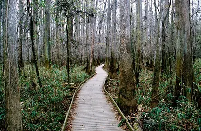
    South Carolina sits on the Atlantic between North Carolina and Georgia, and for most travelers it's all about the Lowcountry: flat salt marsh, sea islands with oak-lined lanes, and towns where Southern history is on every corner. People come for Charleston, for the beaches and for one of the most unusual national parks in the country.Near Columbia, the inland capital, Congaree National Park protects the largest remaining tract of old-growth bottomland hardwood forest in the U.S. The coast offers very different trips: the Grand Strand around Myrtle Beach up north, with its boardwalk and high-rise hotels; Hilton Head Island down south, with bike paths and golf; and in between, Beaufort, where a national park tells the story of Reconstruction.The state's history is tied to rice and slavery. Many plantations and museums now address that directly; in the Lowcountry, pick tours that put the lives of enslaved people at the center.
    Georgia

    Georgia

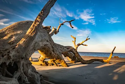
    Georgia runs from the southern tip of the Appalachians down to a quiet Atlantic coast of salt marsh and barrier islands. People come for Savannah, for Atlanta's civil rights history, and for wild places like the Okefenokee Swamp and undeveloped Cumberland Island.In Atlanta, the Martin Luther King Jr. National Historical Park preserves the neighborhood where King was born and preached. Down on the coast are the Golden Isles: Jekyll Island was the winter retreat of an exclusive millionaires' club from 1888 to 1942 and has belonged to the state since 1947, while Cumberland Island is home to 100 to 200 feral horses. In the southeast corner lies the Okefenokee, a vast wetland that feeds the Suwannee and St. Marys rivers.Georgia was one of the original 13 colonies and later joined the Confederacy. Slavery, the Civil War and the civil rights movement have left visible marks on many of the places you'll visit.
    Savannah

    Savannah

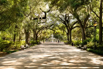
    Savannah sits on the Savannah River just upstream from the Atlantic, right on the South Carolina line, and is Georgia's oldest city. People come for its 22 shady squares draped in Spanish moss, its 19th-century townhouses and a historic district you can easily cover on foot.The street grid and its squares go back to founder James Oglethorpe. The best walk is south down Bull Street, square by square, to Forsyth Park. To the north, River Street runs along the water past old cotton warehouses. For Bonaventure Cemetery, the oak avenue at Wormsloe and the beaches on Tybee Island, you'll need a car or a tour.Like Charleston, Savannah was built on wealth from enslaved labor. The Owens-Thomas House and Wormsloe show how enslaved people lived in town and on the plantation.

    Sources & method

    • Photos: Wikimedia Commons, Google Maps. Each photo carries its credit.
    • Place data such as addresses and ratings comes from Google Maps.
    • The content is based on web research from public, traceable sources. How the content is made · The role of AI