Central Macedonia stretches from Olympus' peak to Chalkidiki's three peninsulas, hosting Thessaloniki, Greece's second-largest city. In between are Vergina's Royal Tombs, Pella's mosaics, and a coast where Greeks themselves summer.
Central Macedonia stretches from Olympus' peak to Chalkidiki's three peninsulas, hosting Thessaloniki, Greece's second-largest city. In between are Vergina's Royal Tombs, Pella's mosaics, and a coast where Greeks themselves summer. Antiquity, Byzantium, and bathing coves lie here as close as almost nowhere else in the country.
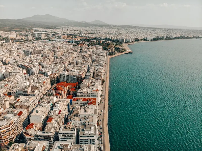
Central Macedonia covers approximately 19,000 square kilometers, making it one of Greece's largest regions. To the south, Mount Olympus rises to 2,918 meters; to the east, the three 'fingers' of Halkidiki stretch into the Aegean Sea. Between them lies the vast alluvial plain of the Axios and Aliakmonas rivers. Thessaloniki is the central hub: From Macedonia Airport and the city's bus stations, you can reach Vergina, Pella, and Dion in one to two hours, and the beach resorts of Halkidiki in one to three. The character changes quickly, from a university city with a bustling promenade to villages where peaches, tobacco, and wine dictate the rhythm of the year. In July and August, the thermometer often climbs above 33 degrees Celsius, and coastal towns are fully booked. April to June and September to October are more pleasant: the archaeological sites can be explored without the midday heat, and the sea stays warm until October.
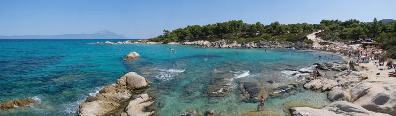
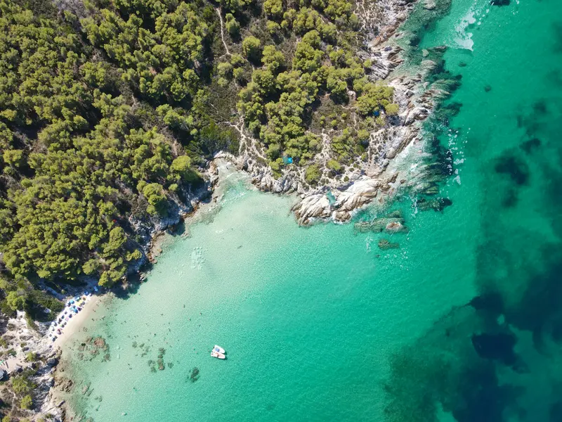
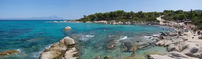
The Chalkidiki peninsula, southeast of Thessaloniki, extends into three narrow fingers: Kassandra, Sithonia, and Athos. Pine forests here stretch to sandy beaches and clear bays.
Discover the most important sights and attractions
Archaeological Park Dion
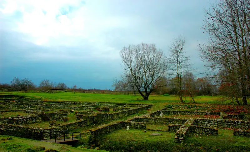
At the northeastern foot of Mount Olympus lay Dion, the most important sanctuary of the Macedonians, dedicated to Zeus and visited by Philip II and Alexander before their campaigns. The park is green and rich in water, with foundations remaining submerged in places even today. You walk along the paved main street, past baths, workshops, and the Sanctuary of Isis; two theaters lie outside. Original mosaics and statues are displayed in the local museum, and a visit to both parts takes about three hours.
Chalkidiki pushes three peninsulas into the Aegean, and each has its own tone. Kassandra in the west is the most developed and quickest to reach from Thessaloniki; Sithonia in the middle is more mountainous, with pine forest down to bays and beaches like Kavourotrypes. The third finger belongs to the Monastic Republic of Athos, accessible only with a permit, and women are forbidden to enter. For the coastal roads, you'll need a car; buses primarily serve the larger towns.
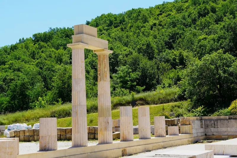
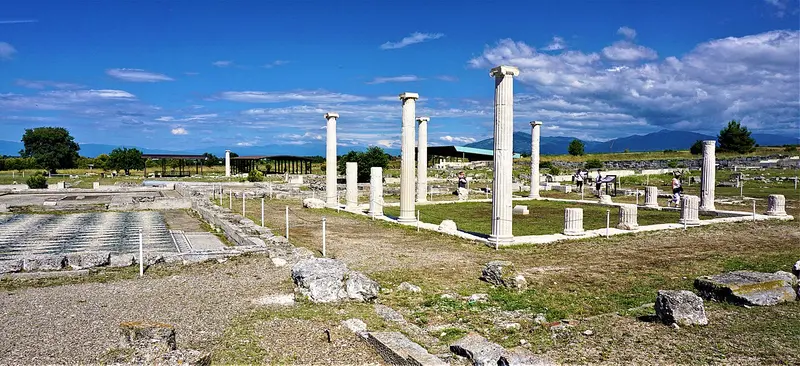
Pella served as the capital of the Macedonian kingdom from the late 5th century BC and was the birthplace of Alexander the Great. Entire city blocks from its orthogonal street grid have been excavated, along with the columned courtyards of wealthy townhouses. Particularly renowned are its pebble mosaics with deer and lion hunt motifs; the originals are displayed in the modern museum at the edge of the site. Pella is located approximately 40 kilometers west of Thessaloniki, and shade on the site is scarce.
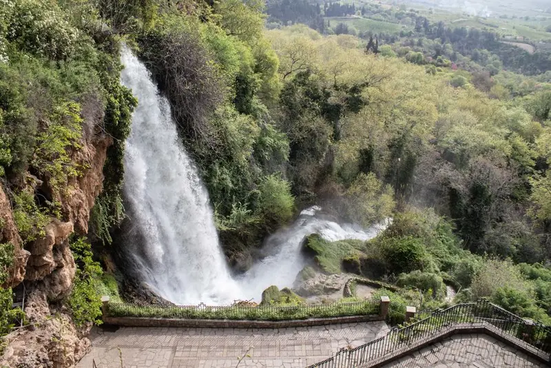
Edessa is perched on a rock edge above the Pella plain, and the Edesseos River plunges in several stages at the city's edge. The largest fall, Karanos, measures around 70 meters, with a path leading behind the wall to a grotto. The surrounding park is shady and just a few minutes from the center. Below, a small water museum explains the old mills. It's a great stop on the way between Thessaloniki and Kastoria, or an ideal day trip by train.
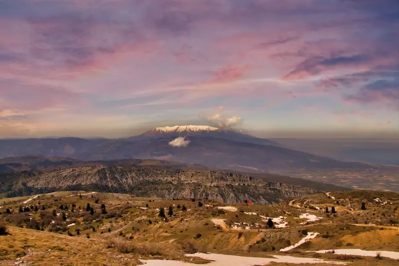
Mount Olympus, at 2,918 meters, is Greece's highest mountain and became the country's first national park in 1938. Litochoro is the starting point for most tours; from there, gravel roads lead to the trailheads of Prionia and Gortsia. Those aiming for Mytikas peak stay overnight in one of the mountain huts and should plan for two days, as the final stretch involves exposed climbing. Significantly easier is the hike through the Enipeas Gorge from Litochoro to Prionia, past waterfalls and the abandoned Monastery of Agios Dionysios.
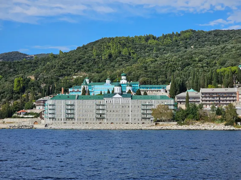
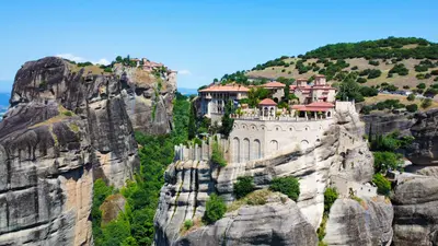
Chalkidiki's third 'finger' is an autonomous monastic state with twenty major monasteries and a history dating back to the 10th century. Men require the Diamonitirion, a residence permit that must be applied for in advance and is valid for four days, for their visit. Women are not permitted to enter the peninsula, but can view the monastery fortresses from excursion boats departing from Ouranoupoli, which sail along the coast a few hundred meters offshore. The journey lasts approximately three hours and showcases the south side with the 2,033-meter-high Athos Peak.
The region's cuisine blends Macedonian peasant fare with the legacy of refugees from Asia Minor who settled in Thessaloniki from 1922. It also features fish from Chalkidiki, cheese from the mountains, and wine from Naoussa.
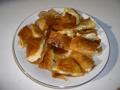
Bougatsa
Phyllo pastry with semolina cream, cheese or minced meat, freshly cut from the tray and wrapped in paper. In Thessaloniki, Bougatsa is breakfast; bakeries open for it before seven. The sweet version comes with powdered sugar and cinnamon.
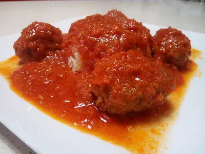
Soutzoukakia
Elongated minced meat rolls with cumin in tomato sauce, named after Smyrna and brought to Thessaloniki by refugees. They are served with rice or mashed potatoes. Almost every taverna in the city center has them on its menu.
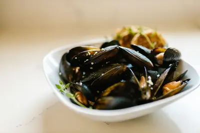
Mussels from the Thermaic Gulf
In the bays of Chalastra and Nea Michaniona lie Greece's largest mussel beds. The mussels are served steamed, baked with Feta, or as Mydopilafo with rice. A glass of Tsipouro pairs perfectly with this, instead of wine.
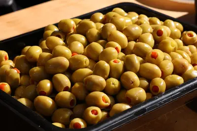
Olives from Chalkidiki
The green, very large Chalkidiki olives have a Protected Designation of Origin and grow on the hills behind the coast. They taste mild and firm, often filled with almond or bell pepper. At markets, you can get them loose from the barrel.
Xinomavro aus Naoussa
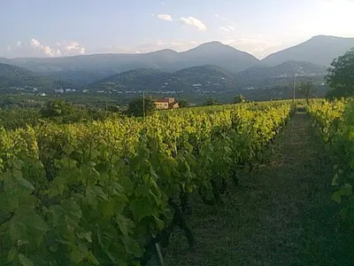
Around Naoussa, less than 30 kilometers from Vergina, the Xinomavro grape variety grows into austere, age-worthy red wines. Many wineries offer walk-in tastings. In the mountain villages, people also drink Tsipouro, the pomace brandy, with small plates.
Best Time to Visit
When is the best time for your trip?
May
June
September
20–25°C·25–35 mm(little rain)
Diese Monate bieten ideale Bedingungen mit angenehmen Temperaturen, viel Sonnenschein und warmem Meerwasser. Der Tourismus ist zwar präsent, aber die größten Menschenmassen der Hochsaison im Juli und August werden oft vermieden, was sowohl für Strandurlaub als auch für kulturelle Erkundungen perfekt ist.
Klimatische Besonderheiten in ZentralmakedonienZentralmakedonien, im Norden Griechenlands gelegen, weist ein Übergangsklima auf, das sowohl mediterrane als auch kontinentale Einflüsse zeigt. Dies führt zu deutlichen regionalen Unterschieden:Küstenregionen (z.B. Thessaloniki, Chalkidiki): Hier herrscht ein klassisches Mittelmeerklima mit heißen, trockenen Sommern und milden, feuchteren Wintern. Die Meerestemperaturen sind von Juni bis September sehr angenehm zum Baden.Binnenland und Bergregionen: Weiter im Landesinneren und in höheren Lagen (z.B. nahe dem Olymp-Gebirge oder in den Präfekturen Pella und Serres) sind die Sommer kühler und die Winter deutlich kälter mit häufigerem Schneefall. Die kontinentalen Einflüsse sind hier stärker ausgeprägt.Niederschlag: Die trockensten Monate sind typischerweise Juli und August. Die meisten Niederschläge fallen im Spätherbst und Winter.Winde: Gelegentlich kann der 'Vardaris' (ein lokaler Wind, der aus dem Flusstal des Vardar/Axios kommt) in der Region Thessaloniki für kühlere und stürmischere Bedingungen sorgen, besonders im Winter.Hitzewellen: Im Hochsommer (Juli, August) sind Hitzewellen mit Temperaturen über 35°C möglich.Generell ist die Region sehr sonnenreich, besonders in den Sommermonaten.
Seasons
Jan
Feb
Mar
Apr
May
Jun
Jul
Aug
Sep
Oct
Nov
Dec
Trockenzeit
Übergangssaison
Regenzeit (relative Niederschlagsspitze)
Nebensaison
Best Time to Visit
▶Show detailed monthly data
Month
Temp (°C)
Rain (mm)
Sun (h)
January
6.0
55
3.0
February
7.0
50
4.0
March
10.0
45
5.0
April
15.0
40
7.0
May
20.0
35
9.0
June
25.0
25
11.0
July
28.0
20
12.0
August
27.0
20
11.0
September
23.0
30
9.0
October
17.0
50
6.0
November
12.0
65
4.0
December
8.0
60
3.0
History of the Region
Kingdom of MacedonThe heartland of the ancient Kingdom of Macedon lay in the plain west of Thessaloniki. Aigai, modern-day Vergina, was the first capital and remained the burial site of the kings; around 400 BC Pella became the new capital. Here, Alexander the Great was born in 356 BC. At the foot of Mount Olympus, Dion was the most important sanctuary of the Macedonians.Rome and ByzantiumAfter the Roman conquest in 168 BC, the Via Egnatia ran through the region, and Thessaloniki became its largest city. In the Byzantine Empire, it was the most important city after Constantinople; its early Christian and Byzantine churches are on the UNESCO World Heritage List. On the Athos peninsula, the great monasteries were founded from the 10th century onwards.Ottomans and Modern EraFrom the 15th century, the region belonged to the Ottoman Empire for about 500 years, and joined Greece in 1912. After 1922, hundreds of thousands of refugees from Asia Minor and the Black Sea settled there; many places therefore bear the prefix 'Nea' in their name.
Traveling in Central Macedonia
By CarA rental car is essential for this region. A1 runs south from Thessaloniki past Katerini/Dion to Athens; Egnatia Odos (A2) links west to Veria/Ioannina and east to Kavala. Both are toll roads, accepting cash/card. On Chalkidiki, the network narrows: Sithonia's coastal roads are winding; allow half a day to tour a 'finger'. Parking in Thessaloniki is difficult; a car park at the city's edge is recommended.Bus, Train, and BoatKTEL intercity buses reliably serve Thessaloniki, Veria, Edessa, Katerini, and Litochoro; Chalkidiki lines leave from a dedicated terminal. Smaller villages often have only one or two daily services; check afternoon return times beforehand. Trains go to Athens, Edessa, and Florina; for Vergina, change in Veria for a bus or taxi. Boats to the Athos coast depart from Ouranoupoli.