ExploreTravel GuidesPlan a trip
    de|en
    All Places & RegionsAbout FernwehFAQPrivacy PolicyImprint
    ExploreTravel GuidesPlan a trip
    • Neighborhoods & highlights
    • Eat & drink
    • Nightlife
    • Accommodation
    • Plan trip
    • Nearby
    Scheunenviertel & Hackescher Markt
    Tuxyso / Wikimedia Commons / CC BY-SA 4.0

    Germany

    Scheunenviertel & Hackescher Markt

    City

    Das Viertel rund um den Hackeschen Markt heißt historisch Spandauer Vorstadt und liegt im Ortsteil Mitte zwischen Spree, Friedrichstraße und Torstraße; den Teil östlich der Rosenthaler Straße nennt man Scheunenviertel.

    1. Home
    2. Destinations
    3. Germany
    4. Berlin
    5. Scheunenviertel & Hackescher Markt
    Das Viertel rund um den Hackeschen Markt heißt historisch Spandauer Vorstadt und liegt im Ortsteil Mitte zwischen Spree, Friedrichstraße und Torstraße; den Teil östlich der Rosenthaler Straße nennt man Scheunenviertel. Ab 1685 wurden hier Straßen angelegt und Parzellen an Berliner Bürger und Hugenotten verkauft, 1712 bekam die Vorstadt mit der Sophienkirche ihre eigene Pfarrkirche. Heute steht das Gebiet als Ensemble unter Denkmalschutz und gilt als der größte und am besten erhaltene historische Stadtteil Berlins.Du bummelst durch die acht Höfe der Hackeschen Höfe, schaust an der Oranienburger Straße zur Kuppel der Neuen Synagoge hinauf und ziehst durch die Auguststraße, die für ihre Galerien bekannt ist. Am Bahnhof Hackescher Markt halten die S-Bahn-Linien S3, S5, S7 und S9 sowie die Trams M1, M4, M5 und M6.
    Spandauer Vorstadt, with its Scheunenviertel, is the historic old town quarter north of the Spree, just opposite Museum Island. Here, the Hackesche Höfe, the Neue Synagoge, and the Sophienkirche are just a few minutes' walk from each other. Auguststraße is known for its galleries, and Monbijoupark invites you to take a break by the Spree. You can easily reach everything on foot from S-Bahnhof Hackescher Markt.

    Sights in Scheunenviertel & Hackescher Markt

    Discover the most important sights and attractions

    New Synagogue Berlin (Centrum Judaicum)
    Museum

    1New Synagogue Berlin (Centrum Judaicum)

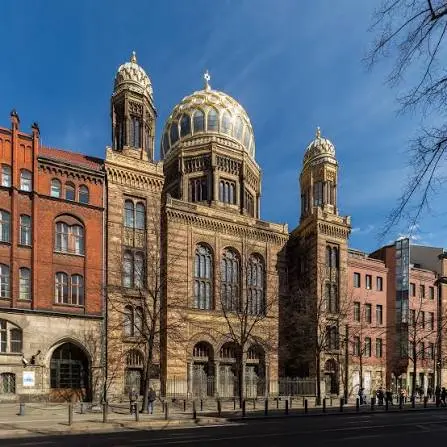
    The synagogue on Oranienburger Straße, inaugurated in 1866, was severely damaged by bombs in 1943; its street front with the 50.21-meter high dome was reconstructed and reopened in 1995 as the Centrum Judaicum. A permanent exhibition showcases Jewish life in Berlin.
    Open in Google Maps
    Monbijou Park
    Park

    2Monbijou Park

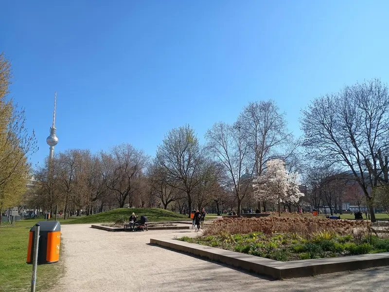
    The roughly four-hectare park on the Spree is located where Monbijou Palace stood until 1959. From the Monbijou Bridge, you get directly to the Bode-Museum on Museum Island; the park also features a children's outdoor pool from 1960.
    Open in Google Maps
    Sophia Church
    Church

    3Sophia Church

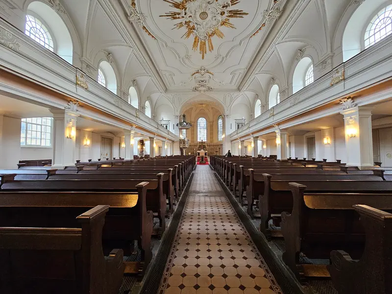
    Die 1712 bis 1713 nach Plänen von Philipp Gerlach erbaute Kirche zwischen Sophienstraße und Großer Hamburger Straße trägt mit ihrem 1732 bis 1734 ergänzten Westturm den einzigen erhaltenen barocken Kirchturm Berlins. Auf dem alten Kirchhof liegen unter anderem Carl Friedrich Zelter und Leopold von Ranke begraben.
    Open in Google Maps
    Hackesche Höfe
    Historic Landmark

    4Hackesche Höfe

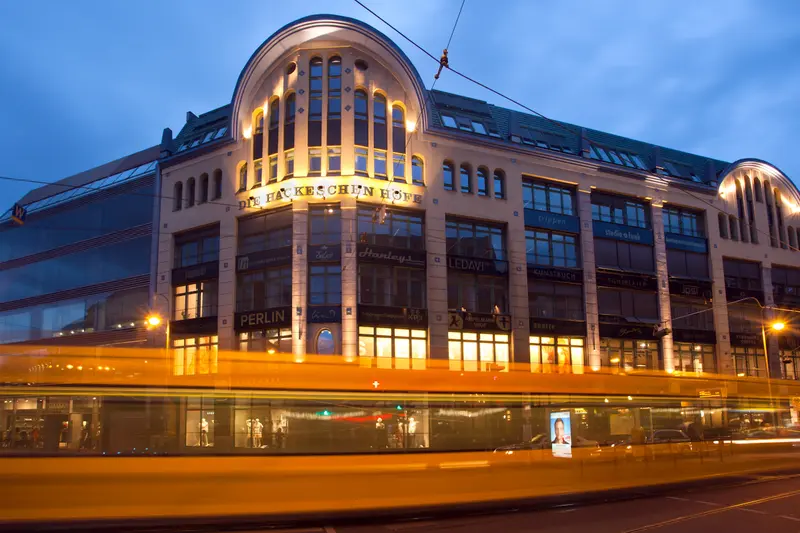
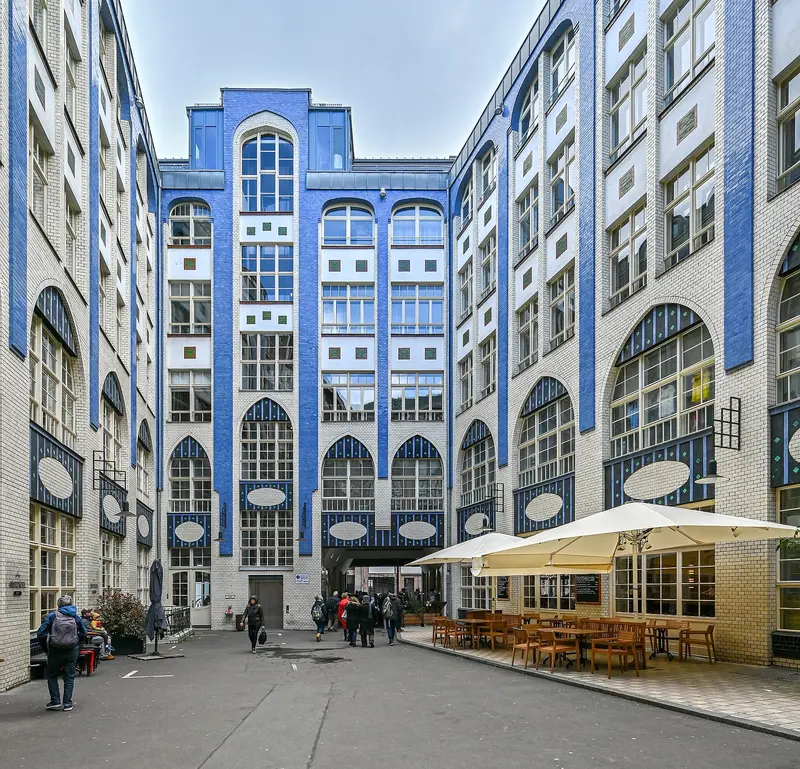
    The eight courtyards between Rosenthaler Straße and Sophienstraße were built from 1905 to 1907 based on plans by Kurt Berndt, with August Endell designing the first. Today, they blend apartments, shops, restaurants, a cinema, and the Chamäleon Theater.
    Open in Google Maps

    Restaurants in Scheunenviertel & Hackescher Markt

    1

    Night Kitchen

    Mediterranean restaurant at Heckmann Höfe.
    Show on Google Maps
    2

    CURRY61 Hackescher Markt

    Small industrial-style spot with local sausages, homemade curry sauce and hand-cut fries.
    Show on Google Maps
    3

    Kin Za

    Simple restaurant with homemade Georgian specialties like Khachapuri and Khinkali, plus a bar and karaoke.
    Show on Google Maps

    Nightlife

    1

    My lakeside house

    Retro bar and club: by day, coffee and cake; later, cocktails and DJs.
    Show on Google Maps
    2

    Buck & Breck

    Hidden cocktail bar with classic and creative drinks, where phones are not permitted.
    Show on Google Maps

    Accommodations in Scheunenviertel & Hackescher Markt

    Find perfect stay in Scheunenviertel & Hackescher Markt

    Booking.com* (Affiliate link)
    Search Hotels
    Agoda* (Affiliate link)
    Search Hotels
    Airbnb
    Vacation Rentals

    * Affiliate link: if you book through it, we earn a small commission. The price stays the same for you.

    Campgrounds in Scheunenviertel & Hackescher Markt

    Find perfect campground in Scheunenviertel & Hackescher Markt

    Search via Google Maps
    Campgrounds nearby (15km)
    Camping.info
    Find Campgrounds
    Park4Night
    RV Parks & Camping

    Plan your trip to Scheunenviertel & Hackescher Markt

    Save places, build a route and plan your city trip, all in one place.

    1. 1
      1234

      Round trip

      12 days · 4 stops

      Saved

      Pick a route

      Pick a ready-made one or save places and plan your own.

      Open bookmarks
    2. 2

      Trip to Scheunenviertel & Hackescher Markt

      Live
      • 1New Synagogue Berlin (Centrum Judaicum)3 days
      • 2Monbijou Park4 days
      • 3Sophia Church5 days
      Budget

      Plan your trip

      The planner sorts stops, days and budget. Plan together in real time.

      Start trip planning
    3. 3
      9:41 No signal
      Available offline

      Use it on the road

      Download the guide to your phone and use it on site, even offline.

    Nearby

    Berlin

    Berlin

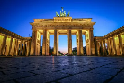
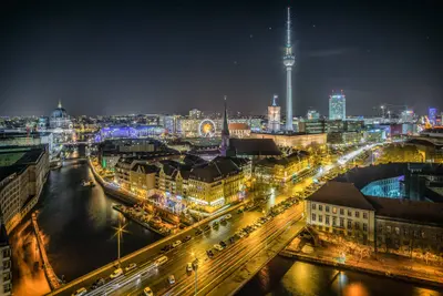
    Berlin is the federal capital and, with around 3.66 million inhabitants, Germany's largest city. The city is completely surrounded by Brandenburg; the Spree flows through it from east to west and empties into the Havel in Spandau. Twelve districts with 97 localities structure the almost 892-square-kilometer urban area.Here are places that make German history come alive: from the Brandenburg Gate, over the remains of the Berlin Wall, to the Reichstag Building, where the Bundestag has met since 1999. Museum Island has been a UNESCO World Heritage site since 1999, and in neighborhoods like Kreuzberg, Friedrichshain, and Prenzlauer Berg, you'll find bars, restaurants, and a vibrant nightlife.
    Berlin

    Berlin

    With approximately 3.66 million inhabitants, Berlin is Germany's largest city and has been the federal capital since reunification in 1990; the federal government and the Bundestag have been based here since 1999. The Spree flows through the city from east to west, its banks are home to the Government District, Museum Island, and the East Side Gallery.Few cities tell the story of the 20th century so powerfully: On Bernauer Straße, you see the former border strip, at the Brandenburg Gate, the symbol of unity. Additionally, there are three opera houses, the museums of the World Heritage Museum Island, and districts like Kreuzberg, Friedrichshain, and Prenzlauer Berg, known for their bars, restaurants, and nightlife.
    Prenzlauer Berg

    Prenzlauer Berg

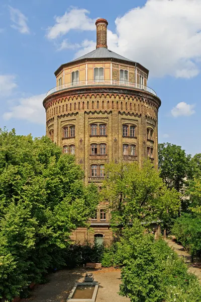
    Prenzlauer Berg is a district in the borough of Pankow and, with 168,947 inhabitants (end of 2023), Berlin's most populous district. Approximately two-thirds of the apartments were built between 1871 and 1914; typical are five-story apartment buildings with courtyards, and over 300 buildings are listed as historical monuments. In the 1980s, the GDR opposition gathered here, for instance around the Gethsemanekirche; after 1990, the district was considered Europe's largest contiguous redevelopment area.You can sit in the cafés and restaurants around Kollwitzplatz, Helmholtzplatz, and Kastanienallee, admire the water tower from 1877, and go to the flea market in Mauerpark on Sundays. The Kulturbrauerei, in the former Schultheiss brewery, combines cinema, stages, and clubs; nightlife focuses around the Eberswalder Straße U-Bahn station. The U2 stops at Senefelderplatz, Eberswalder Straße, and Schönhauser Allee, along with the M1 and M10 trams and five Ringbahn stations.
    Kreuzberg

    Kreuzberg

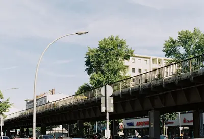
    Kreuzberg is a district in the Friedrichshain-Kreuzberg borough, named after the 66-meter-high Kreuzberg hill in Viktoriapark, where Schinkel's National Monument for the Liberation Wars has stood since 1821. During the time of the Berlin Wall, the eastern part, SO 36, was enclosed on three sides and became the hub of the alternative movement and squatting in the 1970s and 1980s. Today, around 160,000 people live here, many with Turkish roots, and its nightlife and cultural scene are well-known far beyond Berlin.During the day, you can visit the Jewish Museum or the German Museum of Technology, climb the Kreuzberg hill in Viktoriapark, or meet up at the Admiralbrücke over the Landwehrkanal, a popular meeting spot. In the evenings, the district's nightlife beckons. You can get here via U-Bahn lines U1 and U3, which largely follow the former Akzisemauer, with U6 and U8 running north-south, and also with U7; in total, there are 14 U-Bahn stations in the district.
    Friedrichshain

    Friedrichshain

    Friedrichshain owes its name to the Volkspark Friedrichshain in the north, laid out from 1846 as Berlin's first public park, and reaching south to the Spree. The 1950s saw the creation of Stalinallee, today's Karl-Marx-Allee, whose Socialist Classicist buildings are now listed monuments; the uprising of June 17, 1953 began on its construction sites. To the east, Gründerzeit tenements define the image; since 2001, the district has formed a joint borough with Kreuzberg.Stroll along Karl-Marx-Allee from Strausberger Platz to Frankfurter Tor, ascend the Großer Bunkerberg in the Volkspark, and browse the Saturday weekly market at Boxhagener Platz. In the evenings, bars and restaurants around Simon-Dach-Straße draw visitors from across the city. Warschauer Straße station serves S-Bahn lines S3, S5, S7, S75, S9, and is the terminus for U-Bahn lines U1 and U3; Ostkreuz is Berlin's busiest station.