Fernweh: Home
    ExploreTravel GuidesPlan a tripMy tripLast visited
    de|en
    All Places & RegionsAll highlightsAbout FernwehFAQPrivacy PolicyImprint
    ExploreTravel GuidesPlan a tripMy tripLast visited
    • Neighborhoods & highlights
    • Eat & drink
    • Food culture
    • Culture
    • Getting around
    • Accommodation
    • Plan trip
    • Nearby
    Kars & Ani

    Turkey

    Kars & Ani

    CityCultureUNESCO

    Kars, situated at an altitude of 1,768 m in Turkey's far northeast, serves as the starting point for the ruined city of Ani, a UNESCO World Heritage site since 2016.

    by Felix Gillen

    1. Home
    2. Destinations
    3. Turkey
    4. East Anatolia
    5. Kars & Ani
    Kars, situated at an altitude of 1,768 m in Turkey's far northeast, serves as the starting point for the ruined city of Ani, a UNESCO World Heritage site since 2016. The city, with a population of over 90,000, features a blend of Armenian churches, a 12th-century castle, and streets dating back to the Tsarist era. Its Russian-influenced grid layout can be found in the districts of Yusufpaşa, Ortakapı, and Cumhuriyet, while the old town Kaleiçi lies beneath the castle.

    Sights in Kars & Ani

    Discover the most important sights and attractions

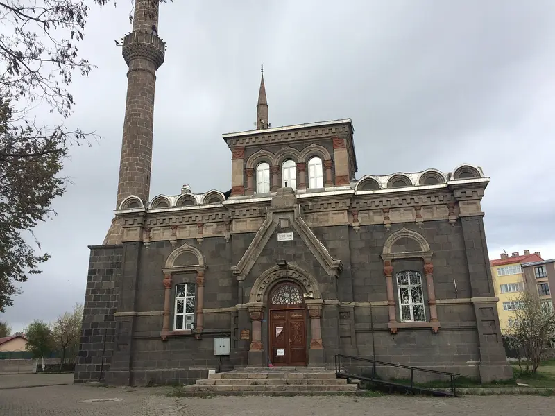
    Fethiye Mosque
    Mosque

    1Fethiye Mosque

    The Russians built it in the late 19th century as an Orthodox Alexander Nevsky Church in Baltic style. Since 1985, it has been a mosque. It symbolizes the era from 1878 to 1918, when Kars was part of the Tsarist Empire.
    Open in Google Maps
    Apostle Church (Kümbet Mosque)
    Mosque

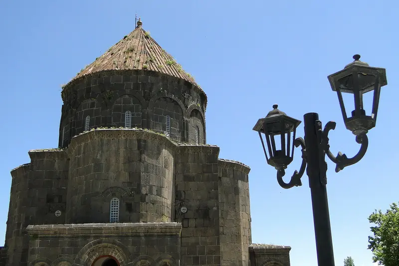
    2Apostle Church (Kümbet Mosque)

    The Armenian Church was built 932-937, when Kars was the Bagratid capital. It is also known as the Church of the Twelve Apostles. Later, it became a mosque, an Orthodox church under Russian rule, and a mosque again in 1993.
    Open in Google Maps
    Taş Köprü
    Attraction

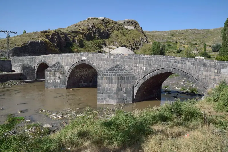
    3Taş Köprü

    The stone bridge over the Kars Çayı in the Kaleiçi old town was built in 1579 under Sultan Murad III. After a flood it was rebuilt on the old piers in 1719; some sources give 1725. It combines well with a walk to the nearby Church of the Holy Apostles.
    Open in Google Maps
    Kars Museum
    Museum

    4Kars Museum

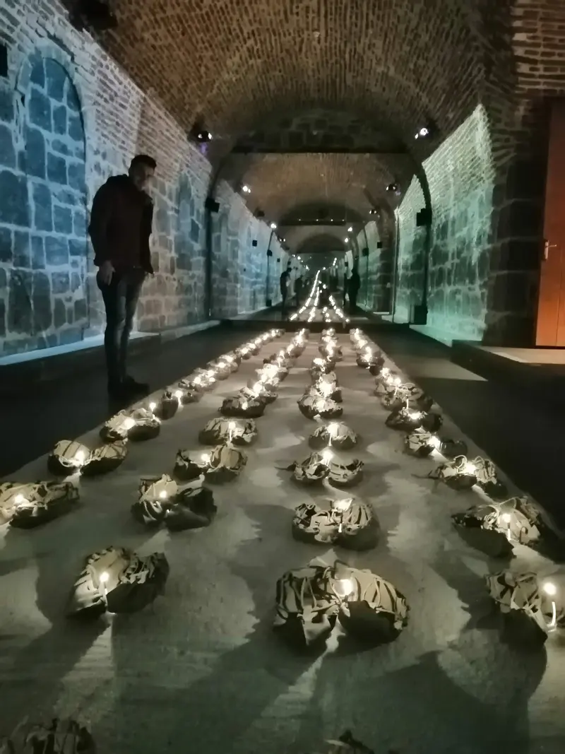
    Founded in 1959, the museum displays the province's archaeology and ethnography. Exhibits include a dinosaur fossil around 65 million years old. A good prelude before your trip to Ani.
    Open in Google Maps
    Ani Ruined City
    Museum

    5Ani Ruined City

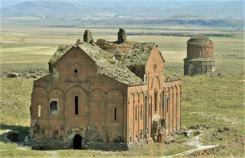
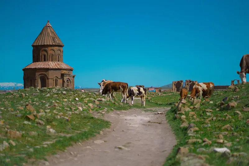
    The ruins of the medieval Armenian capital lie approximately 45 km east of Kars on a plateau above the Achurjan River, directly at the Armenian border. From 961, Ani was the capital of the Bagratids and was known as the City of 1001 Churches. Preserved structures include the Cathedral (1001), the Church of Tigran Honents (1215), and the Manuchihr Mosque. Ani has been a UNESCO World Heritage site since 2016.
    Open in Google Maps
    Kars Fort

    6Kars Fort

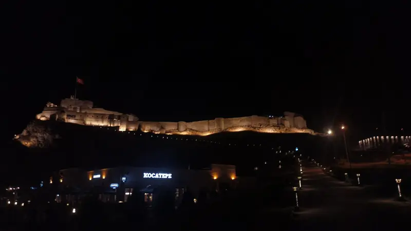
    The Kars Citadel, also known as İç Kale, is constructed of basalt ashlar. Early fortifications date from the period of the Armenian Bagratids; in 1153, the castle was rebuilt under the Saltukids. Following its destruction by Timur in 1386, Lala Mustafa Pasha had it rebuilt in 1579 on behalf of Sultan Murad III. The inner citadel is approximately 250 by 90 meters.
    Open in Google Maps

    Restaurants in Kars & Ani

    1

    Kars Kaz Evi

    Opened in 2010, this restaurant specializes in goose, Kars' classic winter specialty. It's served roasted with bulgur pilaf, pickled vegetables, and ayran. Goose should be pre-ordered.
    Show on Google Maps
    2

    Hanımeli Kars Kitchen

    The eatery in Ortakapı district serves Eastern Anatolian home cooking. On the menu are goose, Piti, Hangel, stuffed vine leaves, and noodle soup, with Umaç Helvası for dessert.
    Show on Google Maps
    3

    Pushkin Cafe Restaurant

    The cafe-restaurant in the Russian-influenced Yusufpaşa district mainly serves lamb and goose. The Turkish breakfast is also praised; a reservation is recommended for goose.
    Show on Google Maps

    Food and Drink

    Kars is known for its cheese, honey, and goose. Many dishes are hearty highland winter cuisine.

    Kaz (Goose)

    Goose is Kars' winter specialty and is often served roasted with Bulgur-Pilav. In restaurants, you should pre-order it.

    Kars Kaşarı

    The cheese, with protected geographical indication (PGI), is made from the milk of animals grazing the high pastures. There's also Kars-Gravyer, Gruyère-style.

    Kars Honey

    The province's honey also bears a geographical indication. It comes from floral high plateaus with many endemic plants.

    Hangel

    The dumplings are among Kars' typical dishes and are on the menu at many eateries.

    Culture & History

    Ani, Capital of the BagratidsIn 961, King Ashot III relocated the Armenian capital from Kars to Ani. It was called the 'city of a thousand and one churches'; excavations show about 50. The Seljuks conquered Ani in 1064; after the Mongol invasion and 1319 earthquake, it fell into ruin by the 17th century.Castle and Church of the ApostlesThe castle, in its current state, was rebuilt under the Saltukid ruler Melik İzzeddin around 1153. Below it is the Church of the Apostles, built 932-937, now the Kümbet Mosque.Russian DecadesFrom 1878 to 1918, Kars belonged to the Tsarist Empire. Houses in the Baltic style and the grid-like street network date from this period. Orhan Pamuk made the city famous with his novel "Snow."

    Arrival & On the Go

    Getting ThereFlight: Kars Harakani Airport has daily direct flights to Ankara and Istanbul.Doğu Ekspresi: The tourist Eastern Express runs in winter from Ankara to Kars, with sightseeing stops in Erzincan and Erzurum. In the 2026/27 season, it operates from December 21st on Mondays, Wednesdays, and Fridays from Ankara. Tickets are sold by TCDD Taşımacılık.To AniThe ruins are located around 45 km east of the city. The easiest way is a rental car or a taxi you book for the whole day. Inquire locally if a Dolmuş runs.NoteAni is located directly on the closed border with Armenia. Before you travel, check the current travel advice from the UK Foreign, Commonwealth & Development Office (FCDO).In January, the average low temperature is around minus 15 degrees, so pack accordingly warm.

    Accommodations in Kars & Ani

    Find perfect stay in Kars & Ani

    Booking.com* (Affiliate link)
    Search Hotels
    Agoda* (Affiliate link)
    Search Hotels
    Airbnb
    Vacation Rentals

    * Affiliate link: if you book through it, we earn a small commission. The price stays the same for you.

    Campgrounds in Kars & Ani

    Find perfect campground in Kars & Ani

    Search via Google Maps
    Campgrounds nearby (15km)
    Camping.info
    Find Campgrounds
    Park4Night
    RV Parks & Camping

    Plan your trip to Kars & Ani

    Save places, build a route and plan your city trip, all in one place.

    1. 1
      Sunrise over alpine peaks and a sea of clouds
      1234

      Round trip

      12 days · 4 stops

      Saved

      Pick a route

      Pick a ready-made one or save places and plan your own.

      Open bookmarks
    2. 2

      Trip to Kars & Ani

      Live
      • 1Fethiye Mosque3 days
      • 2Apostle Church (Kümbet Mosque)4 days
      • 3Taş Köprü5 days
      Budget

      Plan your trip

      The planner sorts stops, days and budget. Plan together in real time.

      Start trip planning
    3. 3
      9:41 No signal
      Kars & Ani
      Available offline

      Use it on the road

      Download the guide to your phone and use it on site, even offline.

    Nearby

    East Anatolia

    East Anatolia

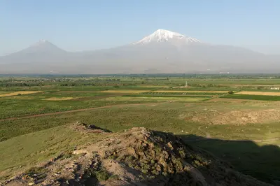
    East Anatolia is the highland region in the far east of Turkey, featuring the 5,137 m high Mount Ararat, Lake Van, and the ruins of Ani. The region lies at an average elevation of 2,200 m and is the highest-lying in the country. Those who seek vast landscapes, Armenian churches, and Urartian castles will find them here.
    Van

    Van

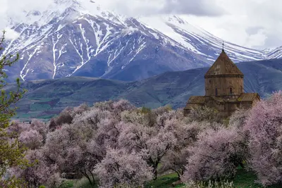
    Van lies at around 1,700 m on the eastern shore of Lake Van, Turkey's largest lake, in eastern Anatolia. The city is a starting point for the Akdamar Church, the Urartian Fortress, and the famous Van breakfast. The city has over 500,000 residents, and its center, with the Breakfast Street, is in the Şerefiye quarter. The fortress rises a few kilometers west along the lakeshore.
    Trabzon

    Trabzon

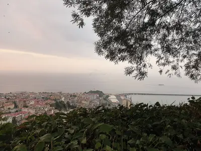
    Trabzon is the largest city on the eastern Black Sea coast and a starting point for the Sümela Monastery and the green valleys of the Pontic Mountains. The port city combines Byzantine heritage with vibrant Black Sea cuisine. The urban area has approximately 335,000 inhabitants; its center is Meydan Square in the Ortahisar district. The Hagia Sophia is located a few kilometers to the west, and the Boztepe viewpoint hill lies to the south, overlooking the city center.
    Mardin

    Mardin

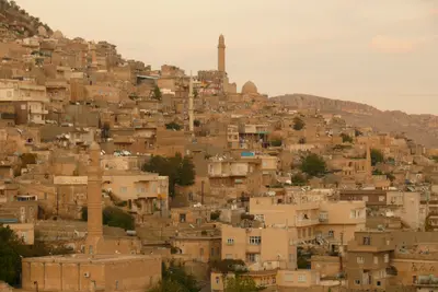
    Mardin, in southeastern Turkey, perches on a slope above the Mesopotamian Plain, famed for its south-facing stone old town. Madrasahs, mosques, and Syriac Orthodox monasteries speak of Artuqids, Akkoyunlu, and past Christian communities. With around 130,000 residents, its old town stretches below the citadel down the south slope, best explored on foot.
    Nemrut Dağı

    Nemrut Dağı

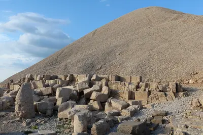
    Nemrut Dağı is a mountain in the Anti-Taurus range in Southeast Anatolia, on whose summit King Antiochus I of Commagene had his tomb-sanctuary with colossal statues of gods erected. Since 1987, it has been a UNESCO World Heritage site and is a popular destination, especially for sunrise and sunset. Starting points are Kahta and the village of Karadut at the foot of the mountain, about 85 km from Adıyaman.

    Sources & method

    • Photos: Wikimedia Commons, Pexels, Google Maps. Each photo carries its credit.
    • Place data such as addresses and ratings comes from Google Maps.
    • The content is based on web research from public, traceable sources. How the content is made · The role of AI