ExploreTravel GuidesMy Trips
    de|en
    All Places & RegionsAbout FernwehFAQPrivacy PolicyImprint
    ExploreTravel GuidesMy Trips
    Sumba
    Island

    Sumba

    Sumba, south of Flores, is one of Indonesia's most pristine islands. Traditional villages with high-peaked roofs, megalithic tombs, savannas, waterfalls, and empty beaches characterize the island.

    More
    1. Home
    2. Destinations
    3. Indonesia
    4. Sumba
    Sumba, south of Flores, is one of Indonesia's most pristine islands. Traditional villages with high-peaked roofs, megalithic tombs, savannas, waterfalls, and empty beaches characterize the island.
    Sumba is part of the province of Nusa Tenggara Timur and is about twice the size of Bali, but significantly less populated. The dry east around Waingapu is characterized by savannas and hills and known for Ikat weaving. The greener west around Tambolaka and Waikabubak features traditional villages with high-pitched roof houses, megalithic tombs, waterfalls, and beaches. The island is little developed for tourism, distances are long, and public transport is rare. The easiest way to travel is by rental car and driver.

    Sights in Sumba

    Discover the most important sights and attractions

    Ratenggaro
    Attraction

    Ratenggaro

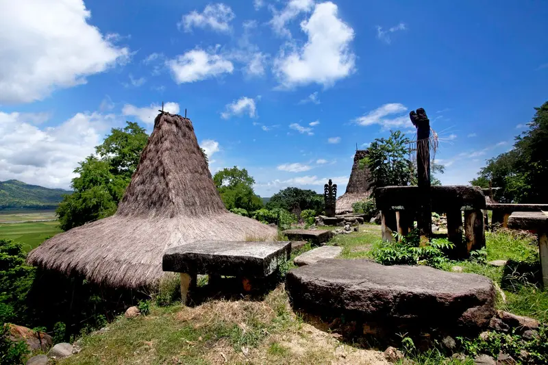
    Southwestern traditional village of towering pointed-roof houses and coastal megalithic tombs.
    Open in Google Maps
    Prai Ijing
    Attraction

    Prai Ijing

    Village with traditional houses and stone graves on a hill near Waikabubak in the west of the island.
    Open in Google Maps
    Bukit Wairinding
    Attraction

    Bukit Wairinding

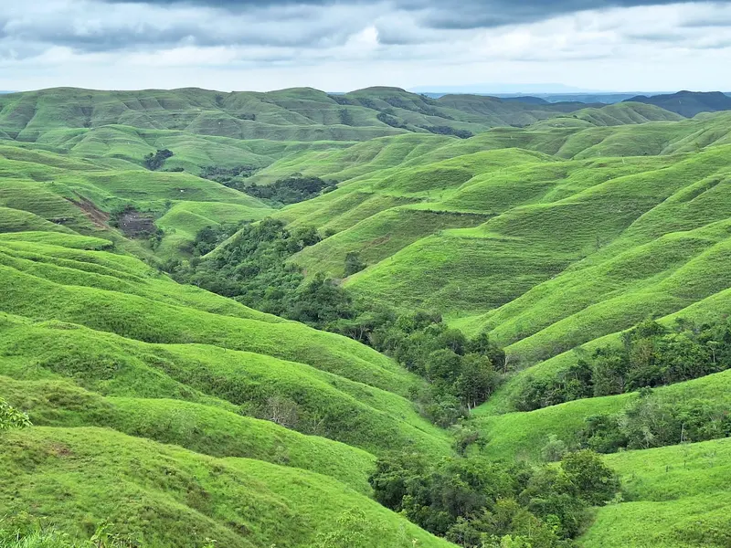
    Rolling grass hills to the east, golden-yellow in the dry season and green in the wet season. Popular at sunset.
    Open in Google Maps
    Pantai Walakiri
    Attraction

    Pantai Walakiri

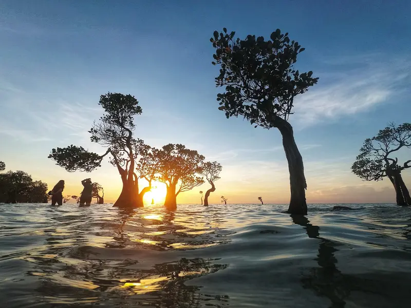
    Beach east of Waingapu with small mangrove trees in shallow water, known for sunsets.
    Open in Google Maps
    Danau Weekuri
    Attraction

    Danau Weekuri

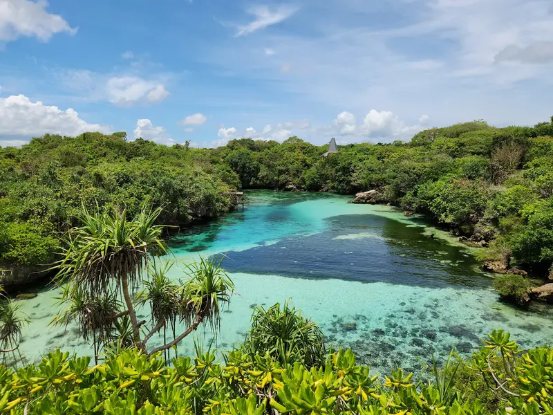
    Clear saltwater lagoon, separated by rocks from the sea, on the northwest coast. Good for swimming.
    Open in Google Maps
    Lapopu Waterfall
    Attraction

    Lapopu Waterfall

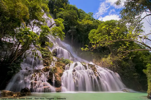
    Tiered waterfall in West Sumba, accessible via a path through the forest.
    Open in Google Maps

    Sights in Sumba

    Discover the most important sights and attractions
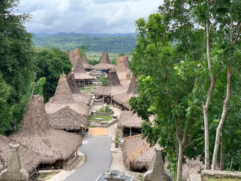
    Ratenggaro
    Attraction

    1Ratenggaro

    Southwestern traditional village of towering pointed-roof houses and coastal megalithic tombs.
    Open in Google Maps
    Prai Ijing
    Attraction

    2Prai Ijing

    Village with traditional houses and stone graves on a hill near Waikabubak in the west of the island.
    Open in Google Maps
    Bukit Wairinding
    Attraction

    3Bukit Wairinding

    Rolling grass hills to the east, golden-yellow in the dry season and green in the wet season. Popular at sunset.
    Open in Google Maps
    Pantai Walakiri
    Attraction

    4Pantai Walakiri

    Beach east of Waingapu with small mangrove trees in shallow water, known for sunsets.
    Open in Google Maps
    Danau Weekuri
    Attraction

    5Danau Weekuri

    Clear saltwater lagoon, separated by rocks from the sea, on the northwest coast. Good for swimming.
    Open in Google Maps
    Lapopu Waterfall
    Attraction

    6Lapopu Waterfall

    Tiered waterfall in West Sumba, accessible via a path through the forest.
    Open in Google Maps

    Restaurants in Sumba

    1

    RM Parahiangan 2

    Simple eatery with Indonesian dishes in Central Sumba, on the route between Waingapu and Waikabubak.
    Show on Google Maps
    2

    Warung Mbak Rina Lewa

    Simple Warung in the interior of Sumba island.
    Show on Google Maps

    Food and Beverages

    Warungs in Waingapu and Tambolaka

    Simple local eateries with rice, fish, chicken, and vegetables; outside the cities, options are limited.

    Sirih Pinang

    Betel nut with betel leaf and lime is offered as a welcome in villages. As a guest, you bring it yourself as a gift.

    Best Time to Visit

    When is the best time for your trip?

    April
    May
    June
    July
    August
    September
    October
    25–28°C·5–70 mm(little rain)
    April to October is dry season; roads are easily passable. Rainy season hills are green; the Pasola Festival is in the west in February and March.
    These values are for Waingapu in the dry east. The island's west receives significantly more rain, and the Waikabubak highlands are cooler.

    Seasons

    Jan
    Feb
    Mar
    Apr
    May
    Jun
    Jul
    Aug
    Sep
    Oct
    Nov
    Dec
    Dry season
    Rain time
    Transfer
    Best Time to Visit
    ▶Show detailed monthly data
    MonthTemp (°C)Rain (mm)Sun (h)
    January27.02006.0
    February27.01906.0
    March27.01507.0
    April27.0708.0
    May27.0308.0
    June26.0158.0
    July25.0109.0
    August25.059.0
    September26.0109.0
    October28.0259.0
    November28.0808.0
    December27.01706.0

    Customs

    Many Sumbanese, alongside Christianity, follow the ancient religion Marapu, which venerates ancestors. The deceased are interred in large stone tombs in the middle of the village. The Pasola festival in the west is well-known, where riders compete with blunt wooden spears between February and March. Its exact date depends on the appearance of certain sea worms along the coast. In the east, women weave elaborate Ikat textiles with animal and ancestral motifs.

    Getting Here and Around

    Getting ThereTambolaka (TMC) in the West: From Denpasar, approx. 1 hour 15 minutes with Nam Air, Batik Air or Sriwijaya.Waingapu (WGP) in the East: From Denpasar, approx. 1 hour 30 minutes with TransNusa or Sriwijaya. Both airports also have connections to Kupang.Ferry: Ferries connect Waingapu with Flores and Timor.Getting AroundTravel between East and West takes about four to five hours. Rental cars with drivers are the most practical option, and for village visits, it's best to take a local guide.

    Day trips

    Flores

    By plane via Bali or Kupang, or by ferry from Waingapu.

    Accommodations in Sumba

    Find perfect stay in Sumba

    Booking.com* (Affiliate link)
    Search Hotels
    Agoda* (Affiliate link)
    Search Hotels
    Airbnb
    Vacation Rentals

    * Affiliate link: if you book through it, we earn a small commission. The price stays the same for you.
    Nearby

    Flores and Komodo National Park

    Flores and Komodo National Park

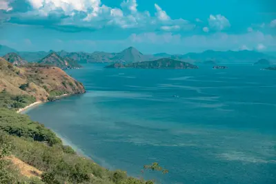
    Flores lies between Sumbawa and Timor and is around 350 km long. In the west, Komodo National Park, with its monitor lizards, starts at Labuan Bajo harbor; inland, volcanoes, rice terraces, and traditional villages extend to Kelimutu's crater lakes.
    Labuan Bajo

    Labuan Bajo

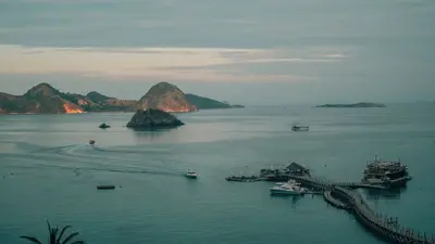
    Labuan Bajo, located at the western tip of Flores, is the gateway for tours into Komodo National Park. This former fishing village has evolved into a vibrant hub for boat trips, diving, and sailing with traditional Pinisi ships.
    Komodo-Nationalpark

    Komodo-Nationalpark

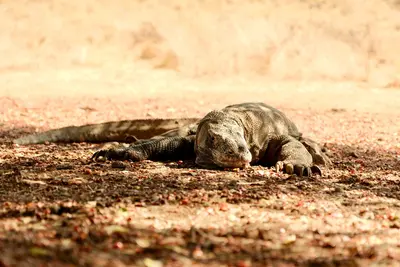
    Komodo National Park, located between Sumbawa and Flores, encompasses the islands of Komodo, Rinca, and Padar, as well as numerous smaller islands and reefs. Here lives the Komodo dragon, the largest living lizard today.
    Bajawa
    Josep M. Gracia / Wikimedia Commons / CC BY-SA 4.0

    Bajawa

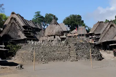
    Bajawa lies at around 1,100 m in the highlands of Flores, overlooked by the volcanic cone Inerie. The small town serves as a gateway to the traditional Ngada villages with their megaliths and ancestor shrines.
    Kelimutu-Seen

    Kelimutu-Seen

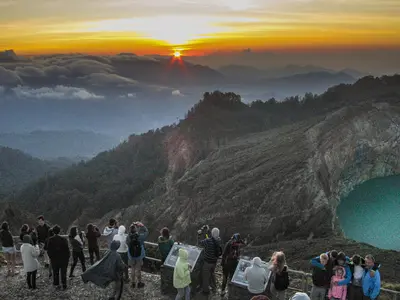
    On the summit of Kelimutu volcano in eastern Flores, three crater lakes lie close together, their colors changing over the years. The National Park is an essential stop on every Flores trip.