Fernweh: Home
ExploreGuideDestinationsMy tripsMy trip
de|en
All Places & RegionsRound tripsNight trains in EuropeAll highlightsAbout FernwehFAQPrivacy PolicyImprint
Download on the App StoreGet it on Google Play
ExploreGuideDestinationsMy tripsMy trip
    • Overview
    • Places in the region
    • Food culture
    • Best travel time
    • Culture
    • Getting around
    • Round trips
    • Nearby
    Flores and Komodo National Park

    Photo: Unsplash

    Indonesia

    Flores and Komodo National Park

    Region

    Flores lies between Sumbawa and Timor and is around 350 km long.

    by Felix Gillen

    1. Home
    2. Destinations
    3. Indonesia
    4. Flores and Komodo National Park
    Flores lies between Sumbawa and Timor and is around 350 km long. In the west, Komodo National Park, with its monitor lizards, starts at Labuan Bajo harbor; inland, volcanoes, rice terraces, and traditional villages extend to Kelimutu's crater lakes.
    Indonesia travel guideSee the round tripPlan a trip with Flores and Komodo National Park

    Contents

    • Overview
    • Places in the region
    • Food culture
    • Best travel time
    • Culture
    • Getting around
    • Round trips
    • Nearby
    Most travelers come to Labuan Bajo for a boat trip through Komodo National Park. Those with more time head east via the Trans-Flores Highway: past Ruteng with the spiderweb-shaped rice fields of Cancar, the mountain village of Wae Rebo, Bajawa with its Ngada villages, and Moni at the foot of Kelimutu, reaching Ende or Maumere. For the journey from Labuan Bajo to Maumere, plan at least a week. The road is winding and the drives are long; many hire a car and driver. Following the 7.7 magnitude earthquake on August 15, 2026, with an epicenter near Nagekeo, several destinations were temporarily closed, including Wae Rebo, Liang Bua, and Kelimutu. Before traveling, check which places have reopened.
    Bajawa

    Josep M. Gracia / Wikimedia Commons / CC BY-SA 4.0, mod.

    Place 1 of 4

    Bajawa

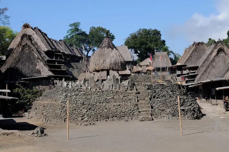
    Bajawa lies at around 1,100 m in the highlands of Flores, overlooked by the volcanic cone Inerie. The small town serves as a gateway to the traditional Ngada villages with their megaliths and ancestor shrines.

    Discover
    Kelimutu Lakes

    Bagus Pinandoyo Basuki / Wikimedia Commons / CC BY-SA 4.0, mod.

    Place 2 of 4

    Kelimutu Lakes

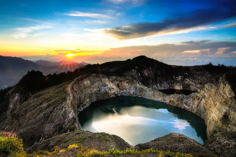
    On the summit of Kelimutu volcano in eastern Flores, three crater lakes lie close together, their colors changing over the years. The National Park is an essential stop on every Flores trip.

    Discover
    Komodo National Park

    Photo by Luca Buhl on Pexels

    Place 3 of 4

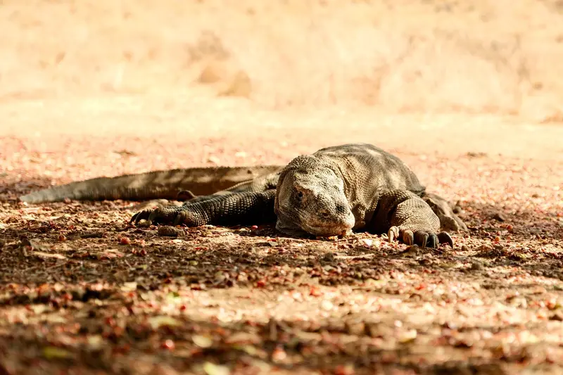
    Komodo National Park

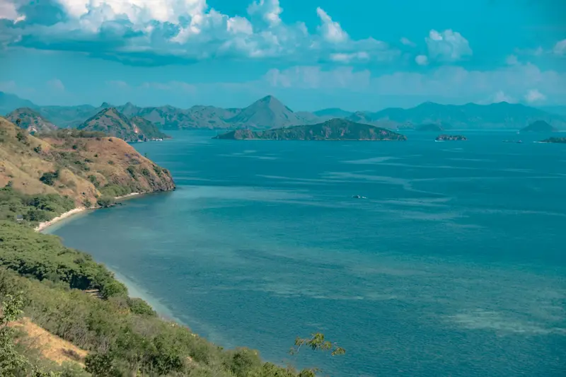
    Komodo National Park, located between Sumbawa and Flores, encompasses the islands of Komodo, Rinca, and Padar, as well as numerous smaller islands and reefs. Here lives the Komodo dragon, the largest living lizard today.

    Discover
    Labuan Bajo

    Photo by Luthfi Shatara on Pexels

    Place 4 of 4

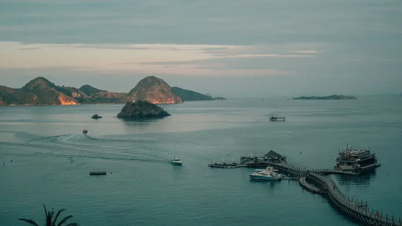
    Labuan Bajo

    Labuan Bajo, located at the western tip of Flores, is the gateway for tours into Komodo National Park. This former fishing village has evolved into a vibrant hub for boat trips, diving, and sailing with traditional Pinisi ships.

    Discover

    Sights in Flores and Komodo National Park

    Discover the most important sights and attractions

    Wae Rebo

    Jakub Hałun / Wikimedia Commons / CC BY 4.0, mod.

    Attraction

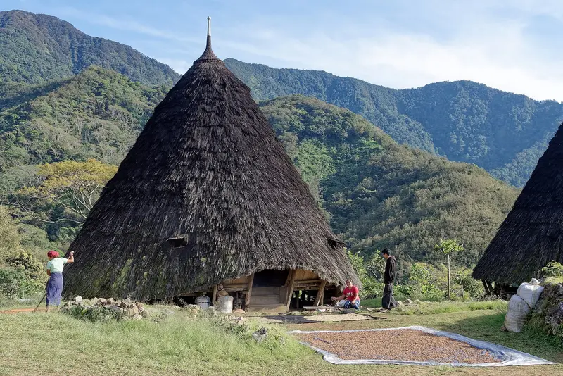
    Wae Rebo

    Mountain village of the Manggarai at approximately 1,100 m with seven cone-shaped houses (mbaru niang). Accessible only on foot in about three hours from Denge, overnight stay possible in the communal house.
    Open in Google Maps

    Food & Drink

    Local specialities

    In Flores und Komodo-Nationalpark you'll find local restaurants, cafés and markets with regional specialities. Taste your way through the dishes typical of the region.

    Best Time to Visit

    When is the best time for your trip?

    April
    May
    June
    July
    August
    September
    October
    27–29°C·5–85 mm(little rain)
    April to October is the dry season on Flores and in Komodo National Park, with the sea usually calm for boat tours. December to March sees the most rain.
    The monthly values apply to Maumere on the north coast of East Flores (climate normals 1991 to 2020, published by the Japanese Meteorological Agency JMA); no normal values are available for Labuan Bajo. From June to September, Maumere only receives 5 to 19 mm of rainfall per month. In the highlands around Ruteng, Bajawa, and Moni, it is significantly cooler and wetter.

    Seasons

    Jan
    Feb
    Mar
    Apr
    May
    Jun
    Jul
    Aug
    Sep
    Oct
    Nov
    Dec
    Dry season
    Shoulder Months
    Rainy days
    Best Time to Visit
    ▶Show detailed monthly data
    MonthTemp (°C)Rain (mm)
    January27.4162
    February27.2170
    March27.6145
    April27.985
    May27.971
    June27.019
    July26.75
    August26.76
    September27.67
    October28.745
    November29.155
    December28.0192

    Culture and History

    HistoryPortuguese seafarers gave the island its name, calling its eastern tip Cabo de Flores after its blooming trees. From the 16th century, Portuguese traders and Dominicans were active, primarily in Larantuka and Sikka. After the Dutch attacked the fort on the neighboring island of Solor in 1613, its population relocated to Larantuka. In the mid-19th century, Portugal ceded its claims to the Netherlands, whose administration, however, only reached the west of the island in 1907. Sukarno lived in exile in Ende from 1934 to 1938. According to his own statements, he contemplated the principles of Pancasila under a breadfruit tree, which now stands in a park.Religion and BeliefsUnlike the rest of Indonesia, the vast majority of Flores' population is Catholic; in 2023, it was around 84 percent. The highlight of the church year is the Semana Santa in Larantuka: On Maundy Thursday, the statue of Mary, Tuan Ma, is washed and dressed in mourning cloths. On Good Friday, a procession moves through the town and across the bay, accompanied by hundreds of fishing boats. Alongside this, ancient forms of belief persist. In Bena near Bajawa, almost all residents are Catholic yet simultaneously adhere to their ancestors' customs.Society and CustomsThe Ngada people around Bajawa live in a matrilineal society and honor their ancestors with shrines in village squares. In Bena, umbrella-like Ngadhu and small, straw-roofed Bhaga houses serve as ancestral symbols, while male or female figures adorn many rooftops. In Manggarai, Wae Rebo features cone-shaped houses (mbaru niang). During Caci, Manggarai men compete with whips and buffalo-hide shields, traditionally at the Penti harvest festival.Visitor ConductIn Wae Rebo, before your tour of the main house, Niang Gendang, you participate in the Waelu'u welcoming ceremony, which asks the ancestors for permission. In villages and at ceremonies, ask before taking photos. For churches and processions, enter with shoulders and knees covered.

    Getting There & Around

    Labuan Bajo has direct flights to Bali and Jakarta. Other airports are in Ende and Maumere. The Trans-Flores-Highway, running between Labuan Bajo and Larantuka, has buses, shared taxis, and cars with drivers. Ferries connect Labuan Bajo with Sape on Sumbawa. You can only reach Komodo National Park by boat.

    Round trips through this region

    Lombok, Gili Islands and Flores

    Lombok, Gili Islands and Flores

    The route starts on Gili Air and South Lombok's bays, then flies to Labuan Bajo, boating from there into Komodo National Park. Next, you drive the winding Trans-Flores Road to Bajawa's highlands and the Kelimutu Lakes near Moni; a driver is common there. Return flights to Bali are from Ende or Maumere, connecting in Labuan Bajo or Kupang, as direct flights are unavailable.

    16 Days
    6 stops
    Open jaw

    Giant Asparagus·Pexels

    Nearby

    Sumba

    Sumba

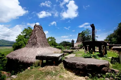
    Sumba lies south of Flores and is largely undeveloped for tourism. Traditional villages with high-pitched roofs, megalithic tombs, savannas, waterfalls, and empty beaches characterize the island.

    Jeffry Surianto·Pexels

    Makassar

    Makassar

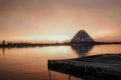
    Makassar is the largest city of Sulawesi and the gateway to Eastern Indonesia. The port city, with Fort Rotterdam, Pinisi shipyards, and a renowned fish cuisine, is the starting point for the journey to Tana Toraja.

    wsdidin·Pexels

    Rinjani National Park

    Rinjani National Park

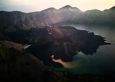
    Gunung Rinjani, at 3,726 meters, is Indonesia's second-highest volcano and dominates northern Lombok. Its caldera contains the crescent-shaped crater lake Segara Anak, along with the young, active cone Barujari. Multi-day treks to the crater rim and summit are among Southeast Asia's most famous mountain tours.

    Unsplash

    Lombok and the Gili Islands

    Lombok and the Gili Islands

    Lombok, east of Bali beyond the Lombok Strait, is much quieter than its neighbor. To the north, Mount Rinjani reaches 3,726m; bays and surf beaches line the south; and the three car-free Gili Islands lie off the northwest coast.

    Unsplash

    Kuta and South Lombok

    Kuta and South Lombok

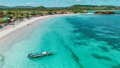
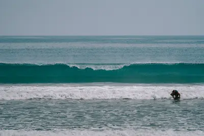
    Southern Lombok is a hilly coast with wide bays, turquoise water, and constant surf waves. Its center is the former fishing village of Kuta, which has developed into a meeting point for surfers and beachgoers. East of it, the Mandalika resort zone is emerging with a racetrack and resorts.

    el jusuf·Pexels

    Your next steps

    Flores and Komodo National Park is in Indonesia. Ways to carry on from here.

    • More in Indonesia

      Highlights, areas, routes and the best time to travel for all of Indonesia.

      Indonesia travel guide
    • Round trips with Flores and Komodo National Park

      One route passes through Flores and Komodo National Park, with stops, nights and a map.

      See the round trip
    • Plan a trip with Flores and Komodo National Park

      The Guide asks about season, length and who is coming, and suggests a trip with Flores and Komodo National Park.

      Plan the trip

    Sources & method

    • Photos: Wikimedia Commons, Unsplash. Each photo carries its credit.
    • Place data such as addresses and ratings comes from Google Maps.
    • The content is based on web research from public, traceable sources. How the content is made · The role of AI