Fernweh: Home
ExploreGuideDestinationsMy tripsMy trip
de|en
All Places & RegionsRound tripsNight trains in EuropeAll highlightsAbout FernwehFAQPrivacy PolicyImprint
Download on the App StoreGet it on Google Play
ExploreGuideDestinationsMy tripsMy trip
    • Places & highlights
    • Recommendations
    • Eat & drink
    • Food culture
    • Culture
    • Getting around
    • Accommodation
    • Round trips
    • Nearby
    Kelimutu Lakes

    Bagus Pinandoyo Basuki / Wikimedia Commons / CC BY-SA 4.0, mod.

    Indonesia

    Kelimutu Lakes

    National ParkCulture

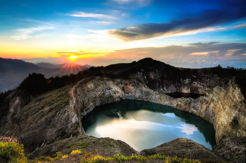
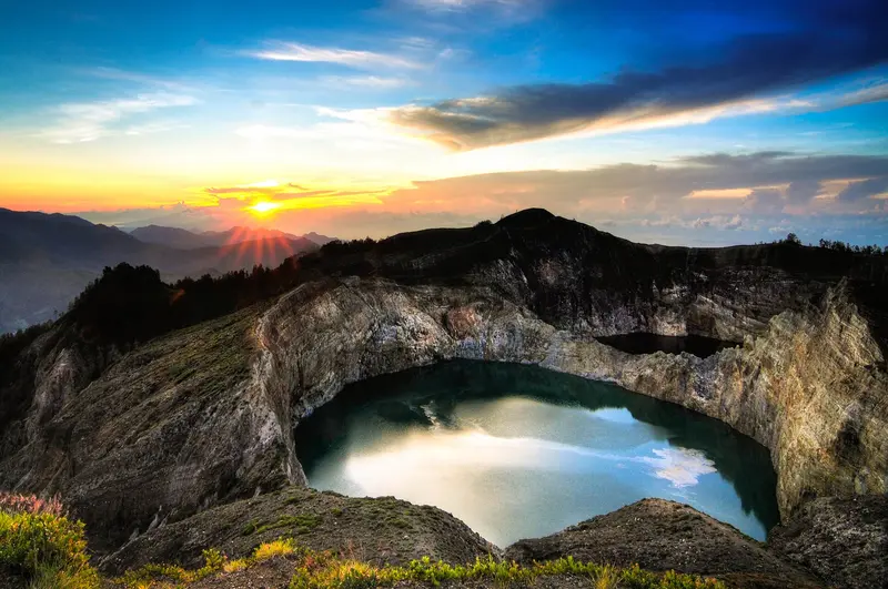
    On the summit of Kelimutu volcano in eastern Flores, three crater lakes lie close together, their colors changing over the years. The National Park is an essential stop on every Flores trip.

    by Felix Gillen

    1. Home
    2. Destinations
    3. Indonesia
    4. Flores and Komodo National Park
    5. Kelimutu Lakes
    On the summit of Kelimutu volcano in eastern Flores, three crater lakes lie close together, their colors changing over the years. The National Park is an essential stop on every Flores trip.
    Indonesia travel guideSee the round tripPlan a trip with Kelimutu Lakes

    Contents

    • Places & highlights
    • Recommendations
    • Eat & drink
    • Food culture
    • Culture
    • Getting around
    • Accommodation
    • Round trips
    • Nearby

    Sights in Kelimutu Lakes

    Discover the most important sights and attractions

    The Crater Lakes of Kelimutu

    Bagus Pinandoyo Basuki / Wikimedia Commons / CC BY-SA 4.0, mod.

    Attraction

    1The Crater Lakes of Kelimutu

    Three lakes on the 1,639-meter-high summit, two of them separated by only a narrow ridge. Their colors change with the water chemistry, which depends on volcanic gases, rain, and dissolved metals like iron and manganese; each lake transforms independently. For the Lio, the lakes are sacred: Tiwu Ata Bupu is considered the Lake of the Elders, Tiwu Ko'o Fai Nuwa Muri the Lake of Young People, and Tiwu Ata Polo the Enchanted Lake, where the souls of evildoers go. From Moni, you drive 30 to 45 minutes to the parking lot; from there, you reach the viewpoint via a paved path with stairs in 15 to 30 minutes. A classic visit is at sunrise; since October 2026, the park reopens after the earthquake from 4:30 AM, but the viewpoint at Tiwu Ata Polo remains closed (see Getting There). Bring a fleece and a windbreaker and do not feed the monkeys along the way.
    Open in Google Maps
    Attraction

    2Murukeba Waterfall

    Waterfall with a pool near Moni, accessible via a short path through rice fields.
    Open in Google Maps
    Attraction

    3Kampung Adat Nggela

    Traditional Lio village south of Kelimutu with well-preserved architecture. The village women traditionally weave Ikat fabrics. Overnight stays in a village house are possible.
    Open in Google Maps
    Attraction

    4Rice Terraces Detusoko Barat

    A tourist village on the main road between Moni and Ende, featuring vibrant green rice terraces, a small river, and a suspension bridge. It is most beautiful just after the rainy season begins.
    Open in Google Maps
    Attraction

    5Air Panas Liasembe

    Public hot spring near Waturaka at the foot of Kelimutu with separate pools for men and women. Many locals come on weekends and in the afternoon, so the best time is a weekday morning after visiting the crater.
    Open in Google Maps

    Restaurants in Kelimutu Lakes

    Food and Drinks

    Warungs at the car park

    At the viewpoint, women from the villages sell coffee, tea, and snacks.

    Venues in Moni

    Simple restaurants on the main street with Indonesian dishes and coffee from Flores.

    Culture

    For the Lio, who live in the villages around the mountain, the lakes are resting places for the souls of the departed. Each lake represents a different group: young people, the elderly, and those who have done evil. During an annual ceremony in August, they bring offerings to their ancestors.

    Arrival and On the Move

    Getting ThereRoad: Moni is located on the Trans-Flores Highway, about 2 hours from Ende and 3 to 4 hours from Maumere. From Bajawa, it's approximately 6 hours via Ende.Flight: Ende Airport (ENE) is served by Wings Air, including flights from Labuan Bajo and Kupang. There is no direct flight from Bali to Ende.To the LakesFrom Moni, you can reach the parking lot by ojek or car in 30 to 45 minutes. From the parking lot, it's a 15 to 25-minute walk to the viewpoint. It's cold at the summit in the morning, so bring a jacket.Admission (2026): for foreign visitors 150,000 IDR on weekdays and 225,000 IDR on weekends, excluding transport and guide.Opening Hours after the Earthquake: Following the earthquake on August 15, 2026, the National Park Authority (as of October 19, 2026) has reinstated normal opening hours from 4:30 AM to 4 PM, making sunrise visits possible again. The Arboretum, Anjungan Garugiwa, Mesbah Pati Ka, and the summit viewpoint are open; however, the viewpoint at Lake Tiwu Ata Polo remains closed until further notice due to cracks in the crater wall. Inquire about the current status in Moni before your visit.Volcano: Authorities advise avoiding the crater rim, especially near the middle lake, as sudden steam explosions are possible there. The current alert level is available at magma.vsi.esdm.go.id.

    Accommodations in Kelimutu Lakes

    Find perfect stay in Kelimutu Lakes

    Booking.com* (Affiliate link)
    Search Hotels
    Agoda* (Affiliate link)
    Search Hotels
    Airbnb
    Vacation Rentals

    * Affiliate link: if you book through it, we earn a small commission. The price stays the same for you.

    Round trips with Kelimutu Lakes

    Lombok, Gili Islands and Flores

    Lombok, Gili Islands and Flores

    The route starts on Gili Air and South Lombok's bays, then flies to Labuan Bajo, boating from there into Komodo National Park. Next, you drive the winding Trans-Flores Road to Bajawa's highlands and the Kelimutu Lakes near Moni; a driver is common there. Return flights to Bali are from Ende or Maumere, connecting in Labuan Bajo or Kupang, as direct flights are unavailable.

    16 Days
    6 stops
    Open jaw

    Giant Asparagus·Pexels

    Nearby

    Bajawa

    Bajawa

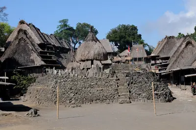
    Bajawa lies at around 1,100 m in the highlands of Flores, overlooked by the volcanic cone Inerie. The small town serves as a gateway to the traditional Ngada villages with their megaliths and ancestor shrines.

    Josep M. Gracia·CC BY-SA 4.0

    Flores and Komodo National Park

    Flores and Komodo National Park

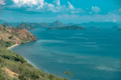
    Flores lies between Sumbawa and Timor and is around 350 km long. In the west, Komodo National Park, with its monitor lizards, starts at Labuan Bajo harbor; inland, volcanoes, rice terraces, and traditional villages extend to Kelimutu's crater lakes.

    Unsplash

    Labuan Bajo

    Labuan Bajo

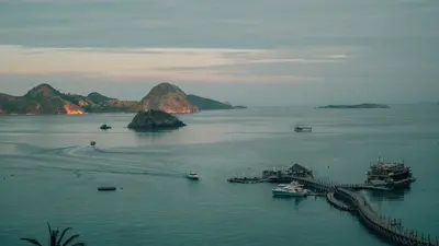
    Labuan Bajo, located at the western tip of Flores, is the gateway for tours into Komodo National Park. This former fishing village has evolved into a vibrant hub for boat trips, diving, and sailing with traditional Pinisi ships.

    Luthfi Shatara·Pexels

    Sumba

    Sumba

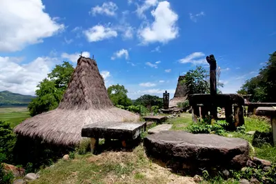
    Sumba lies south of Flores and is largely undeveloped for tourism. Traditional villages with high-pitched roofs, megalithic tombs, savannas, waterfalls, and empty beaches characterize the island.

    Jeffry Surianto·Pexels

    Komodo National Park

    Komodo National Park

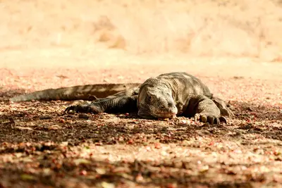
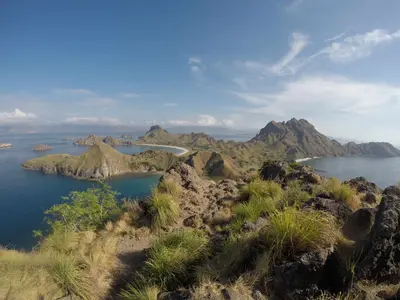
    Komodo National Park, located between Sumbawa and Flores, encompasses the islands of Komodo, Rinca, and Padar, as well as numerous smaller islands and reefs. Here lives the Komodo dragon, the largest living lizard today.

    Luca Buhl·Pexels

    Your next steps

    Kelimutu Lakes is in Indonesia. Ways to carry on from here.

    • More in Indonesia

      Highlights, areas, routes and the best time to travel for all of Indonesia.

      Indonesia travel guide
    • Round trips with Kelimutu Lakes

      One route passes through Kelimutu Lakes, with stops, nights and a map.

      See the round trip
    • Plan a trip with Kelimutu Lakes

      The Guide asks about season, length and who is coming, and suggests a trip with Kelimutu Lakes.

      Plan the trip

    Sources & method

    • Photos: Wikimedia Commons. Each photo carries its credit.
    • Place data such as addresses and ratings comes from Google Maps.
    • The content is based on web research from public, traceable sources. How the content is made · The role of AI