Fernweh: Home
    ExploreTravel GuidesPlan a tripMy tripLast visited
    de|en
    All Places & RegionsAll highlightsAbout FernwehFAQPrivacy PolicyImprint
    ExploreTravel GuidesPlan a tripMy tripLast visited
    • Neighborhoods & highlights
    • Eat & drink
    • Culture
    • Nightlife
    • Getting around
    • Accommodation
    • Plan trip
    • Nearby
    Moab
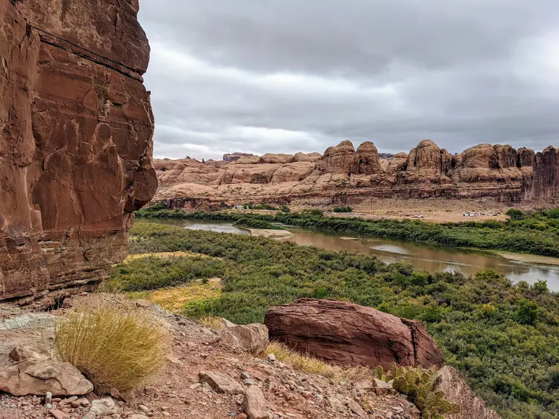
    Quintin Soloviev / Wikimedia Commons / CC BY 4.0

    United States

    Moab

    City

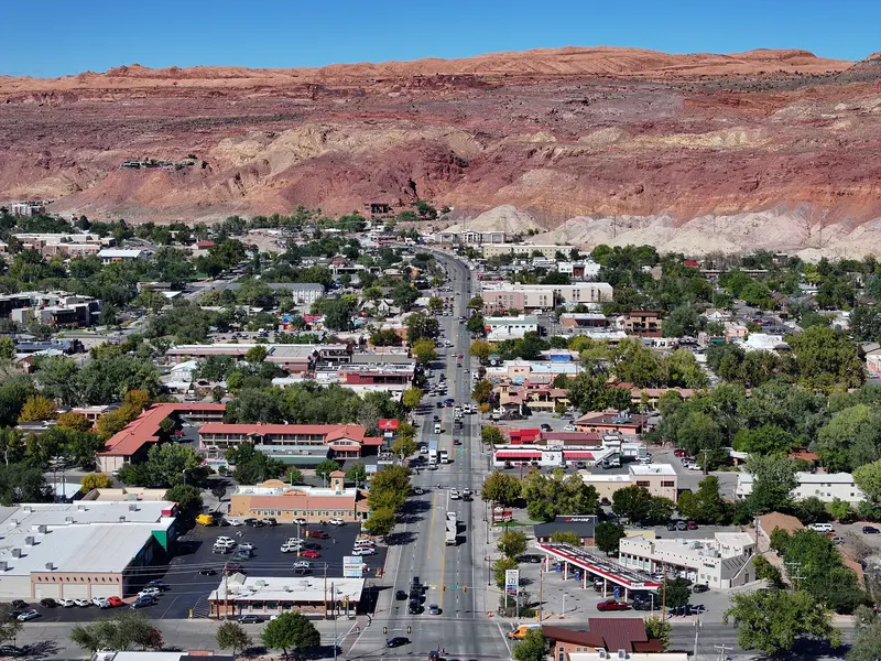
    Moab is a small town of about 5,000 people in eastern Utah, on the Colorado River and US 191, just under four hours' drive southeast of Salt Lake City.

    by Felix Gillen

    1. Home
    2. Destinations
    3. United States
    4. Utah
    5. Moab
    Moab is a small town of about 5,000 people in eastern Utah, on the Colorado River and US 191, just under four hours' drive southeast of Salt Lake City. It's where you'll stay for Arches National Park, five minutes up the road, and Canyonlands' Island in the Sky district, about 45 minutes away.Main Street doubles as US 191: motels, outfitters, grocery stores and most restaurants are on it or a block or two off it. Jeep, rafting and mountain bike tours leave from here, and in the evening most visitors end up on the Main Street patios after a day on the trail.Good to knowPeak season: March through October, especially around Easter (Jeep Safari) and holiday weekends like Memorial Day and Labor Day. Book rooms and campsites weeks or months ahead.Heat: July and August regularly top 100°F. Hike early in the morning or in the evening.Groceries: City Market on Main Street is the biggest grocery store in the area. Stock up on water and supplies before heading into the parks.

    Sights in Moab

    Discover the most important sights and attractions

    Dead Horse Point State Park
    Park

    1Dead Horse Point State Park

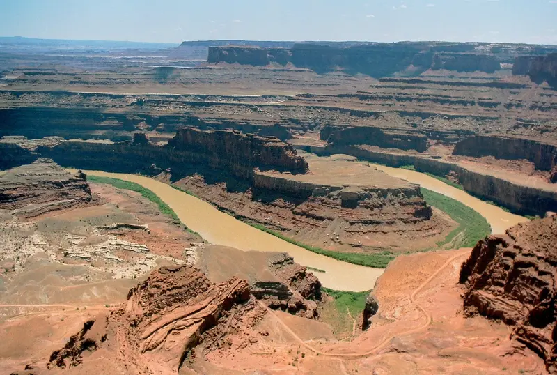
    A narrow rock promontory approximately 2,000 feet above a bend of the Colorado River, 32 miles (about 45 minutes) from Moab via UT 313, on the same road as Island in the Sky. From the viewpoint at the end of the road, you look out onto the river bend, the blue potash ponds, and the canyons of Canyonlands. The State Park has its own entrance fee: $20 per vehicle; the National Park Pass is not valid here. The light is most beautiful at sunrise and in the hour before sunset. An easy Rim Trail connects several viewpoints; there is a Visitor Center and drinking water, but no water for filling RV tanks.
    Open in Google Maps
    Potash Road: Petroglyphs and Dinosaur Tracks
    Historic Landmark

    2Potash Road: Petroglyphs and Dinosaur Tracks

    The UT 279 (Potash Road) branches off US 191 1.3 miles north of the Colorado River Bridge and follows the river beneath towering sandstone walls. After 5.1 miles, a pullout with an "Indian Writing" sign is on the right-hand river side: On the rock face opposite, you'll see petroglyphs from the Fremont culture (approx. 600 to 1300 AD), including animals and rows of figures holding hands, as well as younger Ute equestrian scenes. A second pullout follows 0.1 miles further. At the Poison Spider Trailhead at mile 6, a path about 200 yards long leads to dinosaur tracks in the rock. Be careful when crossing the road and do not touch the rock art. Good as a late afternoon detour when the walls are in shadow.
    Open in Google Maps
    Mill Canyon Dinosaur Trails
    Point of Interest

    3Mill Canyon Dinosaur Trails

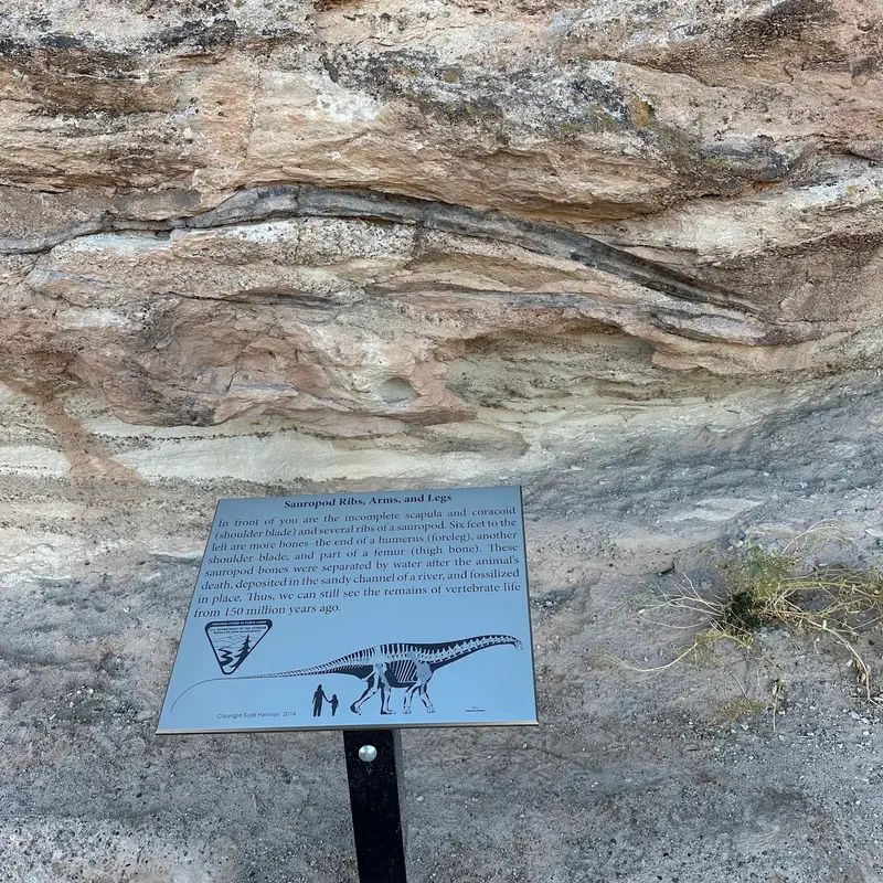
    Two free Bureau of Land Management sites, about 15 miles north of Moab: Just past mile marker 141, turn left from US 191 onto Mill Canyon Road, cross the tracks, and after 0.6 miles you'll reach the Tracksite. A boardwalk with interpretive signs leads over more than 200 early Cretaceous footprints there, from theropods, sauropods, and ornithopods. About a mile further (bear right at the fork) is the Bone Trail, a short path to Allosaurus and Camarasaurus bones still embedded in the rock. Both trails are short and great for kids. The gravel access road is passable for regular cars, but can become muddy after rain.
    Open in Google Maps

    Restaurants in Moab

    1

    Desert Bistro

    Moab's upscale restaurant, set in a historic house at 36 S 100 W, one block west of Main Street. Visit Utah highlights bacon-wrapped dates and the elk fillet as classics; the cuisine features wild game and ingredients from the Southwest. Reservations are recommended for peak season evenings; open for dinner only. It's a great way to cap off your trip if you want to dine out of your hiking gear for once.
    Show on Google Maps
    2

    Milt's Stop & Eat

    Burger stand since 1954 at 356 S Mill Creek Drive, on the way to the Slickrock Trail. Known for the Cowboy Burger, Onion Rings, and chocolate milkshakes. Order at the window, eat at outdoor tables; the patio is dog-friendly. Affordable and fast, a line often forms at lunchtime after hiking.
    Show on Google Maps
    3

    Sabaku Sushi

    Southwestern-inspired sushi at 90 E Center Street, one block east of Main Street: Ceviche, Elk Tataki, and several vegetarian rolls. Per Visit Utah, the kitchen readily adapts dishes for intolerances. Evenings are busy; reserve in season or come early. The patio is dog-friendly.
    Show on Google Maps
    4

    Antica Forma

    Neapolitan wood-fired pizza at 267 N Main Street, on the northern edge of town and on your way back from Arches. Visit Utah recommends the Funghi and Capanna pizzas; Calzone and gluten-free dough are also offered. A relaxed spot for families, expect evening waits during peak season.
    Show on Google Maps

    History and culture

    Mormon settlers from northern Utah founded Moab in 1878 at Brigham Young's direction and took its name from the Bible. For decades the town lived off ranching and orchards.In the 1950s Moab became the "Uranium Capital of the World" after geologist Charlie Steen struck a rich uranium deposit south of town, and the population boomed. When the Cold War ended most mines closed, and by the early 1980s many houses stood empty. Steen's hilltop home above town is now the Sunset Grill restaurant.Today Moab, the Grand County seat with about 5,300 residents (2020 census), runs on tourism: mountain biking on the Slickrock Trail, Jeep trails across the slickrock, and rafting on the Colorado. The biggest event of the year is the Easter Jeep Safari the week before Easter, when lodging books up far in advance.

    Nightlife

    1

    Moab Brewery

    Brewery with a bar at 686 S Main Street, on the south end of downtown. At the bar, you can enjoy their home-brewed beers, such as Dead Horse Ale or Rocket Bike American Lager, fresh from the tap. In the evenings, mountain bikers, rafting guides, and hikers meet here after their tours, with pub food available to go with your beer.
    Show on Google Maps
    2

    Woody's Tavern

    Established bar at 221 S Main Street, right downtown, popular with locals and visitors alike. Long wooden bar featuring US and Utah brewery beers, pool and foosball, a street-side porch and a patio. Often live music or karaoke. During the Easter Jeep Safari and on big event weekends, it gets very crowded.
    Show on Google Maps

    Getting there and around

    Moab sits on US 191, 31 miles south of I-70 (exit at Crescent Junction). It's just under four hours from Salt Lake City and about six from Denver. The prettier way in is UT 128 along the Colorado River, which leaves I-70 near Cisco.Flying inCanyonlands Regional Airport (CNY) is about 16 miles north of town. Since October 1, 2026, SkyWest has flown nonstop to Salt Lake City (as Delta Connection) and Denver (as United Express) under the Essential Air Service program, 12 round trips a week in total. You'll still need a rental car.Around townArches: the entrance is five minutes north on US 191.Canyonlands (Island in the Sky) and Dead Horse Point: north on US 191, then UT 313, about 45 minutes.Transit: there's no public bus to the parks. Local outfitters run shuttles for bikers and rafting groups.Gas and water: there are no gas stations in the parks. Fill up the tank and your water jugs in Moab.Traveling by RVMain Street is US 191 and gets heavy through traffic on busy weekends. There are no height-restricted parking garages, but curbside spots on Main are tight for big rigs. Leave the RV at your campground and walk or bike into town. Fill your fresh water tank in Moab: there's no RV water fill at Dead Horse Point State Park or in Canyonlands.

    Accommodations in Moab

    Find perfect stay in Moab

    Booking.com* (Affiliate link)
    Search Hotels
    Agoda* (Affiliate link)
    Search Hotels
    Airbnb
    Vacation Rentals

    * Affiliate link: if you book through it, we earn a small commission. The price stays the same for you.

    Campgrounds in Moab

    Find perfect campground in Moab

    Search via Google Maps
    Campgrounds nearby (15km)
    Camping.info
    Find Campgrounds
    Park4Night
    RV Parks & Camping

    Plan your trip to Moab

    Save places, build a route and plan your city trip, all in one place.

    1. 1
      Sunrise over alpine peaks and a sea of clouds
      1234

      Round trip

      12 days · 4 stops

      Saved

      Pick a route

      Pick a ready-made one or save places and plan your own.

      Open bookmarks
    2. 2

      Trip to Moab

      Live
      • 1Dead Horse Point State Park3 days
      • 2Potash Road: Petroglyphs and Dinosaur Tracks4 days
      • 3Mill Canyon Dinosaur Trails5 days
      Budget

      Plan your trip

      The planner sorts stops, days and budget. Plan together in real time.

      Start trip planning
    3. 3
      9:41 No signal
      Moab
      Available offline

      Use it on the road

      Download the guide to your phone and use it on site, even offline.

    Nearby

    Arches National Park

    Arches National Park

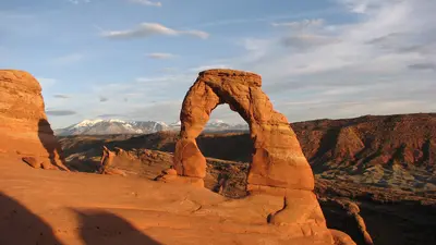
    Arches National Park lies in eastern Utah just north of the town of Moab, about four hours southeast of Salt Lake City. It holds more than 2,000 sandstone arches, and the most famous, including Delicate Arch and Landscape Arch, are within short to moderate hikes of the road.A 19-mile scenic drive runs through the park past the trailheads for the Windows Section, Balanced Rock, Wolfe Ranch and, at the far end, Devils Garden. You'll reach many arches within 15 minutes on foot, but there's almost no shade along the way.Moab as your baseMoab is five minutes from the park entrance and also the base for Canyonlands National Park and Dead Horse Point State Park. It has hotels at every price point, grocery stores, gas and outfitters for jeep, rafting and canyoneering trips. Rooms book up early in the March to October high season.What to know in 2026No timed entry: you don't need an entry reservation in 2026. Expect lines at the entrance on weekends and holidays, and lots that staff close temporarily when they fill up.Still reservation-only: Devils Garden Campground (March through October) and every Fiery Furnace hike, self-guided or ranger-led.Entrance fee: $30 per private vehicle. Arches does not charge the $100 nonresident surcharge. The $55 Southeast Utah Parks annual pass covers Arches, Canyonlands and two national monuments.Heat: July and August highs often pass 100°F. Hike early or late and carry at least two liters of water per person; water is only available at the visitor center.
    Canyonlands National Park (Island in the Sky)

    Canyonlands National Park (Island in the Sky)

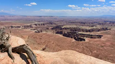
    Island in the Sky is the northern and most accessible district of Utah's Canyonlands National Park, about 32 miles west of Moab. You come for the view: from a mesa top you look roughly 2,200 feet down into the canyons of the Colorado and Green Rivers, and the best overlooks are just minutes from the car.The park splits into three districts that no road inside the park connects. The Needles to the south and the Maze to the west are separate trips; Island in the Sky makes an easy day trip from Moab. One road runs from the visitor center across the mesa to Grand View Point, with a spur to Upheaval Dome.Before you goEntrance fee: $30 per private vehicle. There's no nonresident surcharge here. The $55 Southeast Utah Parks pass also covers Arches.Supplies: no restaurants or gas in the park. Potable water is available at the visitor center only, spring through fall, and there's none on the trails. Fill the tank and pack lunch in Moab.Visitor center: open daily March through December from 9 a.m., with longer summer hours.Combine it: Dead Horse Point State Park is on the way, with its own fee, and its view of the Colorado River's gooseneck is worth the detour.
    Utah

    Utah

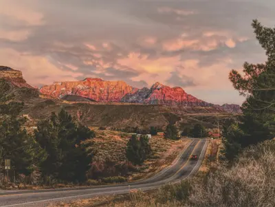
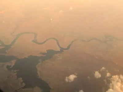
    Utah sits between Nevada, Arizona, Colorado, Wyoming, and Idaho. Most visitors come for the five national parks in the south, the "Mighty Five": Zion, Bryce Canyon, Capitol Reef, Arches, and Canyonlands. In winter, the draw is the Wasatch Range, with ski resorts less than an hour from Salt Lake City.Salt Lake City hosted the 2002 Winter Olympics and gets the Games again in 2034. Northwest of town lies the Great Salt Lake, a remnant of Ice Age Lake Bonneville. The state's high point is Kings Peak (13,518 ft) in the Uinta Mountains.Down south, the parks sit close together: Zion with the Narrows of the Virgin River, Bryce Canyon and its hoodoos, Capitol Reef along the Waterpocket Fold, and Arches and Canyonlands outside Moab. Monument Valley and Lake Powell are right on the Arizona line.
    Page

    Page

    Page is a town of about 7,400 people in far northern Arizona, right on the Utah line and the shore of Lake Powell. It's the base for three stops that top many Southwest road trips: Horseshoe Bend, Antelope Canyon and Lake Powell with Glen Canyon Dam, all less than 15 minutes from town.It's roughly four and a half to five hours from both Las Vegas and Phoenix and about three from the Grand Canyon's South Rim. Plan at least one night: Horseshoe Bend is emptiest at sunrise and best lit in the afternoon, Antelope Canyon glows most around midday, and a boat trip on the lake is worth the time.Book aheadAntelope Canyon: guided tours with a Navajo-owned operator only. In spring and summer, book days or weeks out; Upper Antelope Canyon doesn't sell tickets on-site. Budget around $100 per person for Lower Antelope Canyon, including the Navajo Nation fee.Horseshoe Bend: no reservation, but parking is $10 per car.Time zones: Page stays on Mountain Standard Time year-round, while the Navajo Nation observes daylight saving time. Double-check which time your tour is listed in.The town itself is no-frills, with motels, grocery stores and a modest choice of restaurants, but it works well as a base.
    Bryce Canyon National Park

    Bryce Canyon National Park

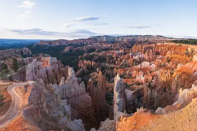
    Bryce Canyon National Park sits on a high plateau in southern Utah, a short day's drive northeast of Zion, at around 8,000 feet and topping out above 9,000 feet at Rainbow Point. You come for the hoodoos: thousands of orange-red rock spires packed into amphitheaters, with short trails that drop from the rim right down among them.Bryce isn't really a canyon but the eroded edge of a plateau. The heart of the park is the Bryce Amphitheater, lined by Sunrise, Sunset, Inspiration and Bryce Points. From there an 18-mile dead-end road with 13 viewpoints runs south to Rainbow Point.Where to stayThe closest hotels and restaurants are in Bryce Canyon City just outside the entrance, home to the sprawling Ruby's Inn. For something quieter, stay in the village of Tropic below the plateau, about 15 minutes away. Inside the park, the Lodge at Bryce Canyon is open spring through fall.Before you goEntrance fee: $35 per private vehicle. Visitors who aren't U.S. residents pay an extra $100 per person age 16 and up; U.S. residents don't. The America the Beautiful pass ($80 for residents, $250 for nonresidents) covers entry, and the nonresident version waives the surcharge for everyone in the car.Altitude and weather: nights are cool even in summer, it freezes almost every night from October through May, and snow is common in winter. Bring a warm layer and rain gear year-round; weather changes fast up here.After dark: Bryce is an International Dark Sky Park. Rangers run stargazing programs in summer, and full-moon hikes are assigned by lottery.

    Sources & method

    • Photos: Wikimedia Commons, Google Maps. Each photo carries its credit.
    • Place data such as addresses and ratings comes from Google Maps.
    • The content is based on web research from public, traceable sources. How the content is made · The role of AI