Fernweh: Home
ExploreGuideDestinationsMy tripsMy trip
de|en
All Places & RegionsRound tripsNight trains in EuropeAll highlightsAbout FernwehFAQPrivacy PolicyImprint
Download on the App StoreGet it on Google Play
ExploreGuideDestinationsMy tripsMy trip
    • Neighborhoods & highlights
    • Recommendations
    • Eat & drink
    • Culture
    • Getting around
    • Accommodation
    • Plan trip
    • Nearby
    Iquitos

    Photo by Deb Dowd on Unsplash

    Peru

    Iquitos

    City

    Iquitos is the largest city in the Peruvian Amazon region and only accessible by plane or boat.

    by Felix Gillen

    1. Home
    2. Destinations
    3. Peru
    4. Amazon Region (Tambopata)
    5. Iquitos
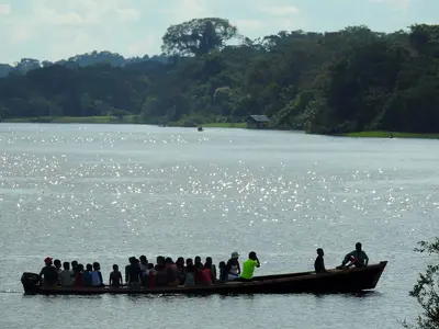
    Iquitos is the largest city in the Peruvian Amazon region and only accessible by plane or boat. Rubber boom mansions, the Casa de Fierro on the Plaza, and the stilt house district of Belén by the river make it a starting point for rainforest tours. From here, boats take you to lodges and the Reserva Nacional Pacaya Samiria.
    Peru travel guideRound trips in PeruPlan a trip with Iquitos

    Contents

    • Neighborhoods & highlights
    • Recommendations
    • Eat & drink
    • Culture
    • Getting around
    • Accommodation
    • Nearby

    Sights in Iquitos

    Discover the most important sights and attractions

    Barrio de Belén and Mercado de Belén

    Carlo Brescia / Wikimedia Commons / CC BY-SA 4.0, mod.

    Market

    1Barrio de Belén and Mercado de Belén

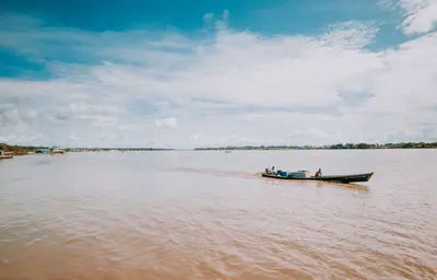
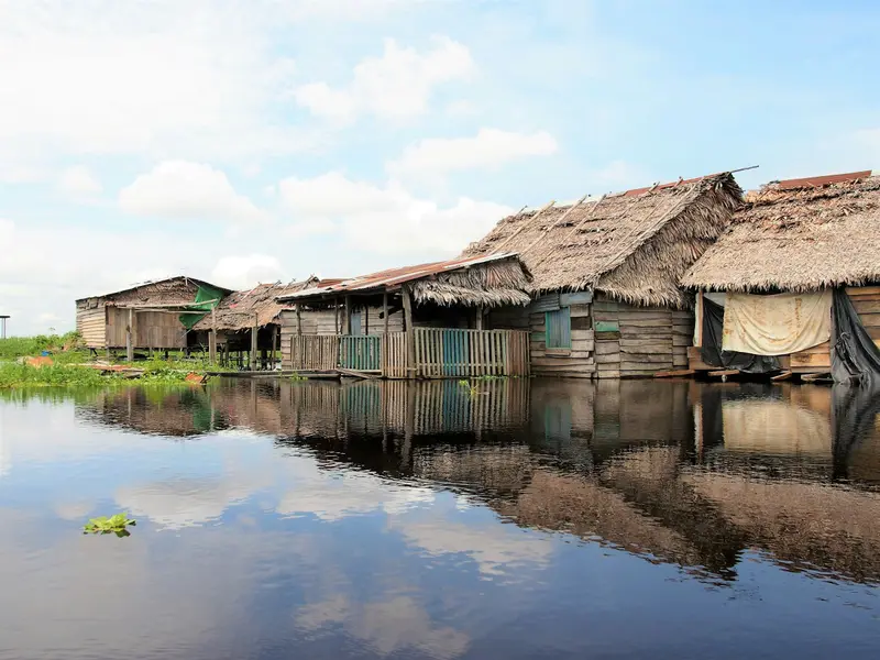
    On the banks of the Itaya lies the city's most unusual district, with a large open-air market and houses on stilts and rafts. In Pasaje Paquito, medicinal herbs and drinks made from Amazonian plants are sold. Frommer's recommends visiting only during the day and in a group, and using cameras discreetly.
    Open in Google Maps
    Casa de Fierro

    Julian71444 / Wikimedia Commons / CC BY-SA 4.0, mod.

    Attraction

    2Casa de Fierro

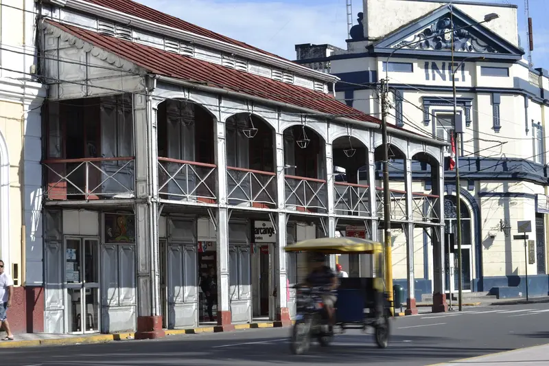
    The two-story house with balconies and iron cladding stands at the corner of Próspero and Putumayo on the Plaza de Armas. The disassembled parts came from Europe and were erected for rubber baron Anselmo del Águila; Gustave Eiffel is credited with its design.
    Open in Google Maps
    Pilpintuwasi

    “Crisálidas del Mariposario Pilpintuwasi” by Taco Witte / Wikimedia Commons / CC BY 2.0, mod.

    Point of Interest

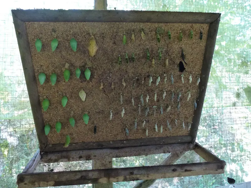
    3Pilpintuwasi

    The butterfly farm is located in the village of Padre Cocha on the Río Nanay. Besides Blue Morpho butterflies, orphaned animals like monkeys, a tapir, an anteater, and a jaguar live here. By boat from Bellavista-Nanay, you'll travel about 20 minutes; from the landing stage, it's about a 15-minute walk through the village.
    Open in Google Maps
    Malecón Tarapacá

    Estados Unidos de América del Sur / Wikimedia Commons / CC BY-SA 4.0, mod.

    Museum

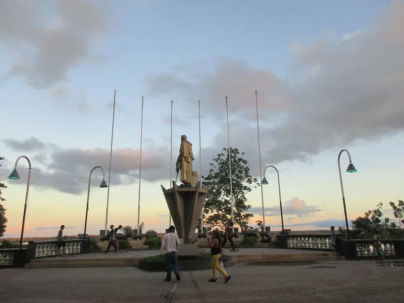
    4Malecón Tarapacá

    The Rubber Boom-era riverside promenade overlooks the Amazon and the port of Belém. Fountains, benches, and lanterns make it the city's evening meeting point. Along it stand 19th-century mansions and the museum ship Ayapua, built in Hamburg in 1906.
    Open in Google Maps

    Restaurants in Iquitos

    1

    Through Cold and Fire

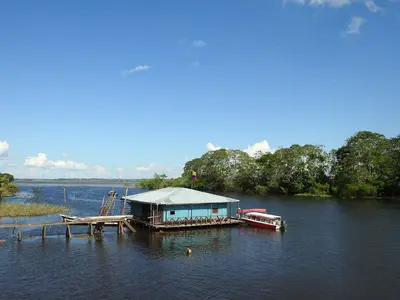
    Floating restaurant on a platform in the river with Amazonian cuisine like Patarashca and Doncella a la loretana. Upscale price level according to Fodor's.
    Show on Google Maps

    The City of Rubber

    Rise with RubberDuring the rubber boom, Iquitos became a crucial shipping port. In the 1880s, about 20,000 people lived here, including many Europeans and Sephardic Jews from Morocco. The boom ended in 1912 when overseas plantations pushed wild rubber out of the market.Architecture on the MalecónFrom this period date the houses clad with azulejos and iron around the Plaza de Armas and along Malecón Tarapacá, including Casa Morey from 1913.Life on the WaterIn the Belén district, houses stand on stilts and rafts, and the market is one of the city's liveliest. For current health and safety advice, refer to the Federal Foreign Office, linked on the country page.

    How to get there only by air or via the river

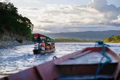
    By PlaneIquitos has no road connection to the rest of Peru. Most visitors arrive by plane from Lima; the flight takes just under two hours.By BoatCargo boats with passenger decks travel from Yurimaguas via the Huallaga and Marañón rivers to Iquitos, taking several days depending on the water level. From Pucallpa via the Ucayali, the journey takes even longer.In the CityExplore the city center around Plaza and Malecón on foot; for longer distances, take a motocarro. Boats to Padre Cocha depart from Bellavista-Nanay, about 4 km north of the center.

    Accommodations in Iquitos

    Find perfect stay in Iquitos

    Booking.com* (Affiliate link)
    Search Hotels
    Agoda* (Affiliate link)
    Search Hotels
    Airbnb
    Vacation Rentals

    * Affiliate link: if you book through it, we earn a small commission. The price stays the same for you.

    Plan your trip to Iquitos

    Save places, build a route and plan your city trip, all in one place.

    1. 1
      Sunrise over alpine peaks and a sea of clouds
      1234

      Round trip

      12 days · 4 stops

      Saved

      Pick a route

      Pick a ready-made one or save places and plan your own.

      Open bookmarks
    2. 2

      Trip to Iquitos

      Live
      • 1Barrio de Belén and Mercado de Belén3 days
      • 2Casa de Fierro4 days
      • 3Pilpintuwasi5 days
      Budget

      Plan your trip

      The planner sorts stops, days and budget. Plan together in real time.

      Start trip planning
    3. 3
      9:41 No signal
      Iquitos
      Available offline

      Photo by Deb Dowd on Unsplash

      Use it on the road

      Download the guide to your phone and use it on site, even offline.

    Nearby

    Amazonas

    Amazonas

    The Amazonas Department is located in the southernmost part of Colombia, where the country borders Brazil and Peru. You come here for the Amazon rainforest, river dolphins, and indigenous communities. The starting point is the capital Leticia, which you reach by flight from Bogotá.

    Kevin Garcia·Pexels

    Puerto Nariño

    Puerto Nariño

    Puerto Nariño is a car-free village on the Amazon, 2 boat hours upstream from Leticia. You come for Lagos de Tarapoto, where pink and grey river dolphins live, and the rainforest's peace. The town, with around 8,000 inhabitants, has no cars, motorbikes or large buildings; you walk everywhere.

    Gatocalvo·CC BY-SA 4.0

    Leticia

    Leticia

    Leticia is the capital of the Amazonas Department and Colombia's gateway to the Amazon, approximately 2 flight hours southeast of Bogotá. From here, boat tours embark for Isla de los Micos, Puerto Nariño, and Amacayacu National Park. This small town, with around 48,000 inhabitants (2018 Census), sits directly on the border with Brazilian Tabatinga, while Peru begins on the opposite riverbank. In the evenings, the town congregates at Parque Santander, as thousands of parakeets fly in to roost.

    Gatocalvo·CC BY-SA 4.0

    Amazonian Lowlands

    Amazonian Lowlands

    UK FCDO travel advice (updated 1 November 2026): the FCDO advises against all but essential travel to areas within 20 km of the border with Colombia, which includes parts of Sucumbíos province. Check the current FCDO travel and health advice, linked on the country page.East of the Andes lie the Amazon lowlands, the Oriente. The major protected areas are Yasuní National Park, a UNESCO biosphere reserve since 1989, and Cuyabeno Reserve with its blackwater lagoons. Gateway towns are Coca, around 30 minutes by air from Quito, Lago Agrio and Tena, Ecuador's centre for rafting and kayaking.

    Jeff Stapleton·Pexels

    Yasuní National Park

    Yasuní National Park

    For current travel, safety and health advice, including any state of emergency, check the UK FCDO travel advice, linked on the country page.Yasuní National Park in Orellana and Pastaza provinces has protected around one million hectares of Amazon rainforest since 1979 and, together with Waorani territory, has been a UNESCO biosphere reserve since 1989. It is reached via Coca and the Río Napo; allow at least four to five days for the remoter parts.

    Tom Fisk·Pexels

    Your next steps

    Iquitos is in Peru. Ways to carry on from here.

    • More in Peru

      Highlights, areas, routes and the best time to travel for all of Peru.

      Peru travel guide
    • Round trips in Peru

      Ready-made routes through Peru, with stops, nights and a map.

      See the routes

    Sources & method

    • Photos: Wikimedia Commons, Unsplash. Each photo carries its credit.
    • Place data such as addresses and ratings comes from Google Maps.
    • The content is based on web research from public, traceable sources. How the content is made · The role of AI