Fernweh: Home
ExploreGuideDestinationsMy tripsMy trip
de|en
All Places & RegionsRound tripsNight trains in EuropeAll highlightsAbout FernwehFAQPrivacy PolicyImprint
Download on the App StoreGet it on Google Play
ExploreGuideDestinationsMy tripsMy trip
    • Overview
    • Places in the region
    • Recommendations
    • Culture
    • Getting around
    • Nearby
    Hardangerfjord

    Holger Uwe Schmitt / Wikimedia Commons / CC BY-SA 4.0, mod.

    Norway

    Hardangerfjord

    Region

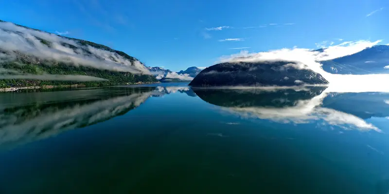
    The Hardangerfjord southeast of Bergen is Norway's orchard: Fruit has been cultivated on its shores since the 13th century, with several hundred thousand trees supplying almost half of Norway's fruit.

    by Felix Gillen

    1. Home
    2. Destinations
    3. Norway
    4. Norway's Fjords
    5. Hardangerfjord
    The Hardangerfjord southeast of Bergen is Norway's orchard: Fruit has been cultivated on its shores since the 13th century, with several hundred thousand trees supplying almost half of Norway's fruit. During blossom season, usually from mid-May for three to four weeks, visitors flock to Ulvik, Lofthus, and Utne.Additionally, there are waterfalls like Vøringsfossen and Låtefossen, the Hardangerbrua suspension bridge, and the long day hike to Trolltunga rock formation above Odda. The Hardanger National Tourist Route is 158 kilometers long.
    Norway travel guideRound trips in NorwayPlan a trip with Hardangerfjord

    Contents

    • Overview
    • Places in the region
    • Recommendations
    • Culture
    • Getting around
    • Nearby
    The Hardangerfjord is a landscape of orchards, waterfalls, and high plateaus. At the inner fjord are Ulvik and Eidfjord with the Vøringsfossen; to the south is Odda as a starting point for Trolltunga and the Låtefossen. The Hardanger National Tourist Route connects these places over 158 kilometers.

    Sights in Hardangerfjord

    Discover the most important sights and attractions

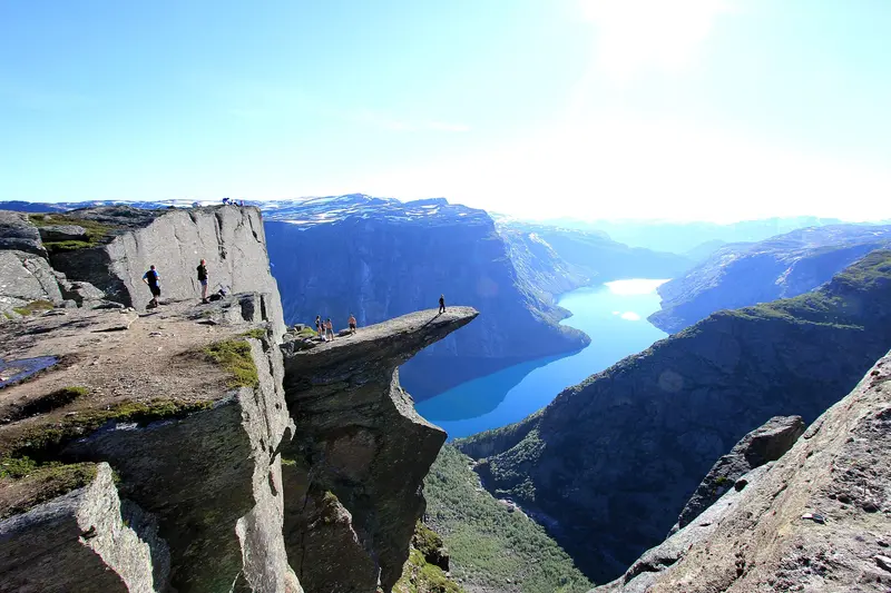
    Trolltunga

    “Trolltunga 2” by Steinar Talmoen / Wikimedia Commons / CC BY-SA 3.0, mod.

    Attraction

    Trolltunga

    The rock tongue rises to 1,126 meters, about 700 meters above Lake Ringedalsvatnet. From P2 Skjeggedal, it's a 27-kilometer round trip, taking 8 to 12 hours. From P3 Mågelitopp (advance booking only, 30 spots), it's 20 kilometers and 7 to 10 hours. From P1 Tyssedal, it's 38 kilometers and about 15 hours. The hiking season typically runs from mid-June to mid-September.
    Open in Google Maps
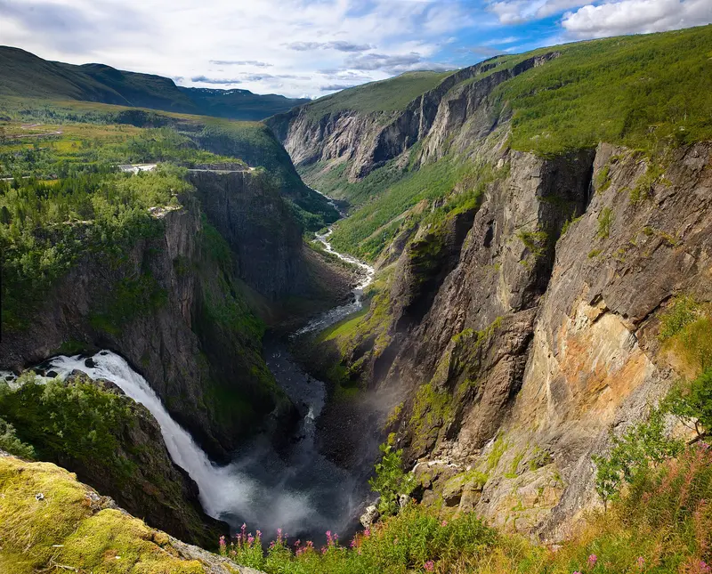
    Vøringsfossen

    “Vøringfossen” by Kenny Louie / Wikimedia Commons / CC BY 2.0, mod.

    Attraction

    Vøringsfossen

    The waterfall plunges a total of 182 meters into Måbødalen, with 145 meters in free fall. A new stepped bridge crosses the river, built as part of the National Tourist Routes project, which was completed in September 2024. Parking at Fossli and Fossatromma is free approximately from April to October; in winter, platforms and the bridge are closed. It's around 18 kilometers from Eidfjord.
    Open in Google Maps
    Attraction

    Låtefossen

    The 165-meter-high twin waterfall plunges next to the Rv13 road, 15 minutes from Odda. At its base, an 1859 stone arch bridge spans the river. The parking lot is small; it's often congested here.
    Open in Google Maps
    Attraction

    Ulvik

    The village on the inner Hardangerfjord calls itself the Fruit Village. A Cider Route connects farms and cideries such as Ulvik Frukt & Cideri, Syse Gard, and Hardanger Saft- og Siderfabrikk. For the fruit blossom (mid-May for 3-4 weeks), Ulvik is a fjord highlight.
    Open in Google Maps
    Attraction

    Hardangerbrua

    Die längste Hängebrücke Norwegens hat 1.310 Meter Spannweite bei 1.380 Metern Gesamtlänge und wurde am 17. August 2013 eröffnet. Autos zahlen Maut, Fußgänger und Radfahrer queren kostenlos und haben einen eigenen Tunnel.
    Open in Google Maps

    Fruit & Cider on Hardangerfjord

    Fruit Growing Since the Middle AgesFruit has been cultivated along the Hardangerfjord since the 13th century. Several hundred thousand fruit trees line its banks, supplying almost half of Norway's fruit.Blossom and CiderThe blossoming usually begins mid-May and lasts three to four weeks. Ulvik calls itself the 'Fruit Village'; a Cider Route connects producers like Ulvik Frukt & Cideri, Syse Gard, and the Hardanger Saft- og Siderfabrikk. In Utne, the Utne Hotel has been in operation since 1722.

    Exploring the Hardangerfjord

    By CarThe Hardangerbrua has a toll for cars; pedestrians and cyclists cross for free.During fruit blossom season, the tourism organisation recommends the Fv550 from Utne to Jondal as a scenic route.To TrolltungaP1 Tyssedal: 227 spaces, year-round, no booking, 330 NOK per day; only parking for campervans.P2 Skjeggedal: 229 spaces, no booking, 550 NOK per day including toll. In summer, a shuttle runs from Odda to P2, approx. 30 minutes.P3 Mågelitopp: 30 spaces, pre-booking only, vehicle height up to 2 meters, 600 NOK plus 220 NOK toll at the machine at P2. Season 2026: June 8 to September 30, entry 6:30 to 11:00.At VøringsfossenThe Fossli and Fossatromma car parks are free from approximately April to October; platforms and bridge are closed in winter.

    Nearby

    Bergen

    Bergen

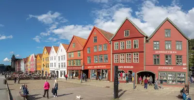
    Norway's second-largest city, with almost 300,000 residents, lies on the west coast between seven mountains and is considered the gateway to the fjords. Along the harbor, the colorful wooden houses of the Hanseatic Quay Bryggen, a UNESCO World Heritage site since 1979, are lined up. Beside them, the 13th-century Bergenhus Fortress guards the harbor entrance. The Fløibanen funicular takes you up its local mountain Fløyen in eight minutes. It rains here on over 200 days a year, so rainwear belongs in your luggage.

    Diego Delso·CC BY-SA 4.0

    Nærøyfjord and Flåm

    Nærøyfjord and Flåm

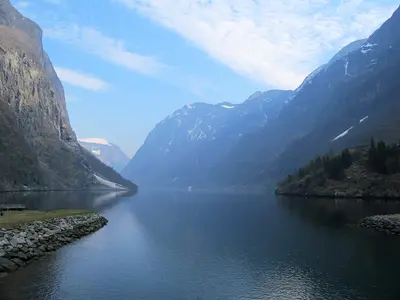
    The approximately 17-kilometer Nærøyfjord is an arm of the Aurlandsfjord, which branches off the Sognefjord. At its narrowest, it is only 250 meters wide; since 2005, it has been UNESCO World Heritage. Access points are Gudvangen at its inner end and Flåm on the Aurlandsfjord, where the steep Flåmsbana ends. Ships between Flåm and Gudvangen travel through both fjords.

    Acediscovery·CC BY 4.0

    Sognefjord

    Sognefjord

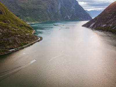
    The Sognefjord north of Bergen stretches over 200 kilometers inland and is up to 1,308 meters deep. Side arms like the Nærøyfjord, the Aurlandsfjord, the Lustrafjord and the Fjærlandsfjord branch off from it.Come here for the Stave Churches of Urnes and Borgund, the glacier tongues of Jostedalsbreen, the Stegastein viewpoint above the Aurlandsfjord, and the old tourist town of Balestrand, located where the fjord is widest.

    Mark Twisselmann·Unsplash

    Norway's Fjords

    Norway's Fjords

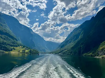
    On the west coast, the great fjords cut deep inland. Geirangerfjord and Nærøyfjord are approximately 120 kilometres apart, together forming the UNESCO World Heritage Site of the West Norwegian Fjords: Their rock walls rise up to 1,400 metres from the sea and plunge 500 metres below sea level, with countless waterfalls cascading down the steep cliffs. Bergen is the main starting point.

    Cbliu·CC BY-SA 4.0

    Telemark

    Telemark

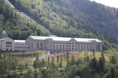
    Telemark is the region in the hinterland of Norway's south coast, stretching from Skien to the edge of the Hardangervidda mountain plateau. You come here for the UNESCO World Heritage site Rjukan-Notodden, a boat trip on the Telemark Canal, and Heddal Stave Church, Norway's largest stave church.Since 2015, the industrial landscape of Rjukan and Notodden has been part of the World Heritage. Norsk Hydro produced artificial fertilizers from atmospheric nitrogen here using hydropower; power plants, pipelines, factories, railways, and ferries are preserved. The Vemork power plant near Rjukan was, upon its completion in 1911, the largest of its kind worldwide.The 105-kilometer long Telemark Canal between Skien and Dalen was completed in 1892 and was then considered the "eighth wonder of the world."

    Linus Folke Jensen·CC BY-SA 4.0

    Your next steps

    Hardangerfjord is in Norway. Ways to carry on from here.

    • More in Norway

      Highlights, areas, routes and the best time to travel for all of Norway.

      Norway travel guide
    • Round trips in Norway

      Ready-made routes through Norway, with stops, nights and a map.

      See the routes
    • Plan a trip with Hardangerfjord

      The Guide asks about season, length and who is coming, and suggests a trip with Hardangerfjord.

      Plan the trip

    Sources & method

    • Photos: Wikimedia Commons. Each photo carries its credit.
    • Place data such as addresses and ratings comes from Google Maps.
    • The content is based on web research from public, traceable sources. How the content is made · The role of AI