Fernweh: Home
ExploreGuideDestinationsMy tripsMy trip
de|en
All Places & RegionsRound tripsNight trains in EuropeAll highlightsAbout FernwehFAQPrivacy PolicyImprint
Download on the App StoreGet it on Google Play
ExploreGuideDestinationsMy tripsMy trip
    • Places & highlights
    • Tours
    • Eat & drink
    • Getting around
    • Accommodation
    • Round trips
    • Nearby
    Nærøyfjord and Flåm

    Acediscovery / Wikimedia Commons / CC BY 4.0, mod.

    Norway

    Nærøyfjord and Flåm

    Point of Interest

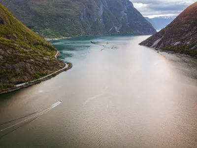
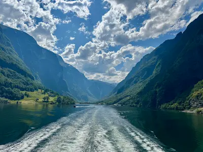
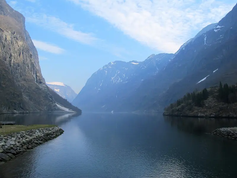
    The approximately 17-kilometer Nærøyfjord is an arm of the Aurlandsfjord, which branches off the Sognefjord. At its narrowest, it is only 250 meters wide; since 2005, it has been UNESCO World Heritage.

    by Felix Gillen

    1. Home
    2. Destinations
    3. Norway
    4. Norway's Fjords
    5. Nærøyfjord and Flåm
    The approximately 17-kilometer Nærøyfjord is an arm of the Aurlandsfjord, which branches off the Sognefjord. At its narrowest, it is only 250 meters wide; since 2005, it has been UNESCO World Heritage. Access points are Gudvangen at its inner end and Flåm on the Aurlandsfjord, where the steep Flåmsbana ends. Ships between Flåm and Gudvangen travel through both fjords.
    Norway travel guideSee the round tripPlan a trip with Nærøyfjord and Flåm

    Contents

    • Places & highlights
    • Tours
    • Eat & drink
    • Getting around
    • Accommodation
    • Round trips
    • Nearby

    Sights in Nærøyfjord and Flåm

    Discover the most important sights and attractions

    Flåmsbana

    W. Bulach / Wikimedia Commons / CC BY-SA 4.0, mod.

    1Flåmsbana

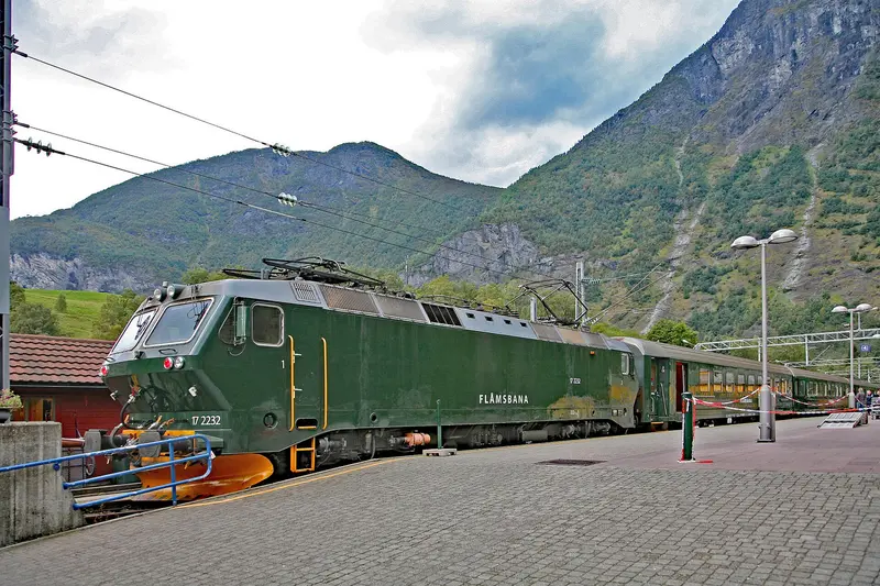
    The approximately 20-kilometer long railway connects Myrdal on the Bergen Line with Flåm on the Aurlandsfjord, overcoming about 865 meters in elevation with a gradient of up to 5.5 percent; the journey takes just under an hour. It has been operating regularly since 1942, electrically since 1944. Along the way, the train stops at Kjosfossen waterfall.

    Open in Google Maps
    Attraction

    2Kjosfossen Waterfall

    The waterfall on the Flåmsbana is only accessible by train: a dedicated stop was established for it in 1951, where trains stop so passengers can disembark and see the fall from a platform.
    Open in Google Maps

    Tours & experiences in Nærøyfjord and Flåm

    Search tours for Nærøyfjord and Flåm on GetYourGuide* (Affiliate link)On GetYourGuide, with reviews from other travellers

    * Affiliate link: if you book through it, we earn a small commission. The price stays the same for you.

    Restaurants in Nærøyfjord and Flåm

    Getting Here and Around

    By Train and BoatThe Flåmsbana takes about an hour from Myrdal on the Bergen Railway down to Flåm, stopping en route at the Kjosfossen waterfall.Fully electric excursion ships operate year-round between Flåm and Gudvangen through Aurlandsfjord and Nærøyfjord; one way takes about two hours. Intermediate stops, for example in Undredal, must be booked in advance. If starting in Gudvangen, book the shuttle bus back to Flåm too.In winter, the route may change at short notice; check the current timetable.

    Accommodations in Nærøyfjord and Flåm

    Find perfect stay in Nærøyfjord and Flåm

    Booking.com* (Affiliate link)
    Search Hotels
    Agoda* (Affiliate link)
    Search Hotels
    Airbnb
    Vacation Rentals

    * Affiliate link: if you book through it, we earn a small commission. The price stays the same for you.

    Campgrounds in Nærøyfjord and Flåm

    Find perfect campground in Nærøyfjord and Flåm

    Search via Google Maps
    Campgrounds nearby (15km)
    Camping.info
    Find Campgrounds
    Park4Night
    RV Parks & Camping

    Round trips with Nærøyfjord and Flåm

    Classic Norway by Train: Oslo, Flåm and Bergen

    Classic Norway by Train: Oslo, Flåm and Bergen

    A week without a car: You start in Oslo with the Opera, Munch Museum, and the museums on Bygdøy, then travel by Bergensbahn over the mountains to Myrdal and by Flåmsbana down to the Aurlandsfjord. After two nights by the fjord, you return to Myrdal and continue to Bergen, where Bryggen and Fløyen await. Return flight from Bergen.

    9 Days
    3 stops
    Open jaw

    Pierre Blaché·Unsplash

    Nearby

    Sognefjord

    Sognefjord

    The Sognefjord north of Bergen stretches over 200 kilometers inland and is up to 1,308 meters deep. Side arms like the Nærøyfjord, the Aurlandsfjord, the Lustrafjord and the Fjærlandsfjord branch off from it.Come here for the Stave Churches of Urnes and Borgund, the glacier tongues of Jostedalsbreen, the Stegastein viewpoint above the Aurlandsfjord, and the old tourist town of Balestrand, located where the fjord is widest.

    Mark Twisselmann·Unsplash

    Hardangerfjord

    Hardangerfjord

    The Hardangerfjord southeast of Bergen is Norway's orchard: Fruit has been cultivated on its shores since the 13th century, with several hundred thousand trees supplying almost half of Norway's fruit. During blossom season, usually from mid-May for three to four weeks, visitors flock to Ulvik, Lofthus, and Utne.Additionally, there are waterfalls like Vøringsfossen and Låtefossen, the Hardangerbrua suspension bridge, and the long day hike to Trolltunga rock formation above Odda. The Hardanger National Tourist Route is 158 kilometers long.

    Holger Uwe Schmitt·CC BY-SA 4.0

    Norway's Fjords

    Norway's Fjords

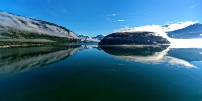
    On the west coast, the great fjords cut deep inland. Geirangerfjord and Nærøyfjord are approximately 120 kilometres apart, together forming the UNESCO World Heritage Site of the West Norwegian Fjords: Their rock walls rise up to 1,400 metres from the sea and plunge 500 metres below sea level, with countless waterfalls cascading down the steep cliffs. Bergen is the main starting point.

    Cbliu·CC BY-SA 4.0

    Bergen

    Bergen

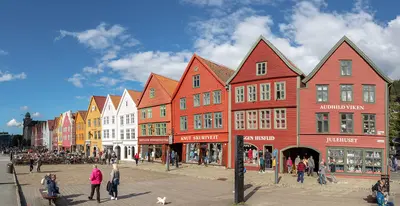
    Norway's second-largest city, with almost 300,000 residents, lies on the west coast between seven mountains and is considered the gateway to the fjords. Along the harbor, the colorful wooden houses of the Hanseatic Quay Bryggen, a UNESCO World Heritage site since 1979, are lined up. Beside them, the 13th-century Bergenhus Fortress guards the harbor entrance. The Fløibanen funicular takes you up its local mountain Fløyen in eight minutes. It rains here on over 200 days a year, so rainwear belongs in your luggage.

    Diego Delso·CC BY-SA 4.0

    Jotunheimen

    Jotunheimen

    Jotunheimen is a high mountain range in western Eastern Norway, covering approximately 3,500 square kilometers. It is home to Galdhøpiggen (2,469 m) and Glittertind (2,464 m), Norway's two highest mountains, and within the national park, you'll discover more than 50 marked trails.The most famous tour is the Besseggen ridge, for which you typically start by boat across Lake Gjende from Gjendesheim. On the edge of the mountain range lies Lom, home to its 12th-century stave church; from there, the Sognefjellsvegen road traverses the range to Gaupne.

    Frankemann·CC BY-SA 4.0

    Your next steps

    Nærøyfjord and Flåm is in Norway. Ways to carry on from here.

    • More in Norway

      Highlights, areas, routes and the best time to travel for all of Norway.

      Norway travel guide
    • Round trips with Nærøyfjord and Flåm

      One route passes through Nærøyfjord and Flåm, with stops, nights and a map.

      See the round trip
    • Plan a trip with Nærøyfjord and Flåm

      The Guide asks about season, length and who is coming, and suggests a trip with Nærøyfjord and Flåm.

      Plan the trip

    Sources & method

    • Photos: Wikimedia Commons. Each photo carries its credit.
    • Place data such as addresses and ratings comes from Google Maps.
    • The content is based on web research from public, traceable sources. How the content is made · The role of AI