Fernweh: Home
ExploreGuideDestinationsMy tripsMy trip
de|en
All Places & RegionsRound tripsNight trains in EuropeAll highlightsAbout FernwehFAQPrivacy PolicyImprint
Download on the App StoreGet it on Google Play
ExploreGuideDestinationsMy tripsMy trip
    • Places in the region
    • Recommendations
    • Culture
    • Getting around
    • Nearby
    Rapa Nui (Easter Island)

    kallerna / Wikimedia Commons / CC BY-SA 4.0, mod.

    Chile

    Rapa Nui (Easter Island)

    RegionCultureNature

    Easter Island, known to its inhabitants as Rapa Nui, lies, according to UNESCO, about 3,700 kilometers west of the Chilean mainland in the Pacific; currently, scheduled flights are only available from Santiago.

    by Felix Gillen

    1. Home
    2. Destinations
    3. Chile
    4. Rapa Nui (Easter Island)
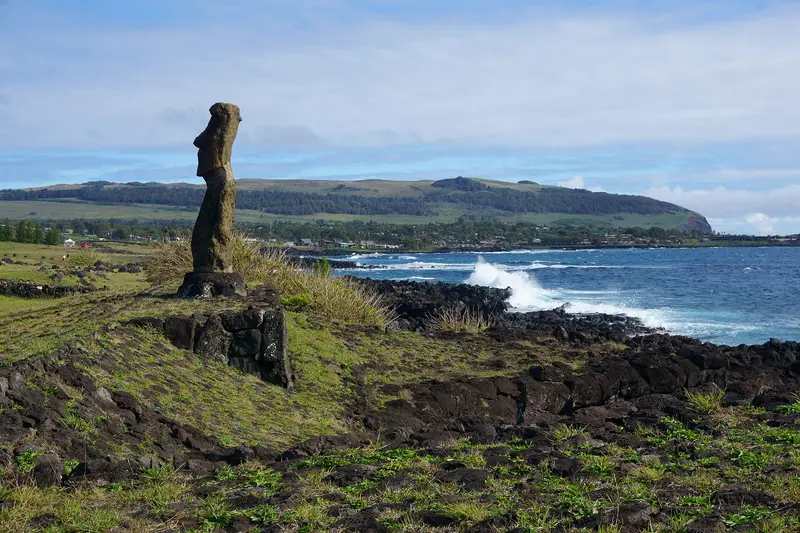
    Easter Island, known to its inhabitants as Rapa Nui, lies, according to UNESCO, about 3,700 kilometers west of the Chilean mainland in the Pacific; currently, scheduled flights are only available from Santiago. You come here for the Moai: A Polynesian culture, isolated for centuries, created some 900 stone figures and over 300 ceremonial platforms (Ahu). Rapa Nui National Park has been a UNESCO World Heritage site since 1995.The only settlement is Hanga Roa on the west coast, home to the airport, port, and museum. From there, you can reach the Moai quarries at Rano Raraku, the 15 figures of Ahu Tongariki, the ceremonial village of Orongo on the crater rim of Rano Kau, and Anakena's palm-fringed beach.
    Chile travel guideRound trips in ChilePlan a trip with Rapa Nui (Easter Island)

    Contents

    • Places in the region
    • Recommendations
    • Culture
    • Getting around
    • Nearby

    More places in Rapa Nui (Easter Island)

    Hanga Roa

    Franz Nawrath·Unsplash

    Hanga Roa

    Hanga Roa on the west coast is Easter Island's only settlement. It is home to Mataveri Airport, the small port of Hanga Piko, the Ma'u Henua National Park office, accommodations, and restaurants.On the northern edge of town, directly by the sea, stands the ceremonial complex Ahu Tahai, the official sunset viewing spot and one of two sites you can visit without a guide. Around 300 m away, the Sebastián Englert Anthropological Museum displays artifacts on the island's history.

    Sights in Rapa Nui (Easter Island)

    Discover the most important sights and attractions

    Rano Raraku

    Aurbina / Wikimedia Commons / public domain

    Attraction

    Rano Raraku

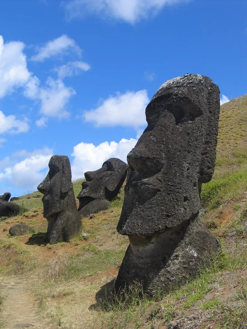
    In the quarry on the slopes of this volcano, almost all the island's Moai were carved from tuff. Around 400 figures stand here in all stages of production, half in the hillside, half upright. Access is only allowed with an accredited local guide, and the park ticket is valid for a single entry here.
    Open in Google Maps
    Ahu Tongariki

    “Ahu Tongariki” by Rivi / Wikimedia Commons / CC BY-SA 3.0, mod.

    Historic Landmark

    Ahu Tongariki

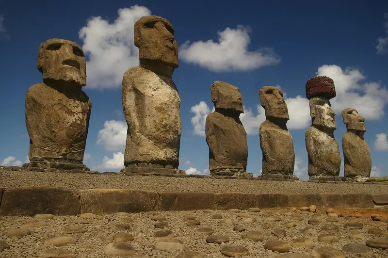
    The ceremonial platform on the east coast, below Rano Raraku, features 15 upright Moai with their backs to the sea. The tsunami following the May 1960 Valdivia earthquake destroyed the site; from 1992, it was reconstructed under the direction of archaeologists Claudio Cristino and Patricia Vargas, and the Moai were re-erected in 1994 and 1995. The platform is aligned with the sunrise on the summer solstice, around December 21st.
    Open in Google Maps
    Orongo

    “Orongohaeuser” by American at German Wikipedia / Wikimedia Commons / CC BY-SA 3.0, mod.

    Historic Landmark

    Orongo

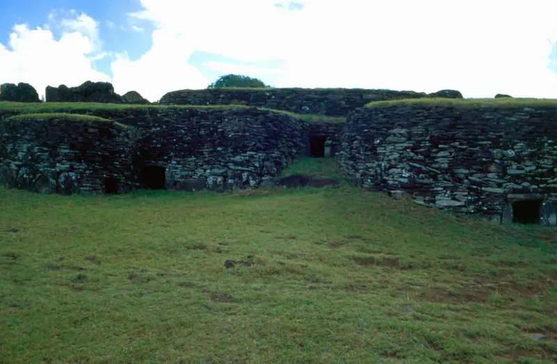
    The ceremonial village on the crater rim of Rano Kau, according to UNESCO, consists of 54 semi-subterranean stone houses (other sources count 53). Rock carvings recall the Birdman cult, which existed until the mid-19th century. As at Rano Raraku, you need an accredited local guide; the park ticket is valid here for a single entry.
    Open in Google Maps
    Rano Kau

    Photo by Franz Nawrath on Unsplash

    Natural Feature

    Rano Kau

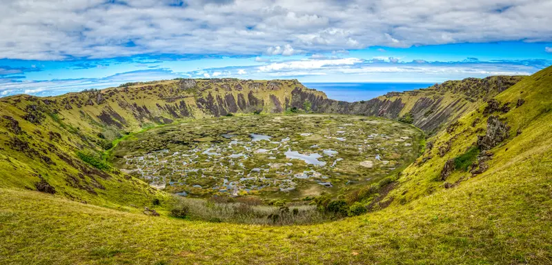
    The volcano on the southwest tip of the island holds a crater of approximately 1.6 kilometers in diameter with freshwater lagoons. From the crater rim, you look out onto the lake and the open Pacific; the ceremonial village of Orongo lies on the rim.
    Open in Google Maps
    Beach

    Anakena

    The white sandy beach with its palm grove is located on the north coast, about 18 kilometers from Hanga Roa. Above the beach stands Ahu Nau Nau with finely carved Moai. Here you can combine sightseeing with a beach day.
    Open in Google Maps
    Attraction

    Ahu Tahai

    The ceremonial complex is a few minutes' walk from Hanga Roa town center, directly by the sea. Due to its west coast location, it's considered the best spot for sunset behind the Moai.
    Open in Google Maps

    Culture and Fests

    Polynesian Island Under Chilean FlagThe Rapa Nui are a Polynesian people. Most Moai were carved from Rano Raraku tuff; UNESCO reports around 900 Moai and over 300 ceremonial platforms on the island. The indigenous community Ma'u Henua manages the National Park today.Birdman Cult and MuseumAfter the Moai period, the Birdman cult around the ceremonial village of Orongo defined religious life, ending mid-19th century. The Sebastián Englert Anthropological Museum in Hanga Roa showcases island history finds, including the coral Moai eye found in 1978 during Ahu Nau Nau's restoration; Fodor's notes a replica is exhibited there today.Tapati Rapa NuiThe Tapati is the year's largest cultural festival, featuring competitions like Haka Ngaru, wave surfing on reed bundles, and a triathlon at Rano Raraku. Its 59th edition, per Imagina Rapa Nui, is scheduled for January 30 to February 12, 2027; the official program is still pending.

    Getting there & around

    Flight and Entry FormScheduled flights are only available from Santiago to Mataveri (IPC) Airport in Hanga Roa, daily with LATAM according to aeropuertosdelmundo (as of November 2026); the flight time is approximately five and a half hours. The connection to Papeete is currently suspended.Before departure, you must complete the free online Formulario Único de Ingreso (FUI); the PDI police will check it at the departure airport; no FUI, no boarding.According to Law 21.070, applied since August 1, 2018, visitors may stay for a maximum of 30 days. Required are a non-transferable return flight ticket within these 30 days and a booking in Sernatur-approved accommodation or an invitation with a folio number from the Gobernación.Park Ticket and GuidesFor the National Park sites, you need the personal park ticket from the indigenous community Ma'u Henua. It is valid for ten consecutive days, and you may only enter Rano Raraku and Orongo once with it. According to an announcement from May 2025, since October 1, 2025, it costs 100 US dollars for foreign adults and 40 US dollars for children; other sources quote 95,000 CLP. Check the price on the official National Park website before your trip.The ticket is sold online via the National Park website and at the Ma'u Henua office in Hanga Roa.Since the reopening in August 2022, you may only visit the sites with an accredited local guide or a host from the Rapa Nui community. Exceptions are Ahu Tahai and Anakena Beach (Hanga Rau), but not the Ahu Nau Nau sector.The park is open daily from 9 AM to 6 PM; specific times apply for sunrise at Tongariki and sunset at Tahai.Travel TimeThe island can be visited year-round. According to the climatic normal values of the Chilean Meteorological Service, the least rain falls from November to February, and the most from April to July.

    Nearby

    Floreana

    Floreana

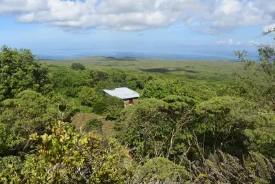
    Before you travel, check the current UK FCDO travel advice, linked on the country page, which reports flooding on Santa Cruz and an emergency declared on 31 October 2026, and the national park's notices on closed visitor sites.Floreana lies in the south of the archipelago, around 50 kilometres south of Santa Cruz, and is one of the four inhabited islands of Galápagos. Most of its roughly 100 residents live in Puerto Velasco Ibarra on the west coast. The island is known for the post barrel at Post Office Bay and for the settler stories of the 1930s.

    Andrew Katsis·CC BY 4.0

    Isabela and Puerto Villamil

    Isabela and Puerto Villamil

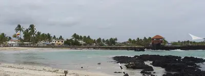
    Isabela, at approximately 4,586 square kilometers, is Galápagos' largest island, bigger than all others combined. Its small main town, Puerto Villamil, is about a two-hour boat ride from Santa Cruz. From here, hike to Sierra Negra volcano's caldera, snorkel in Concha de Perla mangrove bay, or spot flamingos in the Humedales lagoons.

    David C. S.·CC BY-SA 4.0

    Galápagos Islands

    Galápagos Islands

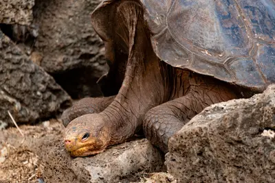
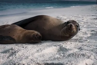
    UK FCDO travel advice (updated 1 November 2026): heavy rain caused flooding on Santa Cruz Island, and an emergency was declared on 31 October 2026, with road closures, power cuts and disruption to journeys to Baltra airport. Avoid flooded areas, confirm travel arrangements with your airline or tour operator and check the current FCDO travel advice, linked on the country page.The Galápagos Islands lie around 1,000 kilometres off the coast of Ecuador in the Pacific; giant tortoises, marine iguanas, sea lions and boobies can be watched here at close range. The archipelago comprises 127 islands, islets and rocks, only four of which are inhabited; around 97 per cent of the land area has been a national park since 1959.In 1978 Galápagos was among the first sites on the UNESCO World Heritage List; the surrounding marine reserve was created in 1986 and enlarged in 1998 to around 133,000 square kilometres. Charles Darwin visited the islands in 1835. Most travellers land on Baltra near Santa Cruz or on San Cristóbal and explore the islands by cruise ship or from the towns of Puerto Ayora, Puerto Baquerizo Moreno and Puerto Villamil.
    Lloyd Douglas·Pexels

    Santa Cruz and Puerto Ayora

    Santa Cruz and Puerto Ayora

    UK FCDO travel advice (updated 1 November 2026): heavy rain caused flooding on Santa Cruz Island and an emergency was declared on 31 October 2026, with road closures, power cuts and disruption to journeys to Baltra airport. Avoid flooded areas, confirm arrangements with your airline or tour operator and check the current FCDO travel advice, linked on the country page.Santa Cruz is the most populous island in Galápagos and, with the nearby airport on Baltra, the archipelago's main hub. The harbour town of Puerto Ayora is home to the Charles Darwin Research Station and the start of the trail to Tortuga Bay; giant tortoises roam free in the highlands.

    Diego F. Parra·Pexels

    San Cristóbal and Puerto Baquerizo Moreno

    San Cristóbal and Puerto Baquerizo Moreno

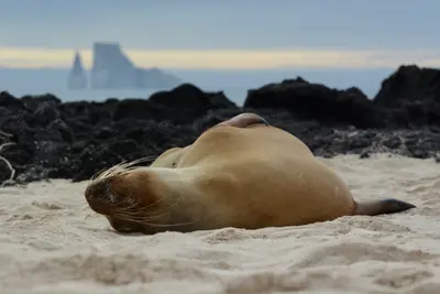
    San Cristóbal is the fifth-largest Galápagos island, covering 558 square kilometers. Its main town, Puerto Baquerizo Moreno, is the provincial capital and has its own airport. From here, you can reach the Interpretation Center, Cerro Tijeretas with snorkeling cove, and the La Lobería sea lion colony on foot; by boat, you can visit León Dormido rock.

    Caroline Ebinger·Unsplash

    Your next steps

    Rapa Nui (Easter Island) is in Chile. Ways to carry on from here.

    • More in Chile

      Highlights, areas, routes and the best time to travel for all of Chile.

      Chile travel guide
    • Round trips in Chile

      Ready-made routes through Chile, with stops, nights and a map.

      See the routes
    • Plan a trip with Rapa Nui (Easter Island)

      The Guide asks about season, length and who is coming, and suggests a trip with Rapa Nui (Easter Island).

      Plan the trip

    Sources & method

    • Photos: Wikimedia Commons, Unsplash. Each photo carries its credit.
    • Place data such as addresses and ratings comes from Google Maps.
    • The content is based on web research from public, traceable sources. How the content is made · The role of AI