Fernweh: Home
ExploreGuideDestinationsMy tripsMy trip
de|en
All Places & RegionsRound tripsNight trains in EuropeAll highlightsAbout FernwehFAQPrivacy PolicyImprint
Download on the App StoreGet it on Google Play
ExploreGuideDestinationsMy tripsMy trip
    • Neighborhoods & highlights
    • Recommendations
    • Eat & drink
    • Getting around
    • Accommodation
    • Plan trip
    • Nearby
    Hanga Roa

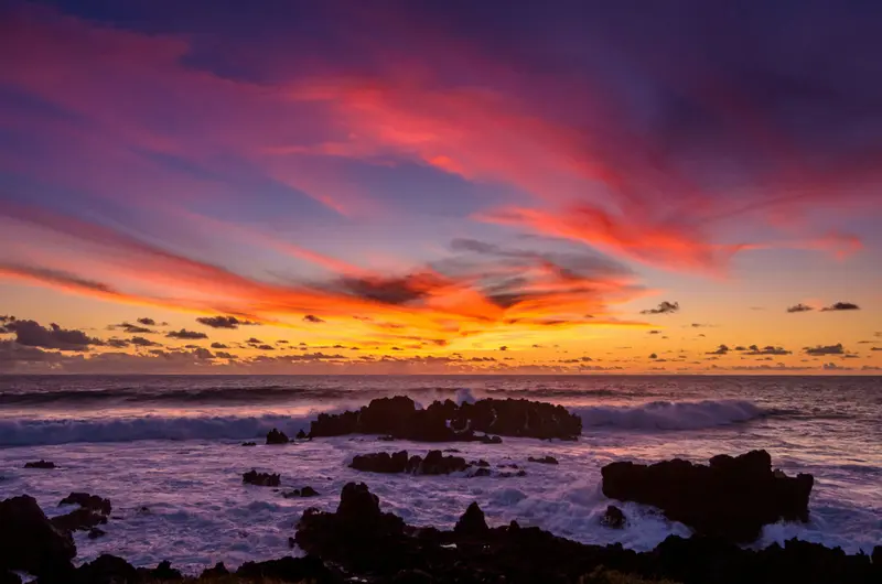
    Photo by Franz Nawrath on Unsplash

    Chile

    Hanga Roa

    CityCulture

    Hanga Roa on the west coast is Easter Island's only settlement. It is home to Mataveri Airport, the small port of Hanga Piko, the Ma'u Henua National Park office, accommodations, and restaurants.

    by Felix Gillen

    1. Home
    2. Destinations
    3. Chile
    4. Rapa Nui (Easter Island)
    5. Hanga Roa
    Hanga Roa on the west coast is Easter Island's only settlement. It is home to Mataveri Airport, the small port of Hanga Piko, the Ma'u Henua National Park office, accommodations, and restaurants.On the northern edge of town, directly by the sea, stands the ceremonial complex Ahu Tahai, the official sunset viewing spot and one of two sites you can visit without a guide. Around 300 m away, the Sebastián Englert Anthropological Museum displays artifacts on the island's history.
    Chile travel guideRound trips in ChilePlan a trip with Hanga Roa

    Contents

    • Neighborhoods & highlights
    • Recommendations
    • Eat & drink
    • Getting around
    • Accommodation
    • Nearby

    Sights in Hanga Roa

    Discover the most important sights and attractions

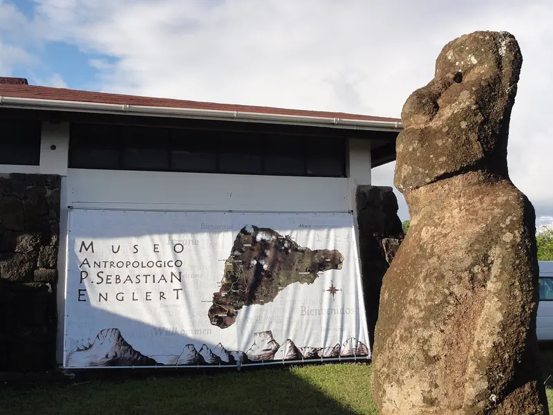
    Anthropological Museum Padre Sebastián Englert

    “Museo Sebastian Englert” by Uncommon fritillary / Wikimedia Commons / CC BY-SA 3.0, mod.

    1Anthropological Museum Padre Sebastián Englert

    The Anthropological Museum is about 300 m from Ahu Tahai and displays findings on the island's history and culture, including a coral Moai eye found in 1978 during the restoration of Ahu Nau Nau. According to Imagina Rapa Nui (as of 2021), admission was free; check opening hours and status before visiting.

    Open in Google Maps

    Restaurants in Hanga Roa

    1

    Te Moana

    Seaside restaurant with fish, seafood, and ceviche, offering a cultural show (per easterisland.travel, dicaschile). Book in high season.
    Show on Google Maps
    2

    Haka Honu

    Beachside spot on Pea with fish, burgers, and cocktails, according to dicaschile a popular sunset spot.
    Show on Google Maps

    On the Road

    Around TownExplore Hanga Roa on foot: From Hanga Piko port to Ahu Tahai on the northern edge, everything is close by. You can get your park ticket online or at the Ma'u Henua office in town.Dining OutAccording to easterisland.travel, a main course with a drink costs approximately 12,000 to 20,000 CLP; during high season, you should make a reservation.

    Accommodations in Hanga Roa

    Find perfect stay in Hanga Roa

    Booking.com* (Affiliate link)
    Search Hotels
    Agoda* (Affiliate link)
    Search Hotels
    Airbnb
    Vacation Rentals

    * Affiliate link: if you book through it, we earn a small commission. The price stays the same for you.

    Plan your trip to Hanga Roa

    Save places, build a route and plan your city trip, all in one place.

    1. 1
      Sunrise over alpine peaks and a sea of clouds
      1234

      Round trip

      12 days · 4 stops

      Saved

      Pick a route

      Pick a ready-made one or save places and plan your own.

      Open bookmarks
    2. 2

      Trip to Hanga Roa

      Live
      • 1Anthropological Museum Padre Sebastián Englert3 days
      Budget

      Plan your trip

      The planner sorts stops, days and budget. Plan together in real time.

      Start trip planning
    3. 3
      9:41 No signal
      Hanga Roa
      Available offline

      Photo by Franz Nawrath on Unsplash

      Use it on the road

      Download the guide to your phone and use it on site, even offline.

    Nearby

    Rapa Nui (Easter Island)

    Rapa Nui (Easter Island)

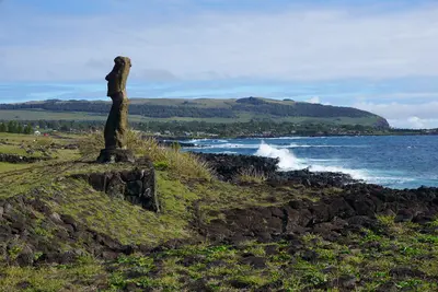
    Easter Island, known to its inhabitants as Rapa Nui, lies, according to UNESCO, about 3,700 kilometers west of the Chilean mainland in the Pacific; currently, scheduled flights are only available from Santiago. You come here for the Moai: A Polynesian culture, isolated for centuries, created some 900 stone figures and over 300 ceremonial platforms (Ahu). Rapa Nui National Park has been a UNESCO World Heritage site since 1995.The only settlement is Hanga Roa on the west coast, home to the airport, port, and museum. From there, you can reach the Moai quarries at Rano Raraku, the 15 figures of Ahu Tongariki, the ceremonial village of Orongo on the crater rim of Rano Kau, and Anakena's palm-fringed beach.

    kallerna·CC BY-SA 4.0

    Isabela and Puerto Villamil

    Isabela and Puerto Villamil

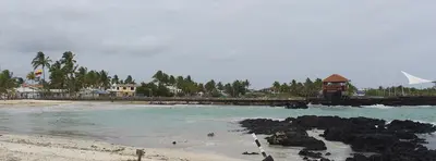
    Isabela, at approximately 4,586 square kilometers, is Galápagos' largest island, bigger than all others combined. Its small main town, Puerto Villamil, is about a two-hour boat ride from Santa Cruz. From here, hike to Sierra Negra volcano's caldera, snorkel in Concha de Perla mangrove bay, or spot flamingos in the Humedales lagoons.

    David C. S.·CC BY-SA 4.0

    Floreana

    Floreana

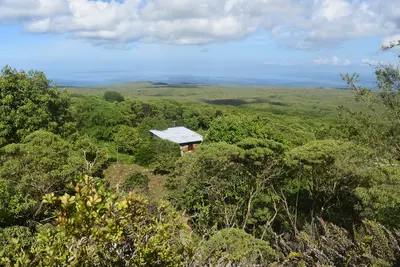
    Before you travel, check the current UK FCDO travel advice, linked on the country page, which reports flooding on Santa Cruz and an emergency declared on 31 October 2026, and the national park's notices on closed visitor sites.Floreana lies in the south of the archipelago, around 50 kilometres south of Santa Cruz, and is one of the four inhabited islands of Galápagos. Most of its roughly 100 residents live in Puerto Velasco Ibarra on the west coast. The island is known for the post barrel at Post Office Bay and for the settler stories of the 1930s.

    Andrew Katsis·CC BY 4.0

    Galápagos Islands

    Galápagos Islands

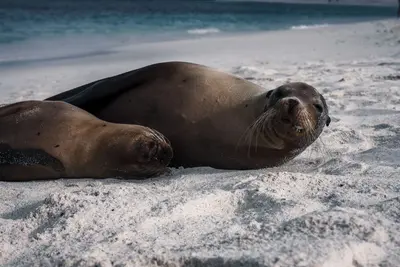
    UK FCDO travel advice (updated 1 November 2026): heavy rain caused flooding on Santa Cruz Island, and an emergency was declared on 31 October 2026, with road closures, power cuts and disruption to journeys to Baltra airport. Avoid flooded areas, confirm travel arrangements with your airline or tour operator and check the current FCDO travel advice, linked on the country page.The Galápagos Islands lie around 1,000 kilometres off the coast of Ecuador in the Pacific; giant tortoises, marine iguanas, sea lions and boobies can be watched here at close range. The archipelago comprises 127 islands, islets and rocks, only four of which are inhabited; around 97 per cent of the land area has been a national park since 1959.In 1978 Galápagos was among the first sites on the UNESCO World Heritage List; the surrounding marine reserve was created in 1986 and enlarged in 1998 to around 133,000 square kilometres. Charles Darwin visited the islands in 1835. Most travellers land on Baltra near Santa Cruz or on San Cristóbal and explore the islands by cruise ship or from the towns of Puerto Ayora, Puerto Baquerizo Moreno and Puerto Villamil.

    Lloyd Douglas·Pexels

    Santa Cruz and Puerto Ayora

    Santa Cruz and Puerto Ayora

    UK FCDO travel advice (updated 1 November 2026): heavy rain caused flooding on Santa Cruz Island and an emergency was declared on 31 October 2026, with road closures, power cuts and disruption to journeys to Baltra airport. Avoid flooded areas, confirm arrangements with your airline or tour operator and check the current FCDO travel advice, linked on the country page.Santa Cruz is the most populous island in Galápagos and, with the nearby airport on Baltra, the archipelago's main hub. The harbour town of Puerto Ayora is home to the Charles Darwin Research Station and the start of the trail to Tortuga Bay; giant tortoises roam free in the highlands.

    Diego F. Parra·Pexels

    Your next steps

    Hanga Roa is in Chile. Ways to carry on from here.

    • More in Chile

      Highlights, areas, routes and the best time to travel for all of Chile.

      Chile travel guide
    • Round trips in Chile

      Ready-made routes through Chile, with stops, nights and a map.

      See the routes

    Sources & method

    • Photos: Wikimedia Commons, Unsplash. Each photo carries its credit.
    • Place data such as addresses and ratings comes from Google Maps.
    • The content is based on web research from public, traceable sources. How the content is made · The role of AI