Fernweh: Home
ExploreGuideDestinationsMy tripsMy trip
de|en
All Places & RegionsRound tripsNight trains in EuropeAll highlightsAbout FernwehFAQPrivacy PolicyImprint
Download on the App StoreGet it on Google Play
ExploreGuideDestinationsMy tripsMy trip
    • Places in the region
    • Culture
    • Getting around
    • Round trips
    • Nearby
    West Coast

    Photo by Kristy An on Unsplash

    La Réunion

    West Coast

    Region

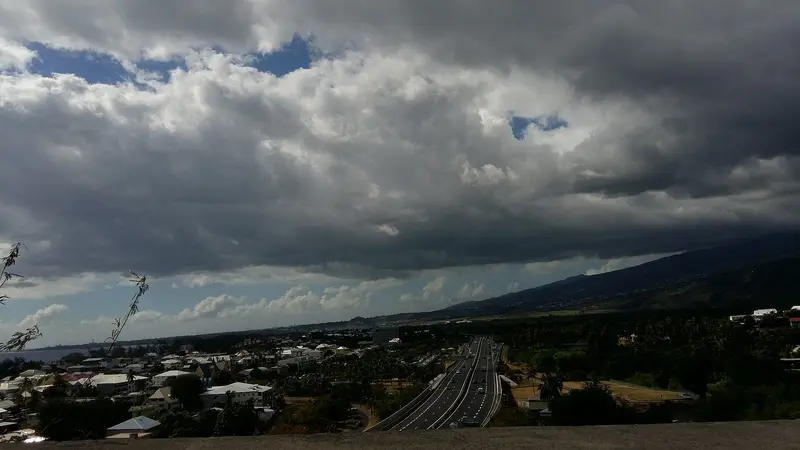
    The west coast is the dry, leeward side of La Réunion and stretches from Saint-Paul via Saint-Gilles-les-Bains to Saint-Leu. Saint-Gilles is located approximately 40 kilometers south of Saint-Denis.

    by Felix Gillen

    1. Home
    2. Destinations
    3. La Réunion
    4. West Coast
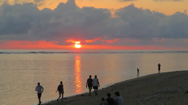
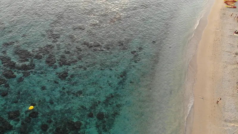
    The west coast is the dry, leeward side of La Réunion and stretches from Saint-Paul via Saint-Gilles-les-Bains to Saint-Leu. Saint-Gilles is located approximately 40 kilometers south of Saint-Denis. Here lie the island's lagoons, protected by a coral reef, which has been part of the Réserve naturelle marine since 2007.This region is the island's bathing center. You can snorkel in the L'Hermitage lagoon, observe humpback whales off Boucan Canot from June to October, and visit the Kélonia turtle center in Saint-Leu. In the hills, the Musée de Villèle and Stella Matutina tell the story of plantation economy, slavery, and sugar.
    La Réunion travel guideSee the round tripPlan a trip with West Coast

    Contents

    • Places in the region
    • Culture
    • Getting around
    • Round trips
    • Nearby
    L'Étang-Salé

    EmilieRaspail / Wikimedia Commons / CC BY-SA 4.0, mod.

    Place 1 of 4

    L'Étang-Salé

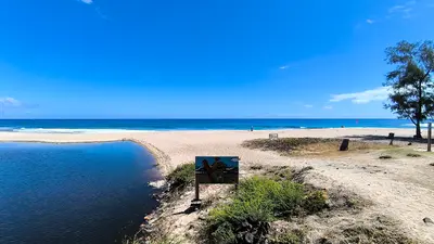
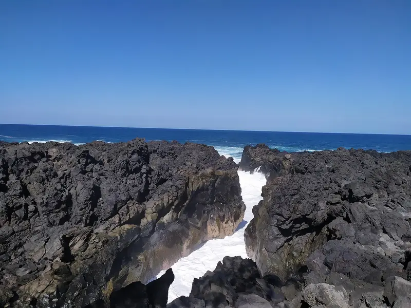
    L'Étang-Salé is a coastal community in the southwest of La Réunion, between Les Avirons and Saint-Louis. You come here for the black sand beach of L'Étang-Salé-les-Bains, the shady coastal forest, and the Gouffre, where the surf crashes into a rocky channel.

    Discover
    La Saline-les-Bains and Trois-Bassins

    BBCLCD / Wikimedia Commons / CC BY-SA 4.0, mod.

    Place 2 of 4

    La Saline-les-Bains and Trois-Bassins

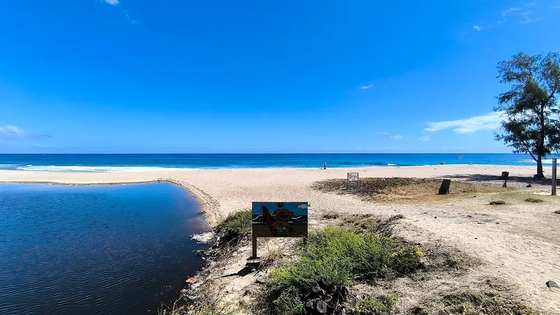
    La Saline-les-Bains is a seaside resort on the west coast, south of Saint-Gilles-les-Bains, and belongs to the municipality of Saint-Paul.

    Discover
    Saint-Leu

    Photo by Nicolas Lesueur on Pexels

    Place 3 of 4

    Saint-Leu

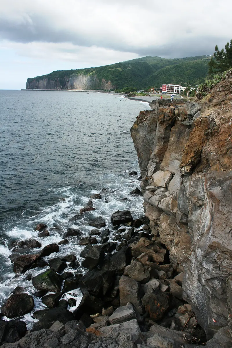
    Saint-Leu is a coastal town on the west coast, about 22 kilometers south of Saint-Gilles-les-Bains, with a main street and a waterfront promenade featuring filao trees and volcanic rock.

    Discover
    La Possession and Dos d'Âne

    Thierry Caro / Wikimedia Commons / CC BY-SA 4.0, mod.

    Place 4 of 4

    La Possession and Dos d'Âne

    La Possession is a commune located between Saint-Denis and Le Port, encompassing a large part of the Mafate cirque.

    Discover

    More places in West Coast

    Saint-Gilles-les-Bains and L'Hermitage

    Clémenceau Lauret·CC BY-SA 4.0

    Saint-Gilles-les-Bains and L'Hermitage

    Saint-Gilles-les-Bains is the best-known seaside resort on the west coast, approximately 40 kilometres south of Saint-Denis, situated between Boucan Canot beach and L'Hermitage lagoon. This former fishing village belongs to the municipality of Saint-Paul.Around the marina, dive schools have been established, and the Aquarium de La Réunion showcases fish from the Mascarene Islands. You can walk to L'Hermitage lagoon, and along the sand, you reach La Saline. Above the village, in Saint-Gilles-les-Hauts, lies the Musée de Villèle.
    Saint-Paul

    LeikTech·CC BY-SA 4.0

    Saint-Paul

    Saint-Paul is the main town of the eponymous commune on the west coast of La Réunion, a few kilometers north of the beaches of Saint-Gilles. You come here because this bay was where the island's settlement began; the town was the island's capital until Saint-Denis took over this role in 1738.With 106,220 inhabitants (2022), Saint-Paul is one of the island's largest communes. It includes seaside resorts such as Saint-Gilles-les-Bains and La Saline-les-Bains, as well as part of the Mafate cirque. Between the old town and the sea lies the Étang de Saint-Paul, a protected wetland; on the outskirts, the Grotte des Premiers Français commemorates the first settlers. On Fridays and Saturdays, the Marché forain takes place along the waterfront.

    Sights in West Coast

    Discover the most important sights and attractions

    Market

    Saint-Paul Outdoor Market

    Weekly market on the Esplanade along the Boulevard du Front de Mer in Saint-Paul: Fridays from 6 AM to 5:30 PM, Saturdays from 6 AM to 12 PM. On offer are tropical fruit, chillis, vanilla, honey, and handicrafts; at the stalls you'll find Samoussas and Bouchons. Come early for the best selection.
    Open in Google Maps
    Point of Interest

    Marine Cemetery of Saint-Paul

    The Seaside Cemetery, established in 1788, has been a protected monument since 2012. Here lies the poet Leconte de Lisle; a symbolic grave with a skull and crossbones commemorates the pirate La Buse, executed in 1730. Open daily from 6 AM to 6 PM, admission free; best visited in the late afternoon, plan 30 to 60 minutes.
    Open in Google Maps

    Culture and History

    Cradle of SettlementThe first French settlers came ashore in Saint-Paul Bay, a fact commemorated by the Grotte des Premiers Français. Until 1738, Saint-Paul was the island's main town. Today, with 106,220 inhabitants (2022), it is the department's second-largest and largest municipality by area.Plantations and SlaveryThe Musée de Villèle in Saint-Gilles-les-Hauts is housed in the former residence of the Panon-Desbassayns family, completed in 1788, and covers colonial history, including slavery. The poet Leconte de Lisle is buried in Saint-Paul's Cimetière marin.Protected LagoonsThe Réserve naturelle marine de La Réunion was established in 2007, encompassing 3,500 hectares along 40 kilometres of coastline between Saint-Paul and L'Étang-Salé. Among other things, it is forbidden to disturb or catch animals, or to take shells, coral fragments, or sand. In five protection zones, two of which are near L'Hermitage, any human presence is prohibited.

    Arrival and Getting Around

    From the AirportSaint-Gilles-les-Bains is about 40 kilometres from Roland Garros Airport. Outside rush hours the drive via the RN1 takes roughly 40 to 60 minutes; in the morning and late afternoon it takes considerably longer because traffic backs up on the coastal road from Saint-Denis. The Car Jaune line T connects Roland Garros Airport via the west coast to Saint-Pierre, with stops including Boucan Canot, Saint-Gilles-les-Bains and Saint-Leu. Current timetables are available at carjaune.re.By CarThe Route des Tamarins expressway runs above the coast from Saint-Paul to L'Étang-Salé. Saint-Gilles gets busy in high season; expect traffic jams and limited parking. From Saint-Gilles to Saint-Leu is about 22 kilometres.SwimmingSwim only in the lagoon and in designated, supervised zones, and pay attention to beach flags. A prefectural order bans swimming and wave sports within 300 metres of the coast outside these zones. In Boucan Canot and at Plage des Roches Noires the swimming zone lies behind shark nets and is supervised by lifeguards. For current safety advice, see the UK FCDO travel advice.

    Round trips through this region

    La Réunion in 12 Days: Lagoon, Cirques and Volcano

    La Réunion in 12 Days: Lagoon, Cirques and Volcano

    This clockwise tour takes you around the island and into two of its three cirques. It begins with beach days on the west coast and the view from Maïdo to Mafate, ascends via the RN5 to Cilaos, connects Saint-Pierre with Piton de la Fournaise and the wild south, and ends after the east coast in Hell-Bourg in the Cirque de Salazie.

    12 Days
    5 stops

    Clémenceau Lauret·CC BY-SA 4.0

    Nearby

    Îlets of Mafate: La Nouvelle, Marla, Roche Plate, Aurère

    Îlets of Mafate: La Nouvelle, Marla, Roche Plate, Aurère

    La Nouvelle, Marla, Roche Plate, Aurère, and Îlet à Malheur are hamlets in the Cirque de Mafate, accessible only on foot. You stay overnight here in gîtes when you traverse the cirque on a multi-day tour; La Nouvelle is the largest îlet and is located two to three hours' walk from the Col des Bœufs.Mafate was settled by escaped slaves. Îlet à Malheur is named after a 1829 raid in which approximately forty refugees were killed. Aurère was almost abandoned in the 1960s due to water scarcity; only the Canalisation Augustave, a 5 km long water pipeline built in 1977, restored supply.

    Louis Paulin·Unsplash

    Cirque de Mafate

    Cirque de Mafate

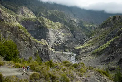
    The Cirque de Mafate is the westernmost of the three cirques in the island's interior and is only accessible on foot or by helicopter; there is no road. You come here to hike between remote hamlets, known as Îlets, where a few hundred people live and where you can stay in gîtes.The cirque is about 14 km long and 7 km wide, ranging from around 250 m at Deux-Bras up to 3,019 m at Gros Morne. It lies within the inhabited core of the National Park, founded in 2007, and is part of the UNESCO World Heritage site. Most Îlets have a school, a shop, and several gîtes; they are supplied by helicopter. You get the best view from above from Maïdo.

    Louis Paulin·Unsplash

    Cirque de Cilaos

    Cirque de Cilaos

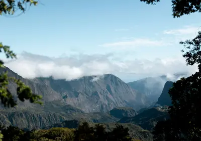
    The Cirque de Cilaos is the southernmost of the three cirques in the island's interior, enclosed by the steep walls of the Piton des Neiges. You go there for the mountain road with over 400 bends, for the ascent to Piton des Neiges, the island's highest point, and for a mountain village with thermal springs, lentil fields, and its own embroidery tradition.The village of Cilaos lies at around 1,200 m altitude. From here, you can reach the hamlets of Bras-Sec and Îlet à Cordes, the small lake Mare à Joncs, and hiking trails leading into the neighboring cirque of Mafate. Wine is grown on the steep slopes. The cirque is part of the UNESCO World Heritage site „Pitons, cirques et remparts“.

    Patrick Portes·CC BY-SA 4.0

    Cilaos

    Cilaos

    Cilaos is the main town of the caldera of the same name in the south of the island, situated at an altitude of approximately 1,200 m. It serves as a starting point for hikes and canyoning in the Cirque and for the ascent to Piton des Neiges; access is via the Route de Cilaos, known as the "Road of 400 Curves". In 2023, the municipality had about 5,040 inhabitants.The name derives from the Malagasy Tsilaosa, meaning "the place one does not leave". The first documented settlement and a thermal spa were established around 1850, and Cilaos has been an independent municipality since 1965. On January 7th and 8th, 1966, 1,825 mm of rain fell here in 24 hours, a world record. Today, the main street is partly a pedestrian zone, and a market is held on Sunday mornings.
    Patrick Portes·CC BY-SA 4.0

    Grand Îlet

    Grand Îlet is a mountain village at approximately 1,100 m altitude in the west of the Cirque de Salazie. You come here because above the village lies the Col des Bœufs, the easiest access to the Cirque de Mafate; the village bears the 'Village Créole' label.Grand Îlet includes the hamlets of Le Bélier and Mare à Martin. The village is particularly cyclone-prone: During Cyclone Gamede, 3,240 mm of rain fell here in three days. The main attraction is the wooden church of Saint-Martin.

    Your next steps

    West Coast is in La Réunion. Ways to carry on from here.

    • More in La Réunion

      Highlights, areas, routes and the best time to travel for all of La Réunion.

      La Réunion travel guide
    • Round trips with West Coast

      One route passes through West Coast, with stops, nights and a map.

      See the round trip
    • Plan a trip with West Coast

      The Guide asks about season, length and who is coming, and suggests a trip with West Coast.

      Plan the trip

    Sources & method

    • Photos: Unsplash. Each photo carries its credit.
    • Place data such as addresses and ratings comes from Google Maps.
    • The content is based on web research from public, traceable sources. How the content is made · The role of AI