Fernweh: Home
ExploreGuideDestinationsMy tripsMy trip
de|en
All Places & RegionsRound tripsNight trains in EuropeAll highlightsAbout FernwehFAQPrivacy PolicyImprint
Download on the App StoreGet it on Google Play
ExploreGuideDestinationsMy tripsMy trip
    • Places in the region
    • Culture
    • Getting around
    • Round trips
    • Nearby
    Lake Manyara National Park

    Photo by Kilinge Adventures on Pexels

    Tanzania

    Lake Manyara National Park

    Region

    Lake Manyara National Park is two hours west of Arusha, at the Rift Valley escarpment's base. Much of the park is the lake itself, its shores lined with evergreen groundwater forests of fig and mahogany.

    by Felix Gillen

    1. Home
    2. Destinations
    3. Tanzania
    4. Lake Manyara National Park
    Lake Manyara National Park is two hours west of Arusha, at the Rift Valley escarpment's base. Much of the park is the lake itself, its shores lined with evergreen groundwater forests of fig and mahogany. It's a good stop en route to Ngorongoro Crater.
    Tanzania travel guideSee the round tripPlan a trip with Lake Manyara National Park

    Contents

    • Places in the region
    • Culture
    • Getting around
    • Round trips
    • Nearby

    Sights in Lake Manyara National Park

    Discover the most important sights and attractions

    Attraction

    Treetop Walkway

    A suspension bridge path leads approx. 370 m through the groundwater forest's treetops, about 18 m above ground at its highest point. Make sure to check if the path is currently open before your visit.
    Open in Google Maps

    Mto wa Mbu

    The lively place before the park entrance is the usual stopover on the way from Arusha to Lake Manyara and further to Karatu and Ngorongoro.
    Open in Google Maps

    Nature and Wildlife

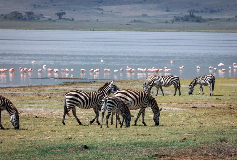
    Groundwater ForestThe park features an evergreen groundwater forest with figs and mahogany, where pelicans and storks breed.Lake and ShoresA large portion of the park's area is the lake itself. At the north end, there is a hippo pond, and hot springs are found on the west shore.Tree-Climbing LionsThe lions here that climb trees are considered a park attraction; however, sightings are not guaranteed.

    Arrival

    From ArushaAround 120 km, about a 2-hour drive. The lively town of Mto wa Mbu lies just before the gate.Onward JourneyFrom Mto wa Mbu, it's about 35 km and roughly an hour to Karatu, from there, 15 km to the Lodoare Gate of the Ngorongoro Conservation Area.ChargesThe rates of the national park authority TANAPA apply; verify the current fee before travel.

    Round trips through this region

    Safari in the North and Zanzibar

    Safari in the North and Zanzibar

    The classic combination: from Arusha via Tarangire and Lake Manyara to the Ngorongoro Crater and into the Serengeti, followed by a flight to Zanzibar, including Stone Town and the East Coast. Safari driving times per leg are two to four hours, the onward journey to Zanzibar is by domestic flight.

    14 Days
    7 stops
    Open jaw

    Blue Ox Studio·Pexels

    Nearby

    Tarangire National Park

    Tarangire National Park

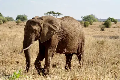
    Tarangire National Park, located approximately 118 km southwest of Arusha, is renowned for its large elephant herds and mighty baobab trees. Covering around 2,850 km², the Tarangire River shapes the landscape: During the dry season, it is the most important water source, and animals gather on its banks and in the swamps. The park is usually the first stop on a northern safari.

    Brett Bennett·Pexels

    Ngorongoro Conservation Area

    Ngorongoro Conservation Area

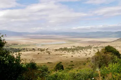
    The Ngorongoro Conservation Area, located between Lake Manyara and Serengeti, is famous for the Ngorongoro Crater: a collapse caldera approximately 20 km wide and about 600 m deep, home to abundant wildlife on its floor. The conservation area spans over 8,000 km², including the Olduvai Gorge, other craters, and Maasai grazing lands. It has been a UNESCO World Heritage site since 1979, and since 2010 also recognized for its cultural significance.

    Dirk Pothen·Pexels

    Arusha

    Arusha

    Arusha, nestled at around 1,400 m at the foot of Mount Meru, is the gateway to safaris in northern Tanzania. From here, safaris depart for Tarangire, Lake Manyara, Ngorongoro, and the Serengeti. Before you set off, explore the Central Market, small museums detailing the city's history, and take a day trip to the nearby Arusha National Park.

    Blue Ox Studio·Pexels

    Kilimanjaro National Park

    Kilimanjaro National Park

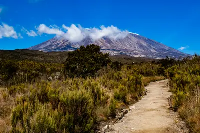
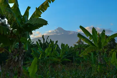
    Kilimanjaro in northeastern Tanzania, with Uhuru Peak (5,895 m), is Africa’s highest mountain and a UNESCO World Heritage site since 1987. The massif consists of the peaks Kibo, Mawenzi, and Shira. Several routes, taking five to nine days, lead through rainforest, moorland, and high desert to the glaciated summit; Moshi is usually the starting point.

    Crispin Jones·Unsplash

    Serengeti National Park

    Serengeti National Park

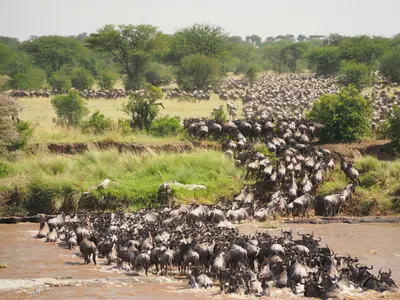
    The Serengeti National Park in northern Tanzania, spanning 14,763 km², is one of the world's most famous protected areas and has been a UNESCO World Heritage site since 1981. Here, every year, the Great Migration of well over a million wildebeest, accompanied by zebras and gazelles, moves in a circular path through the savanna. The central Seronera Valley is known for big cats, the Southern Serengeti for the calving season, and the north for the Mara River crossings.

    Jorge Tung·Unsplash

    Your next steps

    Lake Manyara National Park is in Tanzania. Ways to carry on from here.

    • More in Tanzania

      Highlights, areas, routes and the best time to travel for all of Tanzania.

      Tanzania travel guide
    • Round trips with Lake Manyara National Park

      One route passes through Lake Manyara National Park, with stops, nights and a map.

      See the round trip
    • Plan a trip with Lake Manyara National Park

      The Guide asks about season, length and who is coming, and suggests a trip with Lake Manyara National Park.

      Plan the trip
    Sources & method

    • Photos: Pexels. Each photo carries its credit.
    • Place data such as addresses and ratings comes from Google Maps.
    • The content is based on web research from public, traceable sources. How the content is made · The role of AI