Fernweh: Home
ExploreGuideDestinationsMy tripsMy trip
de|en
All Places & RegionsRound tripsNight trains in EuropeAll highlightsAbout FernwehFAQPrivacy PolicyImprint
Download on the App StoreGet it on Google Play
ExploreGuideDestinationsMy tripsMy trip
    • Places in the region
    • Culture
    • Getting around
    • Round trips
    • Nearby
    Tarangire National Park

    Photo by Brett Bennett on Pexels

    Tanzania

    Tarangire National Park

    Region

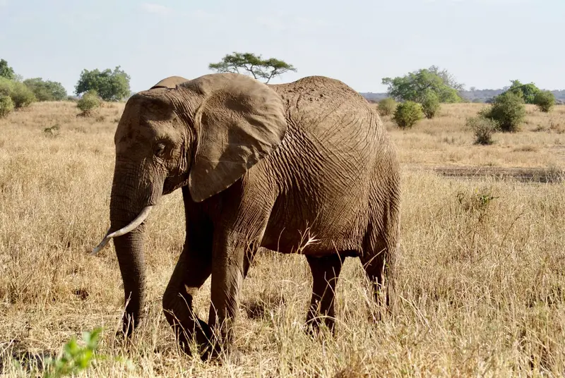
    Tarangire National Park, located approximately 118 km southwest of Arusha, is renowned for its large elephant herds and mighty baobab trees.

    by Felix Gillen

    1. Home
    2. Destinations
    3. Tanzania
    4. Tarangire National Park
    Tarangire National Park, located approximately 118 km southwest of Arusha, is renowned for its large elephant herds and mighty baobab trees. Covering around 2,850 km², the Tarangire River shapes the landscape: During the dry season, it is the most important water source, and animals gather on its banks and in the swamps. The park is usually the first stop on a northern safari.
    Tanzania travel guideSee the round tripPlan a trip with Tarangire National Park

    Contents

    • Places in the region
    • Culture
    • Getting around
    • Round trips
    • Nearby

    Sights in Tarangire National Park

    Discover the most important sights and attractions

    Point of Interest

    Silale Swamp

    One of the permanent swamps in Tarangire National Park, which retains water even during the dry season and therefore attracts many animals. A picnic area is located at its edge.
    Open in Google Maps

    Nature and Wildlife

    Elephants and BaobabsTarangire is known for large elephant herds. Baobabs store water in their trunks; their fruits and leaves are traditionally used.River and SwampsThe Tarangire River gives the park its name and flows north into Lake Burunge. During the dry season, it is the most important water source; permanent swamps like Silale also contribute.

    Getting Here and Best Time

    Getting ThereFrom Arusha, drive approx. 118 km southwest, on asphalt to within 7 km of the gate. The drive takes under 2 hours.Best Time to VisitYou'll see most animals in the dry season from June, when the herds gather at the river.FeesTANAPA National Park Authority rates apply per person per 24 hours; verify current rates before travel.

    Round trips through this region

    Safari in the North and Zanzibar

    Safari in the North and Zanzibar

    The classic combination: from Arusha via Tarangire and Lake Manyara to the Ngorongoro Crater and into the Serengeti, followed by a flight to Zanzibar, including Stone Town and the East Coast. Safari driving times per leg are two to four hours, the onward journey to Zanzibar is by domestic flight.

    14 Days
    7 stops
    Open jaw

    Blue Ox Studio·Pexels

    Nearby

    Lake Manyara National Park

    Lake Manyara National Park

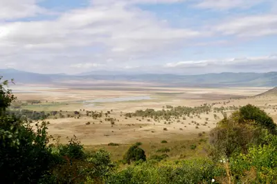
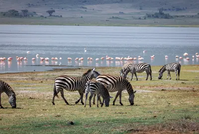
    Lake Manyara National Park is two hours west of Arusha, at the Rift Valley escarpment's base. Much of the park is the lake itself, its shores lined with evergreen groundwater forests of fig and mahogany. It's a good stop en route to Ngorongoro Crater.

    Kilinge Adventures·Pexels

    Ngorongoro Conservation Area

    Ngorongoro Conservation Area

    The Ngorongoro Conservation Area, located between Lake Manyara and Serengeti, is famous for the Ngorongoro Crater: a collapse caldera approximately 20 km wide and about 600 m deep, home to abundant wildlife on its floor. The conservation area spans over 8,000 km², including the Olduvai Gorge, other craters, and Maasai grazing lands. It has been a UNESCO World Heritage site since 1979, and since 2010 also recognized for its cultural significance.

    Dirk Pothen·Pexels

    Arusha

    Arusha

    Arusha, nestled at around 1,400 m at the foot of Mount Meru, is the gateway to safaris in northern Tanzania. From here, safaris depart for Tarangire, Lake Manyara, Ngorongoro, and the Serengeti. Before you set off, explore the Central Market, small museums detailing the city's history, and take a day trip to the nearby Arusha National Park.

    Blue Ox Studio·Pexels

    Kilimanjaro National Park

    Kilimanjaro National Park

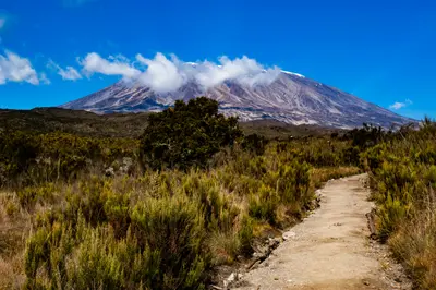
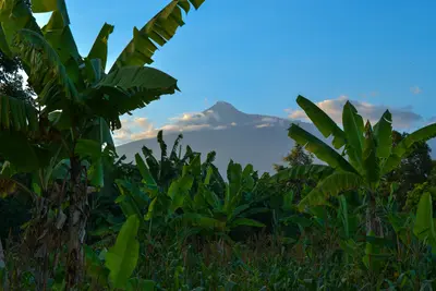
    Kilimanjaro in northeastern Tanzania, with Uhuru Peak (5,895 m), is Africa’s highest mountain and a UNESCO World Heritage site since 1987. The massif consists of the peaks Kibo, Mawenzi, and Shira. Several routes, taking five to nine days, lead through rainforest, moorland, and high desert to the glaciated summit; Moshi is usually the starting point.

    Crispin Jones·Unsplash

    Amboseli National Park

    Amboseli National Park

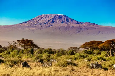
    Amboseli National Park, in southern Kenya bordering Tanzania, approx. 240 km southeast of Nairobi, overlooks Kilimanjaro across the border. Elephant herds against the peak, towering over the plains on clear days, define its iconic scene.Across 392 square kilometers, dry plains, the mostly dry Lake Amboseli, and green swamps alternate. From Observation Hill, you overlook swamps and plains.

    Stephan Bechert·Unsplash

    Your next steps

    Tarangire National Park is in Tanzania. Ways to carry on from here.

    • More in Tanzania

      Highlights, areas, routes and the best time to travel for all of Tanzania.

      Tanzania travel guide
    • Round trips with Tarangire National Park

      One route passes through Tarangire National Park, with stops, nights and a map.

      See the round trip
    • Plan a trip with Tarangire National Park

      The Guide asks about season, length and who is coming, and suggests a trip with Tarangire National Park.

      Plan the trip
    Sources & method

    • Photos: Pexels. Each photo carries its credit.
    • Place data such as addresses and ratings comes from Google Maps.
    • The content is based on web research from public, traceable sources. How the content is made · The role of AI