The Isle of Skye is the largest island of the Inner Hebrides and has been connected to the mainland since 1995 via the Skye Bridge. Its Gaelic name An t-Eilean Sgitheanach is usually interpreted as the winged isle, which describes its rugged shape with long peninsulas.Geologically, Skye is divided into two parts. The Black Cuillin in the south are made of Gabbro, a rough, magnetic rock that has created Britain's most jagged mountain forms; the ridge is considered the island's most challenging mountain tour and is not for the inexperienced. The north, with the Trotternish Peninsula, is built from basalt layers that lie on softer ground and have therefore been sliding for millennia. From this, the rock pinnacles of the Old Man of Storr and the terraces of the Quiraing have emerged, forming Britain's largest active landslide.Skye is overcrowded in summer, with its infrastructure pushed to the limit. Those visiting in July or August should book accommodation and rental cars well in advance, and aim for parking at popular spots early in the day.
Sights in Isle of Skye
Discover the most important sights and attractions
1Old Man of Storr
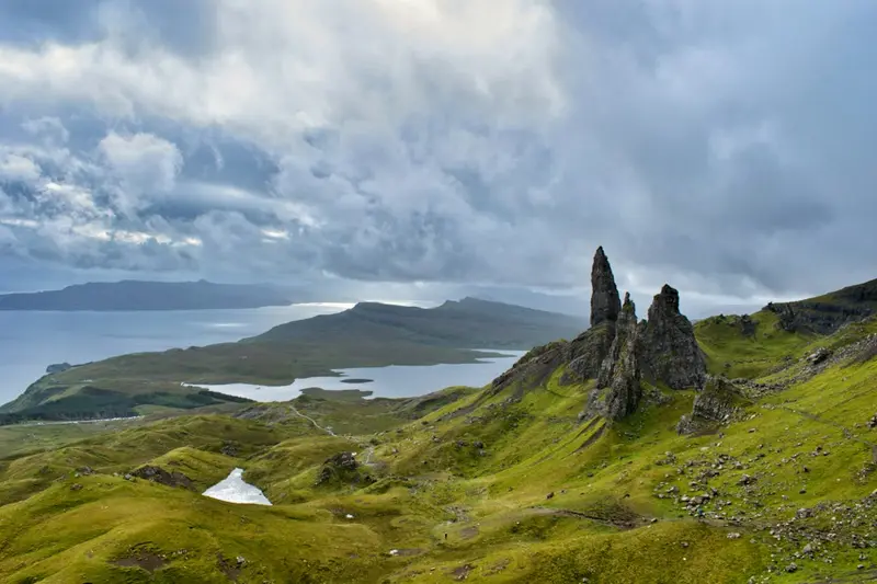
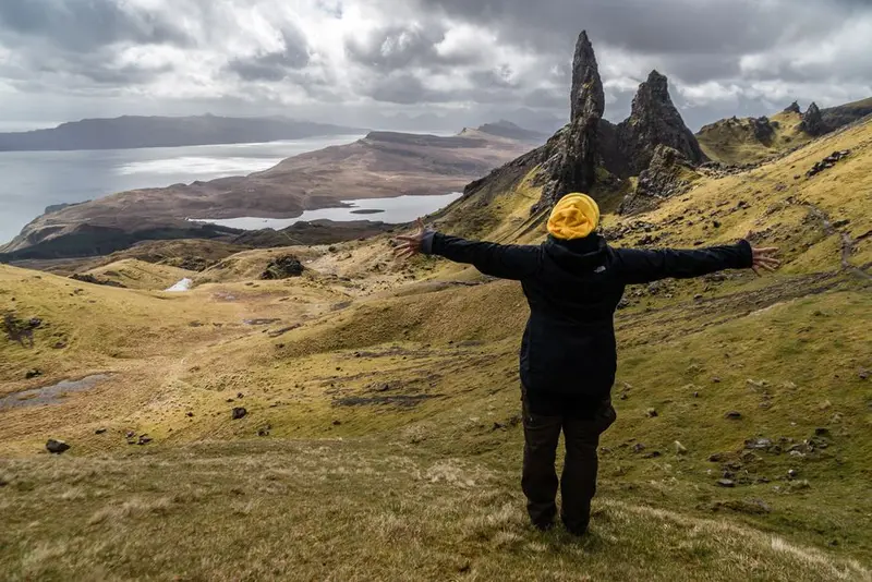
The Old Man of Storr is a roughly 50-meter-high basalt pinnacle at the foot of the Storr cliffs on the Trotternish Peninsula. It remained when the hillside slipped away: heavy basalt layers rest on softer sedimentary rock, which gives way under the load. The entire ridge is therefore in motion, a process that has continued since the end of the Ice Age.From the car park on the A855, a paved path leads up in about 45 minutes. The ascent is short, but steep and exposed to wind. At the top, you look out over the Sound of Raasay to the mainland. The path is heavily frequented; it's quieter early in the morning or late in the evening, and in summer, it's also still light then.
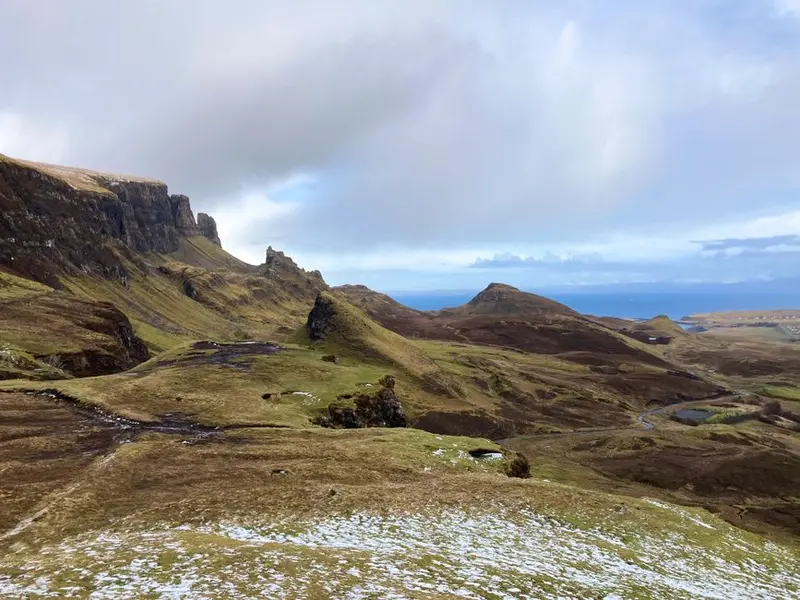
The Quiraing at the northern end of the Trotternish Ridge is Britain's largest active landslide. The ground still moves; the road below needs regular maintenance. This movement has formed bizarre features that bear their own names: The Needle, a 37-meter-high rock pinnacle; The Prison, a castle-like rock block; and The Table, a flat grassy area between cliffs where livestock was once hidden from rustlers.A loop trail of about six kilometers leads from the pass between Staffin and Uig through the formations. It is partly exposed and slippery when wet, with a duration of two to three hours.
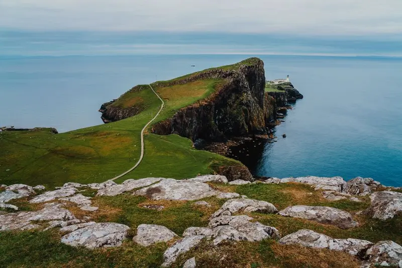
Neist Point is the westernmost point of Skye, a narrow basalt tongue reaching far out into the Minch. A paved path with concrete steps leads from the car park down to the 1909 lighthouse, which was staffed until 1990, in about 30 minutes.The cliffs on the north side drop vertically over 90 meters and are home to seabirds. With a little patience, whales, dolphins, and Basking Sharks can be spotted in the waters below. The return journey goes back up the steps and is significantly more strenuous than the descent. Sunset is the most popular time, and the small car park gets correspondingly crowded.
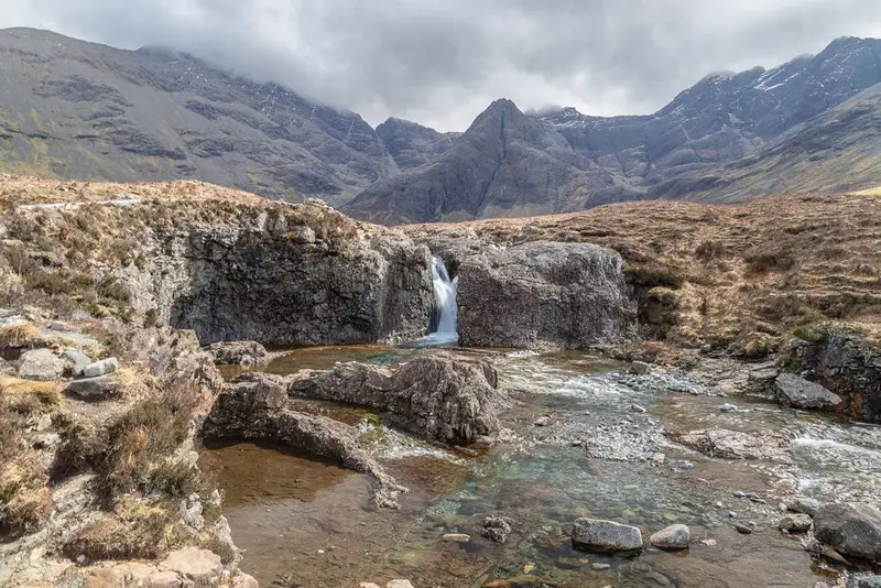
The Fairy Pools are a series of pools and small waterfalls in Glen Brittle at the foot of the Black Cuillin. The water comes directly from the mountains and is unusually clear due to the gabbro bedrock, with a blue-green hue that remains transparent to the bottom in shallow areas.From the car park, a path of approximately 2.4 kilometres leads upstream, including several stream crossings without bridges; after rain, these can be impassable. Those wishing to swim should be aware that the water temperature remains between 8 and 12 degrees Celsius year-round. In the background stand the jagged peaks of Sgùrr an Fheadain and the Cuillin Ridge.
These places are nearby — perfect for additional days or a day trip.
Glencoe & Fort William
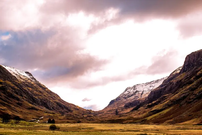
Glencoe is the most famous valley in the Highlands, a trough carved out by glaciers, with flanks that rise almost vertically. The subsoil is the remains of a collapsed Devonian volcano, and the Three Sisters on the south side are remnants of its crater rim. The A82 runs straight through, making the valley accessible even without hiking.In Scotland, the name is inextricably linked to the 1692 Massacre, when soldiers of the Campbells killed 38 members of the MacDonald clan after being billeted with them for twelve days. The breach of hospitality weighed heavier than the act itself and shapes the memory to this day.Fort William, at the north end of the valley, is the region's practical base: the end point of the West Highland Way, a starting point for Ben Nevis, and a station on the railway line to Mallaig, which crosses the Glenfinnan Viaduct. The town itself is functional, not beautiful.
Scotland
Scotland occupies the northern third of the island of Great Britain and has been united with England since 1707, yet it retains its own legal system, education system, banknotes, and, since 1999, its own Parliament. Those arriving from England will notice the difference in language immediately: besides English, Scots and, in the northwest, Scottish Gaelic are spoken.Three LandscapesThe south comprises the gentle Southern Uplands, characterized by sheep pastures and ruined abbeys. Above this lies the Central Belt, a densely populated strip between Edinburgh and Glasgow, home to three-quarters of the population. North of the Highland Boundary Fault begin the Highlands: valleys sculpted by glaciers, long narrow lochs, and mountains that, despite their modest height, offer alpine conditions because the tree line here is around 600 meters. Additionally, there are almost 800 islands, about 90 of which are inhabited.Weather, Not ClimateThe Gulf Stream keeps winters mild, while the Atlantic ensures changeable weather. On the west coast, some areas receive over 3,000 millimeters of rainfall annually, while in the east around Aberdeen, it's less than 700. The best time for the Highlands is May and June, as well as September: long days, comparatively dry weather, and no midges. The Midges, tiny biting gnats, make calm evenings between June and August in the west a test of patience.Access to the LandThe Land Reform Act of 2003 grants you extensive access rights to undeveloped land, including wild camping for one to two nights. This fundamentally distinguishes Scotland from England and Wales. It is linked to the Scottish Outdoor Access Code, which demands responsible behavior: no fires on peatland, keep a distance from houses, and take all your litter with you.
Cairngorms National Park
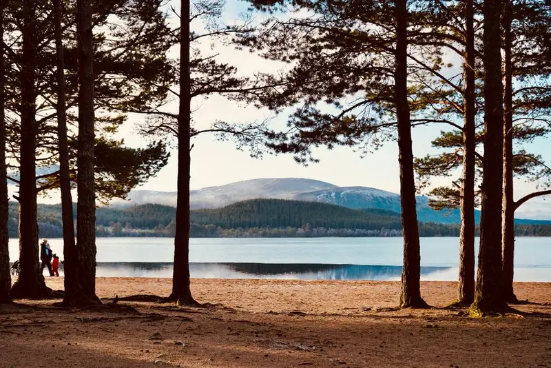
The Cairngorms National Park, covering 4,528 square kilometers, is Britain's largest national park, roughly twice the size of the Saarland. Its core is a granite plateau, home to five of Scotland's six highest mountains. The high plateau features subarctic tundra, the only significant area of its kind in the British Isles, with snow lingering in sheltered hollows in some places until mid-summer.On its fringes lie the last major remnants of the Caledonian Forest, the original Scottish pine forest that once covered vast areas of the Highlands and has now shrunk to just a few percent of its former extent. Here live capercaillie, ptarmigan, Scottish crossbill, and Britain's only wild reindeer herd, which was reintroduced in 1952.The weather on the plateau is the country's harshest; wind speeds exceeding 280 km/h have been recorded on Cairn Gorm. Anyone heading up needs winter gear and navigation skills, even in spring. In the valleys, however, the park is straightforward: Aviemore, Braemar, and Speyside with its whisky distilleries are easily accessible year-round.
Glasgow
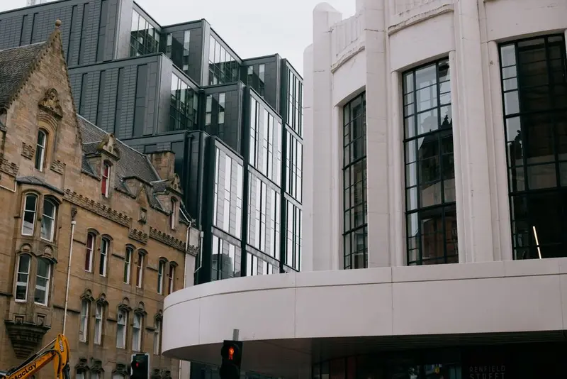
Glasgow is Scotland's largest city and the counterpart to Edinburgh: less pretty, significantly louder, with a self-confidence rooted in its industrial history. In the 19th century, about a fifth of all ships in the world were built on the Clyde. The decline from the 1960s onwards hit the city hard.What remained is a substance of red and blonde sandstone, showcasing its Victorian wealth, and a cultural scene that emerged from the structural upheaval. Since 2008, Glasgow has held the UNESCO title City of Music; on some evenings, over a hundred live concerts take place. Charles Rennie Mackintosh is influential for the cityscape, his Art Nouveau buildings blending Scottish, Japanese, and modern influences.The local dialect, the Glasgow Patter, is a challenge even for experienced English speakers. The city is considered Britain's friendliest, which visitors usually notice right at the train station.
Edinburgh
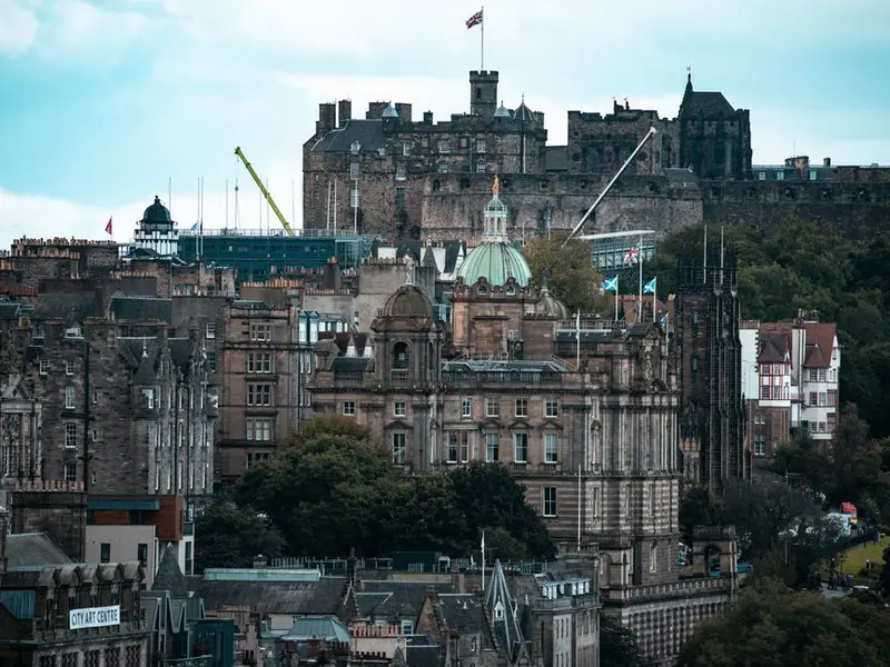
Edinburgh is built on extinct volcanic rock. A glacier scoured the hard basalt plug, upon which the castle now stands, leaving behind an elongated ridge. The Royal Mile lies precisely on this ridge, and this geology explains the entire layout of the Old Town: The lanes, the *Closes*, descend steeply on both sides.The city is divided into two contrasting halves. The Old Town is densely medieval, with tenements up to eleven stories high, which were among the tallest buildings in Europe in the 17th century. North of it, the New Town was developed from 1767 onwards, following the grid plan of the then 26-year-old James Craig, and is considered the world's largest contiguous Georgian quarter. Together, both have been on the World Heritage list since 1995.In August, Edinburgh transforms into an entirely different city thanks to the Fringe, the world's largest cultural festival: The population doubles, every space becomes a stage, and accommodation costs multiply. Those who want to experience the city more peacefully should visit in May or September.