Fernweh: Home
    ExploreTravel GuidesPlan a tripMy tripLast visited
    de|en
    All Places & RegionsAll highlightsAbout FernwehFAQPrivacy PolicyImprint
    ExploreTravel GuidesPlan a tripMy tripLast visited
    Hà Giang
    Velvet / Wikimedia Commons / CC BY-SA 4.0

    Vietnam

    Hà Giang

    Point of InterestNatureRoad Trip

    Hà Giang is the mountainous far north of Vietnam, on the border with China.

    by Felix Gillen

    1. Home
    2. Destinations
    3. Vietnam
    4. Northern Vietnam
    5. Hà Giang
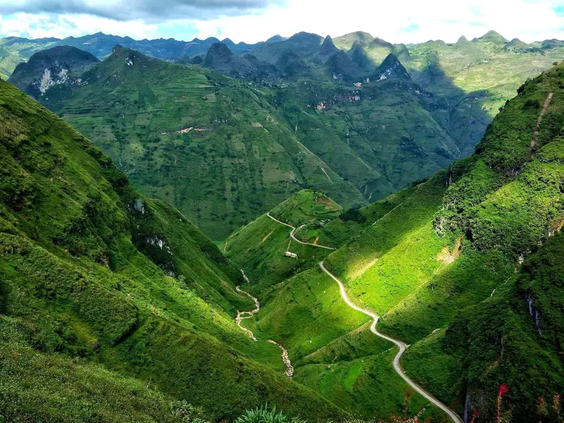
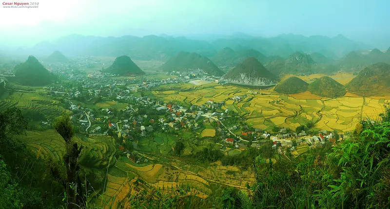
    Hà Giang is the mountainous far north of Vietnam, on the border with China. Since the 2025 administrative reform, the former province has been part of Tuyên Quang province, and the former provincial capital now forms the wards of Hà Giang 1 and Hà Giang 2. For travelers it is the starting point of the Hà Giang Loop, a circuit that usually takes four days, heading northeast on QL4C via Đồng Văn and Mèo Vạc and returning to Hà Giang on QL34.Most of the route lies within the Đồng Văn Karst Plateau Geopark, a UNESCO Global Geopark since 2010: about 2,357 square kilometers (910 square miles) of limestone mountains with an average elevation of 1,400 to 1,600 meters (4,600 to 5,200 ft), home to 17 ethnic groups, including the Hmong, Dao, Lô Lô, Tày and Nùng. Highlights include the Heaven's Gate Pass near Quản Bạ, the Mã Pí Lèng Pass high above the Nho Quế River, and the Lũng Cú Flag Tower near the country's northernmost point.For road safety, riding motorbikes on mountain roads and the current security situation, check the UK FCDO Travel Advice (gov.uk/foreign-travel-advice).

    Sights in Hà Giang

    Discover the most important sights and attractions

    Palace of the Vương Family (Dinh thự họ Vương)
    Attraction

    1Palace of the Vương Family (Dinh thự họ Vương)

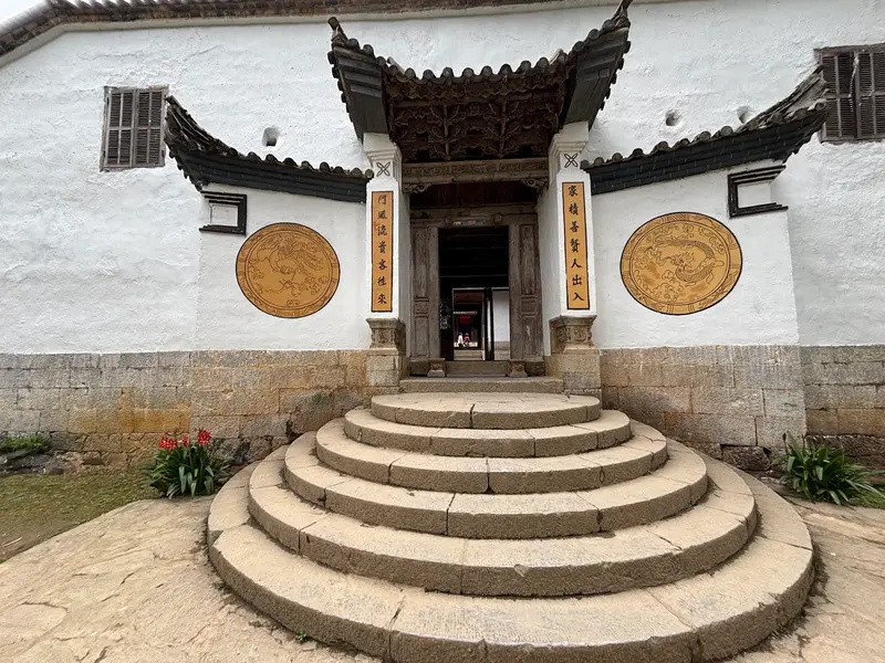
    In the Sà Phìn Valley, Vương Chính Đức, the “King” of the Đồng Văn Plateau in the late 19th and early 20th centuries, had his residence built between 1919 and 1928. The complex covers almost 3,000 square meters with four transverse and six longhouses and 64 rooms. Since 1993, it has been protected as a national architectural monument. On the Hà Giang Loop, it is located on the second day between Yên Minh and Đồng Văn.
    Open in Google Maps
    Mã Pí Lèng Pass
    Natural Feature

    2Mã Pí Lèng Pass

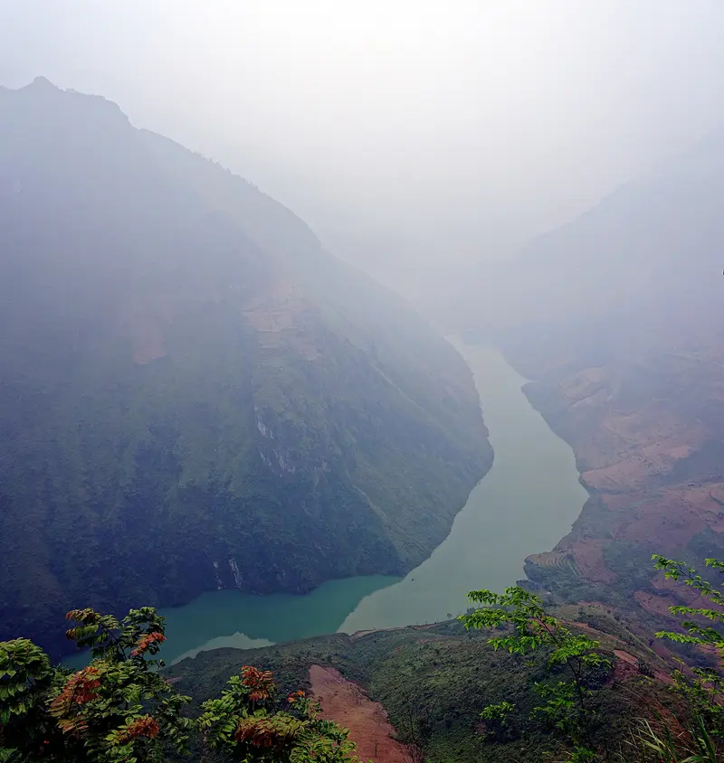
    The Mã Pí Lèng Pass links Đồng Văn with Mèo Vạc, 24 km (15 miles) away, and is considered the scenic highlight of the Hà Giang Loop. The road runs high above the gorge of the Nho Quế River; side road 193A leads to a viewpoint over the river. During the rainy season from May to September, landslides can close sections of the route.
    Open in Google Maps
    Quản Bạ Heaven's Gate (Cổng Trời Quản Bạ)
    Attraction

    3Quản Bạ Heaven's Gate (Cổng Trời Quản Bạ)

    The Heaven's Gate Pass on QL4C near Quản Bạ is the first big viewpoint of the Hà Giang Loop and the highlight of the stage from Hà Giang to Yên Minh. From here you get your first wide view over the karst mountains of the Đồng Văn Geopark, which takes in much of the former Quản Bạ district.
    Open in Google Maps

    Restaurants in Hà Giang

    Culture and History

    Karst Plateau and GeoparkSince October 3, 2010, the Đồng Văn Karst Plateau has been part of the UNESCO Global Geoparks network. It encompasses large parts of the former districts of Mèo Vạc, Đồng Văn, Yên Minh, and Quản Bạ. At Lũng Cú, the park's oldest fossil was found, approximately 540 million years old.The Vương Family PalaceIn the Sà Phìn Valley, Vương Chính Đức, who ruled as “King” over the Đồng Văn Plateau in the late 19th and early 20th century, had his residence built from 1919 to 1928: almost 3,000 square meters with 64 rooms. Since 1993, it has been protected as a national architectural monument.Markets and Old TownThe Old Town of Đồng Văn consists of about 40 houses from the early 20th century along a street just under one kilometer long. On weekends, people from the mountain villages come to the market in their traditional attire. On Lũng Cú Mountain, a 54-square-meter national flag waves, its area representing Vietnam's 54 ethnic groups.

    Getting There and Around

    Getting There from HanoiHanoi is approximately 300 kilometers away. By private car, it takes six to seven hours. A limousine minivan takes about the same time. The sleeper bus from Mỹ Đình bus station usually travels overnight and takes seven to eight hours. Rain, fog, or weekend traffic can extend the journey.On the LoopYou can rent motorbikes in Hà Giang; many travelers opt for a tour with a driver instead.Ride only during daylight hours and allow ample time for each leg of the journey.Carry enough cash, as ATMs are scarce outside of Hà Giang.During peak season, accommodations in Đồng Văn book up quickly, so book early.Best Travel TimeOctober and November are considered the best travel time, with dry roads and clear visibility. Buckwheat usually blooms from late October into November. The rainy season lasts from May to September; especially in July, landslides can block sections of the route for hours or days. From December to February, it is dry, but on the passes, it's often near freezing and foggy at night.
    Accommodations in Hà Giang

    Find perfect stay in Hà Giang

    Booking.com* (Affiliate link)
    Search Hotels
    Agoda* (Affiliate link)
    Search Hotels
    Airbnb
    Vacation Rentals

    * Affiliate link: if you book through it, we earn a small commission. The price stays the same for you.

    Nearby

    Sa Pa

    Sa Pa

    Sa Pa is a mountain town in Vietnam's far northwest, approximately 250 kilometers from Hanoi and 20 kilometers from the Chinese border. You travel there to hike through the rice terraces of the Mường Hoa Valley, visit Hmong and Dao villages, and take the cable car up Fansipan, Indochina's highest mountain. The town is situated in the Hoàng Liên Sơn mountain range at an average elevation of about 1,600 meters, with a climate significantly cooler than the lowlands. The French developed the area into a hill station from 1909 onwards; almost 300 summer villas were built after the opening of the Hanoi–Lào Cai railway in 1920. The stone church in the center dates from this period. The majority of the population belongs to ethnic minorities, primarily Hmong and Dao, alongside Tày and Giáy. The town itself is heavily tourist-oriented; it becomes quieter in the villages in the valley. The best time to visit is September to November, when the terraces are golden-yellow, as well as March to May.
    Northern Vietnam

    Northern Vietnam

    North Vietnam stretches from the Red River Delta to the mountains on the Chinese border. It is home to the capital Hanoi, the limestone islands of Halong Bay, the karst landscape around Ninh Bình, and the rice terraces around Sa Pa.The climate experiences distinct seasons: Winter, from about December to February, is cool and often grey; summer is hot and rainy. The most pleasant time to travel is in spring and autumn.
    West Lake (Tây Hồ)

    West Lake (Tây Hồ)

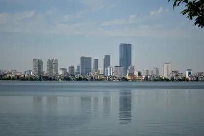
    The Tây Hồ district is located around West Lake, one of Vietnam's largest natural lakes, with approximately 17 kilometers of shoreline. It is quieter than the city center, with villas, cafés, and many Western restaurants, as a large part of Hanoi's foreign population lives here.On a small island near the southeastern shore stands the Trấn Quốc Pagoda, the city's oldest pagoda. Since 1996, the Quảng Bá flower market has taken place nightly in the district, one of the largest in the country. The lakeside is well suited for a bike ride.
    Ba Dinh

    Ba Dinh

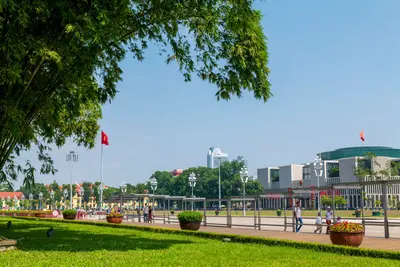
    Ba Đình, west of the Old Quarter, is Hanoi's political center and the district with the most imperial and revolutionary sites. It is home to the Ho Chi Minh Mausoleum, the One Pillar Pagoda, and the Imperial Citadel of Thang Long, a UNESCO World Heritage site since 2010.On today's Ba Đình Square, Ho Chi Minh read the Declaration of Independence on September 2, 1945. Wide avenues, ministries, and embassies characterize the district, which can easily be explored with a stroll from the square to the Citadel.
    Old Town (Phố cổ)

    Old Town (Phố cổ)

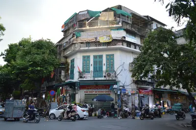
    Hanoi's Old Quarter is the dense maze of alleyways north of Hoàn Kiếm Lake, and the district where most travellers stay. Here, affordable accommodations, street food stalls, and cafés are tightly packed, and the street network has largely been preserved as it evolved over centuries.Locally, the district is known as "36 Gassen" (36 Streets), named after the guilds that once worked here. Many street names begin with "Hàng" (meaning 'goods') and still reveal what was traded there, such as Hàng Bạc after the silversmiths. Most of the narrow shop-houses with sloping tiled roofs date from the 18th and 19th centuries.In the north of the district lies Đồng Xuân Market, dating from the French colonial era, and hidden among the houses is the Bạch Mã Temple. The best way to explore the Old Quarter is on foot.

    Sources & method

    • Photos: Wikimedia Commons, Google Maps. Each photo carries its credit.
    • Place data such as addresses and ratings comes from Google Maps.
    • The content is based on web research from public, traceable sources. How the content is made · The role of AI