Fernweh: Home
ExploreGuideDestinationsMy tripsMy trip
de|en
All Places & RegionsRound tripsNight trains in EuropeAll highlightsAbout FernwehFAQPrivacy PolicyImprint
Download on the App StoreGet it on Google Play
ExploreGuideDestinationsMy tripsMy trip
    • Neighborhoods & highlights
    • Eat & drink
    • Culture
    • Getting around
    • Accommodation
    • Plan trip
    • Round trips
    • Nearby
    Amarillo

    Photo by Brian Hackworth on Pexels

    United States

    Amarillo

    City

    Amarillo is the largest city in the Texas Panhandle and a classic stop on Route 66.

    by Felix Gillen

    1. Home
    2. Destinations
    3. United States
    4. Texas
    5. Amarillo
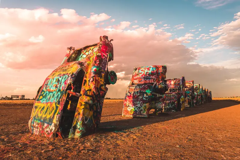
    Amarillo is the largest city in the Texas Panhandle and a classic stop on Route 66. West of the city, the ten colorfully spray-painted cars of the Cadillac Ranch have been stuck in the field since 1974, and you can paint them yourself with spray paint.In the Route 66 Historic District on Sixth Avenue, you'll find antique shops. Southeast of the city, the Palo Duro Canyon opens up, according to Texas Parks and Wildlife, the second largest canyon in the USA.
    United States travel guideSee the round tripPlan a trip with Amarillo

    Contents

    • Neighborhoods & highlights
    • Eat & drink
    • Culture
    • Getting around
    • Accommodation
    • Round trips
    • Nearby

    Sights in Amarillo

    Discover the most important sights and attractions

    Attraction

    1Cadillac Ranch

    Since 1974, ten Cadillacs have been stuck here, nose-down in the ground. The site is free and open 24/7; spray-painting is explicitly encouraged. You'll find it on the southern frontage road of I-40, east of the Arnot Road exit.

    Open in Google Maps
    Park

    2Palo Duro Canyon State Park

    According to Texas Parks and Wildlife, Palo Duro is the second-largest canyon in the USA. In summer, the show 'TEXAS' runs in the park's open-air theater. Admission is $8 USD for ages 13 and up; it's best to reserve your Day Pass in advance.
    Open in Google Maps

    Restaurants in Amarillo

    1

    The Big Texan Steak Ranch

    The steakhouse on I-40 is known for its 72-ounce steak challenge, and Amarillo's tourism office counts it among the Route 66 classics.
    Show on Google Maps

    Route 66

    Steaks and Art on the HighwayThe Big Texan on I-40 is famous for its 72-ounce steak challenge. In summer, the open-air theater in Palo Duro Canyon presents the show "TEXAS".

    Traveling

    PracticalCadillac Ranch: Free admission, open 24/7, on the southern frontage road of I-40 east of Arnot Road exit.Palo Duro Canyon State Park: 8 USD for ages 13+, reserve Day Pass in advance.

    Accommodations in Amarillo

    Find perfect stay in Amarillo

    Booking.com* (Affiliate link)
    Search Hotels
    Agoda* (Affiliate link)
    Search Hotels
    Airbnb
    Vacation Rentals

    * Affiliate link: if you book through it, we earn a small commission. The price stays the same for you.

    Campgrounds in Amarillo

    Find perfect campground in Amarillo

    Search via Google Maps
    Campgrounds nearby (15km)
    Camping.info
    Find Campgrounds
    Park4Night
    RV Parks & Camping

    Plan your trip to Amarillo

    Save places, build a route and plan your city trip, all in one place.

    1. 1
      Sunrise over alpine peaks and a sea of clouds
      1234

      Round trip

      12 days · 4 stops

      Saved

      Pick a route

      Pick a ready-made one or save places and plan your own.

      Open bookmarks
    2. 2

      Trip to Amarillo

      Live
      • 1Cadillac Ranch3 days
      • 2Palo Duro Canyon State Park4 days
      Budget

      Plan your trip

      The planner sorts stops, days and budget. Plan together in real time.

      Start trip planning
    3. 3
      9:41 No signal
      Amarillo
      Available offline

      Photo by Brian Hackworth on Pexels

      Use it on the road

      Download the guide to your phone and use it on site, even offline.

    Round trips with Amarillo

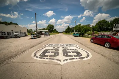
    Route 66: From Chicago to Santa Monica

    Route 66: From Chicago to Santa Monica

    Route 66 was established in 1926 and was decommissioned as a federal highway in 1985. There is no continuous original road left: Between Chicago and St. Louis, Interstate 55 has replaced the route, Interstate 44 from St. Louis to Oklahoma City, and from there to Barstow, California, Interstate 40. Williams, Arizona, was the last place bypassed in 1984. Many old sections are still traversable, as town thoroughfares, parallel roads, or marked Historic Route 66; others are dilapidated, built over, or have disappeared under the Interstate. A special Route 66 guide with section maps is therefore essential, and some stages you will inevitably drive on the Interstate. Arizona has the longest preserved original section, with approximately 385 miles, including the 67 miles of State Route 66 between Seligman and Kingman, off the Interstate. In New Mexico, until 1937, the road ran via Santa Fe; the later alignment leads directly through Albuquerque; this itinerary includes both. The Grand Canyon is not part of Route 66, but is a worthwhile detour from Flagstaff or Williams.

    18 Days
    13 stops
    Open jaw

    Get Lost Mike·Pexels

    Nearby

    Oklahoma

    Oklahoma

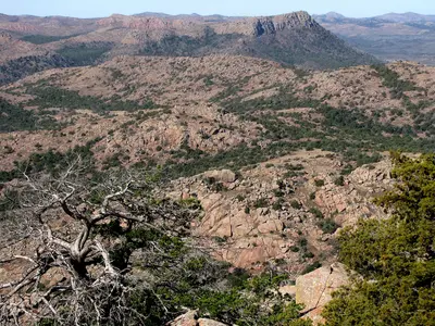
    Oklahoma is located between Kansas and Texas in the southern Great Plains, with its capital being Oklahoma City. Many indigenous nations live in the state, including Cherokee, Muscogee, and Choctaw, whose headquarters you can visit in Tahlequah or Okmulgee.Of all states, Oklahoma has the most preserved miles of Route 66, which leads via Tulsa and Oklahoma City west into the Texas Panhandle.

    OKJaguar·CC BY-SA 4.0

    Santa Fe

    Santa Fe

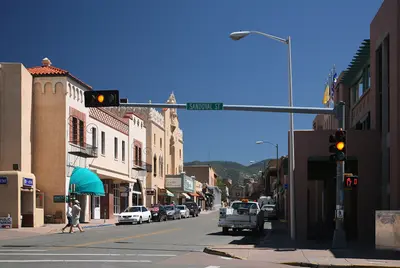
    Santa Fe, at around 2,100 meters at the foot of the Sangre de Cristo Mountains, is the oldest US state capital, founded circa 1610. Adobe buildings surround the Plaza, and under the arcades of the Palace of the Governors, indigenous artisans sell their jewelry.Over 100 galleries line Canyon Road, and the Georgia O'Keeffe Museum showcases the painter who made New Mexico famous. Bandelier and Taos Pueblo are within day-trip distance.

    Daniel Schwen·CC BY-SA 4.0

    Oklahoma City

    Oklahoma City

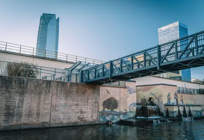
    Oklahoma City is the capital and largest city of Oklahoma and is located on Route 66. The Oklahoma City National Memorial commemorates the bombing of the federal building on April 19, 1995, in which 168 people died; a museum tells the story.The First Americans Museum presents the history of Oklahoma's 39 indigenous nations, while in the former warehouse district of Bricktown, a water taxi travels the canal.

    An Vuong·Pexels

    New Mexico

    New Mexico

    New Mexico is located in the Southwest between Arizona and Texas, with Santa Fe as its capital and Albuquerque as its largest city. Pueblo cultures, Spanish colonial history, and Adobe architecture shape the land to this day.You come here for the high deserts and mountains, the Pueblos like Taos and Acoma, and the cuisine featuring green and red chile. Route 66 crosses the state from east to west via Albuquerque.

    John Fowler·Unsplash

    Albuquerque

    Albuquerque

    Albuquerque, located on the Rio Grande, is New Mexico's largest city. Its Old Town, featuring the San Felipe de Neri Church, dates back to the Spanish founding in 1706, and Central Avenue follows the historic Route 66.The Sandia Peak Tramway takes you up to 3,163 meters, while the Indian Pueblo Cultural Center showcases the cultures of the state's 19 Pueblos. In early October, over 500 hot air balloons ascend for the Balloon Fiesta.

    Lad Fury·Pexels

    Your next steps

    Amarillo is in United States. Ways to carry on from here.

    • More in United States

      Highlights, areas, routes and the best time to travel for all of United States.

      United States travel guide
    • Round trips with Amarillo

      One route passes through Amarillo, with stops, nights and a map.

      See the round trip

    Sources & method

    • Photos: Pexels. Each photo carries its credit.
    • Place data such as addresses and ratings comes from Google Maps.
    • The content is based on web research from public, traceable sources. How the content is made · The role of AI