Fernweh: Home
    ExploreTravel GuidesPlan a tripMy tripLast visited
    de|en
    All Places & RegionsAll highlightsAbout FernwehFAQPrivacy PolicyImprint
    ExploreTravel GuidesPlan a tripMy tripLast visited
    • Overview
    • Places in the region
    • Nearby
    Texas
    Larry D. Moore / Wikimedia Commons / CC BY 4.0

    United States

    Texas

    Region

    Texas stretches from the Gulf Coast to New Mexico and the Rio Grande border with Mexico, with Austin as its capital.

    by Felix Gillen

    1. Home
    2. Destinations
    3. United States
    4. Texas
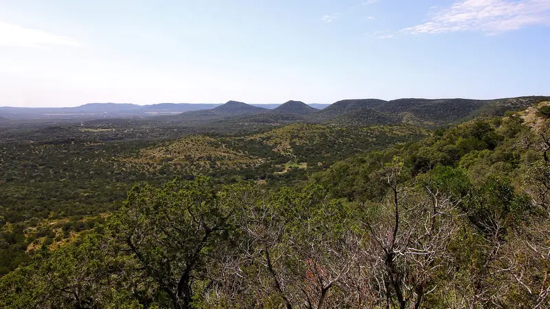
    Texas stretches from the Gulf Coast to New Mexico and the Rio Grande border with Mexico, with Austin as its capital. Come for brisket and live music in Austin, the swimming holes and rolling hills of the Hill Country, and the desert mountains of Big Bend in the far west.The scale is hard to overstate: about 268,600 square miles and more than 31 million people. Houston is the largest city, and San Antonio and Dallas also top a million residents. Budget plenty of time for driving, since distances between cities are long and you'll need a car once you leave the urban cores.The state's two national parks are both out west: Big Bend (established 1944) on the Rio Grande and Guadalupe Mountains (1972) on the New Mexico line. The Gulf Coast is humid with mild winters, while the Panhandle up north gets noticeably colder in winter.
    Most trips to Central Texas start in Austin, the jumping-off point for the Hill Country and for barbecue towns nearby such as Lockhart. Outside the cities you'll need a car or RV; intercity public transportation is thin.Spring and fall are the most comfortable seasons. Summers in Central Texas are very hot, and on the Gulf Coast hurricane season runs from June 1 to November 30. Follow National Hurricane Center forecasts and heed any evacuation orders.Traveling by RVTexas State Parks: Most campsites and cabins can be booked up to five months ahead, with the window opening at 8 a.m. Day-use entry passes can be reserved up to a month in advance. Popular parks near Austin often fill up on weekends.Late arrivals: If you'll get in after the park office closes, call during office hours beforehand. You have to check in at the office by noon the next day or the reservation may be canceled.Near Austin: McKinney Falls State Park is about 13 miles from the Capitol, and all 81 campsites have water and electric hookups. Details are on the Austin page.
    More places in Texas

    Austin

    Austin is the capital of Texas, a good 80 miles northeast of San Antonio on the Colorado River in the heart of Central Texas. You come for the live music almost every night, for brisket from Michelin-starred barbecue joints, and for the cold springs of Barton Springs right in the city.The city center is compact: From the Capitol, Congress Avenue leads straight down to Lady Bird Lake, the impounded Colorado River. South of the Congress Avenue Bridge lies South Congress with its shops, food trucks, and the Continental Club. East of Interstate 35 is East Austin, where many of the best barbecue and taco spots are located today.In March, the city is crowded and expensive during the South by Southwest festival, as it is on weekends with University of Texas home games in the fall. From May to September it is hot, but then every evening the bats fly out from under the Congress Avenue Bridge.

    Nearby

    Austin

    Austin is the capital of Texas, a good 80 miles northeast of San Antonio on the Colorado River in the heart of Central Texas. You come for the live music almost every night, for brisket from Michelin-starred barbecue joints, and for the cold springs of Barton Springs right in the city.The city center is compact: From the Capitol, Congress Avenue leads straight down to Lady Bird Lake, the impounded Colorado River. South of the Congress Avenue Bridge lies South Congress with its shops, food trucks, and the Continental Club. East of Interstate 35 is East Austin, where many of the best barbecue and taco spots are located today.In March, the city is crowded and expensive during the South by Southwest festival, as it is on weekends with University of Texas home games in the fall. From May to September it is hot, but then every evening the bats fly out from under the Congress Avenue Bridge.
    Louisiana

    Louisiana

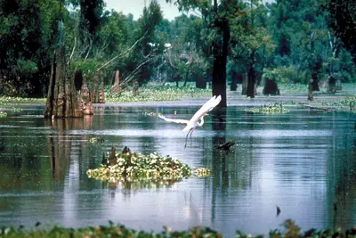
    Louisiana sits on the Gulf of Mexico between Texas, Arkansas and Mississippi, and much of it was built up over millennia by the Mississippi River and its delta. People come for the bayous and swamps, and for a Cajun and Creole culture that runs far deeper than New Orleans.Louisiana is the only state divided into parishes instead of counties, 64 in all. West of Baton Rouge lies the Atchafalaya Basin, the largest swamp in the country. I-10 crosses it between Grosse Tete and Henderson on the 18-mile Atchafalaya Basin Bridge, and the swamp is home to alligators and the Louisiana black bear.Beyond the basin is Acadiana, the heartland of the descendants of Acadians expelled from Canada, centered on Lafayette. Baton Rouge has the tallest state capitol in the U.S. at 450 feet, with an observation deck on the 27th floor. On the Mississippi's west bank in Vacherie is Oak Alley Plantation, whose main house was built by enslaved people between 1837 and 1839.
    Garden District and Uptown

    Garden District and Uptown

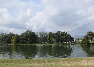
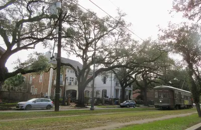
    The Garden District and Uptown are the residential neighborhoods upriver from downtown, strung along the St. Charles streetcar line. Come for the mansions under live oaks, the shops and restaurants of Magazine Street, and music clubs where the crowd is mostly local.The Garden District, between St. Charles Avenue and Magazine Street, was built up from the 1830s on former Livaudais Plantation land. It belonged to the City of Lafayette until New Orleans annexed it in 1852 and has been a National Historic Landmark since 1974. Take the streetcar to Washington Avenue for Commander's Palace and Lafayette Cemetery No. 1 (1833), which reopened in October 2026 after seven years, though only for guided tours of up to 16 people (book at prcno.org). For a route through the streets, see the New Orleans city walks.Uptown has no hard borders. Most people mean the stretch between the river and Claiborne Avenue, from the Garden District out to Audubon Park and the Tulane and Loyola campuses. In the 1800s St. Charles Avenue was the city's millionaires' row, and many of those houses still stand. Closer to the river, Magazine Street runs parallel, lined with independent boutiques, galleries and places to eat.
    Tremé and Mid-City

    Tremé and Mid-City

    Tremé and Mid-City lie inland from the French Quarter, between Rampart Street and City Park. Come for the city's Black history, brass bands in neighborhood bars, and Creole soul food that locals happily line up for.Tremé starts right across Rampart and is often called the oldest Black neighborhood in the country: free people of color were buying property here as early as the 1700s. It's home to Louis Armstrong Park and Congo Square, and to St. Augustine Church, founded in 1841. Beyond it, Mid-City is a residential area stretching along Canal Street and Bayou St. John out to City Park.City Park and NOMA, Parkway Bakery and The Broadside are covered on the main New Orleans page. Conditions can change from one block to the next; for current safety guidance, see the UK FCDO Travel Advice.
    New Orleans

    New Orleans

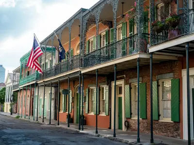
    New Orleans sits on the Mississippi in south Louisiana. You come for live music every night of the week, for Creole cooking, and for streets that still show their French and Spanish colonial past.The city was founded in 1718 under Jean-Baptiste Le Moyne de Bienville. Its historic core is the French Quarter, anchored by Jackson Square with St. Louis Cathedral, the Cabildo and the Presbytère. For live music, head to Frenchmen Street in neighboring Faubourg Marigny, where more locals go out than on Bourbon Street.The St. Charles streetcar has been running since 1835 and is considered the oldest continuously operating streetcar line in the world. It rolls from Canal Street through the Garden District to Carrollton, and at $1.25 it's the cheapest city tour you'll find. You don't need a car for the French Quarter, Marigny or Tremé; parking there is scarce and expensive.The neighborhoodsFrench Quarter: the old city, with museums, old-line Creole restaurants and the oldest bars in town, best explored on foot by day.Marigny and Bywater: just downriver, with the Frenchmen Street music strip, colorful cottages, street art and Crescent Park on the river.Garden District and Uptown: mansions along St. Charles Avenue, shopping on Magazine Street, Audubon Park and clubs like Tipitina's.Tremé and Mid-City: Black history around Congo Square, brass bands in neighborhood bars, Bayou St. John and City Park.PlanningWhen to go: February through May and October through November are the most comfortable. June through September is hot and humid, and Atlantic hurricane season runs June 1 to November 30.Big dates: During Carnival season (January through Fat Tuesday) and Jazz Fest (late April into early May), hotels sell out or spike months ahead. Book as early as you can.Where to stay: The French Quarter and Marigny put you closest to music and food; the Garden District and Uptown along the St. Charles line are quieter.

    Sources & method

    • Photos: Wikimedia Commons. Each photo carries its credit.
    • The content is based on web research from public, traceable sources. How the content is made · The role of AI