Fernweh: Home
ExploreGuideDestinationsMy tripsMy trip
de|en
All Places & RegionsRound tripsNight trains in EuropeAll highlightsAbout FernwehFAQPrivacy PolicyImprint
Download on the App StoreGet it on Google Play
ExploreGuideDestinationsMy tripsMy trip
    • Overview
    • Places in the region
    • Culture
    • Getting around
    • Round trips
    • Nearby
    New Mexico

    Photo by John Fowler on Unsplash

    United States

    New Mexico

    Region

    New Mexico is located in the Southwest between Arizona and Texas, with Santa Fe as its capital and Albuquerque as its largest city. Pueblo cultures, Spanish colonial history, and Adobe architecture shape the land to this day.

    by Felix Gillen

    1. Home
    2. Destinations
    3. United States
    4. New Mexico
    New Mexico is located in the Southwest between Arizona and Texas, with Santa Fe as its capital and Albuquerque as its largest city. Pueblo cultures, Spanish colonial history, and Adobe architecture shape the land to this day.You come here for the high deserts and mountains, the Pueblos like Taos and Acoma, and the cuisine featuring green and red chile. Route 66 crosses the state from east to west via Albuquerque.
    United States travel guideSee the round tripPlan a trip with New Mexico

    Contents

    • Overview
    • Places in the region
    • Culture
    • Getting around
    • Round trips
    • Nearby
    New Mexico is a state ideal for road trips. In the north are Santa Fe, Taos Pueblo, and Bandelier; in the center, Albuquerque on Route 66; in the south, the gypsum dunes of White Sands and the Carlsbad Caverns. Far in the northwest lies the remote Chaco Canyon.
    Santa Fe

    Daniel Schwen / Wikimedia Commons / CC BY-SA 4.0, mod.

    Place 1 of 2

    Santa Fe

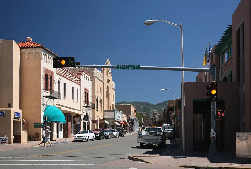
    Santa Fe, at around 2,100 meters at the foot of the Sangre de Cristo Mountains, is the oldest US state capital, founded circa 1610.

    Discover
    Albuquerque

    Photo by Lad Fury on Pexels

    Place 2 of 2

    Albuquerque

    Albuquerque, located on the Rio Grande, is New Mexico's largest city. Its Old Town, featuring the San Felipe de Neri Church, dates back to the Spanish founding in 1706, and Central Avenue follows the historic Route 66.

    Discover

    Sights in New Mexico

    Discover the most important sights and attractions

    National Park

    White Sands National Park

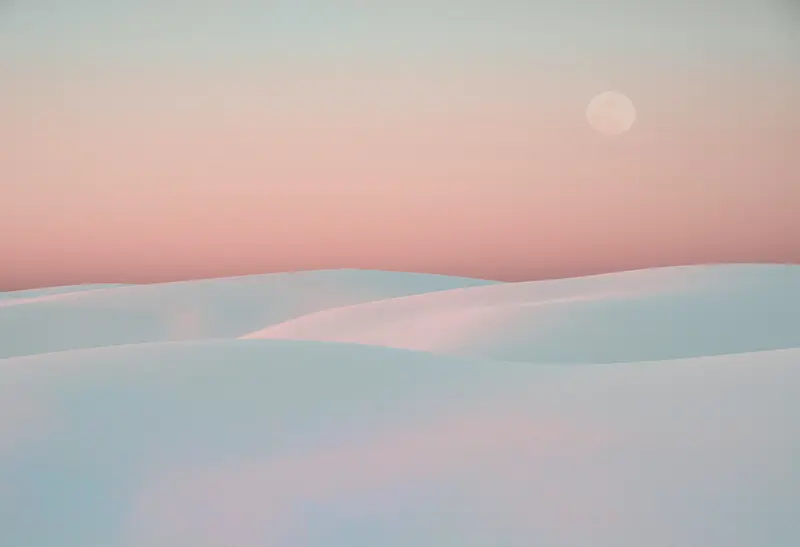
    The world's largest gypsum dune field covers approximately 712 square kilometers in southern New Mexico. The Dunes Drive leads 26 kilometers round trip into the dunes; short trails like the Interdune Boardwalk offer foot access, and sand sledding is permitted. Rocket tests at the neighboring White Sands Missile Range can close the road for up to three hours. From Alamogordo, it's about 20 minutes.
    Open in Google Maps
    Point of Interest

    Carlsbad Caverns National Park

    Via the Natural Entrance or by elevator, you reach the Big Room, a huge underground chamber; both routes are approximately 2 kilometers long. For entry, you need a timed-entry ticket via recreation.gov ($1 USD, released 30 days in advance), the admission fee is paid on-site. Last entry is at 2:30 PM.
    Open in Google Maps
    Historic Landmark

    Taos Pueblo

    The multi-story Adobe houses at the foot of the Sangre de Cristo Mountains were built in the late 13th and early 14th century and are still inhabited today. Since 1992, the Pueblo has been a UNESCO World Heritage site. Admission: 25 US dollars. In late winter, the Pueblo closes for several weeks; opening days are also inconsistent: call ahead or check taospueblo.com. No photography during ceremonies.
    Open in Google Maps
    National Park

    Bandelier National Monument

    About an hour from Santa Fe, Ancestral Puebloan cliff dwellings lie in a canyon. The Main Loop Trail is about 2 kilometers long; to the Alcove House, 43 meters above the valley floor, you climb four ladders. Admission $25 per vehicle; during peak season, a shuttle runs, mandatory only when parking is full.
    Open in Google Maps

    Custom

    Pueblos and Spanish HeritagePueblo peoples have lived here for centuries; Taos Pueblo, dating from the late 13th and early 14th centuries, is still inhabited today and is a UNESCO World Heritage site. In Chaco Canyon (850 to 1250) and Bandelier, you can see the traces of the Ancestral Puebloans. With the Spanish colonial era came adobe churches and plazas, such as in Santa Fe and Old Town Albuquerque.Chile with Everything“Red or Green?” has been New Mexico’s official state question since 1996, referring to red or green chile sauce.

    Traveling

    By CarMost destinations are only accessible by rental car. Albuquerque is located on Route 66 and is the starting point for northern and southern routes.Important for PlanningCarlsbad Caverns: Timed-entry ticket via recreation.gov required, released 30 days in advance.White Sands: Opens daily at 7 AM; rocket tests can close Dunes Drive for up to three hours.Chaco Canyon: Access only from the south via Hwy 9 and Hwy 57, with approximately 34 kilometers of rough and sometimes impassable dirt road; northern access is closed. Not recommended for RVs.

    Round trips through this region

    Route 66: From Chicago to Santa Monica

    Route 66: From Chicago to Santa Monica

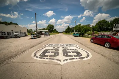
    Route 66 was established in 1926 and was decommissioned as a federal highway in 1985. There is no continuous original road left: Between Chicago and St. Louis, Interstate 55 has replaced the route, Interstate 44 from St. Louis to Oklahoma City, and from there to Barstow, California, Interstate 40. Williams, Arizona, was the last place bypassed in 1984. Many old sections are still traversable, as town thoroughfares, parallel roads, or marked Historic Route 66; others are dilapidated, built over, or have disappeared under the Interstate. A special Route 66 guide with section maps is therefore essential, and some stages you will inevitably drive on the Interstate. Arizona has the longest preserved original section, with approximately 385 miles, including the 67 miles of State Route 66 between Seligman and Kingman, off the Interstate. In New Mexico, until 1937, the road ran via Santa Fe; the later alignment leads directly through Albuquerque; this itinerary includes both. The Grand Canyon is not part of Route 66, but is a worthwhile detour from Flagstaff or Williams.

    18 Days
    13 stops
    Open jaw

    Get Lost Mike·Pexels

    Nearby

    Holbrook (Petrified Forest)

    Holbrook (Petrified Forest)

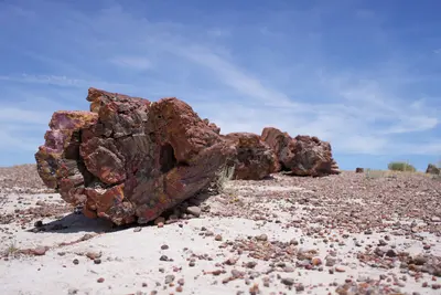
    Holbrook is a small town on historic Route 66 in northeastern Arizona and the closest town to the southern end of Petrified Forest National Park, about 18 miles (nearly 30 kilometers) away. The park features over 200-million-year-old petrified tree trunks nestled among the colorful hills of the Painted Desert.In town, the historic Navajo County Courthouse from 1898 houses a museum with jail cells and serves as the visitor center.

    Strange Happenings·Pexels

    Amarillo

    Amarillo

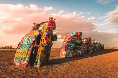
    Amarillo is the largest city in the Texas Panhandle and a classic stop on Route 66. West of the city, the ten colorfully spray-painted cars of the Cadillac Ranch have been stuck in the field since 1974, and you can paint them yourself with spray paint.In the Route 66 Historic District on Sixth Avenue, you'll find antique shops. Southeast of the city, the Palo Duro Canyon opens up, according to Texas Parks and Wildlife, the second largest canyon in the USA.

    Brian Hackworth·Pexels

    Arizona

    Arizona

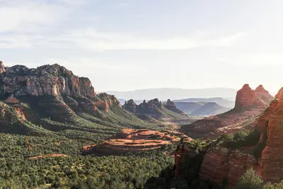
    Arizona is located in the Southwest USA, bordering California, Nevada, Utah, New Mexico, and Mexico. You travel here for the Grand Canyon, the red rock landscapes in the north, and the Sonora Desert with its Saguaro cacti around Phoenix and Tucson.The capital, Phoenix, is also the largest city. The lower-lying south has a desert climate with hot summers, while the Colorado Plateau in the north is cooler and gets snow in winter. The highest peak is Humphreys Peak near Flagstaff, at 3,852 meters. A large part of the northeast is occupied by the Navajo Nation, the largest tribal nation in the USA. Its territory includes Monument Valley and Antelope Canyon.Besides the Grand Canyon, Arizona has two other national parks: Petrified Forest, featuring petrified wood approximately 225 million years old, and Saguaro near Tucson. Sedona is known for its red sandstone formations.
    Edmundo Mendez, Jr.·Unsplash

    Monument Valley

    Monument Valley

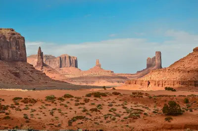
    Monument Valley is located on the border between Arizona and Utah on the land of the Navajo Nation, who call the valley Tse'Bii'Ndzisgaii. The sandstone buttes like the Mittens and Merrick Butte rise 120 to 300 meters above the plain and have been an iconic image of the American West since John Ford's Westerns.This area is not a national park, but rather the Monument Valley Navajo Tribal Park, which the Navajo Nation manages itself. For an entrance fee, you can drive the unpaved Valley Drive yourself; many areas off-road can only be entered with a Navajo guide.

    Ganapathy Kumar·Unsplash

    Flagstaff

    Flagstaff

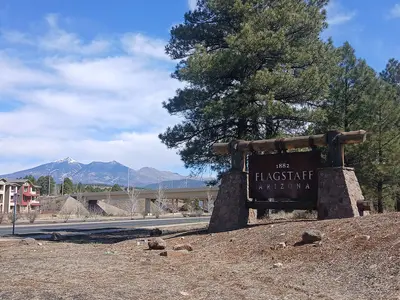
    Flagstaff, in northern Arizona on old Route 66, is the classic gateway to the Grand Canyon's South Rim. Pluto was discovered at Lowell Observatory on Mars Hill, and on Oct. 24, 2001, Flagstaff became the world's first International Dark Sky City.Surrounding the city are three National Park Service protected areas: the cliff dwellings of Walnut Canyon, Sunset Crater volcano, and the Wupatki Pueblos.

    Dakman111·CC0

    Your next steps

    New Mexico is in United States. Ways to carry on from here.

    • More in United States

      Highlights, areas, routes and the best time to travel for all of United States.

      United States travel guide
    • Round trips with New Mexico

      One route passes through New Mexico, with stops, nights and a map.

      See the round trip
    • Plan a trip with New Mexico

      The Guide asks about season, length and who is coming, and suggests a trip with New Mexico.

      Plan the trip

    Sources & method

    • Photos: Unsplash. Each photo carries its credit.
    • Place data such as addresses and ratings comes from Google Maps.
    • The content is based on web research from public, traceable sources. How the content is made · The role of AI