Fernweh: Home
ExploreGuideDestinationsMy tripsMy trip
de|en
All Places & RegionsRound tripsNight trains in EuropeAll highlightsAbout FernwehFAQPrivacy PolicyImprint
Download on the App StoreGet it on Google Play
ExploreGuideDestinationsMy tripsMy trip
    • Neighborhoods & highlights
    • Tours
    • Eat & drink
    • Culture
    • Getting around
    • Accommodation
    • Plan trip
    • Round trips
    • Nearby
    Flagstaff

    Dakman111 / Wikimedia Commons / CC0

    United States

    Flagstaff

    City

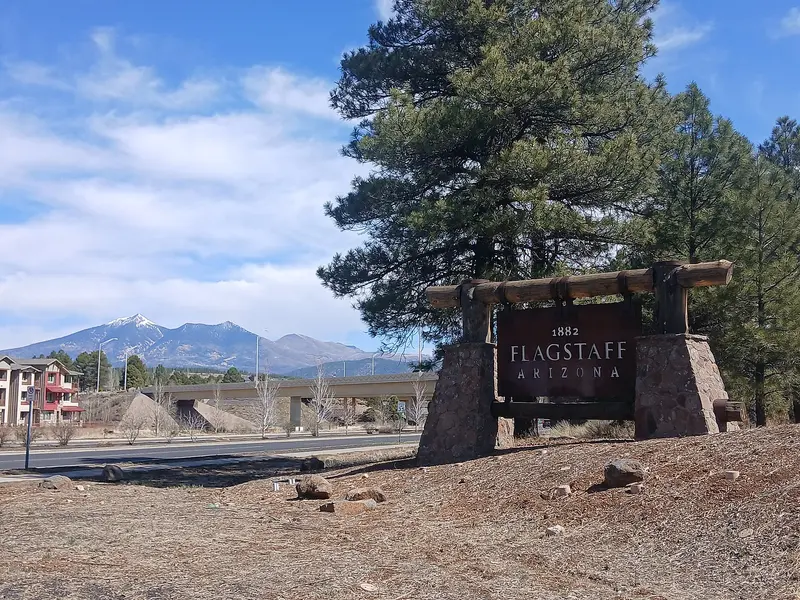
    Flagstaff, in northern Arizona on old Route 66, is the classic gateway to the Grand Canyon's South Rim. Pluto was discovered at Lowell Observatory on Mars Hill, and on Oct.

    by Felix Gillen

    1. Home
    2. Destinations
    3. United States
    4. Arizona
    5. Flagstaff
    Flagstaff, in northern Arizona on old Route 66, is the classic gateway to the Grand Canyon's South Rim. Pluto was discovered at Lowell Observatory on Mars Hill, and on Oct. 24, 2001, Flagstaff became the world's first International Dark Sky City.Surrounding the city are three National Park Service protected areas: the cliff dwellings of Walnut Canyon, Sunset Crater volcano, and the Wupatki Pueblos.
    United States travel guideSee the round tripPlan a trip with Flagstaff

    Contents

    • Neighborhoods & highlights
    • Tours
    • Eat & drink
    • Culture
    • Getting around
    • Accommodation
    • Round trips
    • Nearby

    Sights in Flagstaff

    Discover the most important sights and attractions

    Historic Landmark

    1Lowell Observatory

    Pluto was discovered on Mars Hill in 1930. Visitors can see the Pluto Dome, the historic 24-inch Clark Refractor, the Astronomy Discovery Center, and on clear evenings, the telescopes of the Giovale Open Deck Observatory. Prices and times vary; book at lowell.edu.
    Open in Google Maps
    National Park

    2Walnut Canyon National Monument

    East of the city lie cliff dwellings dating from around 1125 to 1250. The Island Trail descends 240 steps past 25 rooms, the Rim Trail stays up on the edge.
    Open in Google Maps
    Attraction

    3Sunset Crater Volcano National Monument

    The cinder cone is located about 30 minutes north of Flagstaff on US 89. A 56-kilometer loop road connects it with the Wupatki National Monument; you'll need about an hour for the drive without stops.
    Open in Google Maps
    Museum

    4Museum of Northern Arizona

    The museum on the northern edge of the city is dedicated to nature, geology, and the indigenous cultures of the Colorado Plateau. The shop features handicrafts by indigenous artists. Open daily from 10 AM to 5 PM, admission 18 US dollars.
    Open in Google Maps

    Tours & experiences in Flagstaff

    Search tours for Flagstaff on GetYourGuide* (Affiliate link)On GetYourGuide, with reviews from other travellers

    * Affiliate link: if you book through it, we earn a small commission. The price stays the same for you.

    Restaurants in Flagstaff

    1

    Shift Kitchen & Bar

    Downtown restaurant that appeared on the 2023 James Beard Awards semifinalist list.
    Show on Google Maps
    2

    Atria

    Restaurant on Leroux Street downtown. Executive Chef Rochelle Daniel was a 2022 James Beard Awards semifinalist for Emerging Chef.
    Show on Google Maps

    Customs

    City of StarsBecause Flagstaff has limited its lighting for decades, the night sky here is exceptionally dark. The Lowell Observatory offers evening observations at its telescopes.Colorado PlateauThe Museum of Northern Arizona explains the nature and indigenous cultures of the plateau. In the city center, several restaurants have received James Beard Foundation nominations, including Shift and Atria.

    Traveling

    Car ExcursionsWalnut Canyon: east of the city.Sunset Crater and Wupatki: 12 miles north on US 89, then 2 miles to the visitor center, around 30 minutes. The Sunset Crater and Wupatki loop is 56 kilometers long.Meteor Crater: privately operated impact crater east of the city, according to the tourism office around 50,000 years old.In the CityExplore downtown with its restaurants and Route 66 on foot; the Lowell Observatory and the Museum of Northern Arizona are just a few minutes' drive away.

    Accommodations in Flagstaff

    Find perfect stay in Flagstaff

    Booking.com* (Affiliate link)
    Search Hotels
    Agoda* (Affiliate link)
    Search Hotels
    Airbnb
    Vacation Rentals

    * Affiliate link: if you book through it, we earn a small commission. The price stays the same for you.

    Campgrounds in Flagstaff

    Find perfect campground in Flagstaff

    Search via Google Maps
    Campgrounds nearby (15km)
    Camping.info
    Find Campgrounds
    Park4Night
    RV Parks & Camping

    Plan your trip to Flagstaff

    Save places, build a route and plan your city trip, all in one place.

    1. 1
      Sunrise over alpine peaks and a sea of clouds
      1234

      Round trip

      12 days · 4 stops

      Saved

      Pick a route

      Pick a ready-made one or save places and plan your own.

      Open bookmarks
    2. 2

      Trip to Flagstaff

      Live
      • 1Lowell Observatory3 days
      • 2Walnut Canyon National Monument4 days
      • 3Sunset Crater Volcano National Monument5 days
      Budget

      Plan your trip

      The planner sorts stops, days and budget. Plan together in real time.

      Start trip planning
    3. 3
      9:41 No signal
      Flagstaff
      Available offline

      Dakman111 / Wikimedia Commons / CC0

      Use it on the road

      Download the guide to your phone and use it on site, even offline.

    Round trips with Flagstaff

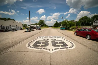
    Route 66: From Chicago to Santa Monica

    Route 66: From Chicago to Santa Monica

    Route 66 was established in 1926 and was decommissioned as a federal highway in 1985. There is no continuous original road left: Between Chicago and St. Louis, Interstate 55 has replaced the route, Interstate 44 from St. Louis to Oklahoma City, and from there to Barstow, California, Interstate 40. Williams, Arizona, was the last place bypassed in 1984. Many old sections are still traversable, as town thoroughfares, parallel roads, or marked Historic Route 66; others are dilapidated, built over, or have disappeared under the Interstate. A special Route 66 guide with section maps is therefore essential, and some stages you will inevitably drive on the Interstate. Arizona has the longest preserved original section, with approximately 385 miles, including the 67 miles of State Route 66 between Seligman and Kingman, off the Interstate. In New Mexico, until 1937, the road ran via Santa Fe; the later alignment leads directly through Albuquerque; this itinerary includes both. The Grand Canyon is not part of Route 66, but is a worthwhile detour from Flagstaff or Williams.

    18 Days
    13 stops
    Open jaw

    Get Lost Mike·Pexels

    Nearby

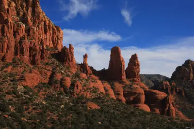
    Sedona

    Sedona

    Sedona is a town of just under 10,000 people in northern Arizona, ringed by red sandstone spires, mesas and canyons. The scenery is the reason to come: dozens of short hikes, from Cathedral Rock to Devil's Bridge, start right at the edge of town.It's about two hours north of Phoenix and an hour south of Flagstaff, a classic stop on the way to the Grand Canyon. Give it at least two full days: hike in the morning, cool off in Oak Creek in the afternoon, and watch the cliffs glow at sunset.Good to knowTrailhead parking: Most trailheads in the Coconino National Forest require a Red Rock Pass ($5 a day, $15 a week, $20 a year) or an America the Beautiful pass.Shuttle: The free Sedona Shuttle runs from park-and-ride lots to the busiest trailheads. While it's running, the Cathedral Rock trailhead lot is closed.Timing: Spring, weekends and holiday weekends are the busiest. Popular lots often fill shortly after sunrise, and summer afternoons get very hot.Beyond the trails there are galleries, the Chapel of the Holy Cross set into the rocks, and plenty of good Mexican and Southwestern restaurants. Book ahead for weekend dinners.

    Adrian Monserrat·Pexels

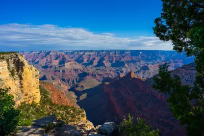
    Grand Canyon National Park

    Grand Canyon National Park

    Grand Canyon National Park in northern Arizona, about a 90-minute drive north of Flagstaff, protects the Colorado River's gorge. You go there to gaze up to 1,800 meters deep into the Canyon from the South Rim, ideally at sunrise or sunset, or to descend a portion of the Bright Angel or South Kaibab Trail.The gorge is 446 kilometers long and up to 29 kilometers wide. Almost all visitors come to the South Rim, which is open year-round. Since 1979, the park has been a UNESCO World Heritage site.The heart of the South Rim is Grand Canyon Village, home to the El Tovar Hotel, opened in 1905. Hermit Road stretches about 11 kilometers west past various viewpoints, while Desert View Drive extends about 40 kilometers east to the Desert View Watchtower, designed by Mary Colter in 1932. For sunrise and sunset, Mather Point, Yaki Point, and Hopi Point are the most famous spots, and consequently, they get crowded.Admission and Rules 2026Admission: 35 US dollars per car, 30 per motorcycle, 20 per person on foot or by bike, each valid for 7 days. Payment is by card only.Surcharge for International Visitors: Starting in 2026, if you do not reside in the USA, you pay an additional 100 US dollars per person aged 16 and above. The surcharge is waived with the America-the-Beautiful Pass for international visitors (250 US dollars per vehicle).Reservation: Not required for entry.South Rim: Flash Flood and Water Shortage (As of Mid-November 2026)The flash flood in Bright Angel Canyon on August 29, 2026, destroyed the Transcanyon water pipeline. Since August 31, Water Conservation Level 4 has been in effect at the South Rim. What this means for you:Lodging: At the end of August, all in-park hotels were closed for overnight stays. According to the operator and NPS, El Tovar, Bright Angel Lodge, Maswik, and Yavapai Lodge are expected to reopen to guests from November 20, 2026, while Phantom Ranch will remain closed until at least January 31, 2027. Check the current status before booking in the park; hotels in Tusayan, outside the South Entrance, are not affected.Camping: Mather Campground is open, but only for dry camping. Trailer Village is expected to reopen from November 20.Food: Many eateries are closed or have reduced hours. Bring provisions.Hiking Trails: Bright Angel Trail only up to Mile-and-a-Half Resthouse, South Kaibab Trail only up to Tip-Off, plus Plateau Point Trail. Trails to the Colorado River and Phantom Ranch are closed. Drinking water is only available at trailheads.Fires: All wood fires are prohibited at Mather Campground.North Rim 2026The North Rim, over 2,400 meters high, is open only for day visitors in 2026, until November 30 or until the first heavy snowstorm. The Dragon Bravo Fire from July 2025 destroyed approximately 70 buildings, including the Grand Canyon Lodge and the visitor center. There is no lodging, no campground, and no drinking water available in the park in 2026; the gas station is closed for the season. The North Kaibab Trail is closed, as are many rim trails such as Bright Angel Point and Widforss Trail. Cape Royal Road and Point Imperial Road are prohibited for vehicles over 22 feet.

    henri buenen·Unsplash

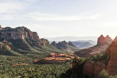
    Arizona

    Arizona

    Arizona is located in the Southwest USA, bordering California, Nevada, Utah, New Mexico, and Mexico. You travel here for the Grand Canyon, the red rock landscapes in the north, and the Sonora Desert with its Saguaro cacti around Phoenix and Tucson.The capital, Phoenix, is also the largest city. The lower-lying south has a desert climate with hot summers, while the Colorado Plateau in the north is cooler and gets snow in winter. The highest peak is Humphreys Peak near Flagstaff, at 3,852 meters. A large part of the northeast is occupied by the Navajo Nation, the largest tribal nation in the USA. Its territory includes Monument Valley and Antelope Canyon.Besides the Grand Canyon, Arizona has two other national parks: Petrified Forest, featuring petrified wood approximately 225 million years old, and Saguaro near Tucson. Sedona is known for its red sandstone formations.

    Edmundo Mendez, Jr.·Unsplash

    Holbrook (Petrified Forest)

    Holbrook (Petrified Forest)

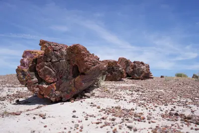
    Holbrook is a small town on historic Route 66 in northeastern Arizona and the closest town to the southern end of Petrified Forest National Park, about 18 miles (nearly 30 kilometers) away. The park features over 200-million-year-old petrified tree trunks nestled among the colorful hills of the Painted Desert.In town, the historic Navajo County Courthouse from 1898 houses a museum with jail cells and serves as the visitor center.

    Strange Happenings·Pexels

    Page

    Page

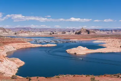
    Page is a town of about 7,400 people in far northern Arizona, right on the Utah line and the shore of Lake Powell. It's the base for three stops that top many Southwest road trips: Horseshoe Bend, Antelope Canyon and Lake Powell with Glen Canyon Dam, all less than 15 minutes from town.It's roughly four and a half to five hours from both Las Vegas and Phoenix and about three from the Grand Canyon's South Rim. Plan at least one night: Horseshoe Bend is emptiest at sunrise and best lit in the afternoon, Antelope Canyon glows most around midday, and a boat trip on the lake is worth the time.Book aheadAntelope Canyon: guided tours with a Navajo-owned operator only. In spring and summer, book days or weeks out; Upper Antelope Canyon doesn't sell tickets on-site. Budget around $100 per person for Lower Antelope Canyon, including the Navajo Nation fee.Horseshoe Bend: no reservation, but parking is $10 per car.Time zones: Page stays on Mountain Standard Time year-round, while the Navajo Nation observes daylight saving time. Double-check which time your tour is listed in.The town itself is no-frills, with motels, grocery stores and a modest choice of restaurants, but it works well as a base.

    Christian David·CC BY-SA 4.0

    Your next steps

    Flagstaff is in United States. Ways to carry on from here.

    • More in United States

      Highlights, areas, routes and the best time to travel for all of United States.

      United States travel guide
    • Round trips with Flagstaff

      One route passes through Flagstaff, with stops, nights and a map.

      See the round trip

    Sources & method

    • Photos: Wikimedia Commons. Each photo carries its credit.
    • Place data such as addresses and ratings comes from Google Maps.
    • The content is based on web research from public, traceable sources. How the content is made · The role of AI