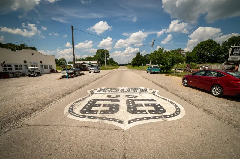
Photo by Get Lost Mike on Pexels
Round trip · United States
Route 66: From Chicago to Santa Monica
by Felix Gillen
- 18 Days / 17 Nights
- Chicago → Los Angeles
Route 66 was established in 1926 and was decommissioned as a federal highway in 1985. There is no continuous original road left: Between Chicago and St. Louis, Interstate 55 has replaced the route, Interstate 44 from St. Louis to Oklahoma City, and from there to Barstow, California, Interstate 40. Williams, Arizona, was the last place bypassed in 1984. Many old sections are still traversable, as town thoroughfares, parallel roads, or marked Historic Route 66; others are dilapidated, built over, or have disappeared under the Interstate. A special Route 66 guide with section maps is therefore essential, and some stages you will inevitably drive on the Interstate. Arizona has the longest preserved original section, with approximately 385 miles, including the 67 miles of State Route 66 between Seligman and Kingman, off the Interstate. In New Mexico, until 1937, the road ran via Santa Fe; the later alignment leads directly through Albuquerque; this itinerary includes both. The Grand Canyon is not part of Route 66, but is a worthwhile detour from Flagstaff or Williams.
At a glance
- Duration
- 18 Days / 17 Nights
- Stops
- 13 · Chicago → Los Angeles
- Arrival
- Flight · Chicago O'Hare (ORD)
- Departure
- Flight · Los Angeles (LAX)
- Best Time to Go
- May to June, September to October
13 stops
Why This Route?
Route 66 is less a road than a journey through time across eight states: neon motels, diners, and old gas stations, alongside prairie, desert, and the land of the Navajo and Pueblo. The Mother Road was established in 1926, and on hardly any other route do you feel so clearly how the car shaped America.
Hidden Gems
- Gemini Giant, the iconic astronaut figure in Wilmington, Illinois
- the narrow original section of roadway from 1919 to 1924 near Miami, Oklahoma
- Cadillac Ranch located west of Amarillo
- the Route 66 segment within Petrified Forest National Park
- Oatman and its free-roaming burros found along the mountain road over Sitgreaves Pass
Getting there and back
Open jaw: start and end are in different places
- Arrival
- Flight · Chicago O'Hare (ORD)From O'Hare, the CTA Blue Line goes directly to the Loop. Pick up your rental car only on departure day; for one-way rentals from Chicago to Los Angeles, companies often charge a high drop-off fee, compare early.
- Departure
- Flight · Los Angeles (LAX)Drop off the car at LAX and allow plenty of time for the drive from Santa Monica due to traffic.
Itinerary
Chicago
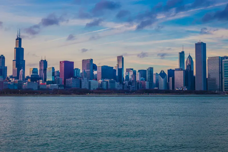
Chicago, on the southwest shore of Lake Michigan, is where the skyscraper was born. After the Great Fire of 1871 the city rebuilt fast, and the Home Insurance Building of 1885 is generally counted as the first modern high-rise. Architecture is still the main draw, along with the lakefront museums and a food scene built on deep-dish pizza and Italian beef.Downtown is the Loop, named for the elevated tracks that circle the business district. Millennium Park and Cloud Gate, the Art Institute of Chicago and the Riverwalk are all within a few blocks. The best introduction is the Chicago Architecture Center's 90-minute river cruise, which passes more than 50 buildings. It runs from mid-March into the fall; book ahead for summer weekends.For the view from the top you have two choices: the Skydeck on the 103rd floor of Willis Tower, with the glass boxes of The Ledge, or 360 Chicago on the 94th floor on the Magnificent Mile, closer to the lake. From O'Hare, the Blue Line runs 24 hours a day and reaches downtown in 40 to 45 minutes; from Midway, the Orange Line takes 20 to 25 minutes.The neighborhoodsThe Loop and Millennium Park: downtown, with Chicago School skyscrapers, plaza art and the lakefront parks.River North, Magnificent Mile and Streeterville: just north of the river, with the big shopping strip, galleries, steakhouses and most of the hotels.Museum Campus and South Loop: the aquarium and planetarium on the lake, Printers Row and jazz clubs.Wicker Park and Logan Square: residential neighborhoods on the Blue Line with record stores, restaurants, cocktail bars and The 606 trail.
Begin sign on Adams Street, Architectural boat tour on the Chicago River, Deep Dish Pizza.
11 Sights
5 Restaurants
Architecture, Blues and Museums
After the Great Fire of 1871, Chicago rebuilt itself as a laboratory for tall buildings, and the Home Insurance Building went up in 1885. The 1893 World's Fair left behind two of the city's great museums: the Field Museum grew out of its collections, and the Art Institute moved into a building put up for the fair on Michigan Avenue.Chicago blues: The Great Migration brought Black musicians up from the South. Muddy Waters, who moved to Chicago in 1943, defined the amplified sound of electric guitar and harmonica, and Chess Records took it national. You can still hear it live at Buddy Guy's Legends in the South Loop and Kingston Mines in Lincoln Park.Chicago Blues Festival: Held every year since 1984.Jazz: The Green Mill in Uptown, open since 1907 and once an Al Capone hangout, has live bands most nights and hosts the Uptown Poetry Slam on Sundays.
St. Louis
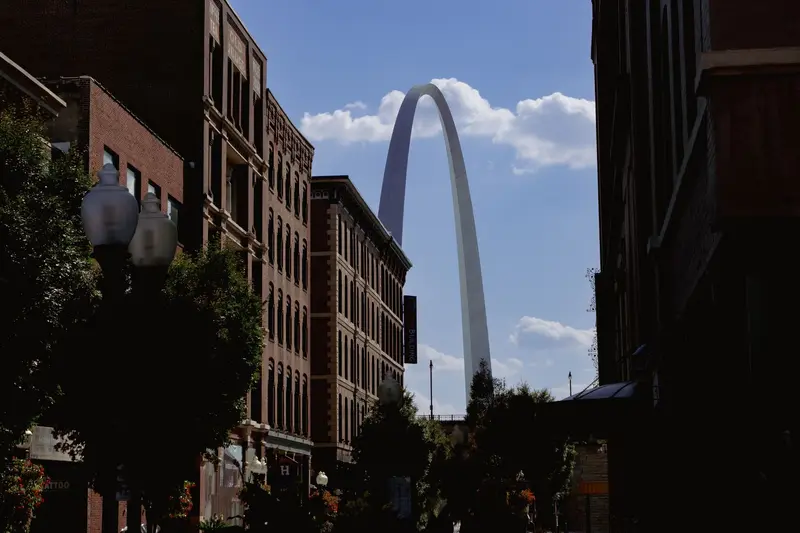
St. Louis, located on the Mississippi's west bank, was the Gateway to the West: This is commemorated by the Gateway Arch towering over the riverfront, and a small tram takes you up to its observation deck.Forest Park, site of the 1904 World's Fair, is home to the Art, History, and Science Museums, as well as the Zoo. The City Museum is an adventure playground for all ages, and the Anheuser-Busch Brewery offers guided tours of its historic brewhouse.
Gateway Arch, Frozen Custard at Ted Drewes on old Route 66 and the Chain of Rocks Bridge over the Mississippi, today only for pedestrians and cyclists.
4 Sights
1 Restaurant
Culture and Food
World's Fair and BreweryThe 1904 World's Fair in Forest Park put the city on the map, and Anheuser-Busch brewery remains a landmark to this day. On the Day Fresh Tour, you'll see the historic brewhouse and the Clydesdale horses.James Beard AwardsThe city's culinary scene regularly receives awards, such as Loryn Nalic of Balkan Treat Box as Best Chef Midwest in 2026.
Springfield (Missouri)
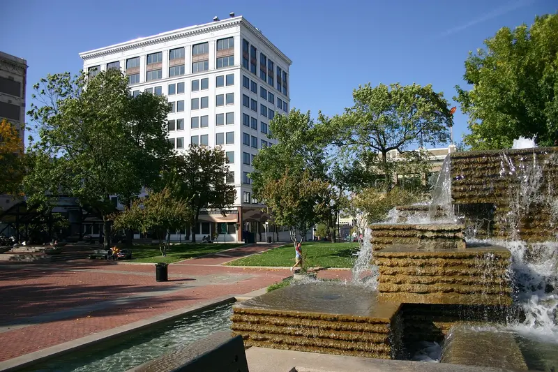
Springfield, Missouri, is considered the birthplace of Route 66: On April 30, 1926, a telegram from the Colonial Hotel was sent to federal authorities, accepting the number 66 for the new highway. The route was officially approved on November 11, 1926.Besides the traces of Route 66, the large Wonders of Wildlife National Museum & Aquarium is worth a visit.
Through the Ozarks, along the way the murals in Cuba, Missouri.
2 Sights
Route 66
Where It All BeganAccording to the tourism office, Red's Giant Hamburg in Springfield had the first known drive-through window. The city's first Route 66 sign was erected in 1991 at the corner of Kearney and Glenstone.
Tulsa
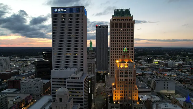
Tulsa on the Arkansas River is one of the Route 66 stops in Oklahoma. In the Greenwood District, the former Black Wall Street, the Greenwood Rising museum commemorates the 1921 massacre of the Black community.By the river is the publicly accessible park Gathering Place. South of downtown, the Philbrook Museum showcases art in an Italian Renaissance-style villa. In the Arts District, the Bob Dylan Center and the Woody Guthrie Center stand side by side.
Briefly through Kansas near Galena and Baxter Springs, then the Blue Whale of Catoosa and the Art Deco downtown of Tulsa.
5 Sights
Customs
GreenwoodGreenwood Rising tells the story of Black Wall Street and the 1921 Tulsa Race Massacre. Open Tuesday to Sunday, 10 AM to 7 PM, admission $15 USD.MusicAt the Bob Dylan Center and the adjacent Woody Guthrie Center, you'll see manuscripts, recordings, and handwritten lyrics by both musicians.
Oklahoma City
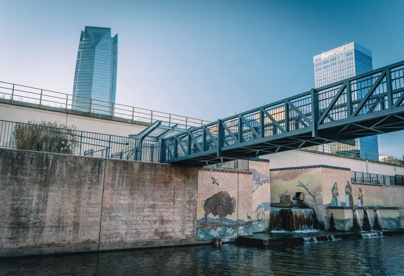
Oklahoma City is the capital and largest city of Oklahoma and is located on Route 66. The Oklahoma City National Memorial commemorates the bombing of the federal building on April 19, 1995, in which 168 people died; a museum tells the story.The First Americans Museum presents the history of Oklahoma's 39 indigenous nations, while in the former warehouse district of Bricktown, a water taxi travels the canal.
On the way, Pops in Arcadia with the giant soda bottle, in the city the Oklahoma City National Memorial.
2 Sights
1 Restaurant
Culture and Cuisine
39 Nations39 Indigenous Nations call Oklahoma home, their history told from their own perspective at the First Americans Museum.Award-winning CuisineFlorence's Restaurant was the first Oklahoma establishment to receive a James Beard Award in 2022, and Andrew Black of Grey Sweater was named Best Chef Southwest in 2023.
Amarillo
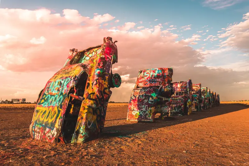
Amarillo is the largest city in the Texas Panhandle and a classic stop on Route 66. West of the city, the ten colorfully spray-painted cars of the Cadillac Ranch have been stuck in the field since 1974, and you can paint them yourself with spray paint.In the Route 66 Historic District on Sixth Avenue, you'll find antique shops. Southeast of the city, the Palo Duro Canyon opens up, according to Texas Parks and Wildlife, the second largest canyon in the USA.
Cadillac Ranch and steak at Big Texan. The next morning, the MidPoint Café in Adrian, the middle of the route.
2 Sights
1 Restaurant
Route 66
Steaks and Art on the HighwayThe Big Texan on I-40 is famous for its 72-ounce steak challenge. In summer, the open-air theater in Palo Duro Canyon presents the show "TEXAS".
Santa Fe
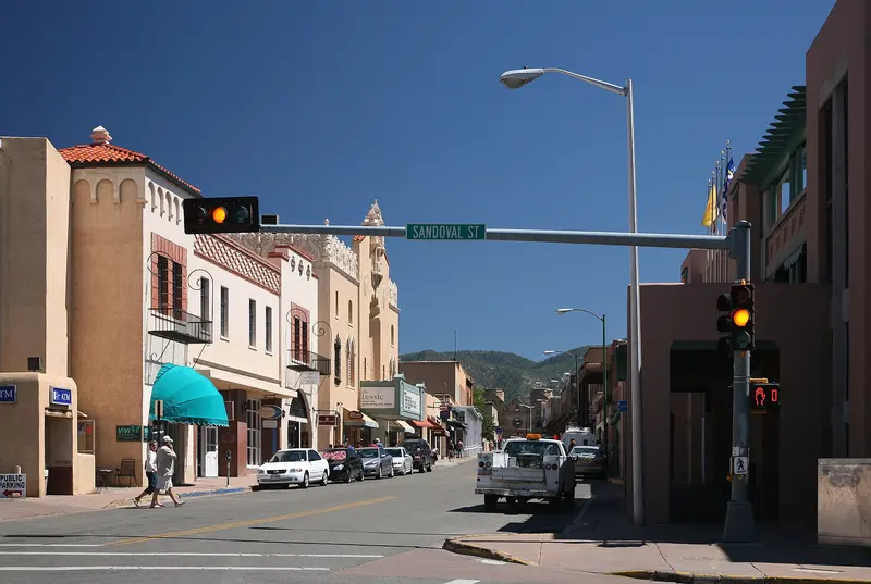
Santa Fe, at around 2,100 meters at the foot of the Sangre de Cristo Mountains, is the oldest US state capital, founded circa 1610. Adobe buildings surround the Plaza, and under the arcades of the Palace of the Governors, indigenous artisans sell their jewelry.Over 100 galleries line Canyon Road, and the Georgia O'Keeffe Museum showcases the painter who made New Mexico famous. Bandelier and Taos Pueblo are within day-trip distance.
Along the pre-1937 route: Plaza, galleries on Canyon Road, Adobe architecture.
7 Sights
1 Restaurant
Culture and Food
Adobe, Pueblos, and ArtPueblo cultures and the Spanish colonial era shape the cityscape: adobe buildings, churches like the San Miguel Chapel, and the Cathedral. Under the portal of the Palace of the Governors, artists from 23 tribes and pueblos sell their works directly.Red or Green?“Red or Green?” has been New Mexico's official state question since 1996: It means whether you want your food with red or green chile sauce. You typically order at restaurants like The Shed on the Plaza.Christmas in Santa FeOn Christmas Eve, paper lanterns line the street during the Farolito Walk on Canyon Road.
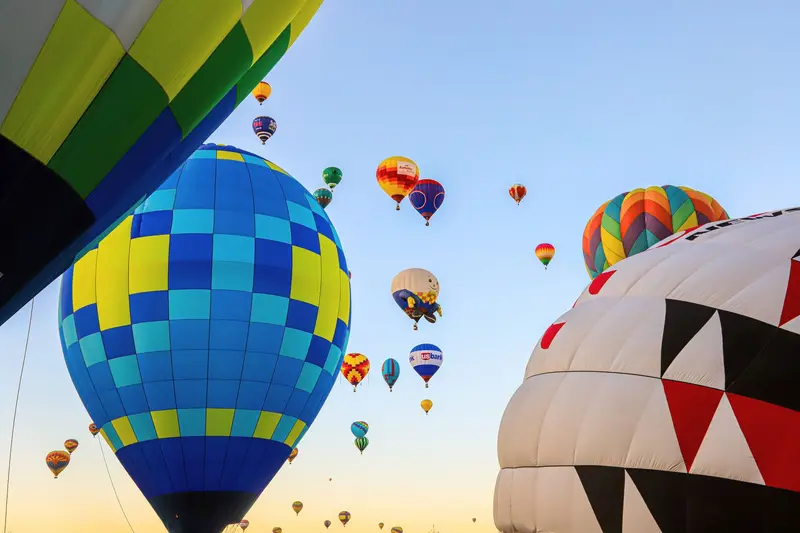
Albuquerque
Albuquerque, located on the Rio Grande, is New Mexico's largest city. Its Old Town, featuring the San Felipe de Neri Church, dates back to the Spanish founding in 1706, and Central Avenue follows the historic Route 66.The Sandia Peak Tramway takes you up to 3,163 meters, while the Indian Pueblo Cultural Center showcases the cultures of the state's 19 Pueblos. In early October, over 500 hot air balloons ascend for the Balloon Fiesta.
Central Avenue is the old Route 66 with neon signs, as well as Old Town.
4 Sights
1 Restaurant
Culture and Events
Pueblos and Spanish FoundingThe city was founded in 1706, the San Felipe de Neri Church on the Plaza dates from 1793. At the Indian Pueblo Cultural Center, you will learn the history of the 19 Pueblos from their own perspective.Albuquerque International Balloon FiestaEvery October, more than 500 balloons launch at Balloon Fiesta Park. The 2027 festival is held from October 2 to 10. Accommodations book up early during this period.
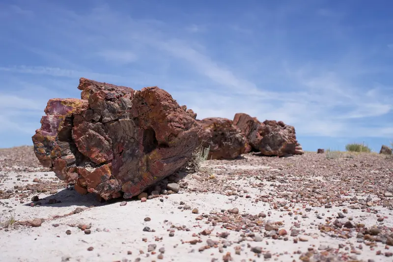
Holbrook (Petrified Forest)
Holbrook is a small town on historic Route 66 in northeastern Arizona and the closest town to the southern end of Petrified Forest National Park, about 18 miles (nearly 30 kilometers) away. The park features over 200-million-year-old petrified tree trunks nestled among the colorful hills of the Painted Desert.In town, the historic Navajo County Courthouse from 1898 houses a museum with jail cells and serves as the visitor center.
Wigwam Motel and Petrified Forest National Park, the only national park to encompass a section of historic Route 66. En route, Winslow and the Standin' on the Corner.
1 Sight
Culture
Navajo County Historic CourthouseThe 1898 courthouse is now a museum with over 70 exhibits and jail cells in the basement. Admission is free, Monday to Saturday, 9 AM to 5 PM. In summer, enjoy free evening Native American dances in front of the building on weekdays.
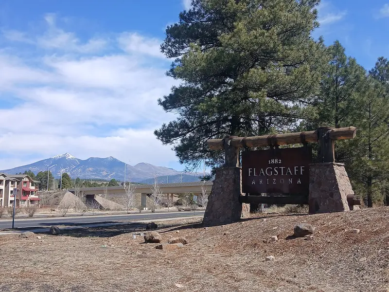
Flagstaff
Flagstaff, in northern Arizona on old Route 66, is the classic gateway to the Grand Canyon's South Rim. Pluto was discovered at Lowell Observatory on Mars Hill, and on Oct. 24, 2001, Flagstaff became the world's first International Dark Sky City.Surrounding the city are three National Park Service protected areas: the cliff dwellings of Walnut Canyon, Sunset Crater volcano, and the Wupatki Pueblos.
Historic city center on the railway line, Lowell Observatory.
4 Sights
2 Restaurants
Customs
City of StarsBecause Flagstaff has limited its lighting for decades, the night sky here is exceptionally dark. The Lowell Observatory offers evening observations at its telescopes.Colorado PlateauThe Museum of Northern Arizona explains the nature and indigenous cultures of the plateau. In the city center, several restaurants have received James Beard Foundation nominations, including Shift and Atria.
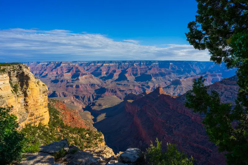
Grand Canyon National Park
Grand Canyon National Park in northern Arizona, about a 90-minute drive north of Flagstaff, protects the Colorado River's gorge. You go there to gaze up to 1,800 meters deep into the Canyon from the South Rim, ideally at sunrise or sunset, or to descend a portion of the Bright Angel or South Kaibab Trail.The gorge is 446 kilometers long and up to 29 kilometers wide. Almost all visitors come to the South Rim, which is open year-round. Since 1979, the park has been a UNESCO World Heritage site.The heart of the South Rim is Grand Canyon Village, home to the El Tovar Hotel, opened in 1905. Hermit Road stretches about 11 kilometers west past various viewpoints, while Desert View Drive extends about 40 kilometers east to the Desert View Watchtower, designed by Mary Colter in 1932. For sunrise and sunset, Mather Point, Yaki Point, and Hopi Point are the most famous spots, and consequently, they get crowded.Admission and Rules 2026Admission: 35 US dollars per car, 30 per motorcycle, 20 per person on foot or by bike, each valid for 7 days. Payment is by card only.Surcharge for International Visitors: Starting in 2026, if you do not reside in the USA, you pay an additional 100 US dollars per person aged 16 and above. The surcharge is waived with the America-the-Beautiful Pass for international visitors (250 US dollars per vehicle).Reservation: Not required for entry.South Rim: Flash Flood and Water Shortage (As of Mid-November 2026)The flash flood in Bright Angel Canyon on August 29, 2026, destroyed the Transcanyon water pipeline. Since August 31, Water Conservation Level 4 has been in effect at the South Rim. What this means for you:Lodging: At the end of August, all in-park hotels were closed for overnight stays. According to the operator and NPS, El Tovar, Bright Angel Lodge, Maswik, and Yavapai Lodge are expected to reopen to guests from November 20, 2026, while Phantom Ranch will remain closed until at least January 31, 2027. Check the current status before booking in the park; hotels in Tusayan, outside the South Entrance, are not affected.Camping: Mather Campground is open, but only for dry camping. Trailer Village is expected to reopen from November 20.Food: Many eateries are closed or have reduced hours. Bring provisions.Hiking Trails: Bright Angel Trail only up to Mile-and-a-Half Resthouse, South Kaibab Trail only up to Tip-Off, plus Plateau Point Trail. Trails to the Colorado River and Phantom Ranch are closed. Drinking water is only available at trailheads.Fires: All wood fires are prohibited at Mather Campground.North Rim 2026The North Rim, over 2,400 meters high, is open only for day visitors in 2026, until November 30 or until the first heavy snowstorm. The Dragon Bravo Fire from July 2025 destroyed approximately 70 buildings, including the Grand Canyon Lodge and the visitor center. There is no lodging, no campground, and no drinking water available in the park in 2026; the gas station is closed for the season. The North Kaibab Trail is closed, as are many rim trails such as Bright Angel Point and Widforss Trail. Cape Royal Road and Point Imperial Road are prohibited for vehicles over 22 feet.
Detour to the South Rim, then via Williams back to Route 66.
6 Sights
2 Restaurants
History and Culture
Native peoples have lived in and around the Grand Canyon for thousands of years. Many tribes are traditionally associated with the park today, including the Havasupai, Hualapai, Hopi, Navajo (Diné), Zuni (A:shiwi), several Paiute bands and the Yavapai-Apache Nation. The Havasupai built the upper part of what became the Bright Angel Trail, and the rest stop once called Indian Garden is now Havasupai Gardens.The canyon became a national monument in 1908 and a national park in 1919. After the railroad reached the South Rim in 1901, Grand Canyon Village grew quickly; today it's a National Historic Landmark District with 257 historic structures. Architect Mary Colter shaped the look of the South Rim for the Fred Harvey Company:Hopi House (1905), modeled on a Hopi puebloLookout Studio and Hermit's Rest (both 1914)Desert View Watchtower (1932), with murals by Hopi artist Fred KabotieBright Angel Lodge (1935)El Tovar was built in 1905 for the Santa Fe Railway to designs by Charles Whittlesey. At Hopi House, Native artists from the region still sell jewelry, pottery and textiles.
Kingman
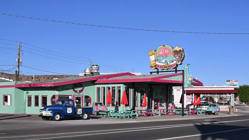
Kingman in western Arizona is a stop on the old Route 66. The historic Powerhouse, built from 1907 to 1911, houses the Visitor Center and the Arizona Route 66 Museum.West of the city, Oatman Road, part of Route 66, winds its way over Sitgreaves Pass to the ghost town of Oatman, where donkeys roam freely through the main street.
First, State Route 66 via Seligman, then the winding mountain road to Oatman.
3 Sights
Los Angeles
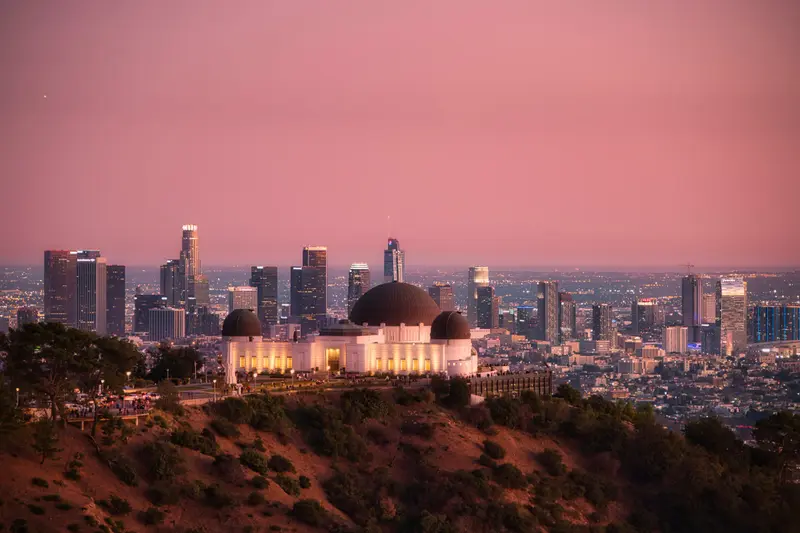
Los Angeles is the second-largest city in the country and the capital of the American film business, a sprawling metro that runs from Pacific beaches into the Santa Monica Mountains. People come for Hollywood and the studios, for museums like the Getty Center and LACMA, for the beaches from Santa Monica to Malibu, and for food shaped by the city's huge Mexican and Korean communities.LA has no single center, just dozens of neighborhoods that are often 30 minutes or more apart. Plan your days by area: Hollywood and Griffith Park one day, Downtown the next, then the coast with Santa Monica and Venice. Freeways jam roughly 7 to 10 a.m. and 3 to 7 p.m. on weekdays, and holiday weekends are worse.Metro Rail has six lines and 110 stations. Since May 2026 the D Line has run under Wilshire Boulevard to Wilshire/La Cienega, with a stop at Wilshire/Fairfax right by LACMA. The E Line links Downtown with Santa Monica, and the B Line runs from Downtown to Hollywood and Universal City.
Through Barstow and the Mojave to Santa Monica. The End of the Trail sign at the Pier is a symbolic end; the historic terminus lay at the intersection of Lincoln and Olympic Boulevard.
8 Sights
3 Restaurants
Culture and History
Los Angeles was founded on September 4, 1781, by 44 settlers, the "Pobladores." Hollywood joined the city in 1910, and by 1921, over 80% of the world's film industry was already based here. On Hollywood Boulevard, the handprints at the TCL Chinese Theatre and the Walk of Fame stars commemorate this.Museums: The Getty Center is free, but requires a timed-entry reservation. The Broad showcases contemporary art with free admission. LACMA opens its Peter Zumthor-designed David Geffen Galleries to all visitors in May 2026; adults without L.A. County residency pay $30.Music: Frank Gehry's iconic Walt Disney Concert Hall opened in 2003 and is the revered home of the Los Angeles Philharmonic.Communities: Approximately 32 percent of residents have Mexican roots. Koreatown, Little Tokyo, and Chinatown each boast their own vibrant restaurant scenes.
Plan this route as your trip
All stops, trains and nights go into your trip planner. You adjust dates and places to stay afterwards.
This route is a suggestion from our research. Please check timetables, times in port, opening hours and prices before you book – what your tour operator or carrier says is what counts.
Fernweh is a free travel guide and trip planner: routes researched by people, taken over in one click, used day by day on the road. More about Fernweh
13 stops
Route Summary
Duration18 Days
Stops13 Places
TypeMixed