Fernweh: Home
ExploreGuideDestinationsMy tripsMy trip
de|en
All Places & RegionsRound tripsNight trains in EuropeAll highlightsAbout FernwehFAQPrivacy PolicyImprint
Download on the App StoreGet it on Google Play
ExploreGuideDestinationsMy tripsMy trip
    • Places & highlights
    • Eat & drink
    • Culture
    • Getting around
    • Accommodation
    • Round trips
    • Nearby
    Monument Valley

    Photo by Ganapathy Kumar on Unsplash

    United States

    Monument Valley

    Point of InterestNature

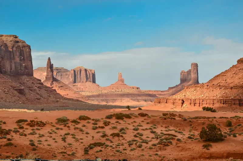
    Monument Valley is located on the border between Arizona and Utah on the land of the Navajo Nation, who call the valley Tse'Bii'Ndzisgaii.

    by Felix Gillen

    1. Home
    2. Destinations
    3. United States
    4. Arizona
    5. Monument Valley
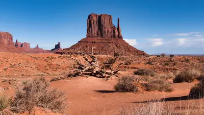
    Monument Valley is located on the border between Arizona and Utah on the land of the Navajo Nation, who call the valley Tse'Bii'Ndzisgaii. The sandstone buttes like the Mittens and Merrick Butte rise 120 to 300 meters above the plain and have been an iconic image of the American West since John Ford's Westerns.This area is not a national park, but rather the Monument Valley Navajo Tribal Park, which the Navajo Nation manages itself. For an entrance fee, you can drive the unpaved Valley Drive yourself; many areas off-road can only be entered with a Navajo guide.
    United States travel guideSee the round tripPlan a trip with Monument Valley

    Contents

    • Places & highlights
    • Eat & drink
    • Culture
    • Getting around
    • Accommodation
    • Round trips
    • Nearby

    Sights in Monument Valley

    Discover the most important sights and attractions

    Attraction

    1Visitor Center and View of the Mittens

    From the terrace at the visitor center, you look directly onto the West and East Mitten Buttes and Merrick Butte, the classic panorama of the valley. Inside, there's a small museum, and in summer, also a restaurant with Navajo dishes. This is where the Valley Drive begins.
    Open in Google Maps
    Attraction

    2Valley Drive

    The unpaved loop road leads from the Visitor Center past the valley's most famous mesas. It is sandy and rough; RVs, motorcycles, and large SUVs are not permitted. In winter, the last entry is at 2:30 PM.
    Open in Google Maps
    Museum

    3Goulding's Trading Post Museum

    The stone trading post of Harry and Leone Goulding at the western edge of the valley was completed in 1928. Today, as a museum, it displays photos and memorabilia from the time when John Ford filmed his Westerns here.
    Open in Google Maps

    Restaurants in Monument Valley

    Culture

    Land of the NavajoThe valley belongs to the Navajo Nation, which manages the Tribal Park itself. Just before the visitor center, Navajo sell jewelry and handicrafts at stands; the visitor center itself has a small museum and a viewing terrace.Hollywood BackdropHarry and Leone Goulding bought land on the edge of the valley in 1921; by 1928, their stone trading post was complete. Harry Goulding showed John Ford photos of the area, after which Ford filmed 'Stagecoach' here. The museum in the old trading post commemorates this.

    Arrival and Visiting

    Admission and Opening HoursThe Navajo Nation charges its own admission fee; national park passes are not valid. The park website states $10 USD per person per day; check navajonationparks.org for current rates and online booking.Winter hours since October 17, 2026: Viewpoint and Valley Drive 8 AM to 5 PM, last entry onto Valley Drive 2:30 PM, Museum until 4:45 PM. Closed on Thanksgiving, December 25, and January 1.Valley DriveThe loop road is unpaved, with deep sand and rough terrain. Stay on the marked route.Motorcycles, RVs, campervans, large SUVs, and off-road vehicles are prohibited on Valley Drive, as are dogs throughout the park. The park is not liable for vehicle damage.To go deeper into the valley, for instance to the Ear of the Wind, you need a guided tour by a Navajo operator. The Wildcat Trail (approx. 2.4 kilometers) is the only self-guided hike; you must register and deregister at the Visitor Center.PhotographyFor commercial photography and filming, you need a permit from the Navajo Nation.

    Accommodations in Monument Valley

    Find perfect stay in Monument Valley

    Booking.com* (Affiliate link)
    Search Hotels
    Agoda* (Affiliate link)
    Search Hotels
    Airbnb
    Vacation Rentals

    * Affiliate link: if you book through it, we earn a small commission. The price stays the same for you.

    Campgrounds in Monument Valley

    Find perfect campground in Monument Valley

    Search via Google Maps
    Campgrounds nearby (15km)
    Camping.info
    Find Campgrounds
    Park4Night
    RV Parks & Camping

    Round trips with Monument Valley

    National Park Loop in the Southwest from Las Vegas

    National Park Loop in the Southwest from Las Vegas

    The loop begins in Las Vegas, proceeds via Zion and Bryce Canyon on Scenic Byway 12 to Capitol Reef, then to Moab (Arches & Canyonlands), through Monument Valley to Page on Lake Powell, and via Desert View East Entrance to the Grand Canyon South Rim. From Sedona, the journey returns to Las Vegas, covering parts of Route 66 and the Hoover Dam in the final kilometers. Popular national parks like Zion, Bryce Canyon, and Grand Canyon require non-US residents to pay an entry surcharge; check beforehand if the America the Beautiful Pass for non-residents is worthwhile for your group. Angels Landing in Zion requires a permit, awarded by lottery on recreation.gov; Fiery Furnace in Arches needs a permit, and Arches' Timed-Entry reservation requirement varies seasonally. Monument Valley and Antelope Canyon are located within the Navajo Nation, which has its own entrance fees; Antelope Canyon may only be entered with an authorized guide. At the Grand Canyon, flash floods and water pipeline damage can temporarily close lodging, campgrounds, and paths to the Colorado River; check nps.gov/grca beforehand and, if in doubt, divert to Tusayan or Williams. The South Rim is open year-round, while the North Rim is seasonal, so this tour utilizes the South Rim.

    18 Days
    10 stops

    Sébastien Vincon·Pexels

    Nearby

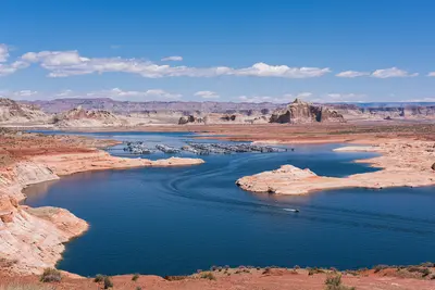
    Page

    Page

    Page is a town of about 7,400 people in far northern Arizona, right on the Utah line and the shore of Lake Powell. It's the base for three stops that top many Southwest road trips: Horseshoe Bend, Antelope Canyon and Lake Powell with Glen Canyon Dam, all less than 15 minutes from town.It's roughly four and a half to five hours from both Las Vegas and Phoenix and about three from the Grand Canyon's South Rim. Plan at least one night: Horseshoe Bend is emptiest at sunrise and best lit in the afternoon, Antelope Canyon glows most around midday, and a boat trip on the lake is worth the time.Book aheadAntelope Canyon: guided tours with a Navajo-owned operator only. In spring and summer, book days or weeks out; Upper Antelope Canyon doesn't sell tickets on-site. Budget around $100 per person for Lower Antelope Canyon, including the Navajo Nation fee.Horseshoe Bend: no reservation, but parking is $10 per car.Time zones: Page stays on Mountain Standard Time year-round, while the Navajo Nation observes daylight saving time. Double-check which time your tour is listed in.The town itself is no-frills, with motels, grocery stores and a modest choice of restaurants, but it works well as a base.

    Christian David·CC BY-SA 4.0

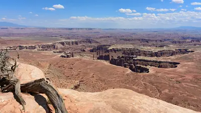
    Canyonlands National Park (Island in the Sky)

    Canyonlands National Park (Island in the Sky)

    Island in the Sky is the northern and most accessible district of Utah's Canyonlands National Park, about 32 miles west of Moab. You come for the view: from a mesa top you look roughly 2,200 feet down into the canyons of the Colorado and Green Rivers, and the best overlooks are just minutes from the car.The park splits into three districts that no road inside the park connects. The Needles to the south and the Maze to the west are separate trips; Island in the Sky makes an easy day trip from Moab. One road runs from the visitor center across the mesa to Grand View Point, with a spur to Upheaval Dome.Before you goEntrance fee: $30 per private vehicle. There's no nonresident surcharge here. The $55 Southeast Utah Parks pass also covers Arches.Supplies: no restaurants or gas in the park. Potable water is available at the visitor center only, spring through fall, and there's none on the trails. Fill the tank and pack lunch in Moab.Visitor center: open daily March through December from 9 a.m., with longer summer hours.Combine it: Dead Horse Point State Park is on the way, with its own fee, and its view of the Colorado River's gooseneck is worth the detour.

    Myrabella·CC BY-SA 4.0

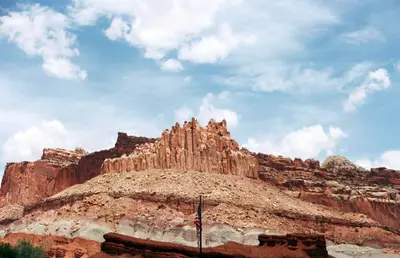
    Capitol Reef National Park

    Capitol Reef National Park

    The National Park in south-central Utah protects the Waterpocket Fold, a nearly 160-km-long fold in the Earth's crust featuring cliffs, canyons, domes, and natural bridges. At the heart of the park lies the historic settlement of Fruita on the Fremont River, with approximately 2,000 fruit trees maintained by the National Park Service; from June to October, you can pick fruit there, tasting is free, and take-home fruit incurs a small fee.The paved Scenic Drive extends approximately 13 km into the park; along State Route 24, you'll see petroglyphs of the Fremont culture; and the path to Hickman Bridge is a short hike to a natural arch. The nearest accommodations are in Torrey, about 18 km west of the visitor center.

    Aiden Guinnip·Unsplash

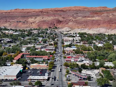
    Moab

    Moab

    Moab is a small town of about 5,000 people in eastern Utah, on the Colorado River and US 191, just under four hours' drive southeast of Salt Lake City. It's where you'll stay for Arches National Park, five minutes up the road, and Canyonlands' Island in the Sky district, about 45 minutes away.Main Street doubles as US 191: motels, outfitters, grocery stores and most restaurants are on it or a block or two off it. Jeep, rafting and mountain bike tours leave from here, and in the evening most visitors end up on the Main Street patios after a day on the trail.Good to knowPeak season: March through October, especially around Easter (Jeep Safari) and holiday weekends like Memorial Day and Labor Day. Book rooms and campsites weeks or months ahead.Heat: July and August regularly top 100°F. Hike early in the morning or in the evening.Groceries: City Market on Main Street is the biggest grocery store in the area. Stock up on water and supplies before heading into the parks.

    Quintin Soloviev·CC BY 4.0

    Bryce Canyon National Park

    Bryce Canyon National Park

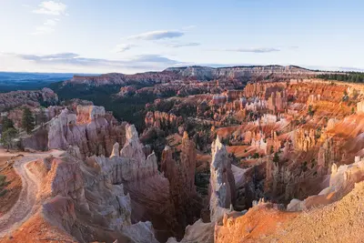
    Bryce Canyon National Park sits on a high plateau in southern Utah, a short day's drive northeast of Zion, at around 8,000 feet and topping out above 9,000 feet at Rainbow Point. You come for the hoodoos: thousands of orange-red rock spires packed into amphitheaters, with short trails that drop from the rim right down among them.Bryce isn't really a canyon but the eroded edge of a plateau. The heart of the park is the Bryce Amphitheater, lined by Sunrise, Sunset, Inspiration and Bryce Points. From there an 18-mile dead-end road with 13 viewpoints runs south to Rainbow Point.Where to stayThe closest hotels and restaurants are in Bryce Canyon City just outside the entrance, home to the sprawling Ruby's Inn. For something quieter, stay in the village of Tropic below the plateau, about 15 minutes away. Inside the park, the Lodge at Bryce Canyon is open spring through fall.Before you goEntrance fee: $35 per private vehicle. Visitors who aren't U.S. residents pay an extra $100 per person age 16 and up; U.S. residents don't. The America the Beautiful pass ($80 for residents, $250 for nonresidents) covers entry, and the nonresident version waives the surcharge for everyone in the car.Altitude and weather: nights are cool even in summer, it freezes almost every night from October through May, and snow is common in winter. Bring a warm layer and rain gear year-round; weather changes fast up here.After dark: Bryce is an International Dark Sky Park. Rangers run stargazing programs in summer, and full-moon hikes are assigned by lottery.
    Christian David·CC BY-SA 4.0

    Your next steps

    Monument Valley is in United States. Ways to carry on from here.

    • More in United States

      Highlights, areas, routes and the best time to travel for all of United States.

      United States travel guide
    • Round trips with Monument Valley

      One route passes through Monument Valley, with stops, nights and a map.

      See the round trip
    • Plan a trip with Monument Valley

      The Guide asks about season, length and who is coming, and suggests a trip with Monument Valley.

      Plan the trip

    Sources & method

    • Photos: Unsplash. Each photo carries its credit.
    • Place data such as addresses and ratings comes from Google Maps.
    • The content is based on web research from public, traceable sources. How the content is made · The role of AI