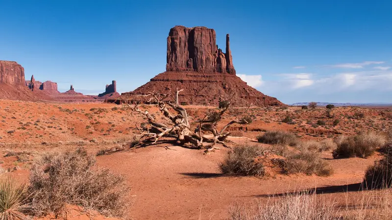
Photo by Sébastien Vincon on Pexels
Round trip · United States
National Park Loop in the Southwest from Las Vegas
by Felix Gillen
- 18 Days / 17 Nights
- Las Vegas → Las Vegas
The loop begins in Las Vegas, proceeds via Zion and Bryce Canyon on Scenic Byway 12 to Capitol Reef, then to Moab (Arches & Canyonlands), through Monument Valley to Page on Lake Powell, and via Desert View East Entrance to the Grand Canyon South Rim. From Sedona, the journey returns to Las Vegas, covering parts of Route 66 and the Hoover Dam in the final kilometers. Popular national parks like Zion, Bryce Canyon, and Grand Canyon require non-US residents to pay an entry surcharge; check beforehand if the America the Beautiful Pass for non-residents is worthwhile for your group. Angels Landing in Zion requires a permit, awarded by lottery on recreation.gov; Fiery Furnace in Arches needs a permit, and Arches' Timed-Entry reservation requirement varies seasonally. Monument Valley and Antelope Canyon are located within the Navajo Nation, which has its own entrance fees; Antelope Canyon may only be entered with an authorized guide. At the Grand Canyon, flash floods and water pipeline damage can temporarily close lodging, campgrounds, and paths to the Colorado River; check nps.gov/grca beforehand and, if in doubt, divert to Tusayan or Williams. The South Rim is open year-round, while the North Rim is seasonal, so this tour utilizes the South Rim.
At a glance
- Duration
- 18 Days / 17 Nights
- Stops
- 10 · Las Vegas → Las Vegas
- Arrival
- Flight · Las Vegas (LAS)
- Best Time to Go
- From April to May, and September to October
10 stops
Why This Route?
Nowhere else are so many grand landscapes so close together: Zion's canyons, Bryce's Hoodoos, Arches' stone arches, Monument Valley's mesas, and finally the Grand Canyon. Driving stages are manageable, and Las Vegas is easily accessible as start and finish.
Hidden Gems
- Kolob Canyons northwest of Zion, with separate access and few crowds
- Scenic Byway 12 between Bryce Canyon and Torrey, with the Hogsback Ridge
- Fruita Orchards in Capitol Reef, where you can pick your own during harvest season
- Dead Horse Point State Park near Moab for sunrise
- Desert View Watchtower on the East Rim of the Grand Canyon
Getting there and back
Round trip, returning to where you started
- Arrival
- Flight · Las Vegas (LAS)Rental car companies are all at the Rent-A-Car Center, about 3 miles south of the airport, served by shuttle buses from the terminals. Stock up on water and groceries before you leave town; there are long stretches between parks with no services.
- Departure
- Flight · Las Vegas (LAS)The last night in Las Vegas gives you a buffer after the long drive back from Sedona. Return the car at the Rent-A-Car Center and allow time for the shuttle to the terminal.
Itinerary
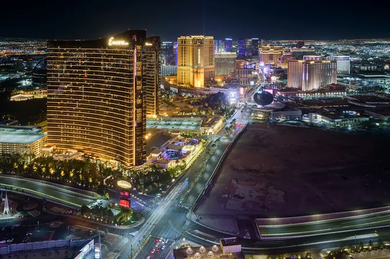
Las Vegas
Las Vegas is the casino and entertainment capital of the Mojave Desert, and nothing else in the country looks like its Strip of themed resorts, dancing fountains and the glowing Sphere. People come for headline shows and concerts, chef-driven restaurants, downtown's vintage neon, and easy day trips to Red Rock Canyon, Hoover Dam and the Grand Canyon.The city was founded as a railroad town in 1905. The roughly 4.2-mile Strip technically sits outside city limits in Paradise and Winchester; old Las Vegas, with Fremont Street, the Mob Museum and the Neon Museum, is Downtown, about 3 miles north. In between lies the Arts District, with galleries, breweries and vintage shops.Resort fees: Nearly every resort adds a nightly resort fee, typically $40 to $55 plus tax on the Strip and $30 to $50 downtown. Since May 2025, booking sites have to show the all-in price, so compare totals. Many resorts also charge for parking.Heat: July highs average 103 to 105°F, and nights often stay above 80°F. Distances between resorts are longer than they look; in summer, walk early in the morning or after dark.Crowds and prices: Room rates jump on Friday and Saturday nights, over holiday weekends, and during big events like the Formula 1 race in November. Midweek stays are usually much cheaper.
Arrive, beat the jet lag, get your rental car, then stroll the Strip at night.
7 Sights
3 Restaurants
Shows, Neon and City History
Las Vegas began in 1905 with a land auction along the Union Pacific tracks and incorporated as a city in 1911. Its culture plays out on resort stages: Elvis Presley performed 636 sold-out shows at the International Hotel, now the Westgate, between 1969 and 1976. Caesars Palace built the Colosseum for Celine Dion in 2003, kicking off the modern residency era, and since 2023 the Sphere has become the hottest venue for it.Cirque du Soleil: Four resident shows are running: "Mystère" at Treasure Island, "O" at Bellagio, "KÀ" at MGM Grand and "Michael Jackson ONE" at Mandalay Bay. Buy direct and pick a weeknight for the best prices.Museums: The Neon Museum preserves more than 200 vintage signs, and tours often sell out, so book ahead. The Mob Museum tells the story of organized crime inside a 1933 federal courthouse.Arts District: Galleries, studios and vintage shops around Main Street and Charleston Boulevard. The monthly First Friday street festival has been on hold since October 2026.
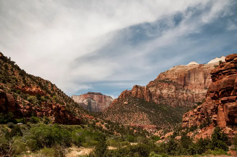
Zion National Park (Springdale)
Zion National Park in southwestern Utah, about two and a half hours northeast of Las Vegas, protects the sheer-walled canyon of the Virgin River. People come for the hikes: wading up the river into the Narrows, climbing the chained ridge of Angels Landing, or taking the short trails to the Emerald Pools.Almost everything happens in Zion Canyon, which you can only drive from March through November on the free park shuttle. For quieter scenery, head to the Kolob Canyons in the park's northwest corner, which have their own entrance off I-15, or take the Zion-Mount Carmel Highway east.Springdale as your baseThe town of Springdale sits right outside the South Entrance. It has most of the hotels, restaurants and paid parking, and the Springdale shuttle drops you at the pedestrian entrance by the visitor center. Staying in town means you skip the morning hunt for a parking spot inside the park, which is often hopeless by mid-morning in season.Before you goEntrance fee: $35 per private vehicle, good for 7 days. Since January 1, 2026, visitors who aren't U.S. residents pay an extra $100 per person age 16 and up. U.S. residents don't pay the surcharge; rangers may ask for a driver's license. An America the Beautiful pass covers it: $80 for U.S. residents, $250 for nonresidents (the nonresident pass waives the surcharge for everyone in the car).Angels Landing: permit required, drawn by lottery on Recreation.gov. Details under sights.The Narrows: closed when the river runs above 150 cubic feet per second or under a flash flood warning. In spring, snowmelt often keeps it closed for weeks.Water: plan on about a gallon per person per day. Don't drink from the river.
During shuttle season, most years from March to November, the Zion Canyon Scenic Drive is closed to private vehicles; you ride the shuttle. Angels Landing by permit only, The Narrows depending on water levels.
5 Sights
3 Restaurants
History
The Southern Paiute lived along the Virgin River long before settlers arrived. In 1858 a Paiute guide led Mormon missionary Nephi Johnson into the canyon, and within a few years settlers were farming the canyon floor. Isaac Behunin, who built a log cabin here in 1863, gave it the biblical name Zion.In 1872 geologist John Wesley Powell called the canyon Mukuntuweap, believing it to be the Paiute name, and President Taft protected it under that name as a national monument in 1909. Local Mormons objected; in 1918 it became Zion National Monument and in 1919 Utah's first national park. The Kolob Canyons were added in 1956.Many of the rock names, such as the Court of the Patriarchs, the Great White Throne and Angels Landing, date from those years and reflect the faith of the early settlers.
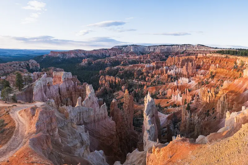
Bryce Canyon National Park
Bryce Canyon National Park sits on a high plateau in southern Utah, a short day's drive northeast of Zion, at around 8,000 feet and topping out above 9,000 feet at Rainbow Point. You come for the hoodoos: thousands of orange-red rock spires packed into amphitheaters, with short trails that drop from the rim right down among them.Bryce isn't really a canyon but the eroded edge of a plateau. The heart of the park is the Bryce Amphitheater, lined by Sunrise, Sunset, Inspiration and Bryce Points. From there an 18-mile dead-end road with 13 viewpoints runs south to Rainbow Point.Where to stayThe closest hotels and restaurants are in Bryce Canyon City just outside the entrance, home to the sprawling Ruby's Inn. For something quieter, stay in the village of Tropic below the plateau, about 15 minutes away. Inside the park, the Lodge at Bryce Canyon is open spring through fall.Before you goEntrance fee: $35 per private vehicle. Visitors who aren't U.S. residents pay an extra $100 per person age 16 and up; U.S. residents don't. The America the Beautiful pass ($80 for residents, $250 for nonresidents) covers entry, and the nonresident version waives the surcharge for everyone in the car.Altitude and weather: nights are cool even in summer, it freezes almost every night from October through May, and snow is common in winter. Bring a warm layer and rain gear year-round; weather changes fast up here.After dark: Bryce is an International Dark Sky Park. Rangers run stargazing programs in summer, and full-moon hikes are assigned by lottery.
Sunrise at Sunrise Point, then down Navajo Loop and Queen's Garden Trail among the Hoodoos. From October to May, it freezes almost every night.
5 Sights
2 Restaurants
History
The park is named for Ebenezer Bryce, a Mormon settler who moved in below the amphitheaters in the 1870s and built a road to haul timber. Neighbors started calling the amphitheater at the end of his road "Bryce's Canyon." He's remembered for calling it "a helluva place to lose a cow." He moved to Arizona in 1880, but the name stuck.By 1919 Ruby and Minnie Syrett were feeding and housing the first tourists in tents near Sunset Point; they later founded Ruby's Inn just outside the park boundary, which still defines Bryce Canyon City today. The area became a national monument on June 8, 1923, and a national park on February 25, 1928.
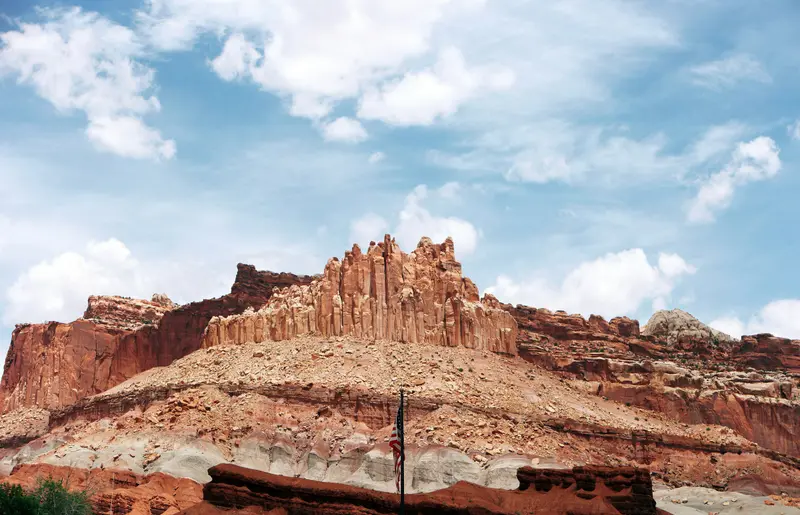
Capitol Reef (Torrey)
The National Park in south-central Utah protects the Waterpocket Fold, a nearly 160-km-long fold in the Earth's crust featuring cliffs, canyons, domes, and natural bridges. At the heart of the park lies the historic settlement of Fruita on the Fremont River, with approximately 2,000 fruit trees maintained by the National Park Service; from June to October, you can pick fruit there, tasting is free, and take-home fruit incurs a small fee.The paved Scenic Drive extends approximately 13 km into the park; along State Route 24, you'll see petroglyphs of the Fremont culture; and the path to Hickman Bridge is a short hike to a natural arch. The nearest accommodations are in Torrey, about 18 km west of the visitor center.
Optional, but rewarding: Drive via Scenic Byway 12, in the park the Scenic Drive and the petroglyphs on State Route 24.
6 Sights
Heritage
Fremont CultureThe rock art along State Route 24 was created by the Fremont Culture, which lived here from approximately 600 to 1300.FruitaSettlers established orchards along the Fremont River, which are maintained today as a historic cultural landscape. At the Gifford House, an old store with a small museum, freshly baked pies are available from spring to autumn.
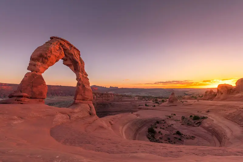
Moab (Arches and Canyonlands)
Arches National Park lies in eastern Utah just north of the town of Moab, about four hours southeast of Salt Lake City. It holds more than 2,000 sandstone arches, and the most famous, including Delicate Arch and Landscape Arch, are within short to moderate hikes of the road.A 19-mile scenic drive runs through the park past the trailheads for the Windows Section, Balanced Rock, Wolfe Ranch and, at the far end, Devils Garden. You'll reach many arches within 15 minutes on foot, but there's almost no shade along the way.Moab as your baseMoab is five minutes from the park entrance and also the base for Canyonlands National Park and Dead Horse Point State Park. It has hotels at every price point, grocery stores, gas and outfitters for jeep, rafting and canyoneering trips. Rooms book up early in the March to October high season.What to know in 2026No timed entry: you don't need an entry reservation in 2026. Expect lines at the entrance on weekends and holidays, and lots that staff close temporarily when they fill up.Still reservation-only: Devils Garden Campground (March through October) and every Fiery Furnace hike, self-guided or ranger-led.Entrance fee: $30 per private vehicle. Arches does not charge the $100 nonresident surcharge. The $55 Southeast Utah Parks annual pass covers Arches, Canyonlands and two national monuments.Heat: July and August highs often pass 100°F. Hike early or late and carry at least two liters of water per person; water is only available at the visitor center.
Delicate Arch for sunset, Windows Section, Devils Garden. Plan one day for Island in the Sky in Canyonlands National Park. Fiery Furnace by permit only.
5 Sights
3 Restaurants
History
Ancestral Puebloans, Fremont groups and later the Ute passed through this country. You can see their mark on the Delicate Arch trail: just past the Wolfe Ranch cabin, a rock panel shows Ute petroglyphs of horseback riders and bighorn sheep.The area became a national monument on April 12, 1929, and a national park on November 12, 1971. Writer Edward Abbey put it on the map; he worked here as a ranger in 1956 and 1957, and his journals from those seasons became "Desert Solitaire," a classic of American nature writing.The arches don't last forever. Wall Arch on the Devils Garden Trail collapsed in August 2008, one reason climbing on any arch is prohibited.
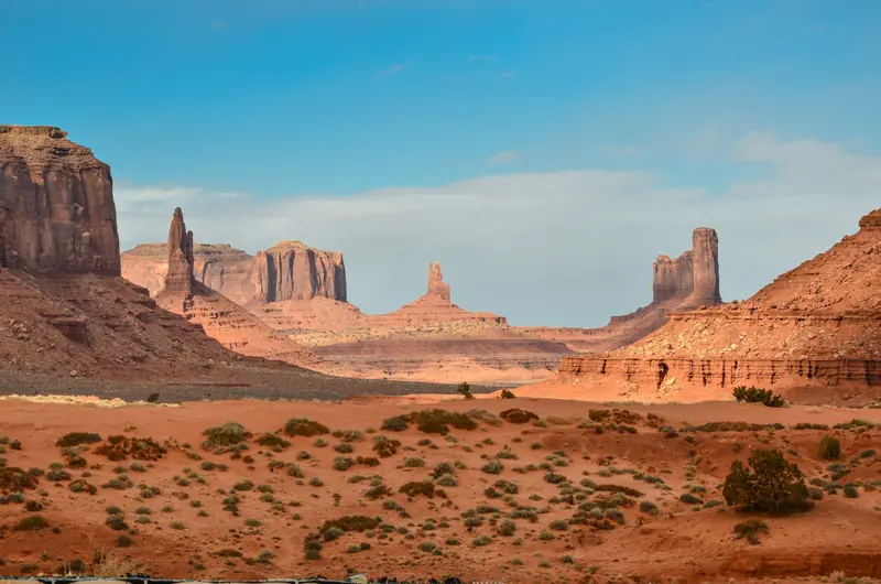
Monument Valley
Monument Valley is located on the border between Arizona and Utah on the land of the Navajo Nation, who call the valley Tse'Bii'Ndzisgaii. The sandstone buttes like the Mittens and Merrick Butte rise 120 to 300 meters above the plain and have been an iconic image of the American West since John Ford's Westerns.This area is not a national park, but rather the Monument Valley Navajo Tribal Park, which the Navajo Nation manages itself. For an entrance fee, you can drive the unpaved Valley Drive yourself; many areas off-road can only be entered with a Navajo guide.
You drive the 17-mile Loop Road in the Navajo Tribal Park yourself; it's sandy and bumpy. Some spots, like Ear of the Wind, require a Navajo guide. The Loop Road's opening hours vary with the season.
3 Sights
Culture
Land of the NavajoThe valley belongs to the Navajo Nation, which manages the Tribal Park itself. Just before the visitor center, Navajo sell jewelry and handicrafts at stands; the visitor center itself has a small museum and a viewing terrace.Hollywood BackdropHarry and Leone Goulding bought land on the edge of the valley in 1921; by 1928, their stone trading post was complete. Harry Goulding showed John Ford photos of the area, after which Ford filmed 'Stagecoach' here. The museum in the old trading post commemorates this.
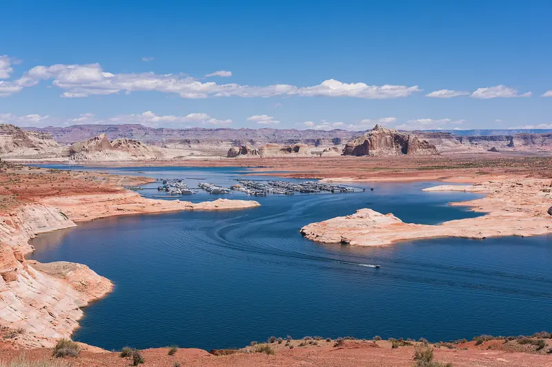
Page
Page is a town of about 7,400 people in far northern Arizona, right on the Utah line and the shore of Lake Powell. It's the base for three stops that top many Southwest road trips: Horseshoe Bend, Antelope Canyon and Lake Powell with Glen Canyon Dam, all less than 15 minutes from town.It's roughly four and a half to five hours from both Las Vegas and Phoenix and about three from the Grand Canyon's South Rim. Plan at least one night: Horseshoe Bend is emptiest at sunrise and best lit in the afternoon, Antelope Canyon glows most around midday, and a boat trip on the lake is worth the time.Book aheadAntelope Canyon: guided tours with a Navajo-owned operator only. In spring and summer, book days or weeks out; Upper Antelope Canyon doesn't sell tickets on-site. Budget around $100 per person for Lower Antelope Canyon, including the Navajo Nation fee.Horseshoe Bend: no reservation, but parking is $10 per car.Time zones: Page stays on Mountain Standard Time year-round, while the Navajo Nation observes daylight saving time. Double-check which time your tour is listed in.The town itself is no-frills, with motels, grocery stores and a modest choice of restaurants, but it works well as a base.
Upper or Lower Antelope Canyon only with a booked tour. Horseshoe Bend via a 2.4 km roundtrip trail; the parking fee is collected by the City of Page. Boat tour or kayak on Lake Powell.
8 Sights
3 Restaurants
History and Culture
Page is one of Arizona's youngest towns. It began in 1957 as a camp for the workers building Glen Canyon Dam, known simply as "Government Camp," on land the federal government got in a swap with the Navajo Nation. It's named for John C. Page, commissioner of the Bureau of Reclamation from 1936 to 1943, and incorporated in March 1975.Construction on the dam began in October 1956, and it was dedicated in 1966. Lake Powell started filling in January 1963, drowning the original Glen Canyon and its side canyons, which remains a sore point between conservationists and the dam's supporters.Page is almost entirely surrounded by the Navajo Nation. Antelope Canyon is on Navajo land, and many guides are Navajo who share what the place means to their families. Ask before photographing people or homes on the reservation.
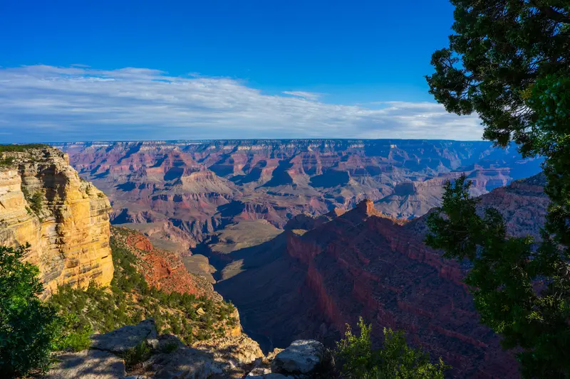
Grand Canyon National Park
Grand Canyon National Park in northern Arizona, about a 90-minute drive north of Flagstaff, protects the Colorado River's gorge. You go there to gaze up to 1,800 meters deep into the Canyon from the South Rim, ideally at sunrise or sunset, or to descend a portion of the Bright Angel or South Kaibab Trail.The gorge is 446 kilometers long and up to 29 kilometers wide. Almost all visitors come to the South Rim, which is open year-round. Since 1979, the park has been a UNESCO World Heritage site.The heart of the South Rim is Grand Canyon Village, home to the El Tovar Hotel, opened in 1905. Hermit Road stretches about 11 kilometers west past various viewpoints, while Desert View Drive extends about 40 kilometers east to the Desert View Watchtower, designed by Mary Colter in 1932. For sunrise and sunset, Mather Point, Yaki Point, and Hopi Point are the most famous spots, and consequently, they get crowded.Admission and Rules 2026Admission: 35 US dollars per car, 30 per motorcycle, 20 per person on foot or by bike, each valid for 7 days. Payment is by card only.Surcharge for International Visitors: Starting in 2026, if you do not reside in the USA, you pay an additional 100 US dollars per person aged 16 and above. The surcharge is waived with the America-the-Beautiful Pass for international visitors (250 US dollars per vehicle).Reservation: Not required for entry.South Rim: Flash Flood and Water Shortage (As of Mid-November 2026)The flash flood in Bright Angel Canyon on August 29, 2026, destroyed the Transcanyon water pipeline. Since August 31, Water Conservation Level 4 has been in effect at the South Rim. What this means for you:Lodging: At the end of August, all in-park hotels were closed for overnight stays. According to the operator and NPS, El Tovar, Bright Angel Lodge, Maswik, and Yavapai Lodge are expected to reopen to guests from November 20, 2026, while Phantom Ranch will remain closed until at least January 31, 2027. Check the current status before booking in the park; hotels in Tusayan, outside the South Entrance, are not affected.Camping: Mather Campground is open, but only for dry camping. Trailer Village is expected to reopen from November 20.Food: Many eateries are closed or have reduced hours. Bring provisions.Hiking Trails: Bright Angel Trail only up to Mile-and-a-Half Resthouse, South Kaibab Trail only up to Tip-Off, plus Plateau Point Trail. Trails to the Colorado River and Phantom Ranch are closed. Drinking water is only available at trailheads.Fires: All wood fires are prohibited at Mather Campground.North Rim 2026The North Rim, over 2,400 meters high, is open only for day visitors in 2026, until November 30 or until the first heavy snowstorm. The Dragon Bravo Fire from July 2025 destroyed approximately 70 buildings, including the Grand Canyon Lodge and the visitor center. There is no lodging, no campground, and no drinking water available in the park in 2026; the gas station is closed for the season. The North Kaibab Trail is closed, as are many rim trails such as Bright Angel Point and Widforss Trail. Cape Royal Road and Point Imperial Road are prohibited for vehicles over 22 feet.
Arrive at Desert View Watchtower, then along the South Rim. Rim Trail and a section of Bright Angel Trail or South Kaibab Trail; you should check beforehand on nps.gov/grca which sections below the rim are open. Water is only available at the trailheads; the return climb is significantly harder.
6 Sights
2 Restaurants
History and Culture
Native peoples have lived in and around the Grand Canyon for thousands of years. Many tribes are traditionally associated with the park today, including the Havasupai, Hualapai, Hopi, Navajo (Diné), Zuni (A:shiwi), several Paiute bands and the Yavapai-Apache Nation. The Havasupai built the upper part of what became the Bright Angel Trail, and the rest stop once called Indian Garden is now Havasupai Gardens.The canyon became a national monument in 1908 and a national park in 1919. After the railroad reached the South Rim in 1901, Grand Canyon Village grew quickly; today it's a National Historic Landmark District with 257 historic structures. Architect Mary Colter shaped the look of the South Rim for the Fred Harvey Company:Hopi House (1905), modeled on a Hopi puebloLookout Studio and Hermit's Rest (both 1914)Desert View Watchtower (1932), with murals by Hopi artist Fred KabotieBright Angel Lodge (1935)El Tovar was built in 1905 for the Santa Fe Railway to designs by Charles Whittlesey. At Hopi House, Native artists from the region still sell jewelry, pottery and textiles.
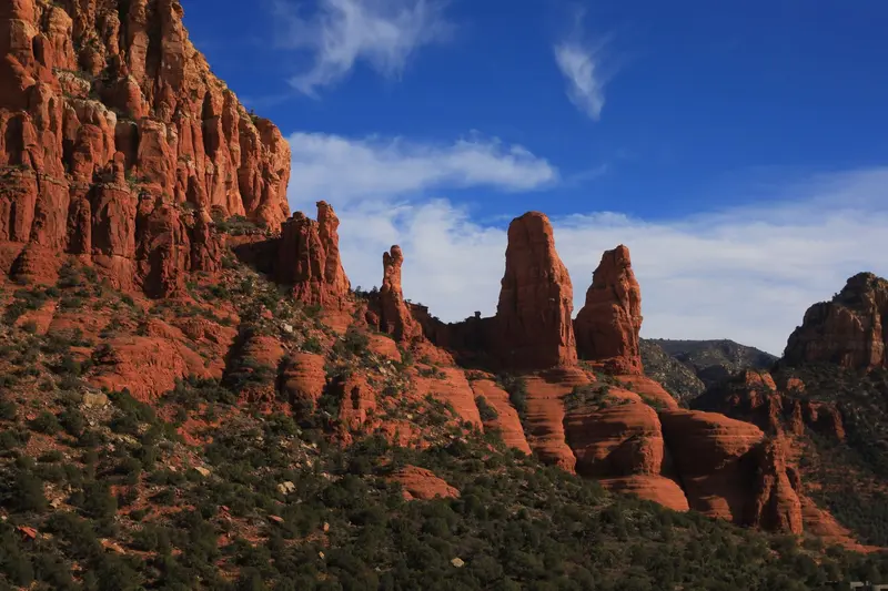
Sedona
Sedona is a town of just under 10,000 people in northern Arizona, ringed by red sandstone spires, mesas and canyons. The scenery is the reason to come: dozens of short hikes, from Cathedral Rock to Devil's Bridge, start right at the edge of town.It's about two hours north of Phoenix and an hour south of Flagstaff, a classic stop on the way to the Grand Canyon. Give it at least two full days: hike in the morning, cool off in Oak Creek in the afternoon, and watch the cliffs glow at sunset.Good to knowTrailhead parking: Most trailheads in the Coconino National Forest require a Red Rock Pass ($5 a day, $15 a week, $20 a year) or an America the Beautiful pass.Shuttle: The free Sedona Shuttle runs from park-and-ride lots to the busiest trailheads. While it's running, the Cathedral Rock trailhead lot is closed.Timing: Spring, weekends and holiday weekends are the busiest. Popular lots often fill shortly after sunrise, and summer afternoons get very hot.Beyond the trails there are galleries, the Chapel of the Holy Cross set into the rocks, and plenty of good Mexican and Southwestern restaurants. Book ahead for weekend dinners.
Hikes to Cathedral Rock or Devil's Bridge between red rocks, a drive through the Oak Creek Canyon.
8 Sights
4 Restaurants
History and Culture
Long before the first settlers, people lived among the red rocks: The cliff dwellings of Palatki west of the city date from around 1150 to 1350, with rock art in the area attesting to even older use. The city owes its name to Sedona Schnebly, whose husband Theodore opened the first post office in 1902; back then, 55 people lived here. Sedona officially became a city only in 1988.From the 1920s to the 1970s, the area served as a backdrop for over sixty Hollywood productions, many of them Westerns like "Broken Arrow" or "3:10 to Yuma." Often, the red rocks played the role of Texas or Nevada.Today, art and spirituality define the image: galleries in Tlaquepaque and Uptown, along with crystal shops and energy work providers, have earned Sedona the reputation of a New Age center. The architectural landmark is the Chapel of the Holy Cross, completed in 1956, which sculptor Marguerite Brunswig Staude had built into the rocks.
Las Vegas
Las Vegas is the casino and entertainment capital of the Mojave Desert, and nothing else in the country looks like its Strip of themed resorts, dancing fountains and the glowing Sphere. People come for headline shows and concerts, chef-driven restaurants, downtown's vintage neon, and easy day trips to Red Rock Canyon, Hoover Dam and the Grand Canyon.The city was founded as a railroad town in 1905. The roughly 4.2-mile Strip technically sits outside city limits in Paradise and Winchester; old Las Vegas, with Fremont Street, the Mob Museum and the Neon Museum, is Downtown, about 3 miles north. In between lies the Arts District, with galleries, breweries and vintage shops.Resort fees: Nearly every resort adds a nightly resort fee, typically $40 to $55 plus tax on the Strip and $30 to $50 downtown. Since May 2025, booking sites have to show the all-in price, so compare totals. Many resorts also charge for parking.Heat: July highs average 103 to 105°F, and nights often stay above 80°F. Distances between resorts are longer than they look; in summer, walk early in the morning or after dark.Crowds and prices: Room rates jump on Friday and Saturday nights, over holiday weekends, and during big events like the Formula 1 race in November. Midweek stays are usually much cheaper.
Return journey via Williams, Kingman and the Hoover Dam, last night before departure.
7 Sights
3 Restaurants
Shows, Neon and City History
Las Vegas began in 1905 with a land auction along the Union Pacific tracks and incorporated as a city in 1911. Its culture plays out on resort stages: Elvis Presley performed 636 sold-out shows at the International Hotel, now the Westgate, between 1969 and 1976. Caesars Palace built the Colosseum for Celine Dion in 2003, kicking off the modern residency era, and since 2023 the Sphere has become the hottest venue for it.Cirque du Soleil: Four resident shows are running: "Mystère" at Treasure Island, "O" at Bellagio, "KÀ" at MGM Grand and "Michael Jackson ONE" at Mandalay Bay. Buy direct and pick a weeknight for the best prices.Museums: The Neon Museum preserves more than 200 vintage signs, and tours often sell out, so book ahead. The Mob Museum tells the story of organized crime inside a 1933 federal courthouse.Arts District: Galleries, studios and vintage shops around Main Street and Charleston Boulevard. The monthly First Friday street festival has been on hold since October 2026.
Plan this route as your trip
All stops, trains and nights go into your trip planner. You adjust dates and places to stay afterwards.
This route is a suggestion from our research. Please check timetables, times in port, opening hours and prices before you book – what your tour operator or carrier says is what counts.
Fernweh is a free travel guide and trip planner: routes researched by people, taken over in one click, used day by day on the road. More about Fernweh
10 stops
Route Summary
Duration18 Days
Stops10 Places
TypeAdventure