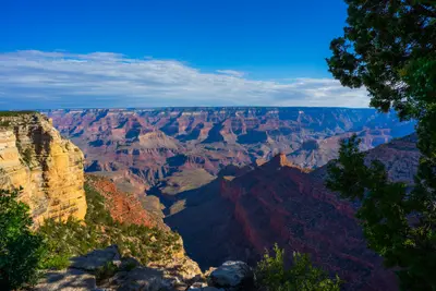
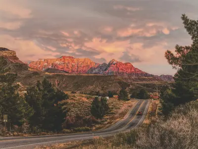
Zion National Park in southwestern Utah, about two and a half hours northeast of Las Vegas, protects the sheer-walled canyon of the Virgin River. People come for the hikes: wading up the river into the Narrows, climbing the chained ridge of Angels Landing, or taking the short trails to the Emerald Pools.Almost everything happens in Zion Canyon, which you can only drive from March through November on the free park shuttle. For quieter scenery, head to the Kolob Canyons in the park's northwest corner, which have their own entrance off I-15, or take the Zion-Mount Carmel Highway east.Springdale as your baseThe town of Springdale sits right outside the South Entrance. It has most of the hotels, restaurants and paid parking, and the Springdale shuttle drops you at the pedestrian entrance by the visitor center. Staying in town means you skip the morning hunt for a parking spot inside the park, which is often hopeless by mid-morning in season.Before you goEntrance fee: $35 per private vehicle, good for 7 days. Since January 1, 2026, visitors who aren't U.S. residents pay an extra $100 per person age 16 and up. U.S. residents don't pay the surcharge; rangers may ask for a driver's license. An America the Beautiful pass covers it: $80 for U.S. residents, $250 for nonresidents (the nonresident pass waives the surcharge for everyone in the car).Angels Landing: permit required, drawn by lottery on Recreation.gov. Details under sights.The Narrows: closed when the river runs above 150 cubic feet per second or under a flash flood warning. In spring, snowmelt often keeps it closed for weeks.Water: plan on about a gallon per person per day. Don't drink from the river.
Sights in Zion National Park
Discover the most important sights and attractions
Attraction
1Angels Landing
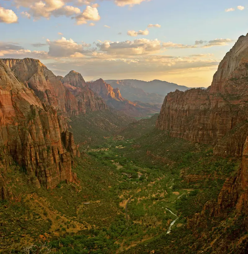
The rock ridge in the middle of Zion Canyon is the park's most famous hike. You start at The Grotto shuttle stop and ascend via Walter's Wiggles switchbacks to Scout Lookout. From there, the trail leads half a mile along a ridge, sometimes less than a meter wide, with chains and steep drop-offs to the summit. For this, you need a permit from recreation.gov: either from the seasonal lottery (apply in July for autumn, Oct 1-20 for winter) or the day-before lottery, apply by 3 PM Mountain Time, results at 4 PM. Without a permit, you can go up to Scout Lookout; the view is already expansive from there.
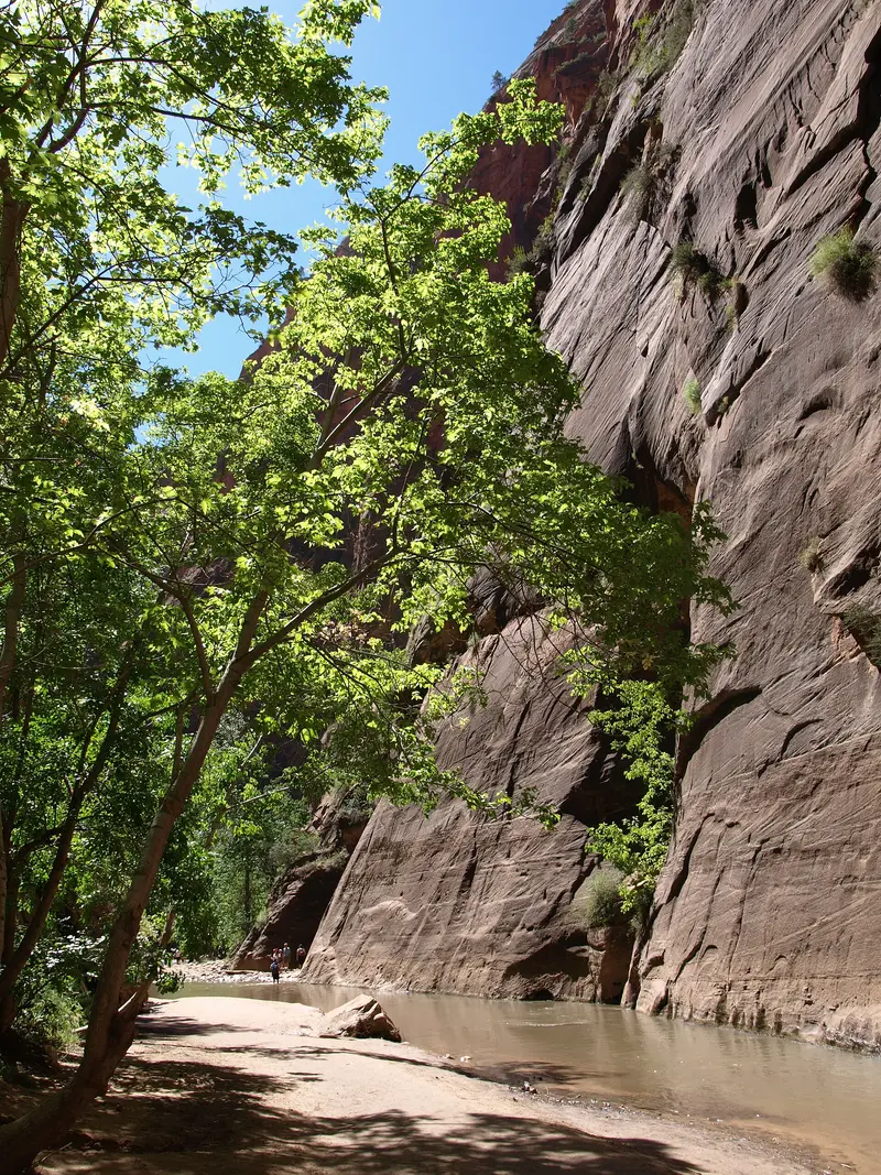
In the narrowest part of Zion Canyon, you hike in the Virgin River itself, between steep, towering rock walls. From the last shuttle stop, Temple of Sinawava, the paved Riverside Walk leads one mile to the entry point, after which you proceed upstream in the water. Without a permit, you can go up to Big Spring, about ten miles round trip, though most turn back significantly earlier. With a flow rate exceeding 150 cubic feet per second or during a flash flood warning, the path is closed, often for weeks in spring due to snowmelt. It's most pleasant in summer and early autumn, but then afternoon thunderstorms pose a risk. Closed, sturdy shoes and a hiking stick are essential; sandals are unsuitable. You can rent special shoes and neoprene socks in Springdale.
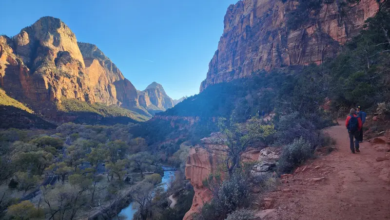
Three pools beneath rock overhangs, which you reach incrementally from Zion Lodge (Shuttle Stop 5). To the Lower Emerald Pool, it's 1.2 miles round trip, about one hour. The Middle Pool is on a ledge above it, the Upper Pool at the base of a tall wall; the last section there is sandy and rocky. Swimming is prohibited in all pools. This loop is a good choice if you're without an Angels Landing permit or with children. In winter, the paths can be icy.
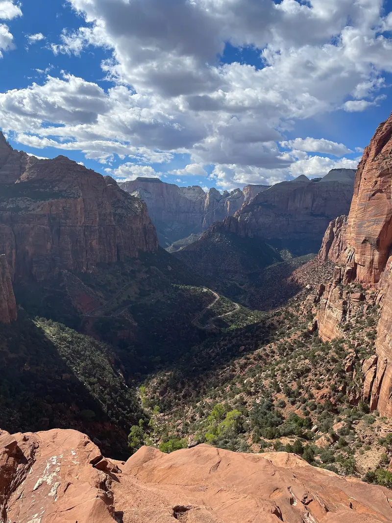
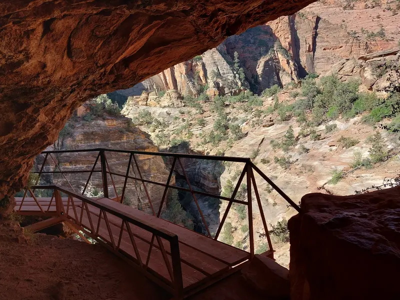
A short trail on the Zion-Mount Carmel Highway that doesn't require a shuttle: It begins directly at the east end of the Zion Tunnel, one mile round trip with a good 160 feet elevation gain, about one hour. Over rock steps and short sections with railings, it leads to a viewpoint high above the lower Zion Canyon and the road's switchbacks. The parking lot has only a few spaces and fills up quickly during the day. Come early in the morning or plan this stop on your drive towards Bryce Canyon.
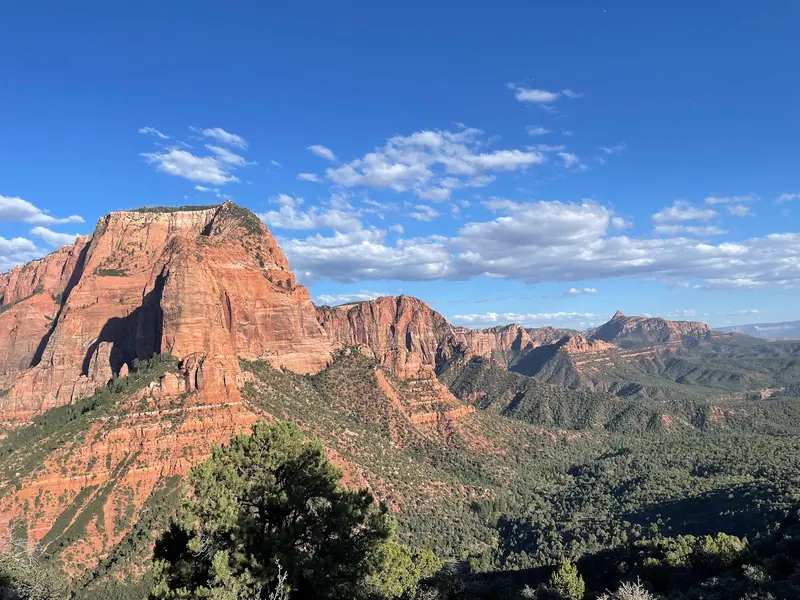
The tranquil northwest of the park has its own access via Exit 40 of I-15, approximately 40 miles north of Zion Canyon and 17 miles south of Cedar City. At the Kolob Canyons Visitor Center, present your park pass or pay the entrance fee, then a five-mile road winds uphill between red rock fingers. At its end, the Timber Creek Overlook Trail begins, one mile roundtrip, about one hour, offering views extending to the Pine Valley Mountains. Longer is the Taylor Creek Trail (five miles roundtrip, about three and a half hours), passing two old homesteader cabins on its way to the Double Arch Alcove. No shuttle service is available here, and in winter, the road may be closed due to snow.
Southwestern cafe on Zion Park Boulevard that opens already for breakfast: Fodor's recommends the Breakfast Burritos with Pork Verde and Huevos Rancheros; later there are burgers, shrimp tacos, and quesadillas. The patio with rock wall views is popular in the evenings; expect a wait during peak dining hours. Main courses cost roughly 13 to 30 US dollars.
Restaurant with a bar on Zion Park Boulevard, near the park entrance. According to Fodor's, it features an upscale, rotating menu of fresh pasta, meat, and fish, with wine and cocktails. Open for dinner; no lunch, and usually no breakfast from October to May. A good choice if you want more than just a burger after a hike.
Restaurant and saloon at Springdale's southern end, featuring creative Southwestern cuisine. Fodor's highlights the sweet potato and pork tamales, the chili ribeye, and homemade sangria. Open evenings only, hours vary seasonally. Closed Monday-Thursday in December and January. Main courses roughly $15-$40.
The Southern Paiute lived along the Virgin River long before settlers arrived. In 1858 a Paiute guide led Mormon missionary Nephi Johnson into the canyon, and within a few years settlers were farming the canyon floor. Isaac Behunin, who built a log cabin here in 1863, gave it the biblical name Zion.In 1872 geologist John Wesley Powell called the canyon Mukuntuweap, believing it to be the Paiute name, and President Taft protected it under that name as a national monument in 1909. Local Mormons objected; in 1918 it became Zion National Monument and in 1919 Utah's first national park. The Kolob Canyons were added in 1956.Many of the rock names, such as the Court of the Patriarchs, the Great White Throne and Angels Landing, date from those years and reflect the faith of the early settlers.
Getting There and the Shuttle
The closest major airport is Las Vegas (LAS), about two and a half hours via I-15 and St. George. Salt Lake City is roughly four and a half hours away.2026 shuttle seasonSince March 7, 2026, the Zion Canyon Scenic Drive has been closed to private vehicles. The free shuttle leaves the Zion Canyon Visitor Center every 5 to 10 minutes and makes nine stops up to the Temple of Sinawava; the one-way ride takes about 45 minutes. You don't need a ticket, just your park pass.First bus: 7 a.m. from the visitor center.Last bus from the visitor center: 6 p.m. through May 16, 7 p.m. May 17 to September 12, 6 p.m. through October 24, 5 p.m. October 25 to November 28.Last bus out of the canyon (Temple of Sinawava): 1 hour 15 minutes later. Miss it and you could be walking up to eight miles back.Break: no shuttle November 29 to December 25, when you can drive the canyon yourself. It runs again December 26 to January 2 (8 a.m. to 4:30 p.m.).Parking and the Springdale shuttleThe visitor center lot fills early in the day in season. When it does, use paid parking in Springdale and ride the free Springdale shuttle (every 10 to 15 minutes from 8 a.m.) to the pedestrian entrance. Weekdays are noticeably calmer than weekends, and holiday weekends like Memorial Day and Labor Day are the busiest of the year.Traveling by RVSince June 7, 2026, firm size limits apply on the Zion-Mount Carmel Highway between Canyon Junction and the East Entrance: no vehicles over 35 feet 9 inches long, 11 feet 4 inches tall, 7 feet 10 inches wide or 50,000 pounds, and combinations no longer than 50 feet. The old paid tunnel permit with one-way escorted traffic is gone; the tunnel now runs two-way at all times. With a larger rig, come in through Springdale and the South Entrance for the campgrounds, and reach Bryce Canyon via SR 20 north of Cedar City, a detour of about 63 miles.Kolob CanyonsSeparate entrance at I-15 exit 40, about 40 miles north of Zion Canyon. No shuttle; you drive yourself.