Fernweh: Home
    ExploreTravel GuidesPlan a tripMy tripLast visited
    de|en
    All Places & RegionsAll highlightsAbout FernwehFAQPrivacy PolicyImprint
    ExploreTravel GuidesPlan a tripMy tripLast visited
    • Neighborhoods & highlights
    • Recommendations
    • Walking tours
    • Eat & drink
    • Food culture
    • Culture
    • Nightlife
    • Getting around
    • Accommodation
    • Plan trip
    • Nearby
    Puerto Natales

    Chile

    Puerto Natales

    City

    Puerto Natales, which lies on Fjord Última Esperanza, is the main gateway to Torres del Paine National Park. This small town developed in the early 20th century around sheep farming and cold stores, and today lives primarily from tourism.

    by Felix Gillen

    1. Home
    2. Destinations
    3. Chile
    4. Magellan and Chilean Antarctic (Magellan Region)
    5. Puerto Natales
    Puerto Natales, which lies on Fjord Última Esperanza, is the main gateway to Torres del Paine National Park. This small town developed in the early 20th century around sheep farming and cold stores, and today lives primarily from tourism. Colorful wooden houses, a waterfront promenade, and many outfitters shape its center.

    Sights in Puerto Natales

    Discover the most important sights and attractions

    1Letras Yo Amo Natales

    Colorful sign "Yo amo Natales" on the waterfront street Avenida Pedro Montt, with Seno Última Esperanza and the mountains in the background. A quick photo stop during a stroll along the Costanera.
    Open in Google Maps

    2Jardin Botanico Natales

    Small botanical garden with a cultural space on Calle Magallanes, near the shore of Seno Última Esperanza at the western end of the center.
    Open in Google Maps
    Museum

    3Puerto Natales Municipal Historical Museum

    The small town museum on Calle Bulnes displays artifacts from prehistory and the settlement of Provincia Última Esperanza. A short visit is a good option before a trip to Cueva del Milodón.
    Open in Google Maps
    Historical Pier
    Attraction

    4Historical Pier

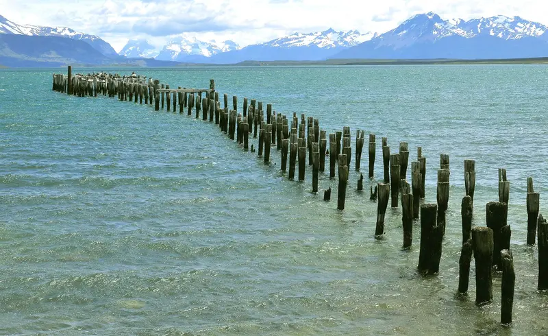
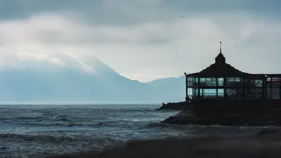
    Only the wooden piles of the old pier of the Braun & Blanchard trading company still stand in the water, from which wool and other *estancia* products were shipped in the early 20th century. In the 1920s, rebellious workers destroyed the facilities; after reconstruction, the pier was only in operation for a few more years. From the coastal road, it is a popular photo subject.
    Open in Google Maps
    Parish María Auxiliadora
    Church

    5Parish María Auxiliadora

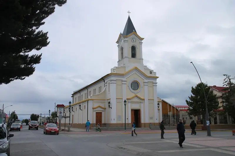
    The María Auxiliadora del Carmen Church is on Plaza de Armas in central Puerto Natales.
    Open in Google Maps

    City walks in Puerto Natales

    Curated walking tours through the city's highlights, handpicked by experienced travel journalists.

    Art, Views & Local Flair: A Walk Through Puerto Natales' Hidden Corners

    On this walk, discover a different side of Puerto Natales. From impressive street art and historic railway relics to local crafts and breathtaking panoramic views, immerse yourself in the authentic life of this Patagonian town off the tourist trail.

    ~2 Std.
    Open in Google Maps
    Stops (6)

    Essen & Trinken

    1

    Quillero-po

    Burger and snack bar on Calle Bulnes east of the city center.
    Show on Google Maps
    2

    Cafe Kaiken

    Small restaurant with Chilean cuisine on Calle Baquedano, southeast of the center.
    Show on Google Maps
    3

    Entrevientos Restaurante

    Restaurant in the center of Puerto Natales, a few steps from the Plaza de Armas.
    Show on Google Maps
    4

    El Pirincho

    A simple grill and bar on Calle Balmaceda, east of the centre.
    Show on Google Maps
    5

    Afrigonia

    Restaurant in the center near Plaza de Armas, whose cuisine combines African and Patagonian influences with regional ingredients. It was founded by a chef couple from Zambia and Chile.
    Show on Google Maps

    Food & Drink in Puerto Natales

    After trekking, many travelers stop in Puerto Natales. The menus prominently feature lamb, fish, and seafood from the South.

    Cordero al palo

    Patagonian lamb, spitted and cooked beside an open fire.

    Centolla

    The King Crab from Patagonia's cold waters comes as baked Chupe or pure with lemon.

    Craft beer

    Baguales Brewery serves its beers at its own brewpub on Calle Bories near Plaza de Armas.

    Calafate

    Cafés craft the blue berry from the Patagonian steppe into jam, ice cream, and cakes; bars make Calafate Sour.

    Culture, Art and History of Puerto Natales

    From the Kawésqar to the SettlersLong before the city's founding, the Kawésqar lived along the Última Esperanza Fjord, navigating the channels by canoe, and the Aónikenk in the steppe. In the late 19th century, settlers arrived, primarily from Germany and Great Britain as well as Chiloé, to raise sheep. In 1895, the German pioneer Hermann Eberhard discovered the Cueva del Milodón.Founding and Frigorífico BoriesPuerto Natales was officially founded on May 31, 1911. A few kilometers north, starting in 1913, the Sociedad Explotadora de Tierra del Fuego built the cold storage plant Frigorífico Bories, where sheep were slaughtered and meat, fat, and wool processed for export. The facility has been a national monument since 1996 and now houses a hotel. The Museo Histórico Municipal on Calle Bulnes displays Kawésqar and Aónikenk artifacts, Eberhard memorabilia, and photos from the pioneering era.Colorful wooden and corrugated iron houses define the townscape. Wool and lamb continue to play a central role in handicrafts and cuisine.

    Nightlife

    1

    Baguales Brewpub

    The Baguales Brewery brewpub on Calle Bories, near Plaza de Armas. They serve their own craft beers, along with burgers and other pub dishes.
    Show on Google Maps

    On the Road in Puerto Natales

    In the CityPuerto Natales town centre is compact: the main square (Plaza), waterfront promenade, restaurants, and accommodation are mostly within a few minutes' walk of each other. For the journey to the bus terminal on the outskirts or if you have heavy luggage, take a taxi; payment is usually in cash.Buses and ExcursionsTo Punta Arenas: Several bus companies operate daily services on the approximately 250 km route, taking about three hours. Some buses stop at Punta Arenas Airport. There are no petrol stations along the way.To Torres del Paine: During peak season, buses depart early morning and midday for the Laguna Amarga entrance, with return services in the early evening. Park tickets must be purchased online in advance via pasesparques.cl, and bus tickets are best bought a day beforehand.To Argentina: Buses connect the city with El Calafate; the journey involves crossing a border.Airport: The small Teniente Julio Gallardo Airport is mainly served during the summer season. Due to runway work, a reduced flight schedule will be in effect from January to March 2027 (January: Friday to Sunday; February and March: weekends only). If you need flexibility, it's better to fly to Punta Arenas.For visiting estancias, Cueva del Milodón (approximately 24 km northwest), and viewpoints further afield, a rental car is practical. Many roads in the area are gravel.

    Accommodations in Puerto Natales

    Find perfect stay in Puerto Natales

    Booking.com* (Affiliate link)
    Search Hotels
    Agoda* (Affiliate link)
    Search Hotels
    Airbnb
    Vacation Rentals

    * Affiliate link: if you book through it, we earn a small commission. The price stays the same for you.

    Plan your trip to Puerto Natales

    Save places, build a route and plan your city trip, all in one place.

    1. 1
      Sunrise over alpine peaks and a sea of clouds
      1234

      Round trip

      12 days · 4 stops

      Saved

      Pick a route

      Pick a ready-made one or save places and plan your own.

      Open bookmarks
    2. 2

      Trip to Puerto Natales

      Live
      • 1Letras Yo Amo Natales3 days
      • 2Jardin Botanico Natales4 days
      • 3Puerto Natales Municipal Historical Museum5 days
      Budget

      Plan your trip

      The planner sorts stops, days and budget. Plan together in real time.

      Start trip planning
    3. 3
      9:41 No signal
      Puerto Natales
      Available offline

      Use it on the road

      Download the guide to your phone and use it on site, even offline.

    Nearby

    Magellan and Chilean Antarctic (Magellan Region)

    Magellan and Chilean Antarctic (Magellan Region)

    The Región de Magallanes y Antártica Chilena encompasses the southernmost part of Chile, from the steppe around Punta Arenas to the granite towers of Torres del Paine and the fjords of Tierra del Fuego. Here you travel through vast, sparsely populated landscapes where wind and weather dictate the daily routine. Punta Arenas and Puerto Natales are the two starting points for almost all tours.
    National Park Torres del Paine

    National Park Torres del Paine

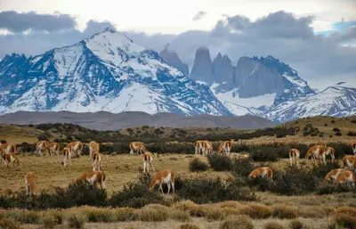
    Torres del Paine in southern Chile is one of Patagonia's most famous national parks: granite towers, glaciers, and turquoise lakes are concentrated here. You can hike multi-day treks like the W and O, or go on day hikes to viewpoints such as Base Torres. The park is located about 110 km north of Puerto Natales, protecting the Paine-Massif with its Torres and Cuernos peaks, as well as glaciers of the South Patagonian Ice Field.
    Perito Moreno Glacier

    Perito Moreno Glacier

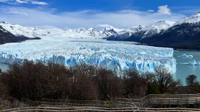
    The Perito Moreno Glacier in Los Glaciares National Park is one of the world's most accessible glaciers. Its ice front rises about 70 meters above Lago Argentino; ice blocks frequently calve into the water with a thunderous roar. Unlike most glaciers worldwide, it has long been largely in equilibrium. Occasionally, it advances to the shore of the Magallanes Peninsula, damming the Brazo Rico until the water breaks through the ice dam.Opposite the ice front, several kilometers of boardwalks offer circular routes of varying length and difficulty; plan at least two to three hours for this. Additionally, there are boat trips in front of the ice wall and guided hikes with crampons on the glacier, which you should book in advance. The National Park charges an entrance fee (50,000 Pesos for foreign visitors from June 2026), which is not included in any tour. From El Calafate, it's about 80 kilometers on a paved road.

    El Calafate

    El Calafate is located on the southern shore of Lago Argentino, Argentina's largest lake, between dry, windy steppe and the Southern Patagonian Ice Field. This compact town is the most important base for the Perito Moreno Glacier, about 80 kilometers to the west, and for boat trips to the Upsala and Spegazzini glaciers, which depart from Punta Bandera port, about 47 kilometers outside.On the edge of town is the Laguna Nimez Bird Sanctuary, with flamingos and black-necked swans; a few kilometers outside, the Glaciarium exhibition center explains the world of ice. The airport is located about 20 kilometers to the east and offers connections to Buenos Aires and Ushuaia. Intercity buses travel in about three hours to El Chaltén and in five to six hours to Chilean Puerto Natales. Stock up here before continuing to El Chaltén: the supermarkets are better stocked and more affordable.
    Punta Arenas

    Punta Arenas

    Punta Arenas on the Strait of Magellan is the largest city in southern Chile and a starting point for penguin tours, Tierra del Fuego, and Torres del Paine. City palaces, museums, and a cemetery with cypress-lined avenues tell of the wealth from the sheep farming era around 1900. The capital of the Magallanes Region is also an important port for ships heading to Antarctica.

    Sources & method

    • Photos: Wikimedia Commons, Pexels, Google Maps. Each photo carries its credit.
    • Place data such as addresses and ratings comes from Google Maps.
    • The content is based on web research from public, traceable sources. How the content is made · The role of AI